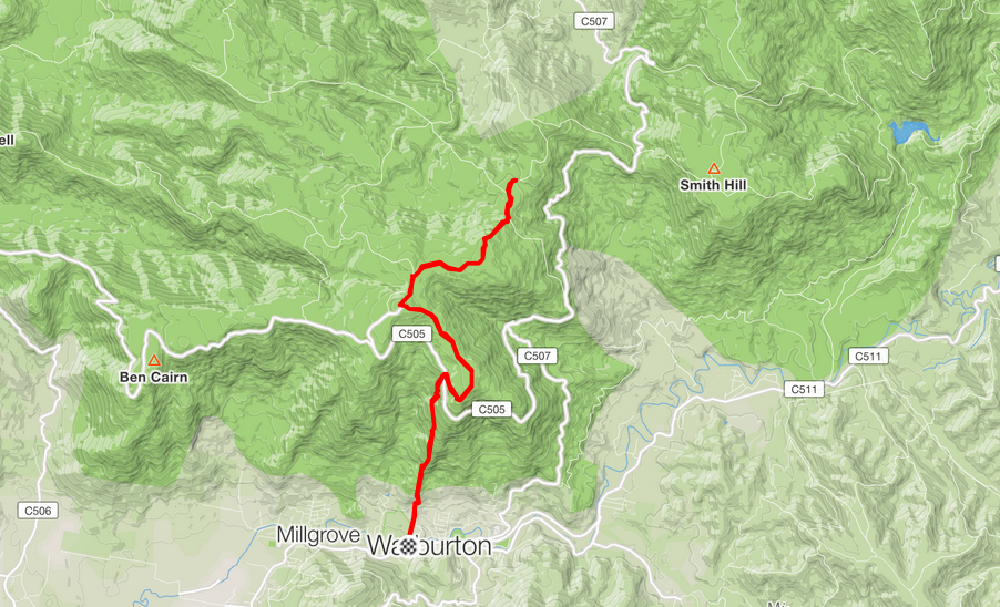
How to get there
This is the route I took through Healesville. Click the More options link on the map to enlarge it.
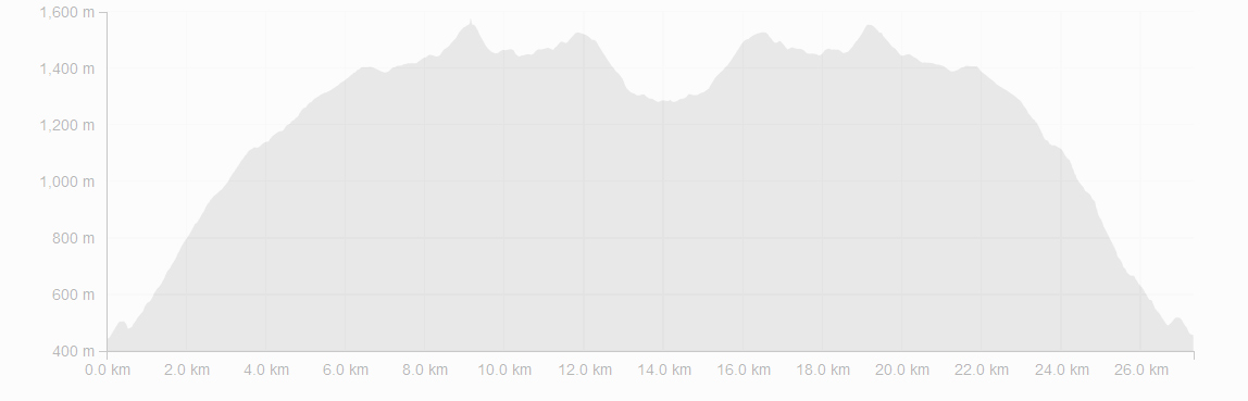
Strava Activity
Feel free to study this activity.
Amenities
The toilets at Dom Dom Saddle are quite old, even eerie. There are picnic tables and quite nice ground.
For the original course (Dom Dom to Boobyalla Saddle) the 8022-4-N Juliet North, 1:25000 topographic map series from VicMap is the best. I bought the pdf map from Avenza maps for $2.65 (US1.99). Unfortunately my phone is cactus when it comes to GPS, so I couldn’t really make the most of this map being GPS, only while close to Dom Dom Saddle—few kms further stopped working, so I ended up using the portion of paper map McMahons Creek 8022-N VicMap which I’ve copied and highlighted the course on. This map is 1:50 000 and is not accurate. I have pointed out in my blog where there were the discrepancies.
Friendly advice
Here are some thoughts that might be useful before heading out on an adventure like this:
- Always check the weather, ask around a local or someone who’s been there a day before
- Carry enough food and water and take your charger and torch (just in case)
- Get the 8022-4-N Juliet North, 1:25 000 topographic map series from VicMap
- Carry a PLB, alternatively keep someone updated about your progress. Garmin has LiveTrack, Strava has Beacon. If you have a smart watch, these can work together very well wherever there is network coverage
- Take some good wound dressings with you (extras, too), very easy to fall and scratch yourself
- Wear something that covers your legs—those pesky grasses can really hurt
- Take your poles, they will help you both up and down.
Hope all this info has helped.