19 July 2018
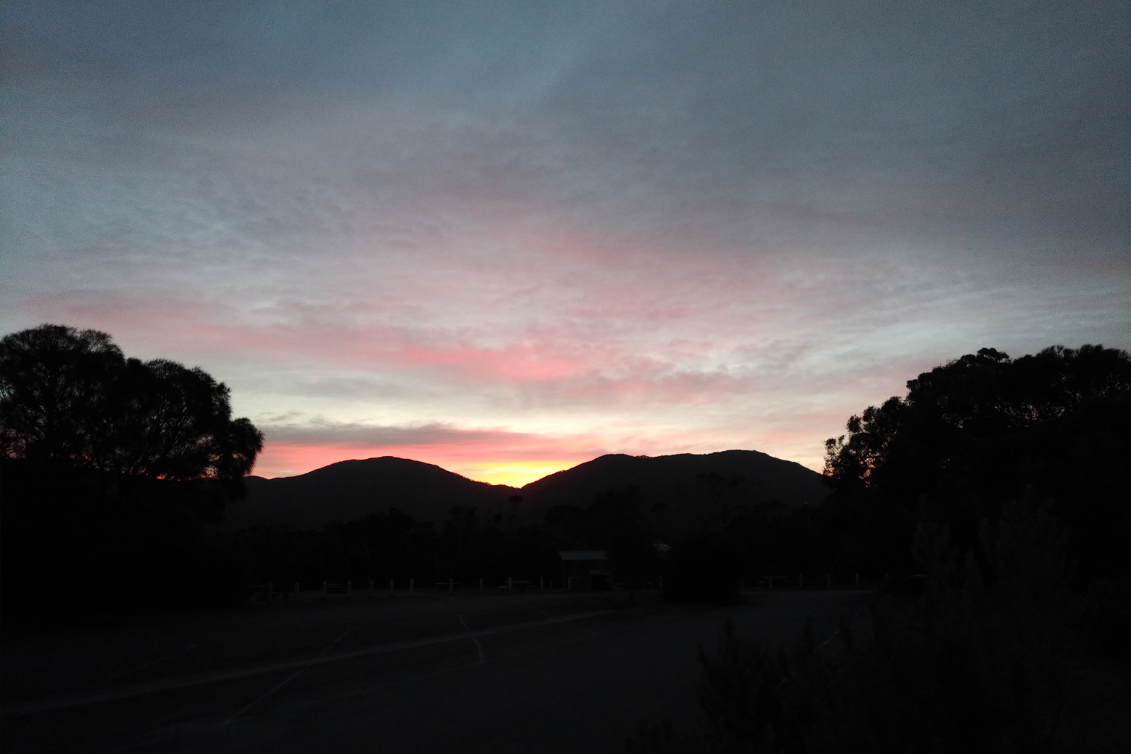
The tide looked perfect at Sealers, it was supposed to be showers and wind during the day. Today it was about testing a few things in adverse conditions.
Had new wheels (those didn’t need testing, as I had similar before and it was great)
New Lululemon top – ran in this at Mt Donna, but wanted to see what it is like on a long(er) distance
The new Salomon Agile 12 Set Lightweight Hydration Backpack – wanted to see how comfortable it is on a long run, how I could store stuff in it and if it’s as waterproof as the description says. Couldn’t have much food in the pockets (they aren’t big enough for this purpose), so I used the Ay Up’s fanny pack for storing the Bloks, rice paper rolls and protein bars. The packet of tissues ended up here, as well.
I started out with the thermals and the waterproof jacket and got warm very quickly, took the thermals off before I reached Telegraph Saddle car park. Had to keep the jacket on because it was very windy. Of course I took it off and put it back on a few times during the day, which seemed like a total waste of time.
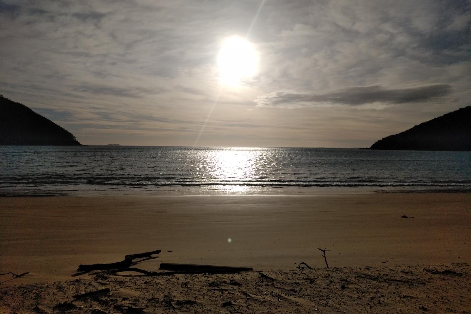
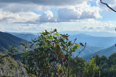
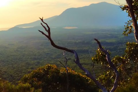
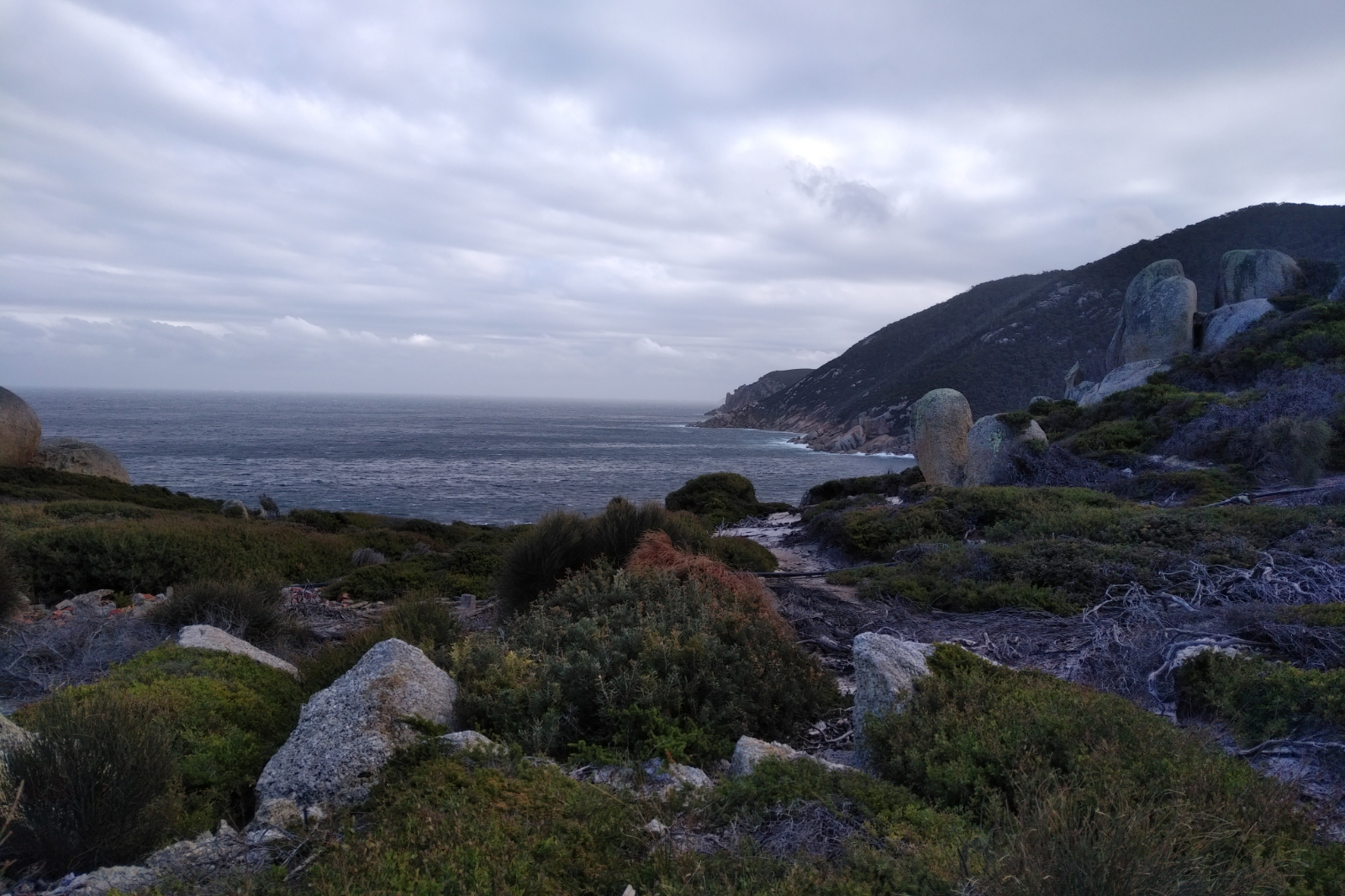
I expected a dark, wet and windy day… it was absolutely stunning all the way to the Lighthouse. The track to Sealers was soft and great to run on, not much mud to get around. The first peak at Sealers!!! Love that view! Then Refuge Cove Nth with its golden sand!! When I got there I remembered the very first time I’ve been here and couldn’t resist getting into the water. The camp sites were empty, not a soul, which was quite strange, but I didn’t mind.
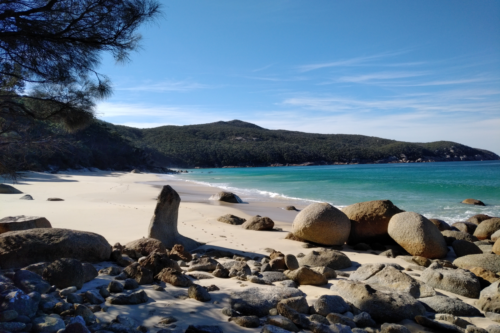
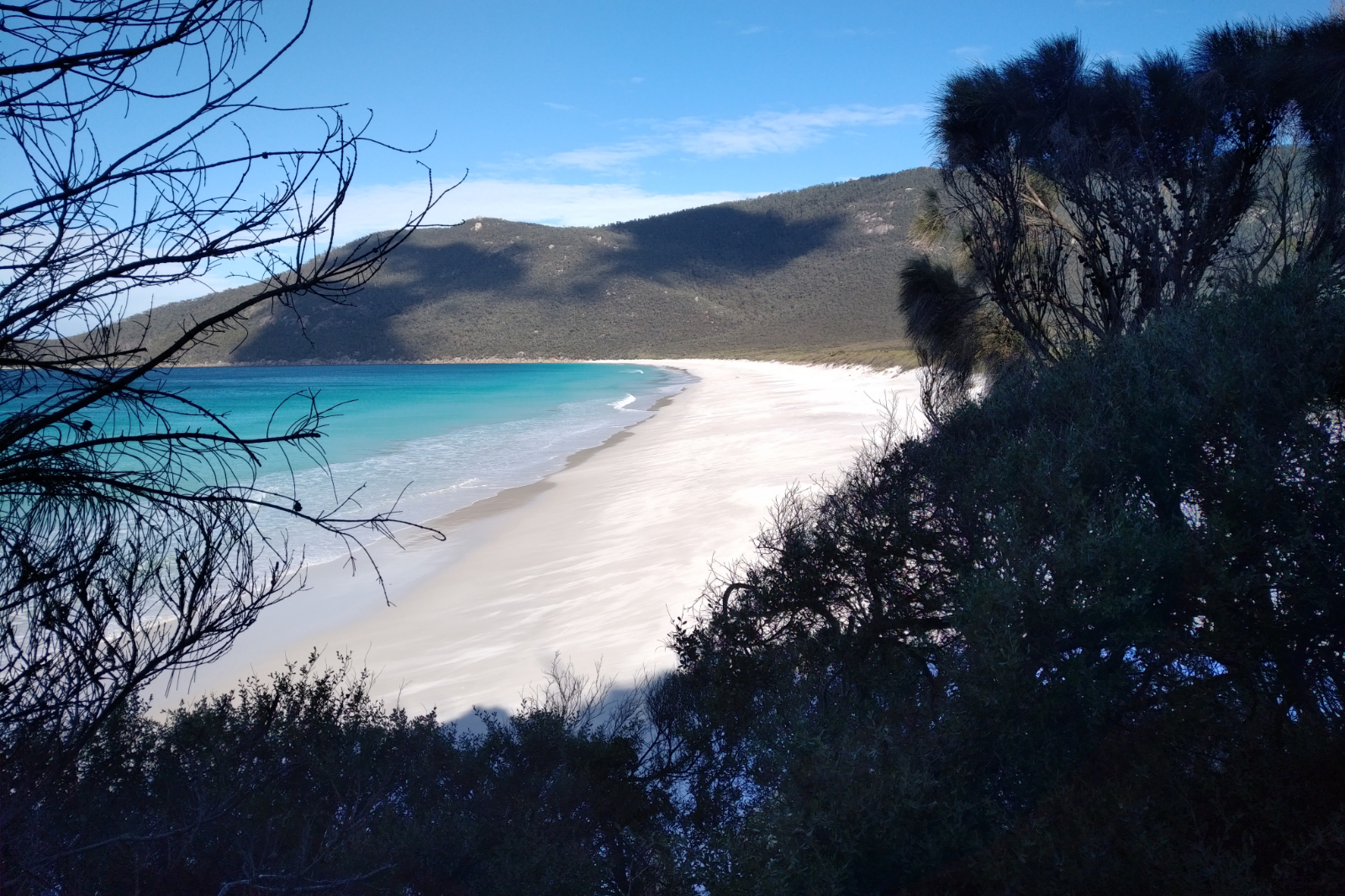
The water at Refuge Cove was pretty dark – must have been quite some rain there earlier. The view from the boulder above it was nevertheless stunning. The rest of the beaches were all brilliant blue – I took so many pictures, it’s not funny. I also found myself stopping and even going back to have another look at these views. I don’t think the pictures make them justice, they have to be seen with the naked eye.
Vodafone must have been doing some upgrades because I had next to no connection. Otto was worried because he couldn’t follow me on Strava (he didn’t even get the link, LiveTrack didn’t start). Restarted my phone twice, sometimes it works, but not today. Anyway, I’ve messaged him hoping that eventually he’ll get it. On the way up to Kersops Peak, there is always a section where the internet works. Got a 3G with no bars for a few seconds but that wasn’t enough. Up at the junction, I saw two backpacks on the ground, their owners must have gone up to the summit and didn’t want to carry the heavy stuff.
I usually have a date at this point, this time I missed it and headed downhill.
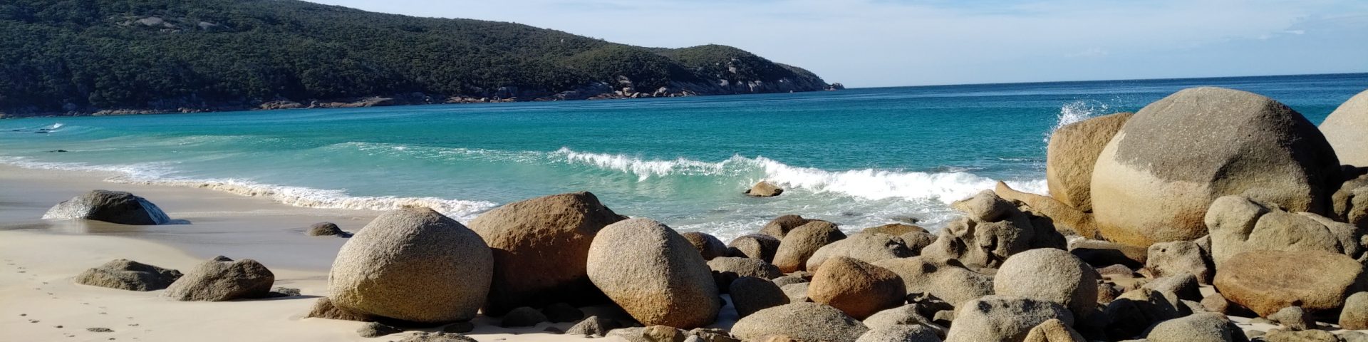
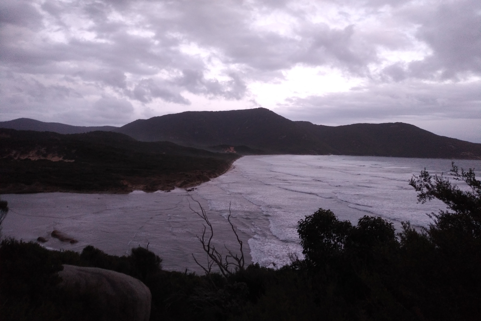
Waterloo Bay Nth was stunning!! Then at Little Waterloo Bay (which is equally beautiful) I saw the very one person I bumped into my entire day out there – a half-naked youngster with a round hat women would wear. Said hello and wished each other a nice day as I was passing. When I was up at the Decision Rock I thought today is too nice to cut it short, so Lighthouse it is!!
I was so looking forward for a dip at Waterloo Bay!! Could see the blindingly white sand from a fair distance… Everything was beautiful and great until I got there. The little delta was big, which meant no dry crossing here. I went down on the right side first to see if I could hop over the rocks, but that proved a no go – the little rock in the middle was in the water and clearly slippery. Went back and down the left (haven’t been this way for ages), went through the tight spot between two rocks, then figured if I could prop myself against that rock and could do one step without trussing against the other two which were about a meter apart, I could make it onto the sand without getting my shoes wet. This is when I slipped. Right foot straight into the water with a series of deep scratches that took the skin off and caused some not so nice bruises. Not a pretty sight. Left foot cramped which immobilised me for a few minutes. Skin off on both palms… Sat there until I could move, seemed forever.
First things first: had to wash off the blood, then took my clothes off behind a cliff (at least it wasn’t windy there) and went into the freezing cold water hoping the salty water would stop the bleeding… not really. This part of the beach was not sun kissed, therefore quite cold. I’ve put my clothes back on (shivering), then started running along the beach. The sand was compact enough to permit that and the sight of the crystal clear water took my mind off the bleeding wound and the burning of my palms. I sat down at the beach exit to put my socks and shoes back on when Otto rang. Gave him a sitrep, then I headed up.
I realised the bushes will scratch my already hurting wounds, so I pulled out the “first aid kit”. Not enough patches and even if I put them on, I’d cover some parts with the sticky part which would make it a pain in the ass taking them off. I pulled out the triangle bandage and loosely bandaged it. Only lasted a few steps, then again… and again, until I had enough and took it off. From here on, every single grass, bush or shrub that touched it, really hurt.
I started to feel the extra weight I’ve stuffed into the pack, my back was feeling it.
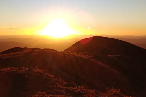
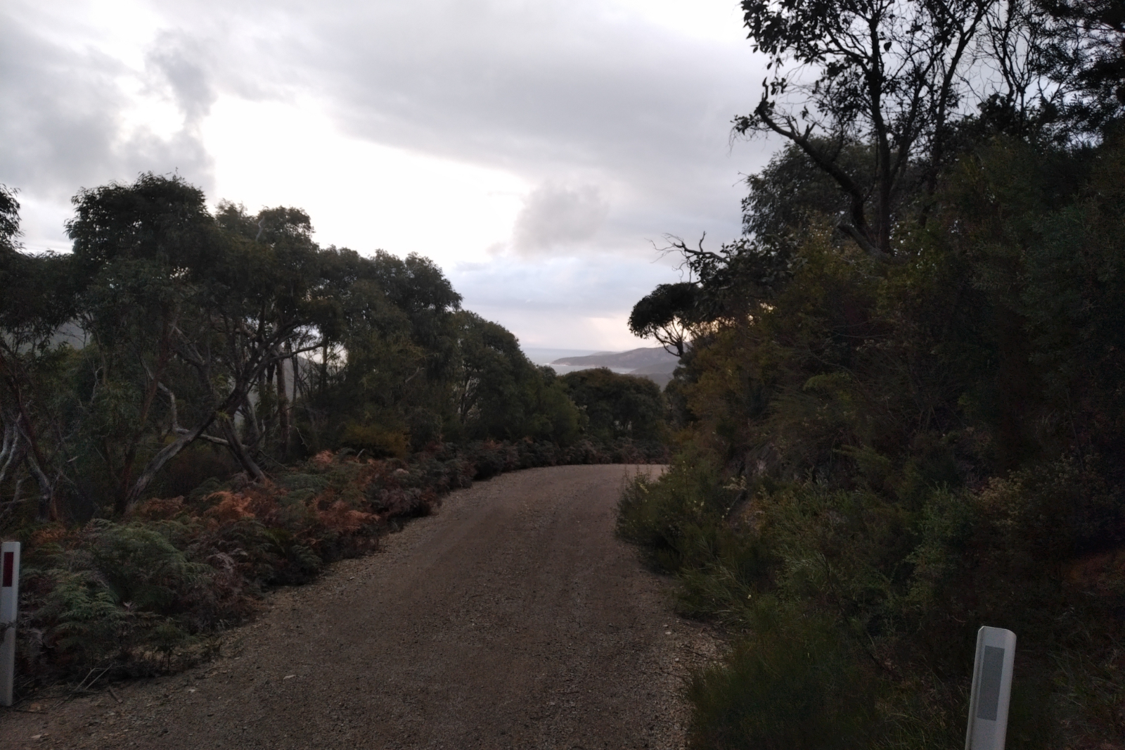
The weather was beginning to turn as I was going from the junction towards the Lighthouse. Strong winds have made for a not so friendly ocean. My friend was right about the extreme weather warnings – they were kicking in.
The cramps I got in my left calf when I fell still didn’t go away making the hike up to the Lighthouse really painful. I was looking forward to filling up and having some water. Had 250 ml straight away as soon as I got to the tap. Then took the Lighthouse door selfie, went to the toilet (it was eerie in there with the wind blowing), filled the two flasks and headed down all shivering beating myself up for not putting on the thermal before I got here. Stopping to do it on the way down was out of question, the wind was really chilly.
Usually not looking forward to the climb out from there, but now I couldn’t wait – it meant I would be warming up quicker. I’ve put the thermals on at some point when it was relatively no wind. They were a bit wet, still better than nothing.
Otto rang, told him I am OK, took a fall (didn’t tell him when or how bad it was, he was already worried), I have plenty of food and liquid and all is good. He asked me how far I need to go. Told him I was at 40 kms, another 20 to go. I must take him on this trip once so he understands what 40 kms means at that certain point. It means I’ve nearly done a marathon with 2000 m + elevation and whatever is left is peanuts compared to what is already done. It was (and always is) a bit debilitating when he asks “only that far you got?!”.
I went as fast as I could, every now and then thinking I could go faster, I am holding back… checked the hip – it was OK, so no reason to go slow. The cramps were still there, though. Saw a tent with neatly lined shoes at Roaring Meg, then a few more tents at Halfway Hut. I realised I forgot to eat and drink.
Rang Otto when I got to Telegraph Junction, as I promised him earlier. Put my phone in a plastic bag, as there were a few rain drops. I wasn’t looking forward to running through those shrubs and getting the wound scratched, but the sand didn’t seem too much fun, either. At the 52 km mark it started to rain. I couldn’t remember if the Ay Ups were waterproof… sooner or later I’ll need them.
I was a bit shocked when I got to Oberon Bay. The tide was high and when I looked along the non-existing beach, I realised it’s quite scary as there were parts where the water was hitting the sand wall… took my shoes off, put my phone in my jacket’s pocket (it’s supposed to be waterproof) and started running. The sand was varying between soft and ok-to-run-on and there was a lot of debris carried in by the tide. In the spots where the waves hit the sand wall the water have reached above my knees. I could see that the sand was wet way above that level on my right, which means a wave like that could just wash me away.
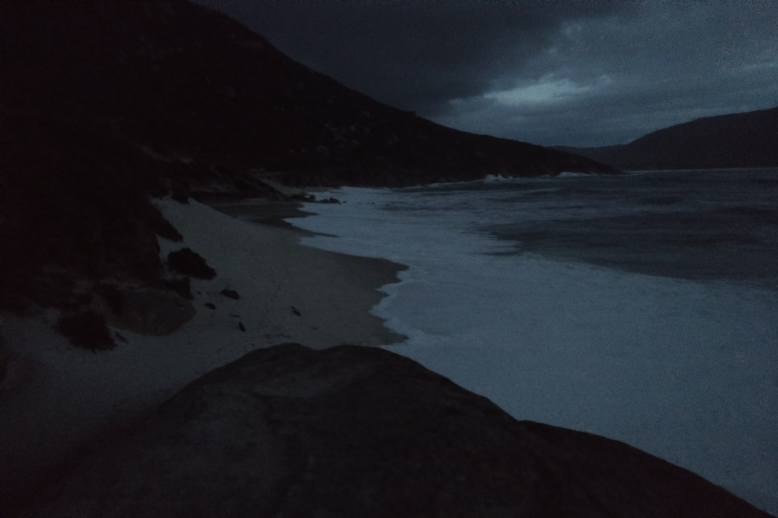
Then there is Lt Waterloo Bay!! Gee, that must be really scary. The waves are bigger there and the beach is narrower. I must step on it to climb out of that one too before it gets totally dark.
I was wondering how deep the creek will be like at the end of Oberon Beach… could see water covering all that area to the trail head. To my biggest surprise it was quite flat, water didn’t reach my knees. I’ve sit down to put my shoes back onto my numb feet. A magpie came very close – not sure what it was hoping for. As soon as the shoes were on, I got going. Have to make it there before it gets dark. Last time I was a bit freaked out by the experience.
I stopped to take the head torch out of the pack while there was still some light. Assembled it, stuck it onto my nugget and went as fast as I could. I already decided that I’ll take the shoes off there as well because it felt warmer with the socks not being wet; the outside temperature started dropping, too.
Thankfully got over it without any issues. Took a deep breath, sat down on the rock to put my shoes back on, took a couple of shots looking back, then tried to call Otto but there was no reception.
My back really hurt by this point, not sure what I did wrong. That last km felt particularly hard this time. I was contemplating on just changing clothes and heading home, giving a miss to the shower I usually take after a run here. I finally could call Otto when I got back to the car; he suggested I take a shower, it will keep me awake on the way home.
While I was in the shower I could hear the rain on the roof… it was freezing getting out of there. Not many people camping this time.
Long drive home, it was pissing down with rain all the way to Nazza.
All up it was a great day. Saw lots of animals: plenty of wombats and wallabies, some kangaroos, rosellas, black cockatoos, a cat, rabbits, three owls and a deer.
Gear
- Lululemon top and crops
- Salomon waterproof jacket (not the Bonatti)
- Feetures socks (bought them at FSM) – great socks!!
- Kathmandu thermals
- Overpants and gloves – didn’t use them
- Agile 12 Set Lightweight Hydration Backpack – didn’t manage to completely fill the back compartment
Nutrition and Hydration
- About 1.5 l of GU Tri-berry
- 2 x 330 ml ginger beer
- Re-filled the soft flasks with water at the Lighthouse but only had a few sips of it
- 4 x small rice paper rolls with Csabai, goat cheese, Philadelphia cheese, rocket, red capsicum, mint, coriander and cucumber
- 6 protein bars (don’t ask why I packed that many) – had 2
- 3 dates – didn’t have any
- Chocolate and uncrystallised ginger
- Bloks – orange and black cherry
- 2 mandarins
- 1 banana (cut in two) – had half
Strava Activity
Feel free to study this activity.
Max elevation: 341 m
Min elevation: -73 m
Total climbing: 3118 m
Total descent: -3109 m
Total time: 11:13:14