23 May 2018
It was pissing with rain all the way to Yanakie – just like on race day. I left just after 5, wasn’t in any hurry to avoid the high tide at Sealers. Stopped for a few photos on the way, they are crap, not worth showing.
This time I parked at Telegraph Saddle car park, the plan was to go down to the Lighthouse, then to South Point and back straight via Telegraph Tk. There were a few cars parked, didn’t make much noise thinking someone might be sleeping in any of them.
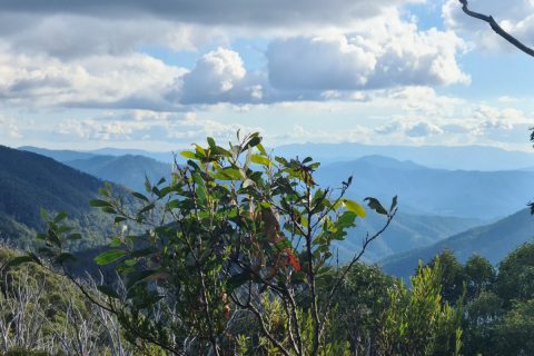
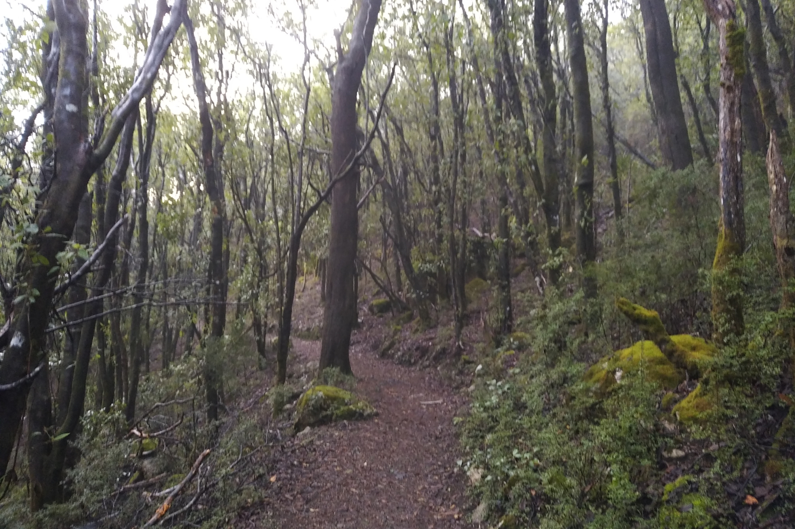
Geared up and got going at almost 7:45. It was strange not having to climb that concrete hill, but getting straight onto the track. Once I got over the niggle and warmed up, I really enjoyed the ride. It was a bit spooky in the forest, foggy.
Just before reaching that switchback, phone signaled an email… work… replied, then kept climbing. Did this a few times before the reception cut out. I took it really easy, didn’t care about pace. In fact would’ve loved to do this all day, on this beautiful track. The ground was soft, a bit softer than on race day, but not as muddy as other times after rain. It was just pure trail pleasure. The board walk was a bit slippery, so I really pulled back there. Parks Vic have cleaned some more or it, now it’s all clear. I was so excited about getting to Sealers… wondering how deep the creek will be… even packed two plastic bags, just in case I need to get deeper into the water.
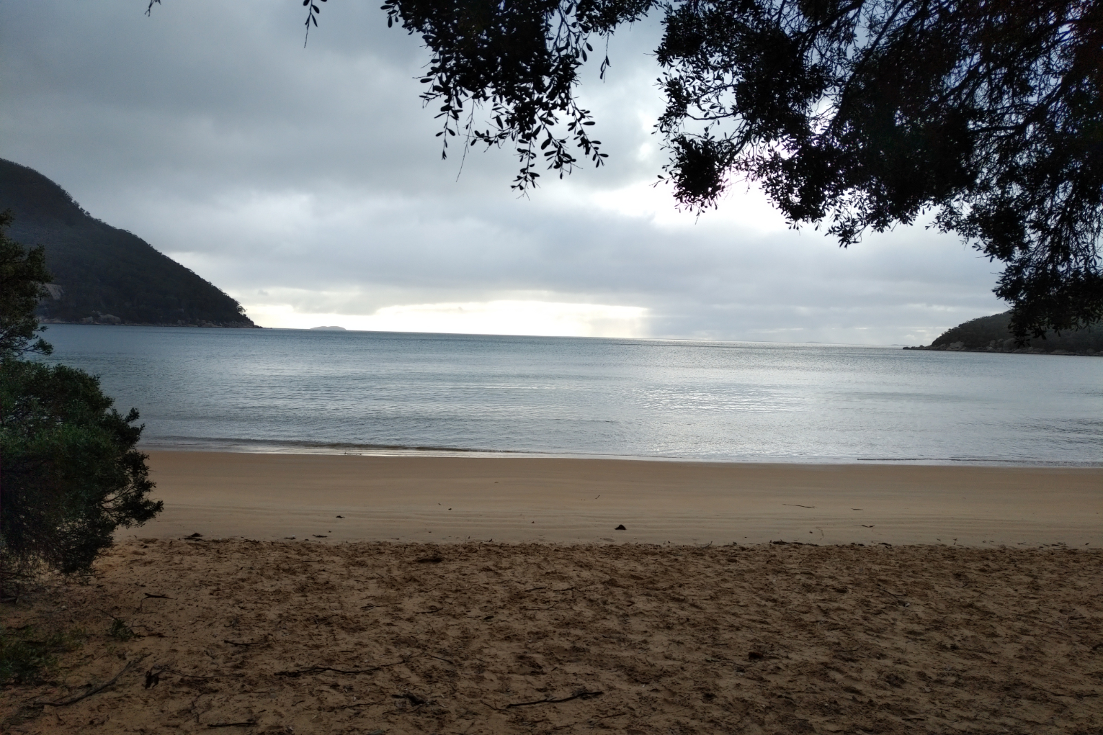
Sealers was a bit overcast, with a huge cloud hanging just above the bay. It made for a beautiful pic anyway. I had some food while getting to the creek crossing, then – as usual – I took my shoes off, crossed closer to the ocean, where the water was about knee deep, then put my shoes back on and started the hike. There was a girl at the camp ground (just realised, haven’t seen anyone on Sealers Tk, which is unusual), having her breakfast. She might have been hung over or something, because she didn’t notice me, in spite of me saying hello quite clearly…
When I saw the water at Refuge Cove Nth, I thought it’s going to be great!! Never mind the occasional showers – they are great, too! Before arriving to Refuge Cove, I’ve spotted a yacht… soon I saw a couple hiking my way. Said hello and asked them where are they heading (they had no packs). They said they are just going to the lookout – that boat is theirs. Told them they are so lucky, wished them all the best and kept going.

I was so preoccupied with my thinking that I forgot to eat, then my tummy complained… it happened quite a few times on this run/hike.
At Refuge Cove I saw the inflatable boat the couple got to shore with and wondered did they take off their hiking shoes to get on the beach?… Kersops was coming up!
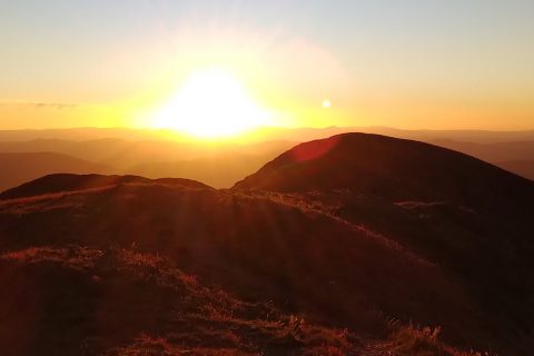
Didn’t push up Kersops, just put one foot in front of the other. Otto messaged me asking how I was going, because he didn’t get the Strava link… told him not to worry about it, it’s quite cloudy, the internet is rubbish. I had a date (with a pit) when I got to the top, took a few pics, then kept going. It was quite windy and it started to rain a bit, but I somehow enjoyed that, too knowing Waterloo Bay Nth is next and if the water is nice, I’ll have a dip. I was really looking forward to that.
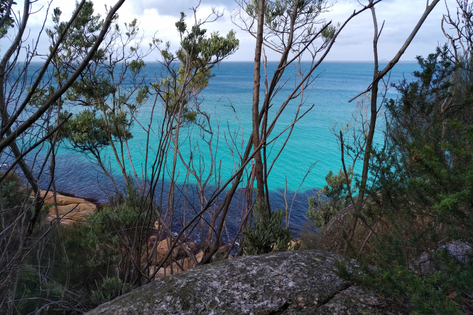
As I was getting closer to the shore, the bright turquoise shone through the trees… yeah… dip it is!!!

I was so happy to see the beach is empty – all mine! Put my gear and clothes onto the big rock and walked towards the water. It was windy and the water was quite cold, but so refreshing!! Suddenly I felt something is off… looked back and saw a crow with a bag in its beak… shit!!! It was my phone!!! I put it in a ziplock bag so it doesn’t get wet and the damn bird was about to steal it! I yelled at it and started walking out, when I saw it dropped it and tried to pick it up… how on earth a bird has such strength. That phone is 215 g + the bag = about 220 g!
Then another surprise… there was a walker at the other end of the beach (this is not a long one). Saw the back pack and the hat, thought he/she was heading the other way…
I was dressed up and about to put my shoes on when the man walked by. He asked me if the water was cold. Told him yes, it was but it was great. Then he said “impressive!” I took this as a compliment.
The beach exit was quite weird, different to what it was before and I couldn’t figure out why. The signs were there, it was something about the rocks…
Lt Waterloo Bay was a stunning view and all the little peaks towards the water on the way there, too. Exchanged a few messages with Otto, he teased me about the onlooker 😃
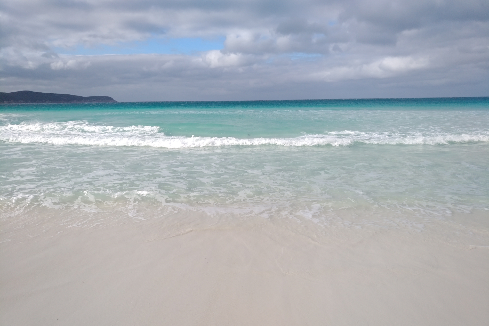
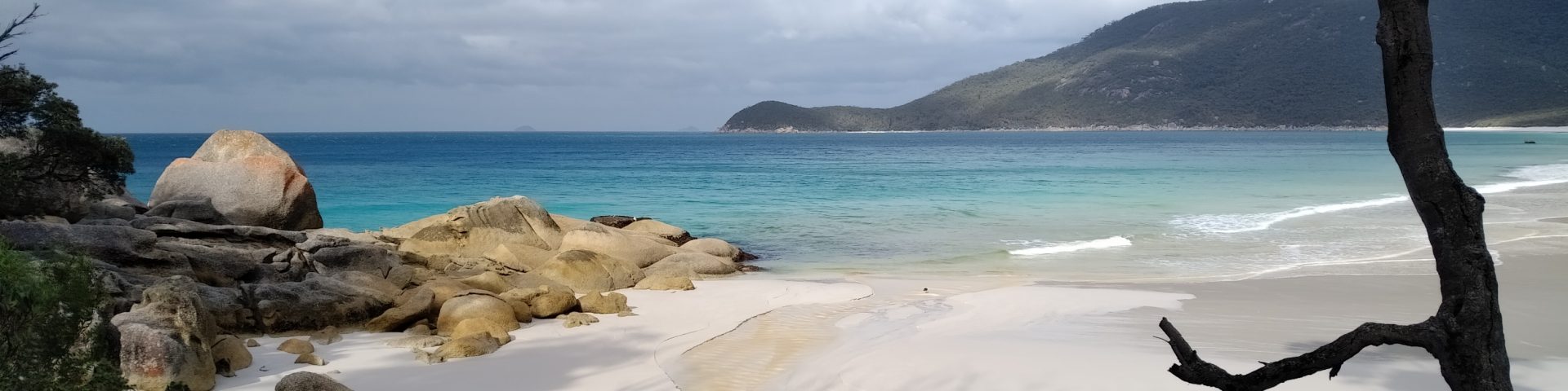
I was already excited about Waterloo Bay, thinking if the water was THIS good at this small beach, it’s surely much nicer there… and boy, it was!!! If it wasn’t for the strong wind that blew sand in every orifice and stung when it hit my skin, it would’ve been heaven! The water was amazing! Nice and flat so I could even swim a little.
I ran most of the beach (minus the dip), then sat down to empty my shoes and socks of sand and put them on. Gosh, sand was everywhere!! Had one of the ginger beers I packed for extra energy before I hit the hill.
Exchanging messages with a good friend took my mind off the hill, I looked back a few times but somehow didn’t realise how hard it is, only saw the beautiful beach of Waterloo Bay. Then Otto messaged me… called him as writing and running on technical terrain doesn’t go hand in hand. He asked me (very nicely) to skip the out and back to South Point. Told him, that I’ll see how I go. He said he’d be much calmer if I wouldn’t finish so late in the dark…
I was surprised I didn’t trip that much. It was the shoes!! I was wearing the Pro Max. These somehow force me to lift my feet off the ground whereas the Sense Pro 2 is a total tripping tool.
Have no idea how I got to the Lighthouse Junction. All I know I enjoyed it and marveled at everything: mushrooms, ferns, moss. Many times I’ve ran by some beautiful mushrooms and a few meters later thought I should’ve stopped and took a shot, who knows if it’s going to be there when I come next time?!
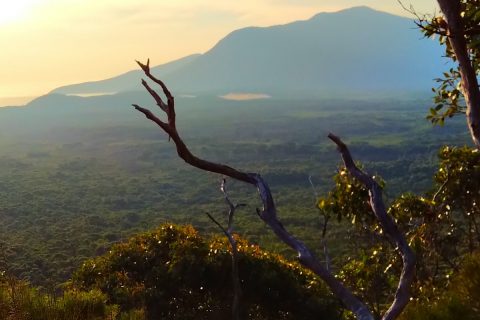
This day was mixed… most of the hikes happened in sunshine and I felt quite warm, but taking off the Bonatti wouldn’t have been a great idea as I was totally soaked underneath (putting the thermal on at start surely wasn’t the best idea). Then there were the windy and rainy parts… when the clothing I was wearing was just perfect. I copped some rain before the Lighthouse, that’s for sure – I remember that, because I was wondering if I am going to score some suckers again.
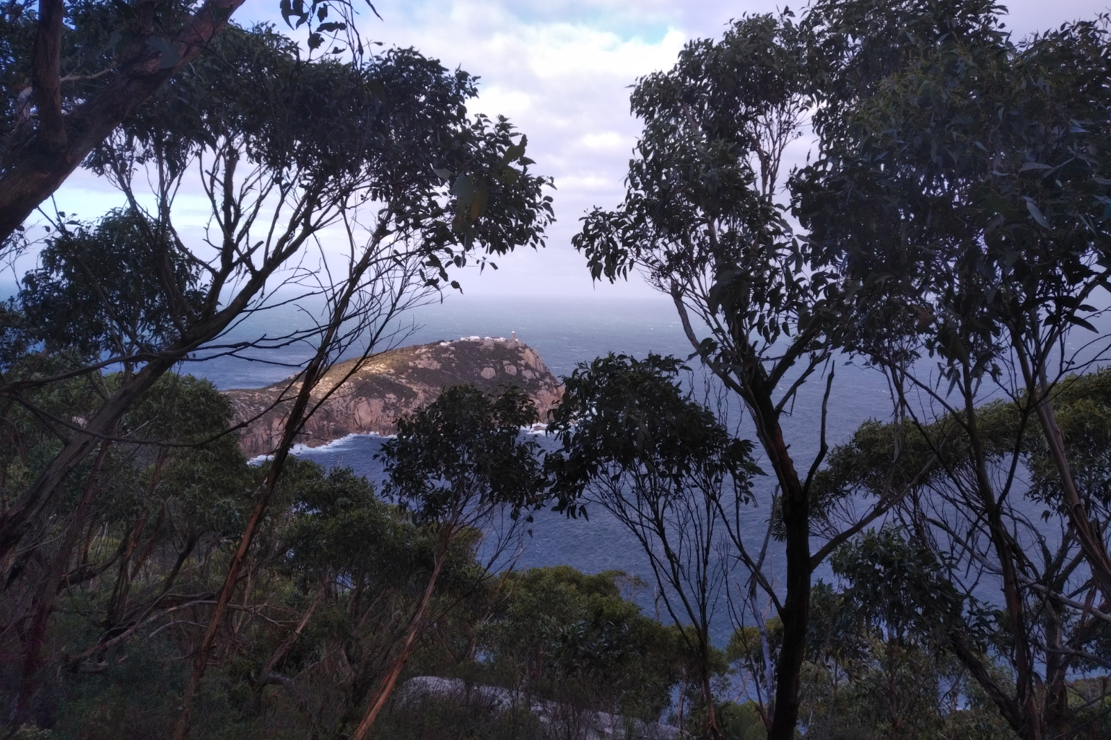
I shuffled on the track towards the Lighthouse (the flat and downhill part, of course). When I reached the open area, the wind pushed me 1.5 m to the left. It crossed my mind “good luck to a chopper to land in this wind!”. At the intersection I looked down, to the left and thought “gee, Hamish had a long way to go down and then hike up on race day!”
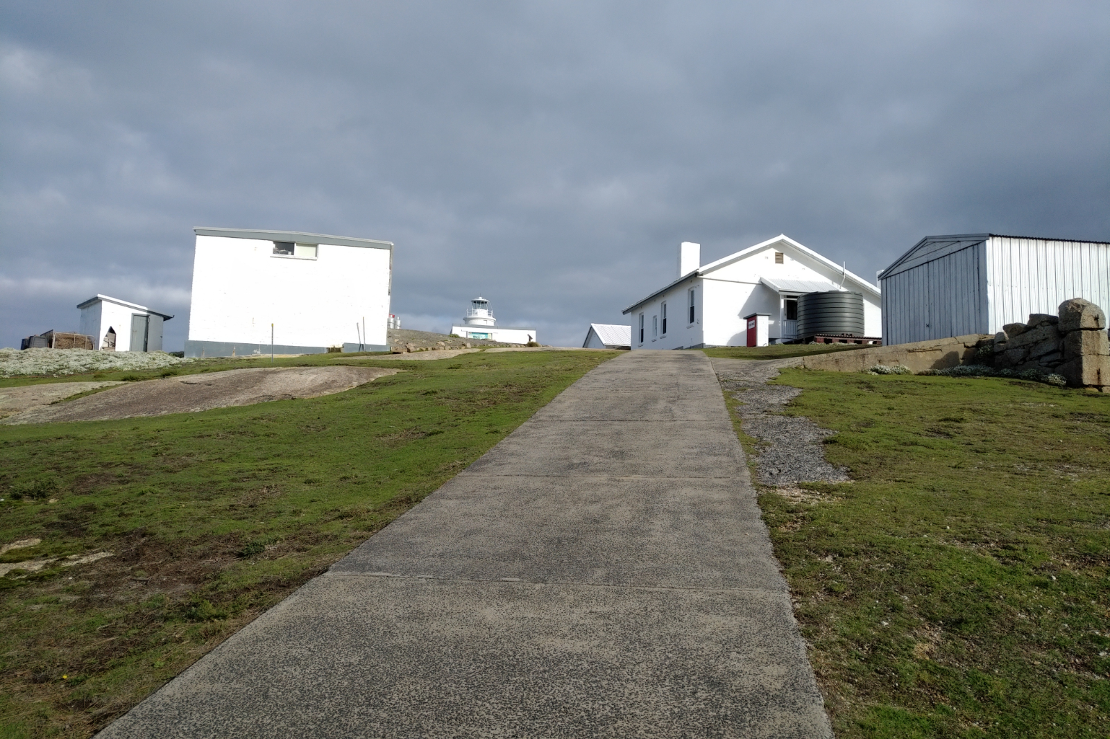
The uphill hike didn’t get any easier, especially since I was the only person on that road. When I got to the buildings, I took a few shots, then filled the flasks, had 250 ml on the spot, refilled then went to take the selfie and to the toilet. It was eerie there… the wind was so loud and the toilet water was moving in the bowl… like in a high rise building. Started to feel cold. When I walked out, I looked around and saw the resident wombat. Took a few pics of him and of the view of the horizon behind the lighthouse. Never been there before. Then all shivering, started the descent. Couldn’t wait to get into some cover, but the hike out has warmed me up.
Not sure at what point, but when I looked back I could still see the Lighthouse, I had the other one of the two ginger beers I’ve packed. It worked! I ran/walked this portion, then as soon as I got onto the 4WD track it started to rain. It was cloudy and windy and I thought going down solo to South Point might not be the best idea in this weather. If anything happens to me, I can’t even be rescued, so I decided to give Sth Point a miss today.
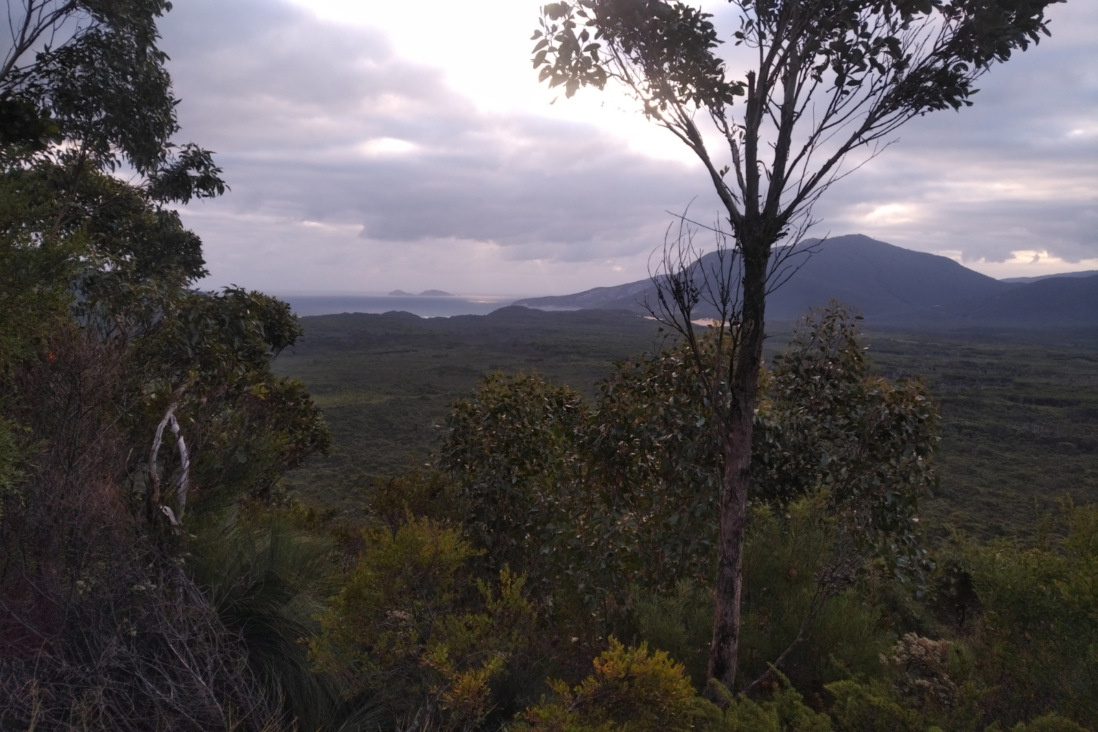
Dunno how I got down and up to Roaring Meg, then even further up on Telegraph Walking Tk. I guess it was the case of putting one foot in front of the other, but by the time I arrived to the 4WD track my toes really hurt, so running downhill was quite painful. Shuffled and called Otto with the sitrep. He was really happy that I headed back earlier and told me that the portion between Telegraph Junction and Telegraph Saddle car park is beautiful, the last 1.5 kms are steep. I’ve never been on this part of the track so I was kinda looking forward to it. I expected some elevation – Mt Oberon seemed quite up there from where I was…
When I got to the Junction, I saw a couple turning out of Mt Oberon Tk (the sandypainintheass one). I don’t think they saw me, because they kept kissing and the guy touching the girls bum… when I got closer to them I said hello in advance and told them that I didn’t mean to sneak up on them. They laughed and the guy’s first question was “how many kays did you do?”. Told him 46.34 (this is what I had on the watch), but will end up with about 51 by the time I get up there?! I asked them where are they going (since only the guy had a backpack). They said only to Telegraph Saddle. We wished each other all the best and I somehow got a bunch of energy and ran. Not fast, but I ran. Then came the up… and I got tired.
As I was “hiking” all of a sudden I could feel something. Looked back and saw these two running. They paid me back and sneaked up on me, but they were very nice. They said I inspired them. This felt really good. So good, that I was prepared to share my beer with them if they are in the car park when I get there.

I was looking for that “beautiful” part Otto told me about… frankly, this part is nothing special after the coast. Yes, there are some dramatic rocks and creeks, but the shore beats this hands down. I kept looking at the radio tower on Mt Oberon, trying to calculate how far I could be from the car park… gosh, it seemed so never ending. About 200 m from the car park I saw a wombat on the left. Took a few shots of him, got quite close, too.
When I finally reached the car park, there was a car leaving and the others seemed without passengers, so beer, change, go was on the menu.
Got home safely – thank you my friend 😊
All up it was a great day. Haven’t seen a human soul between Refuge Cove and the couple on Telegraph Tk. This is a long time and many kms in solitude. The rain?! It’s another kind of good weather.
Gear
- Lululemon crop, top, socks (changed at Waterloo Bay Nth)
- Salomon Bonatti wp jacket
- Kathmandu thermals
- Salomon Pro Max shoes
Food and drinks
-
- 3 larger rice paper rolls
- 2 dates
- 1 small protein bar
- Shot Bloks
- Chocolate and ginger
- 1 mandarine
- 2/3 banana (two pieces)
- 2 x 330 ml ginger beer
- GU Energy drink – 500 ml +250 ml (in flasks) +750 ml in bladder – refilled the flasks with water at the
- Lighthouse. Brought back most of the water and a bit of the energy drink
Strava Activity
Feel free to study this activity.
Max elevation: 348 m
Min elevation: -119 m
Total climbing: 2795 m
Total descent: -2792 m
Total time: 09:34:37