Babi's Trail Running Adventures
Cope Hut

Miler vs Babi 4:0

16 December 2019

I’ve been wanting to do something crazy like this for years. This time – except for the weather – the planets aligned.
The initial plan was this: park the car at Cope Hut, ride back to Falls Creek, start run at 4:30 next morning, do the original Alpine Challenge course (with the Mt Bogong loop), fuel up, change into night gear when at Cope Hut (about 80 kms in), continue to Pole 333, then Harrietville, have a shower and a good breakfast there, then head back via the original course. Ride to Cope Hut next morning to pick up the car.
There were still fires near Bogong a week before, so I decided to go with the route we did (actually others did) at AC. On the day I drove up I checked again, the website said the tracks are opened, but the map showed otherwise, so I contacted Parks Vic and they confirmed that a part of the track falls into the fire danger area and it’s closed.

The goals:

1. Do the 160 kms
2. Thread effortlessly to conserve energy for as long as possible
3. Take my time – it’s not a race – check out those things/places that are along the course
4. Enjoy the food in Harrietville

The outcome:

1. 108 kms
2. It’s easy to thread effortlessly with no pack… when you add the pack into the equation it only works (well, kinda) if you slow down. For me effortless means no funny feeling in the stomach, like floating
3. I did take my time. Took lots of pics, tried to cool down my body at every opportunity (creek, stream), looked at the views, checked out creatures that moved in the bush
4. Well… there is nothing open on a Monday afternoon in Harrietville, except for the pubs and they only serve beer

Sunrise above Rocky Valley Dam

Drove up on Sunday afternoon. Dropped off two bags at Harrietville Caravan Park for resupplies and a set of change clothes for next morning. I also had an 18 A charger thinking while I eat and have a shower I can charge my phone and watch.
Butch was extremely helpful and so excited for me. He let me stash my stuff in the staff area, even use the fridge for the perishables.
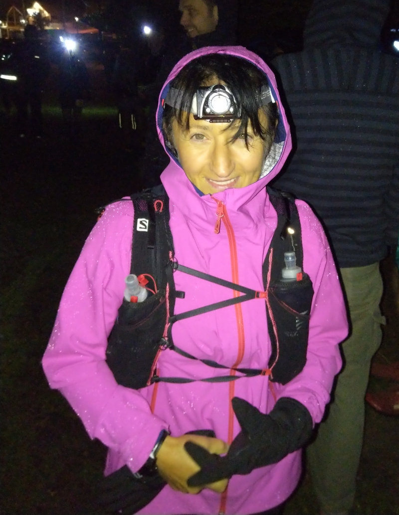
Checked into Falls Creek Country Club Hotel (Jude was very nice) and then I got my things ready.
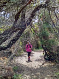
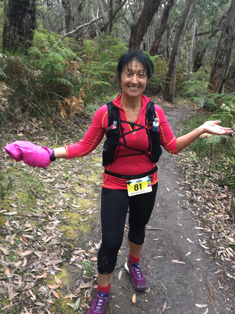
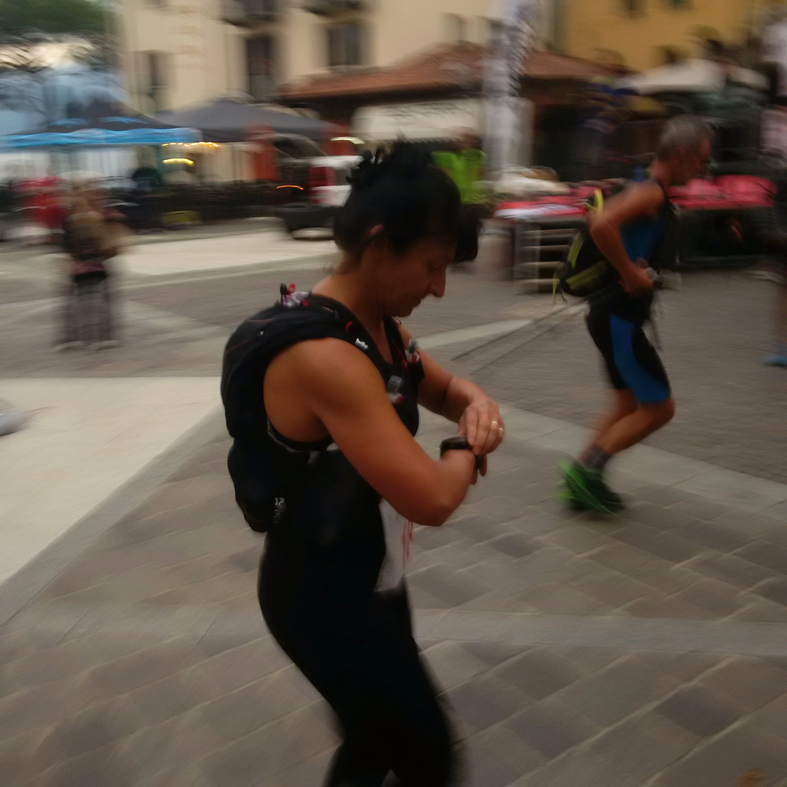
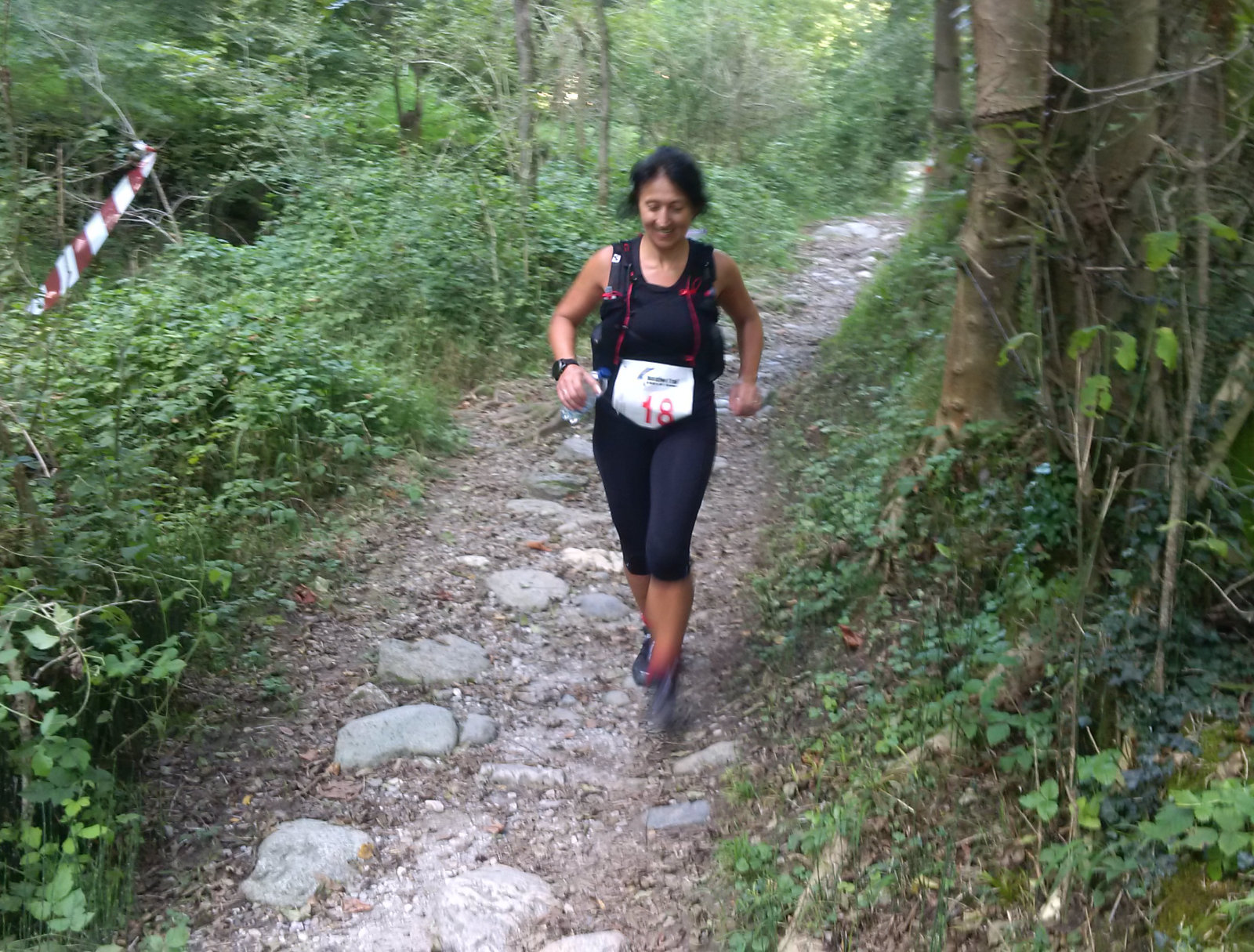
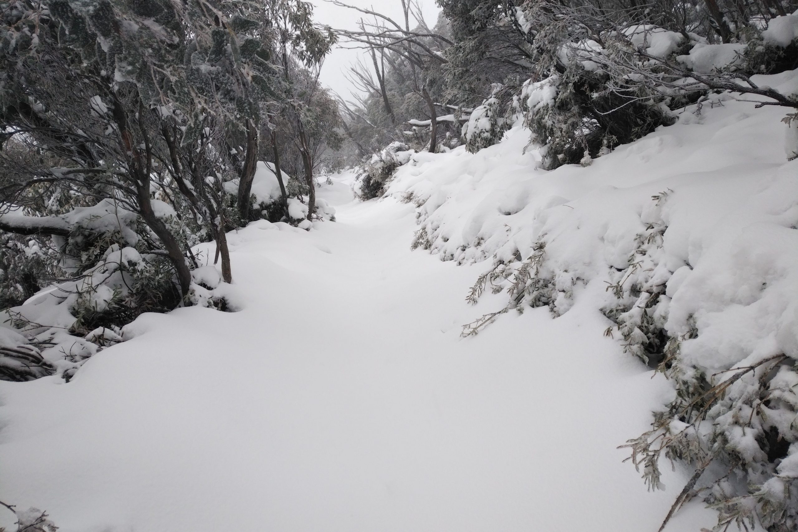
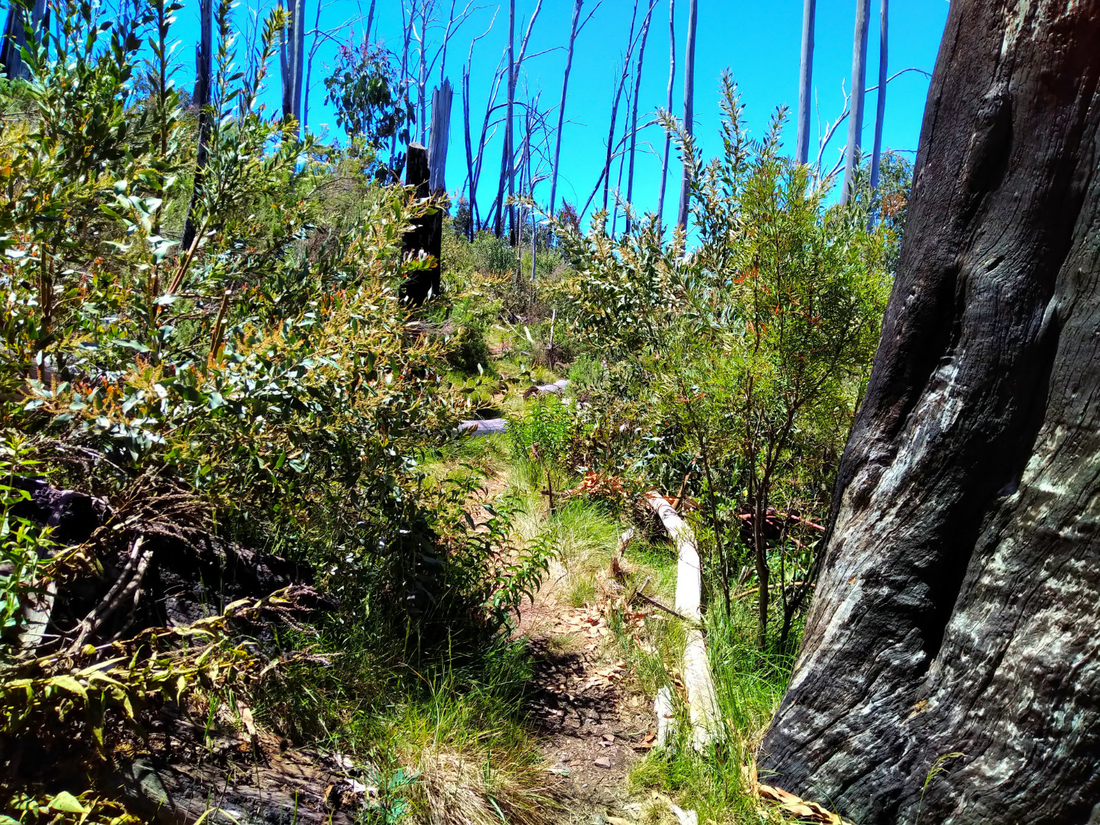
Started just after 4:30; I thought it would be freezing out there but it was OK, didn’t need long sleeves. I managed to get a tad lost before getting onto the track below the dam wall. I always followed the crowd at the start in the dark (I didn’t have these issues in daylight) and there were no pink flags, either 😃 I had to check the Avenza map!!

Couldn’t resist these colours

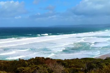
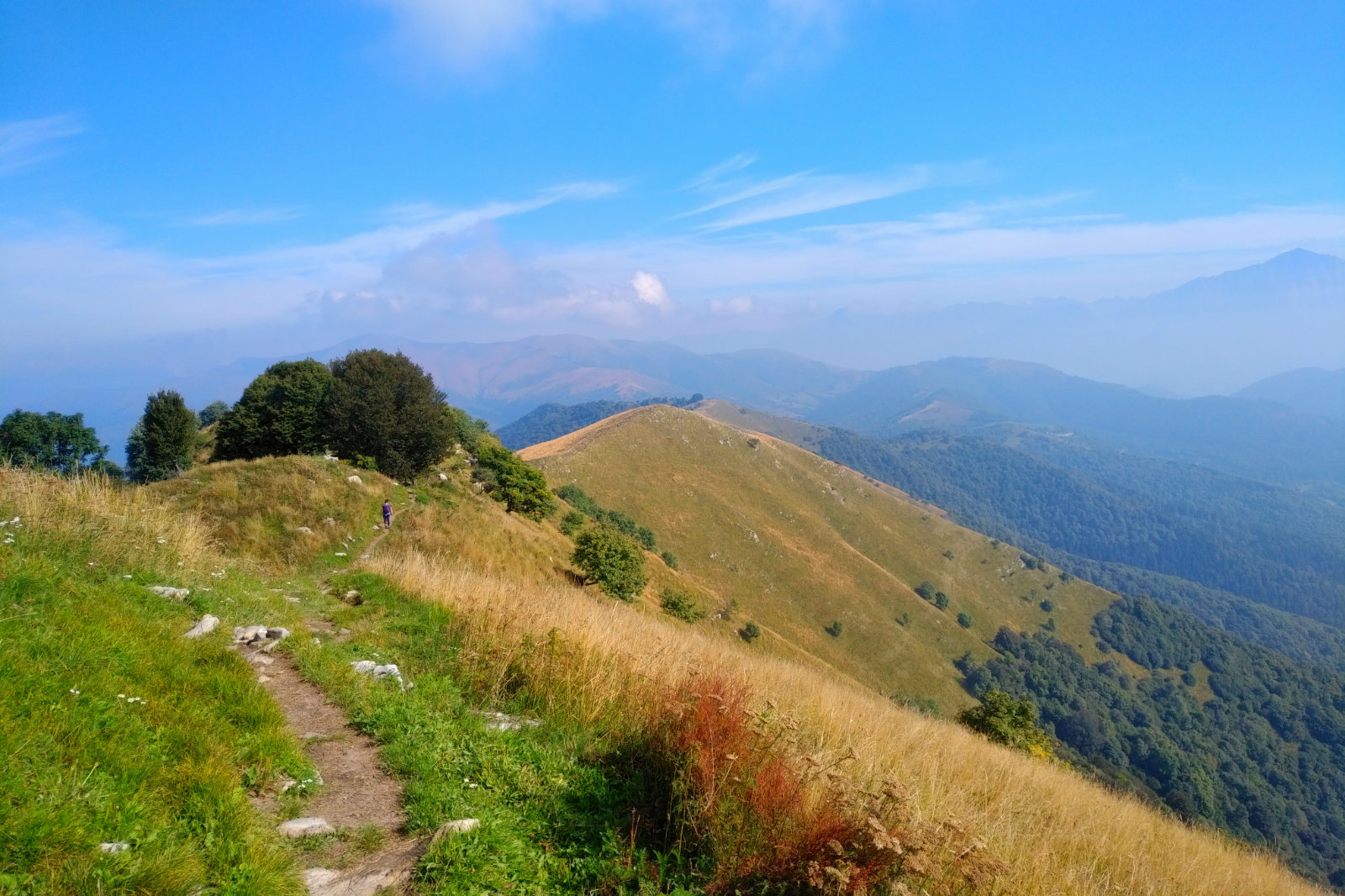
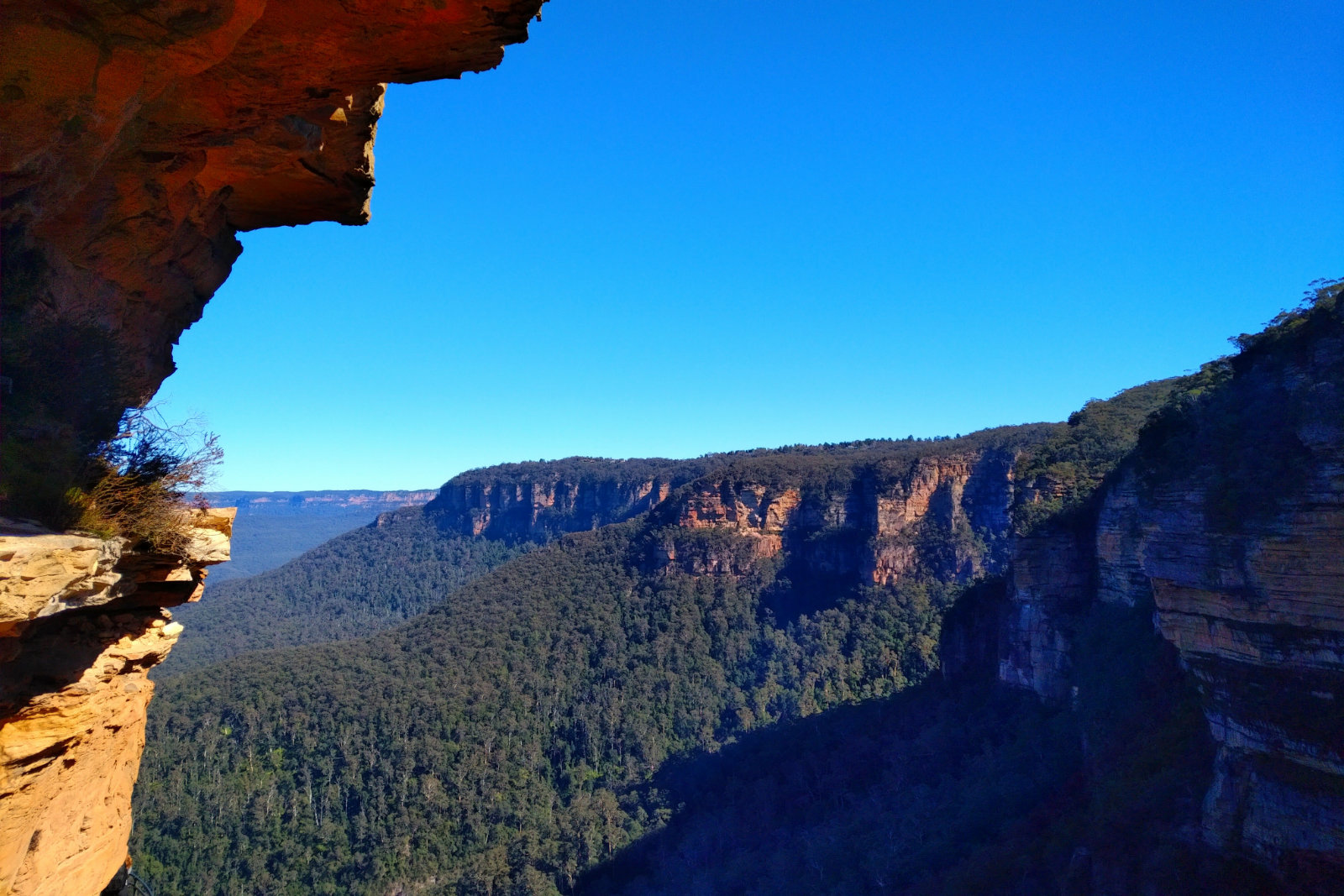
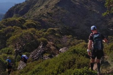
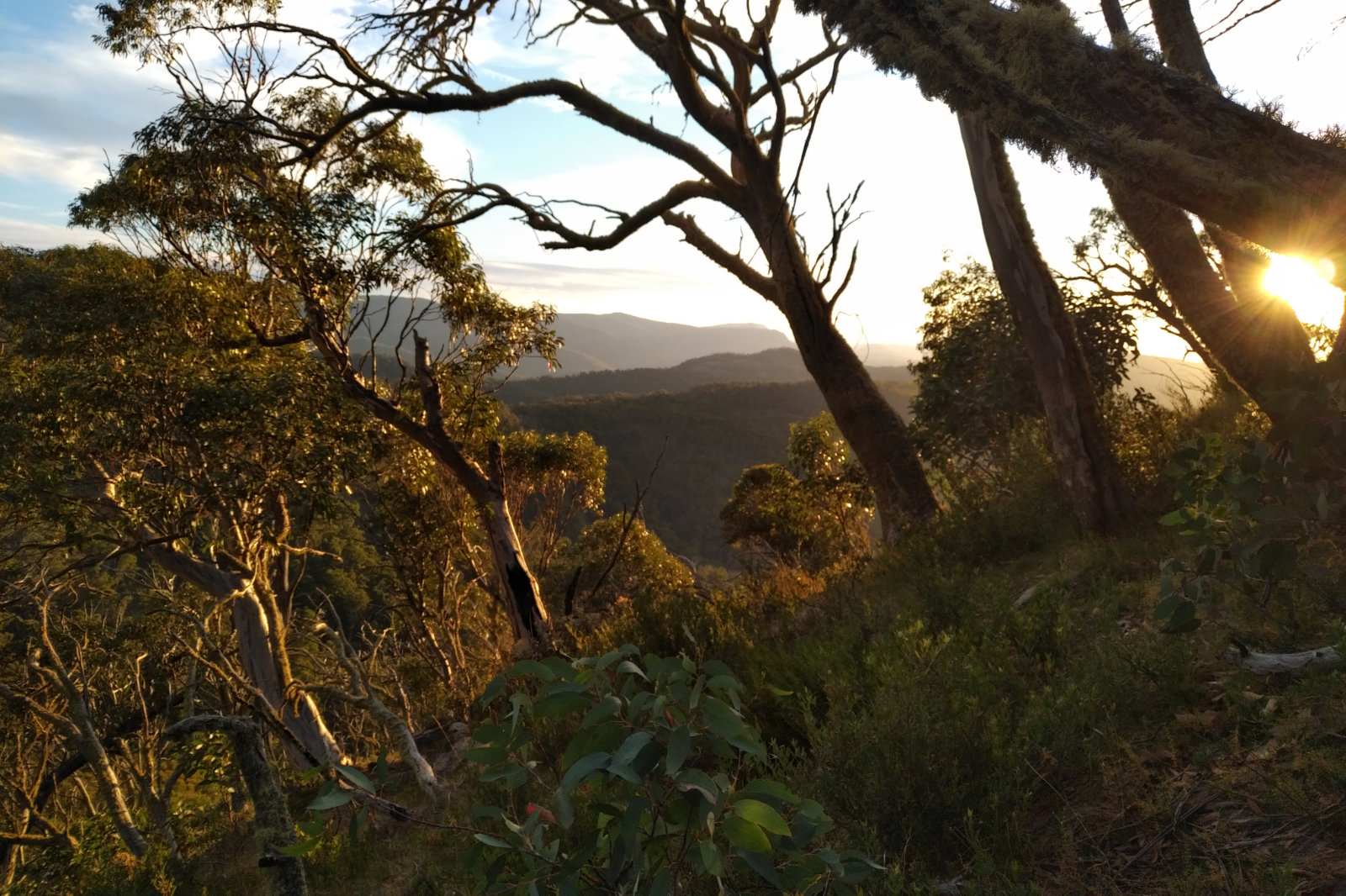
The sunrise was just spectacular, it always is there. I have also noticed the beauty of Heathy Spur as I wasn’t looking at someone else’s feet in front of me. After I turned onto Big River Spur I saw brumbies on the slope, beautiful creatures. Marum Pt track was beautiful, I enjoyed it.
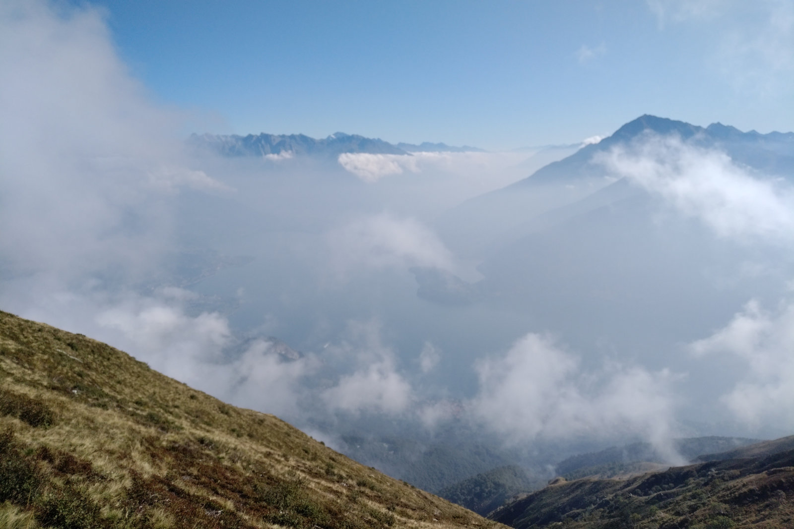
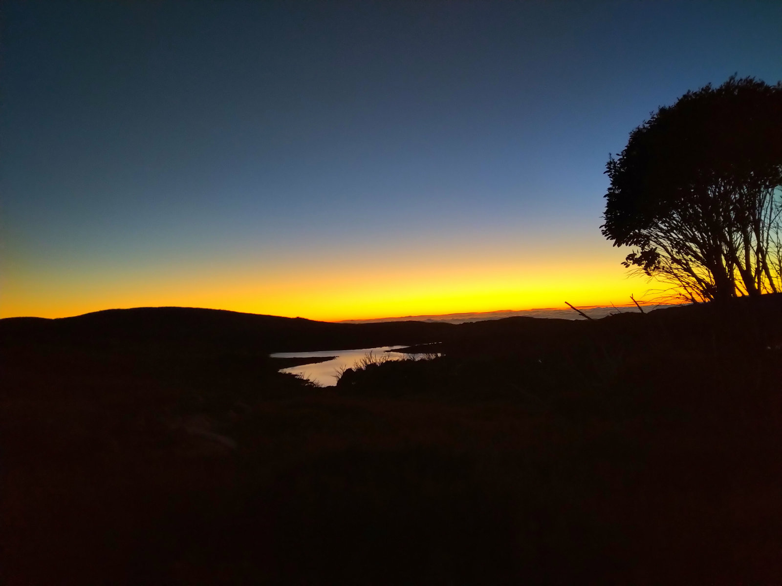
Both the sun and the moon were visible… the shot I took at the little dam (?) before Langfords Gap has the moon reflected in the water. It was just a beautiful sight with some amazing colours. The mist sitting in the valley was another spectacular view.

After the Bogong Rover Chalet I saw a wild cat run across the road and into the bush. It was dark grey with light stripes in the front of its neck, the size of a young tiger. Stunning sight. It happened too fast for me to take a shot, but it got me thinking… what else is out there?!

The mist sitting over the valley

I left with 500 ml of sugary water in one flask and another with plain water + the BeFree flask with the filter. I was planning my water resupply points as I was going. There were streams and also the aqueduct at Cope Saddle Hut – I really had to get water there, because the sure next point is Cobungra River. After I filled up the flask I headed up towards Pole 333. There was a little breeze, but the heat was already cooking and the flies started to approach. I managed to fall, straight on my right knee – the one I’ve injured in February. Stood up, dusted off my pants, checked the damage, nothing serious.

The brumby that scared me

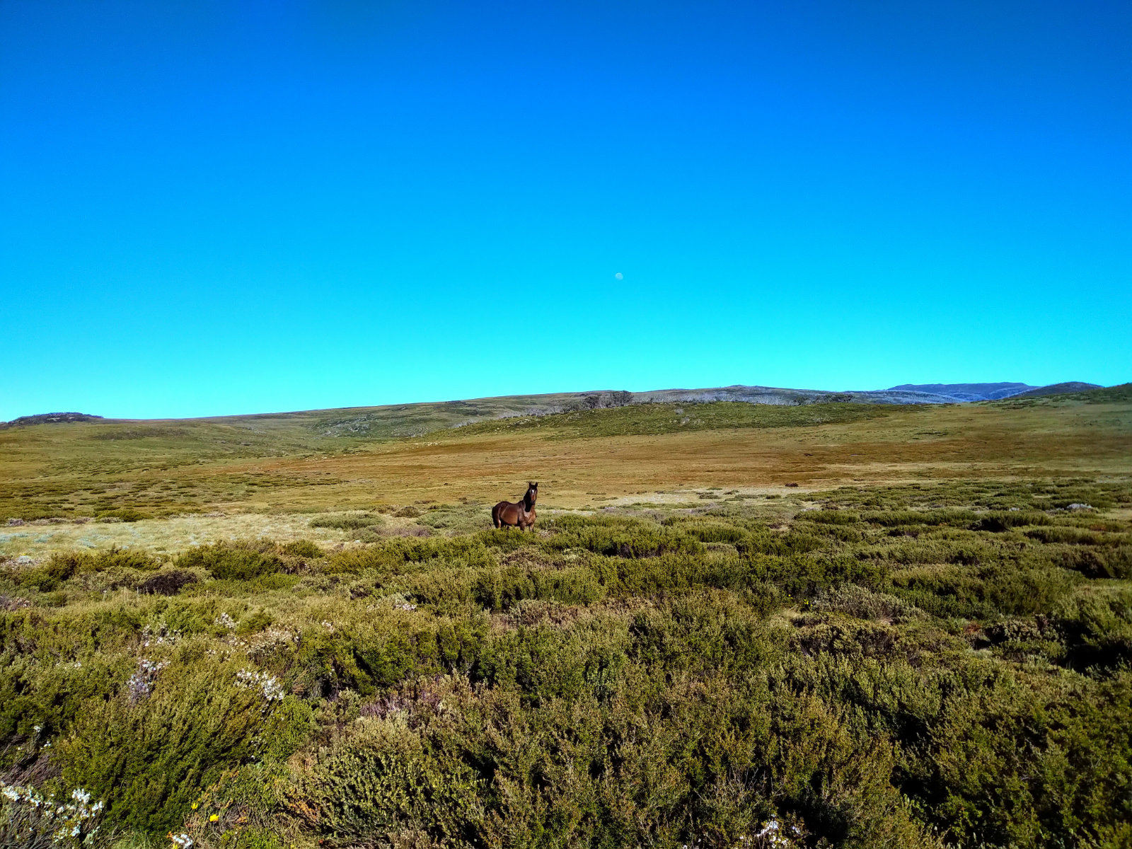
As I was getting closer to Pole 333, I’ve noticed a brumby maybe 15 m from the track. I pulled the phone out to take photos, when the horse did a sound trying to scare me off, then made a move like he wanted to charge. Well, that was scary!! I started to yell “go away!!” and stumped my foot to the ground, then slowly moved away. I kept looking back because the horse started to move around and tried to figure out what I would do if it was coming for me. My only option would be to stand behind a pole, since there was nothing else to move behind on the High Plains.

The famous Pole 333

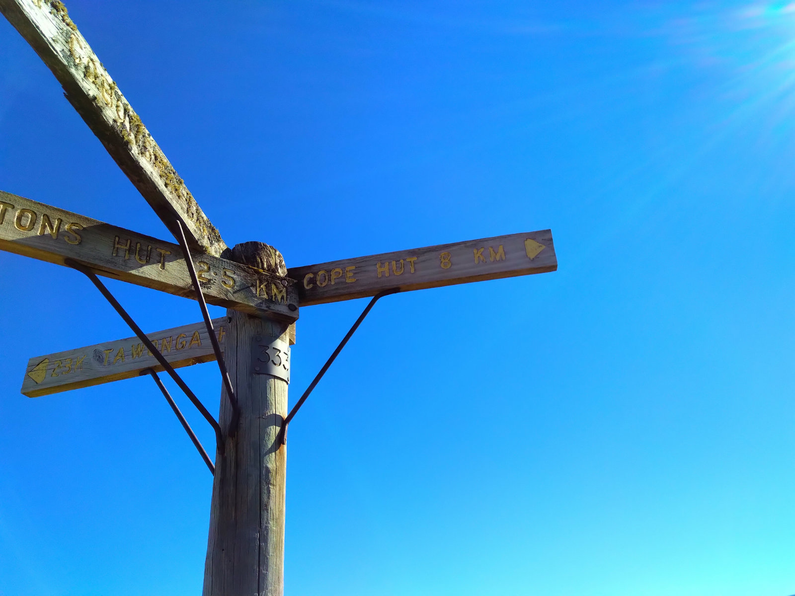
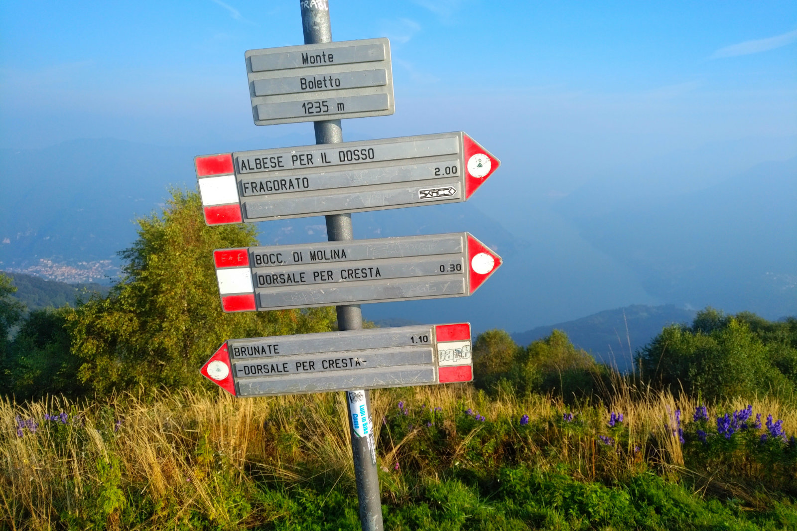
At Pole 333 I took a few shots of the sign, then turned left and followed the pole line, noticing that I must have done -970 m. The sign at the intersection says 5 km to Cobungra Gap and the one a bit further says 6 km. Go figure.

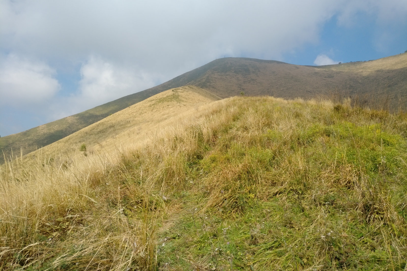
Loved the perfume of the wild flowers the slight breeze brought towards me all along to pole 267. It was fun going down to Cobungra Gap. Took it slower – last time I fell twice and couldn’t afford that today. I could see Mt Hotham and thought how easy would be just to jump over.
I managed to eat so far and was looking forward to the cold creek water at Cobungra River.

When I got there, I thought it’s time to get the triangle bandages out, they will be handy on the way up Swindlers Spur. Drank some water, soaked the bandages, poured some water on my neck and cooled down my arms, then headed towards Swindlers Spur.

This, and Westons Spur are the two hardest hikes for me, the ones I struggle the most. These are the uphills I always get to in the heat of the day, making it even more painful. At AC I pretty much powered up and then paid for it dearly, now I just wanted to go up slow and steady. About 50 m in I realised the food I had wasn’t enough, so I pulled out the ginger beer and had it, then continued.

It was getting warmer and warmer, the flies wilder with their relentless attacks on my face. I wish I brought a fly screen. Gosh, how many times I repeated this sentence over the two days!

I really liked this sign

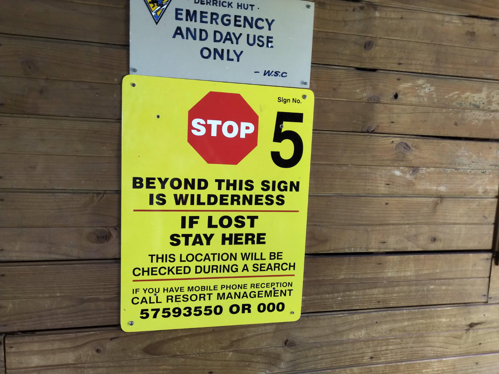
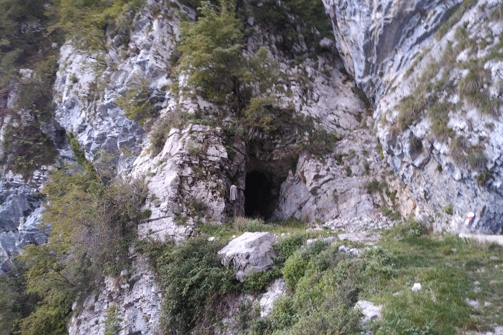
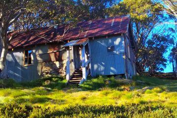
I eventually got to the flatter part, with some runnable sections, then reached Derricks Hut. I’ve never been in there, so I thought it’s time to check it out. It was nice and clean with some useful posters on the wall, although most of them reminded the visitors to stick to the etiquette. I took some pictures, then closed the door behind me and left. It was getting close to noon and quite hot.

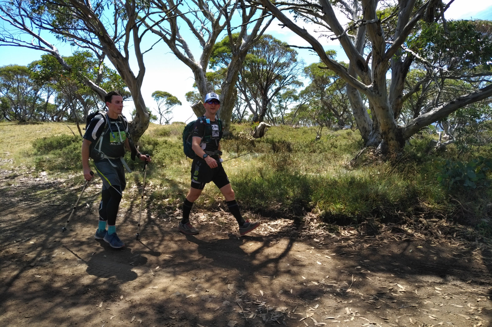
At pole 60 I turned left towards Mt Loch car park. Machinery Spur is not that fun, it’s a gravel road all in the open, going up, then down, then up again. In the down bit I saw two hikers. Gee, I thought, these are the first humans I’ve seen along the 40 kms!! Had a little chat with the two ladies, they were going to Derricks Hut, then to Spargos. They had big packs and were totally covered.

I felt like a kid here

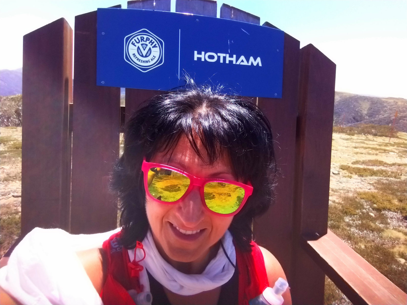
When I was close to Mt Loch car park, I thought I’ll check out the big chair. Never came this close to it even though I passed it several times before. I climbed up, took a few selfies and dangled my legs like a kid – it was fun! Short one, but it was. Because what followed a bit later, wasn’t.

The building the ASAR checkpoint was in was now empty. It says “Toilets” above the door, but when I went to open it, it was closed. You can clearly see the toilet doors with the signs on them through the window. It’s like showing a kid a candy, then not letting them have it! Shrugged my shoulders, said “That’s not funny!” and kept going.
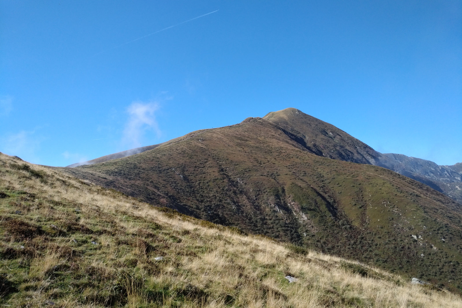
I’m dreading the hike up to Mt Hotham!! Those bushes always scratch my legs and there’s no proper track to follow. Couldn’t wait to get to the top. There were a few guys working on the poles and another two cleaning some metal, with the music banging from their ute. They didn’t care about me, I said hello, they half heartedly said something back.
I felt that I really need some calories, so I got one of the Spring gels out and ripped the top off. The top came off, but the lining inside didn’t follow, so it was like pushing on a bubble that doesn’t want to burst. Eventually I bit it off, but didn’t need this extra struggle. With a gel!!
I saw there is someone in the tower, but by the time I got there, the person disappeared. It was a bit spooky, as the door was banging against something in an eerie way. I took a few shots, then headed down towards Diamantina Hut. The sign says Diamantina Springs, so I thought I’ll check out the back of the hut, maybe there is a spring there. Haven’t found any, so I crossed the road and headed along the Razorback. Saw a pink tape and smiled – last year I was collecting them on my way down at 4 Peaks.

Bon Accord, a tad overgrown

Bon Accord was a struggle in the heat, with temperatures over 30°C, reaching 35° for some time. The overgrown, scratchy bushes, the dry dust, rocks, branches so slippery and I couldn’t afford to fall, damage any ligaments or tendons today. Kept saying “Careful with that ACL!! Can’t get injured!”. I also couldn’t afford to get bitten by a snake, so I was extra attentive the whole day. I just wished it was raining… I can do rain any time, even enjoy it!
This constantly scanning the ground for snakes is quite tiring, just like when running at night – I’ll end up with HFP (Head Forward Posture) soon.
I could hear the sound of the water below and just couldn’t wait to get there. I already imagined taking off my shoes and soaking my feet in the cold water while cooling down my arms, face and neck. This cooling down arms, face and neck became one of my favourites on this trip, I did it at nearly every opportunity.
I loved that the water doesn’t taste plasticky from that BeFree flask, and it’s a luxury and privilege to have COLD water on such a hot day in the middle of nowhere.
When I got there, I found a spot with a little shade on the other side and I did exactly how I imagined, it felt great! Now I started to look forward to a proper meal and something cold… I bet they have non-alcoholic beer (yeah, I know that’s not like me, but I wanted to play it safe) at the pub…
There was a group of school girls bathing in the river, they made quite a noise. They said hello when they saw me, which I thought was really nice.
I first walked into the pub and had a beer (non-alcoholic), it felt sooo good! I had another one and had a chat to the bar tender (Matt) while another person walked in. He looked like a regular.
Then I headed down to the caravan park to get my charger. When I came back I asked where is the best place to have some food now in Harrietville. Both Matt and the other guy were looking at me strangely. When this person said that the Bakery is closed, the Ice Creamery might have something, if I hurry I might get there before they close… he saw the guy putting the chairs up. Well… that didn’t sound promising, but I headed that way anyway. The Bakery was closed, and so was the Ice Creamery. I thought I’ll check out the other pub – they usually have pizza or something. The sign in front does say that, but when I walked in the lady told me that they don’t have food, they just bought the place yesterday and will be making changes. I could see they are making changes, but to the stone work outside, which wasn’t much help for me.
I walked back, hoping the Snowline pub might have something (anything!!). Matt said the kitchen opens only on Wednesday, but I can have some beef jerky… in retrospective I should’ve had the beef jerky, but I was looking forward to something substantial. Something that will give me enough energy to get up to Mt Feathertop and through the night with some top ups from the stuff I packed. That alone (the stuff) wasn’t enough, I’ve already used up too much by that time and frankly, I didn’t feel like eating that anymore.
I had another beer while charging my phone and watch, and spoke to Robbie (the regular, who happened to come from WA, is a stone mason and is helping his friend out at the other pub). Matt asked me if I get spooked out by animals. Told him that deer sometimes do that, especially in the dark. Forgot to mention that a duck did that to me along the aqueduct in the morning. Then he went on to say that there are dingos in the mountains and they attack in a pack. I asked what do you do when you get attacked by dingos? Robbie said that just pick up a stick a whack around. I tried to imagine that and thought the walking poles now would be handy.
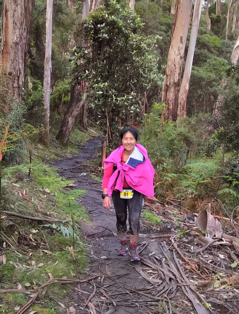
I went back to the caravan park to drop off the power bank and re-stash my pack, then headed towards Bungalow Spur. As I was walking across the little bridge, I thought I should just get some fresh water from the river, it’s cooler than the tap water I filled the BeFree flask with (as it turned out it even tasted like chlorine). I didn’t do it and I paid for it later.
It was hot, very hot, even though I left later compared to three weeks ago. The fact that I was energy depleted, didn’t help, either. I set myself a goal – at Tobias Gap sit down and eat a protein wafer. NO MATTER HOW!! So when I got there, I sat down on the Tobias Gap sign (just like I did 3 weeks ago) and bit into the wafer. It felt like and tasted like saw dust, so I poured a bit of water into my mouth to try to actually chew it. It didn’t feel good, but eventually finished it, then stood up and went on.
I’ve noticed it’s hard to breathe and tried to figure out why. I pulled away the top above the xiphoid process and was able to breathe easier, it made a huge difference. I decided to take the crop off and put the thermal on instead when I get to the hut. I also folded down the seam of my pants so it won’t press on my abdomen.

Bungalow Spur near Federation Hut

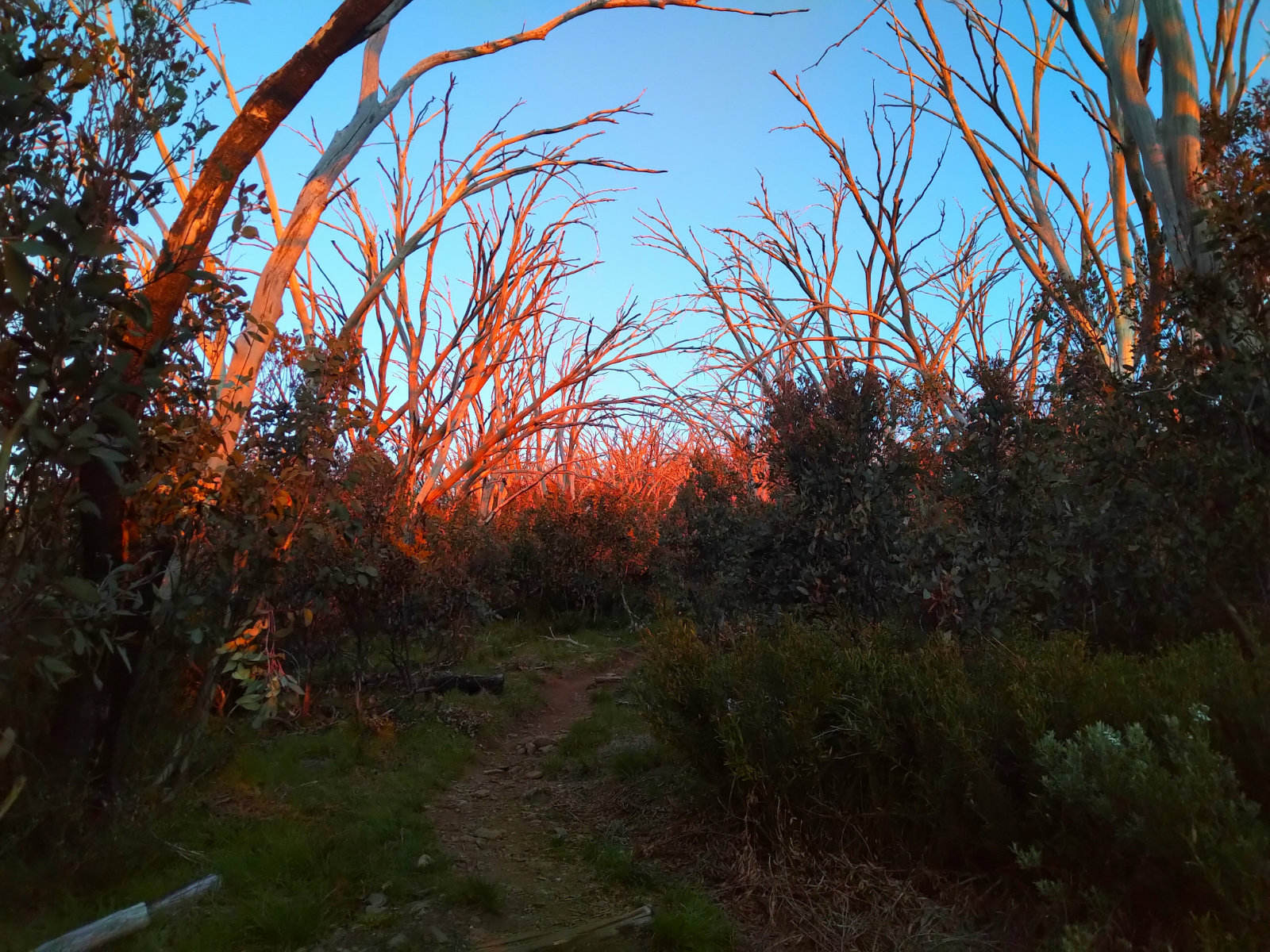
The colours of the trees and the sun setting were just spectacular! Saw a bird so beautiful. It let me take a shot, which made me forget about the hard part for a bit.
The tap water was simply yuck, couldn’t wait to get to the spring. I was hoping that the one closer, on the left will have some water flowing but that wasn’t the case, so my last chance was the one before the hut. Gosh, that water felt amazing!!! It was icy cold and tasted like water (if water can taste anything). I also wetted one of the triangle bandages, thinking it’s getting cold soon, no need for this much wet stuff.
The rays of the setting sun painted the trees pink, just stunning!!
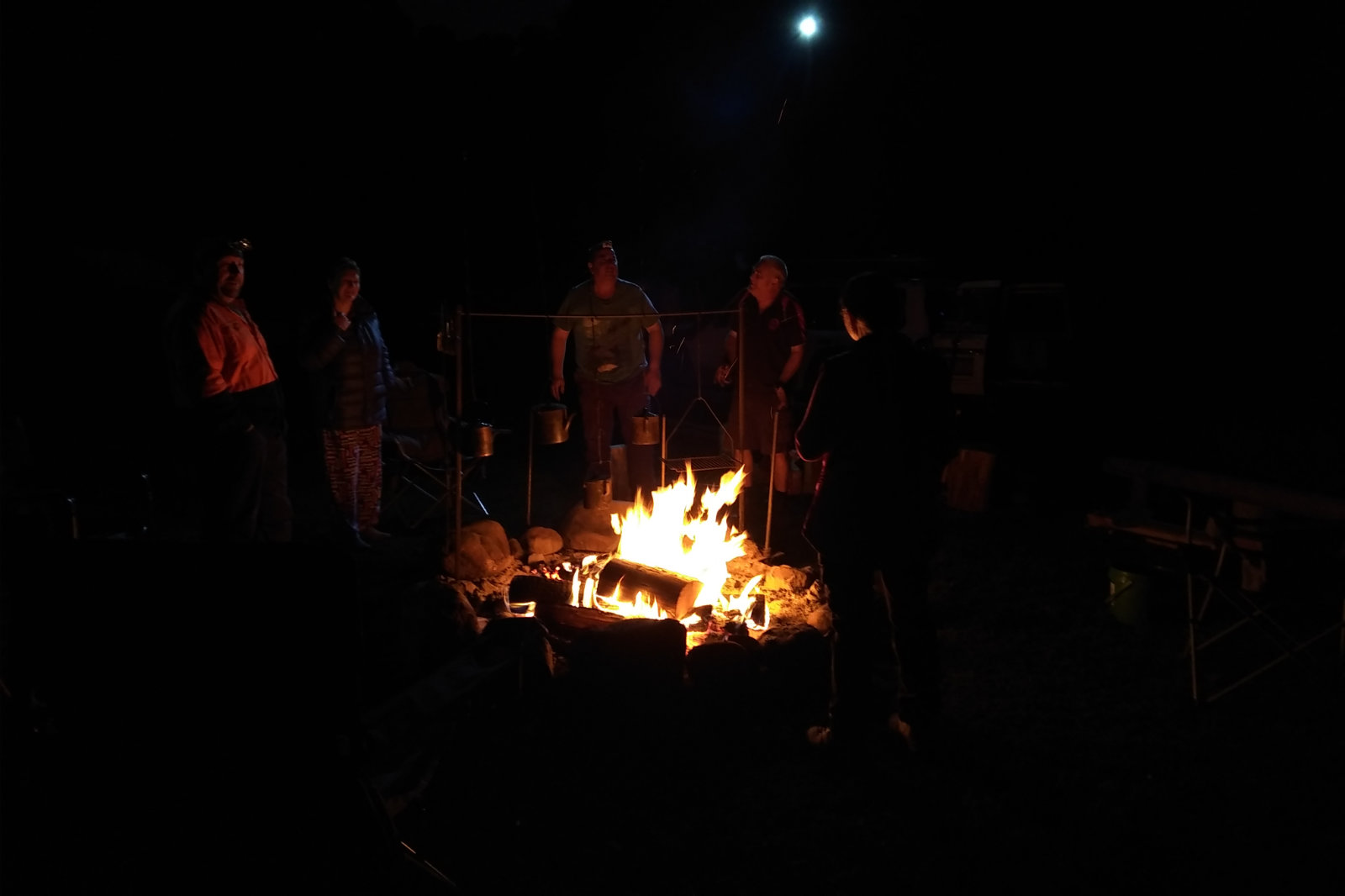
I could hear voices when I was getting closer to Federation Hut. There was a group of youngsters camping there, ready to prepare dinner. We had a chat, then I went into the hut to take off the top and change into the thermal. I also got the torch out as it was getting dark. Before I left I asked if they had a walking pole. They didn’t, but one of them had a good walking stick, which he gave to me. They asked me if I was OK, which I think was very thoughtful of the. I thanked them, said good bye and headed up to Mt Feathertop.

The sunset from the way up to Mt Feathertop

By this time it was getting dark, I realized I forgot to eat at the hut, my energy levels were below functional, started tripping (more) and thought I need to come up with a plan. Got up to the first peak and turned around thinking I’ll go back to the hut, rest for a bit, hopefully I’ll be able to eat and then continue. I am glad Otto called me while I was up there, otherwise there is no reception in the hut. I told him what I will do and promised I’d only continue if it was safe.
When I was getting closer to the hut I could hear voices, but couldn’t see anyone until the torch found the youngsters. Few of them were sitting on a log, the rest standing around and gazing at the stars. I couldn’t help but let a “Wowww!” out, it was truly spectacular. Told them I’d stay until I get better. They asked if I needed anything… a pillow?! I said I’ll be OK, thanked them and went inside the hut.
It felt very cold in there, but since I wasn’t staying for long I didn’t light the fire. Took my shoes and socks off, pulled out whatever clothes I had from the pack, put the WP pants on, pulled the WP gloves over my feet and laid down on the hard bench to get some rest. It felt good and I think I dosed off for a short time. I couldn’t stay in the same position for long on the hard surface. When my body temperature fell I pulled out the space blanket. Kept the long johns and the beanie as pillow.
I looked at my watch, it was 22:31. If I get out and continue, I might get into trouble on the way down on Diamantina Spur. I will also have to go through the whole shebang as today – the heat, getting to Harrietville in the afternoon, no food, no energy. And those bloody dingoes!!! I couldn’t get them out of my mind!! The space blanket kept my body heat in and every time I wasn’t covered I could feel the freezing cold. I also thought that it must be very cold out there and the gear I am wearing is just simply not enough on upper body (the legs were ok).
I also contemplated getting out and getting along the Razorback and arriving to Harrietville in the morning… but then again, the cold could’ve been an issue. I decided to play it safe (not so much for my own sake, but for my loved ones) and stay until morning. Put my phone on charge and tried to get some sleep. The space blanket wasn’t helping, I should’ve just bought that Escape Bivvy that works like a sleeping bag but it’s very light and packable.
At some point I sat up and tried to eat – wasn’t happening, bit more rest required… then the morning came. I could hear some noises outside, thought an animal or one of the youngster went to the toilet. I managed to eat a protein wafer, so the prospects of going on for a while looked good.
When I looked outside, the youngsters were sitting on the log, having their coffees. How cool is that?! I thought it’s time to face the music and get out of the hut, expecting freezing cold. Big surprise! Outside it was much warmer than inside. Had a quick chat with them and headed up to Mt Feathertop.

Turned around and took this shot on the way up to Mt Feathertop

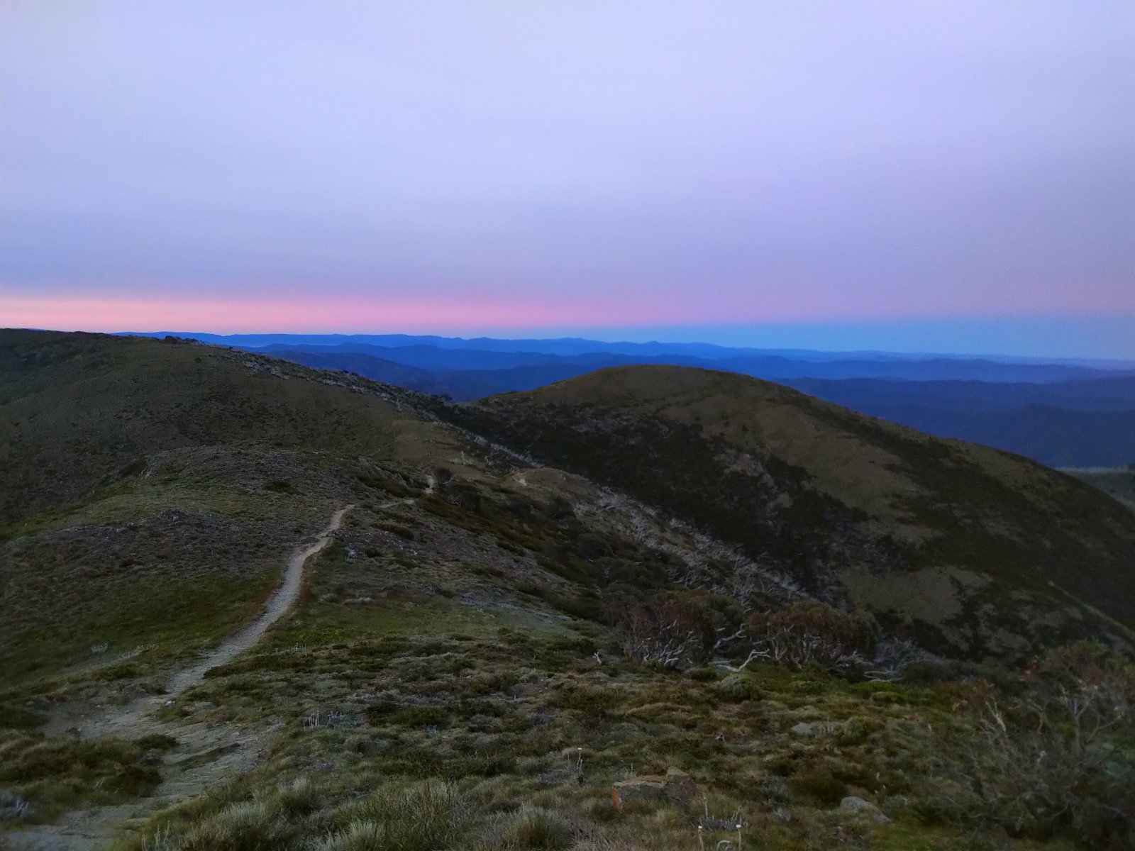
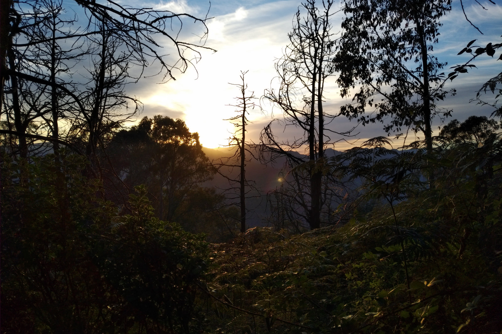
The sunrise was spectacular! I always wanted to experience this on that mountain. It took a weird twist of tale to actually end up here at this time, but I wanted to make the most of it. Took a few shots and stopped every now and then to really enjoy the view. As I looked back, I saw the youngsters heading up the mountain. They were going quite fast, which I admired, but then I thought how much easier is without a 4-5 kg pack. I was trying to avoid the same mistake I made at AC (powering up after just having recovered), I just took it slow, thinking of which point did I really reached the previous night.
I took a few shots on the top of the mountain, then took the WP pants off, packed them and headed down. I was a bit embarrassed taking the WP jacket as well, as all I had underneath was the thin ioMerino thermal (a tad transparent). Said hello and bye to the group as I saw them on my way down, then after the cross I stopped to take the jacket off – it was getting warm and I didn’t expect to see anyone for a while. Contemplated on rinsing, then putting the crop back on at Kiewa, but the thought of it restricting my breathing on the way up Westons made me dismiss the idea.

Kiewa River – in reality so much more beautiful

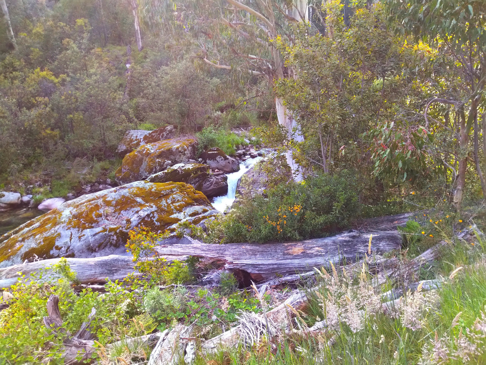
Diamantina Spur was as scratchy on the legs and arms and hard as always, with the bewildered flies as an added anguish. I was looking forward to getting some cold water from the Kiewa river, then take my shoes off and cool down at Blairs Hut before the Westons hike. Based on my calculations it would be about noon by the time I get to the top with a water top up at the Westons Hut stream.
The water was refreshing in both places. Standing in the icy cold water after Blairs Hut was pure bliss!!
As I was hiking relatively steadily, I remembered the time I was here with Tay (similar circumstances: heat, flies, ants… being tired), then at night time at AC, where I met the group I ended up travelling with for pretty much the rest of the course. How much better the darkness and cool was?! But today I also noticed the horse poo and footprint… which meant brumbies must have been on this track. Tried to work out where I’d jump if a heard came down towards me. I’m sure they’d be spooked to see this bright thing.
Eventually got to Westons Hut; saw a bench near the fire place and thought it would be nice just to lie down for a few minutes, so I took the pack off and did just that – lied down and stretched my back a little. Then I heard the hut’s door moving – sat up, looked and listened. It was the wind causing a draft, but I thought I should go anyway.
At the stream I dipped the bandages into the little waterhole, then cooled down my arms, neck and face. There is a bucket a bit further up, where I thought there’d be better flow, but it seemed too cumbersome to get up there, so I aborted the thought.
Did about 50 m (?) when I dropped one of the bandages, straight into dust. Went back and this time I climbed up and tried to wash it, as it was full of dirt and pieces of chips or something… wasn’t perfect, but I put that one around my neck and used the cleaner one on my head and face to fend off the wild flies. They were just maddening!
As I was reaching the High Plains, I could pick up the pace a little. Couldn’t really run, but walking faster was possible. I passed a few streams and did the arms, neck and face thing as often as I could (well, compared to how fast my sleeves were drying). The sun was getting stronger and the heat hotter – could feel it on my calves and forearms.
When I was getting closer to Pole 333, I saw a group of hikers sitting down to the right just next to the AWT. Waved them (they waved back), then I turned left, heading towards the Fainters turnoff. This part would’ve been fun if it wasn’t for the flies. It’s mostly downhill, even though the terrain is uneven and unpredictable (sloshy grass, moving rocks that splash mud on you). Then came the abrupt turn to the right onto Fainters with the rocky/grassy 4WD uphill… I thought it never ends. It even seemed longer than in the cold, mist and dark at AC. Probably the flies and the heat had something to do with it.
When I saw Pretty Valley Pondage, I had a wow moment – never seen it from this point in the daylight and it was beautiful! I soon bumped into a couple, the lady had such a fair skin, I thought she’d be burning very fast. They were heading just out to the hut. I was so over everything, that I forgot to ask which one. We wished each other the best, then I went on, crossing the wall (not sure if that’s it, though) and trying to distract myself with the view.
Saw cars in the parking lot, a guy unpacking his bicycle. I waved, but he didn’t bother waving back, even though I saw he was looking at me.
Then I saw this 4WD approaching. “Here we go, they won’t slow down, leaving me in the dust” – I thought, but to my surprise the Parks Vic car slowed and the window went down as well, revealing two ladies. The one at the wheel was older, maybe my age, the other one probably in her twenties. They were really nice; asked me if I was OK, if I needed a ride, or something. She offered cashews, which I couldn’t accept because I couldn’t eat anything. They asked me what I was doing. When I told them they were very excited about it, clearly liking the idea. The lady at the wheel told me that they will be coming back, I can still make up my mind about taking a ride back with them.
Two more cars came, none of them was this careful with slowing down. In fact one (obviously a cyclist, because he had a bicycle in the back) didn’t slow down at all, leaving me in the biggest dust. “What a dickhead!!” – I thought. What’s wrong with cyclists?! Aren’t they human?!
There were a few streams along the road and as soon as I felt that the bandage is drying, I stopped to get it wet, it seemed that there were fewer flies than as when it was dry. Besides, the water was icy cold and felt really good. At one of these streams I slipped and scratched my right little finger, which started to bleed and attract more flies… can’t win.
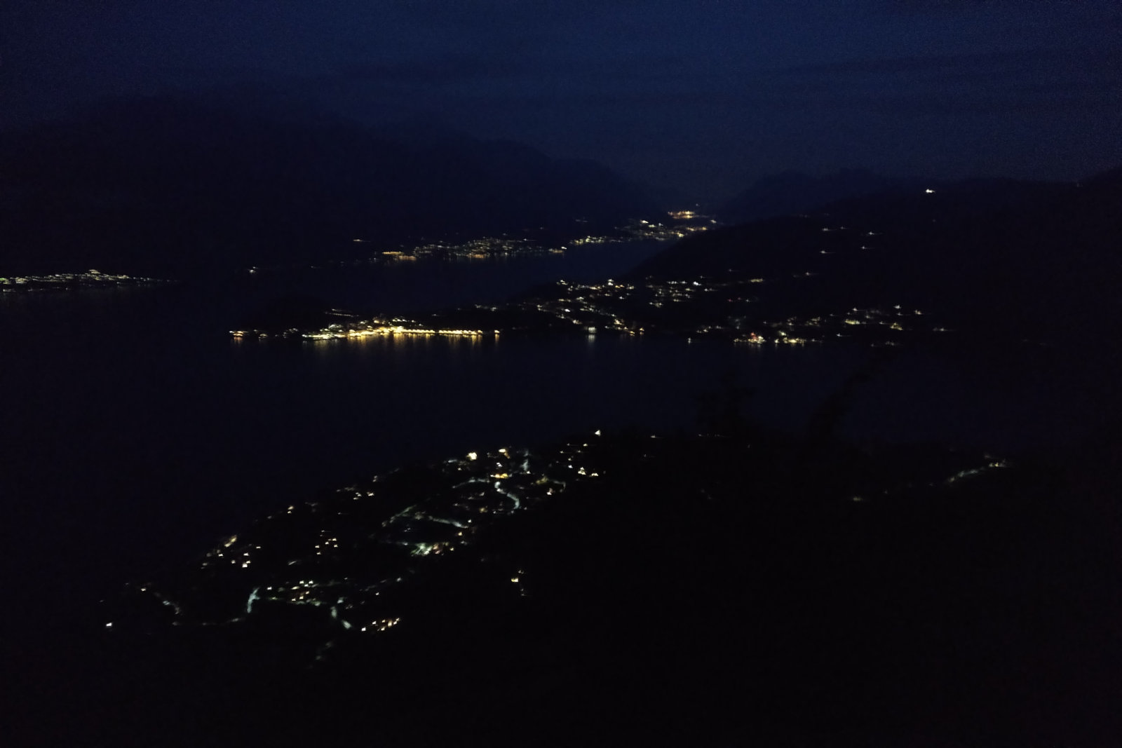
“Not much more to go” I thought. I decided long ago that I’ll give Mt McKay a miss – didn’t feel the urge to go up on this occasion and I was sure as hell to not take the scenic route (Ruined Castle track across The Desert) as we do at AC. I saw one more car after the Mt McKay turnoff, then another one just before Falls Creek. Those few kms felt like eternity in the heat and with the constant fly attacks.
I felt a relief when I saw the Last Hoot turnoff; headed down the grassy slope, when I saw a ute and 2 guys working on the right. One of them waved. “Wow! That’s a new one!!” I thought. I waved back then spoke to them as I passed them, mentioning a cold beer when finished.
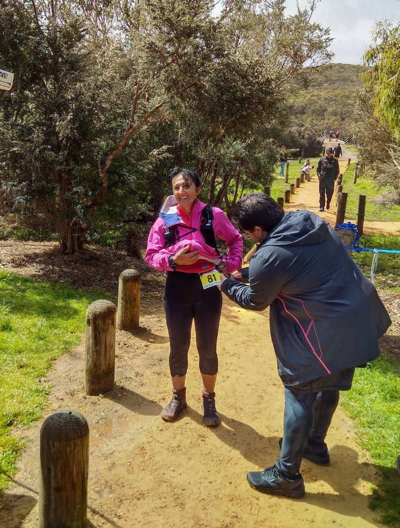
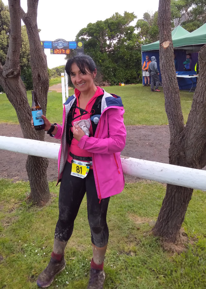
I took a turn and ended up on one of the back streets of the village… I thought “Good one, that’s all what I need right now – a detour!!” Looked at the tiny village map when I got to the cul de sac and figured out how to get down to Slalom Plaza. Within a few minutes I was there, stopped my watch walked to my accommodation and was ready for that beer, toothbrush, food, beer and sleep.
What I took away from this experience
1. Don’t count on food in a small town – have a backup plan
2. Take a fly screen on a hot day – it will save the energy spent on waving the flies away or holding the bandage
3. Increase distance incrementally (10-15 km at a time for this distance) – it worked in the past, why reinvent the wheel?!
4. Take Otto out on each of the miler loops (one by one), so he knows what they are like and stops freaking out every time I head up to the mountains
5. Take the poles with me/get the lightweight ones eventually
6. Get the Escape Bivvy – it’s a tad bigger than the space blanket, but I think it’s a better option, especially on a solo outing
7. Carry extra clothing
What worked
• Vegemite and butter toast bites – with lots of vegemite
• Peanut butter and homemade cumquat jam – wasn’t that sweet, just perfect
• Banana
• Non-alcoholic beer
• Cold creek water
• Water with dextrose monohydrate although the tap water made it taste a bit like Cl
• Spring gel – even though I had to really push it down, it tasted like real food. Might have made a difference if I had it earlier (not last minute)
• Mashed potato – the tastiest food I had. Pity I forgot the pickled cucumbers to go with it 😃
• Ginger beer – still works, wish I took more with me
• Coke – wish I took more
• Love the Salomon WP pants – they are so comfy and they don’t feel baggy as my previous overpants
• Triangle bandages – will never go on a long run without them
• The new Salomon Advance Skin 12 l pack – it’s super light (when empty), but the new pocket arrangement and front hooks need a bit of getting used to. I will need to remove the small pocket that’s dangling inside the right front pocket – it gets caught when reaching in/out of the pocket
• Saucony Peregrine – very comfy, although they won’t last long. Why aren’t these shoes made for ultras?! Two long runs is all they can handle???
• DexShell WP socks – they ARE waterproof, but they collect a ton of dust and by the end chafed my legs a little (not complaining, though)
• 10 A power bank – I only had a 6 A at AC and ran out of juice, had to borrow one to charge my phone. The 10 A Belkin Pocket Power is 234 g (I know, nearly like the pack itself), but can charge the phone 3 x
• Stashing my resupply at the caravan park – true it’s a trip down the lane but when doing things solo it’s one of the best options, because I could’ve had a shower in the morning and started the last stretch fresh
• Going “effortless” – helped me hold on to the energy for a bit longer
What didn’t work
• Cherries when I got to a point when not feeling well. I mean they tasted great, but they felt too acidic once I had them. True they weren’t the super sweet ones to start with
• The Lululemon top I chose – need to go for an older one, the not-that-tight kind
Reflecting back to the whole experience
I might have slightly underestimated the magnitude of this undertaking and how it impacts my family. Truth is, I didn’t want anyone to worry about me. Encouragements were welcome (thank you), but I didn’t want the negativity that comes with worry. Of course there are “What if?!”s with a trip like this and let’s face it, things could go pear-shaped, but unless I give it a go I won’t know. I value experiences. Good or bad, they are experiences that shape me into who I am. The reason I put this all in writing is to share it with everyone who takes the time to read it and is interested in getting into the mountains or going these distances. So they learn and don’t make the same mistakes as I did.
After each big trip I take a look at my body – scratches, bruises, cuts, damaged toenails… I pretty much know where I got which, so next time I’m back in the same spot it doesn’t happen again (except for the damn bushes that scratch my legs, unless I wear something long I’ll have to put up with them).
I’d like to thank those who have messaged me, called me and supported me – you know who you are.

Total distance: 110.95 km
Max elevation: 1831 m
Min elevation: 499 m
Total climbing: 4955 m
Total descent: -5041 m
Total time: 09:10:12
Download file: Miler_vs_Babi_4_0.gpx

2019 GOW 80 km Race

19 October 2019


At the start

Started out well – maybe too well. Enjoyed the muddy downhills – maybe too much.
Ran with Dylan [MacLean] for a while, lost him somewhere after Cape Otway. Found out later I’ve missed Otto at Shelly Beach (he got there too late). A few of us got a tad confused at the Blanket Bay beach exit, but got back on the track within a few minutes.

Had a pleasant surprise at the Blanket Bay check point, which made my day.
Then the weather got nice and warm. Beautiful, but struggle for me. The views and the huge waves were just stunning. Also frightening at times. Otto meeting me at every possible point and the cheer squad were just a fantastic touch to this event.

After passing Cape Otway the first time, I was looking out for the fast ones coming towards me. As I was passing the first guy (sorry, didn’t recognise the name) and congratulating him, I tripped and fell with a cramp. He turned around and wanted to help me. Told him that I’ll be OK, just keep going. He did ask me a few times if I was sure, until he finally continued. This is trail running – people so nice to each other out there.
Then the other fasties were coming, Jo [Nevin] leading the ladies. There were lots of hi fives on that section and I was so happy for them.

Closer to Aire River runners warned me of a snake on the trail, so I slowed down [even more]. Saw the guy in front of me took a few shots of the snake, I just got out of its way and then paid more attention to the track, just in case that snake had some relatives visiting…

As I was descending the sandy track towards the inlet, I was already dreading the way back. Aire River is stunning by the way.

My bib being punched at the Aire River turnaround
At the Aire River check point

I had my bib punched at the check point, my gear checked for the map and overpants, then asked if I wanted something. Told the lovely gentleman that a beer would be nice… he said at the finish line. Said hi to Jared, he didn’t seem too cheerful this day.
Otto gave me a small can of ginger beer, which felt really nice, then ushered me towards the car to change my shoes and socks, filled in my soft flasks with sweet water, gave me the food I packed for the return leg and opened another bottle of ginger beer – could only drink half of it, though. Then I said good bye, kiss and started the journey back among the cheering of the two ladies – they were so nice!!

The hike up on the soft sandy trail was a bit of a struggle in the warm weather. I was contemplating taking off my jacket… should’ve. I kept looking out for the snake, but thankfully it was gone. Said hello to the oncoming runners, the Scotts were in great shape and then I saw Oliver. I wish I knew it was his birthday, would’ve made it so much special for him.

I’ve been trying to eat, but struggling with that part. Decided to have a piece of pineapple at every km to Cape Otway – sometimes it worked, other times not so much. Then I had the little can of ginger beer, which helped a little. The view was spectacular from above, those huge waves just astonishing.

Approaching the Lighthouse for the second time

Otto came to take pictures of me before I got to the Lighthouse and the cheering squad was happy and lovely as all the other times I’ve passed through a checkpoint/meeting point. Went through the car park and got onto the trail, but then turned around and went to the toilet – I made this mistake in Italy, haven’t emptied my bladder for >14 hrs and remembered what Andy said about kidneys and stuff…

Those 10 kms between Cape Otway and Blanket Bay seemed sooooo long. At Parker Inlet I was happy to see Julie and Karen, gave them a sticky hug, then got down on the sand and headed towards the beach exit, stopping in the middle of the creek to cool down my feet a little. Asked Julie if I can stay here, she said yes, of course 😊
I was looking forward to the Blanket Bay check point, imagining how I’d have 1, 2 or 3 cups of Coke. I craved Coke.


Smile for your husband

In the forest I bumped into my friend, who promised to let Otto know where I was and in what shape. He told me I looked a million dollars even though I felt like crap a few moments before. Otto couldn’t follow me on Strava and that really stuffed up his plan so he was very happy to get the message and the picture.

There was a party at Blanket Bay – the Moxhams really know how to do support. “Love Shack” was playing and Ali was dancing – loved it!! Asked her to dig out my plastic cup from the pack, then sculled down about 200 ml of Coke. Had my number checked, then I had a piece of boiled potato and got going (later on I wished I’d taken some chips or another piece of that potato).


Before the Shelly Beach cheering area

After the few kms of lovely rolling single track, the muddy part was a real struggle. Tried to run (more of a jog) as much as I could and hiked the uphills, even though they weren’t really that steep. I slipped in the mud a few times and fell on my left side with a cramp once. I laid there in the thick, wet mud until the damn cramp went away, then slowly got up on my fours and stood up somehow. If someone would’ve recorded the whole thing, it would’ve been a great Australia’s Funniest Video Show material.

Otto messaged me that he is at Shelly Beach, so I was really looking forward to seeing him. I could hear lots of voices cheering as I approached the corner where I saw Otto and the cheering squad that popped up at different points along the course. Otto wasn’t sure if he’s supposed to feel sorry for me or laugh when he saw me, it was quite funny actually. He gave me a hug and a kiss, then said see you at the finish line.

Later on I saw George, he was adding more signs… I thought yeah, navigation seemed much easier on the way back. Walked with him for a little while, then took off. I just wanted this to end.

Getting up on the hill just before Marengo was a real struggle. It reminded me of Mt San Primo in Italy, where I had to stop every few meters to breathe. Once I was on the flattish grass a little girl from a house up on the left yelled to keep going, then I saw the finish line, Otto waving… when I got closer, I just couldn’t help myself, stepped on it and sprinted into the finish. I was very sick for a few minutes after this stint but it was worth it.

With the beer after the finish
…and the beer

Otto handed me the beer, someone said I ran as I was finishing a Parkrun and everyone was really nice. Brett gave me a hug, then Andy congratulated me and gave me the buckle.

Huge thanks to Andy, Brett, the EMS team and to all the awesome volunteers who made this event happen. It’s a great feeling being part of it and if everything goes well, I’ll be back next year for the 100.

Gear

  • Lululemon top and crop
  • iOMerino thermal top and socks
  • Salomon Sense Ride 2 on the outbound half
  • Salomon Sense Pro Max on the way back (not the best choice, no grip)
  • Salomon AdvancedSkin jacket

Nutrition/Hydration

  • Clif Bloks – black cherry and strawberry
  • pineapple pieces
  • dextrose monohydrate in water
  • electrolyte – orange
  • ginger beer
  • coke
  • boiled potato – 1 piece at the check point
  • dates
Total distance: 81.68 km
Max elevation: 227 m
Min elevation: -38 m
Total climbing: 2835 m
Total descent: -2878 m
Total time: 12:35:09
Download file: GOW_80_km.gpx


Going up to Monte Bregagno

2019 Marathon Lago di Como 60 km

21 September 2019

Picked up the race pack

One of the hardest races I’ve ever done. Felt like finishing AC 100 km.
Originally I wanted to do it purely for the experience, making it my goal to finish within the cutoff time of 14:30, then these three lovely people (Vera, Roberto and Mauro) have said that they will come to cheer me at Condogna… and possibly have a pizza and beer in Menaggio after finishing. I thought I shouldn’t make them wait for so long, so I shot for 14 hrs or less.

Picked up the race bib the previous night where the race start/finish was being set up. Couple of days before the RD sent out an email with the race info, warning people that above 1500 m there may be below 0 temperatures and that we need to bring the map and the elevation profile. Too late for me, didn’t print them out before we left Australia… I wanted to get my gear checked when I picked up my bib, but they said tomorrow morning. Next morning (I was worried all night), I went down to have the gear check done. They superficially checked my gear. As it turned out, I was the only one who’s gear was checked, and only because I insisted.

This is when I realised the courses are missing

Had two versions of the course loaded on my watch (amongst other courses), but when the countdown got to 0, I couldn’t find ANY of them, so I started the watch and wished myself good luck, as the map the organisers lovingly gave me (it was stuck to the registration table and only removed before the race start) was 1:50 000, didn’t show the little turns in the villages I was really worried about. I tried to stick with others. These guys don’t talk, or at least not to strangers. I also found that Italian men don’t like to be overtaken by a woman. One guy made sure I will never pass him, holding his poles in a way that forced me to keep a safe distance.

I met Marco at the start line, then Paolo in the first two kms. He didn’t speak English but he seemed very nice (he looked like our own Buttercup). Out of the two guys who were in front of me, talking about running and races (Ultra Trail de Monte Rosa miler was one of them), one took off, leaving Gianni behind. Gianni spoke quite good English and told me he is usually the last. He also told me that women do better in ultras because men sometimes sign up as a joke. I chatted with Gianni for some time, while the others got further and further away, then felt that I can go faster and decided not to hold back. He told me he started Monte Rosa 170 km, but the race was stopped at 50 kms because of a storm. The main point of the conversation was the gear they had to carry, which even including the bivvy, was 4.5 kg – something that is pretty average in our ultras.

The over Lake Como - covered by clouds
Lago di Como covered in clouds

We went through Menaggio, Loveno, then Il Piazzo to arrive to the first check point in Plesio. The course was going through the cobbled, narrow streets of these villages, the forest, behind people’s gardens, across roads, constantly up. It was only at 3.8 km from the start, but we’ve climbed 394 m. In Plesio (first time, because we went through this checkpoint twice), they had mineral water, both sparkling and non-sparkling. I always opted for the sparkling version, as we don’t get the chance to have this in Australia. They also had some apples, bananas and lemon. I didn’t spend much time at check points, got going as soon as possible.

A bit of down hill was really nice after all this climbing. I’ve really enjoyed the light descent, the sun was rising straight into my face. I saw a herd of mules not that far away and thought how on earth I am going to get through that, when a hiking couple coming from the opposite direction yelled at me saying that I missed the turn, look up, everyone’s going up… f$%^!! Had to go back. True, only about 200 m, but still. Saw Gianni, who also missed the turn (even though this wasn’t his first time on this course). We tracked back and got onto the narrow uphill single track. From that point onwards I had my eyes stuck on the ground or looking for signs.

One really smart thing the organisers did, was throwing white confetti (they must have emptied all the hole punches in Menaggio and surrounding villages) on the ground along the course. Other signs were yellow painted arrows (or paint on rocks), white/red tape, little flags with the race logo, race logo on the normal signs and at night, the reflective red and green signs. We got pictures of what the signs will look like.
The steep hike to St Amate, then to Monte Bregagno started. There was a checkpoint at St Amate with water, tea and fruit, it was at about 9 km, but because of the climb it felt way longer. I could see the sun shining over the lake, the mountains half way in the clouds with their tips sticking out. Stunning views I only indulged briefly in.

At the St Amate check point I had my number registered and kept going. At all this high altitude checkpoints there were at least 3-4 salvamontes – guys in red uniform, I wasn’t always sure what they thought of us. There were points along the course where there were rocks to climb/get across, some a bit hairy (for my abilities). I was so glad I did the Como-Bellagio run/hike and the hike up to Grignetta a week earlier – had a taste of what is awaiting. There was a rocky corner, where there were two salvamonte guys, making sure everyone gets through. They were equipped with ropes and all that climbing gear.

It was really interesting – parts of the course were so similar to what we have in Australia. The Razorback, the climb up on Westons Spur, the track towards Langfords Gap, Muesli Spur, Quartz Ridge and many more.

Those little dots along the crest are runners

Getting up to Monte Bregagno was no walk in the park. It was steep, rocky in places and we were above the clouds. I took a few shots, but since the view was blocked by the clouds, there was not much point. On Monte Bregagno (about 15 km at 2001 m altitude) there is a huge cross, the salvamonte guys and one of the volunteers registered my number, asked me if I had enough water. Then poured me some into the flask, gave me a chocolate and showed me the direction I should be going. They were very supportive, showing respect to the runners.

Tricky parts on rocks after this, I managed to fall once, hitting my left leg on a sharp rock and ending up with a lot of dark dust on my arms, no big damage, though. Running on the crest was really fun. I thought I’ll be shitting myself when I saw the video, but I enjoyed it. Then there was this grassy downhill, where I could go faster, but was worried about doing my ankle. I overtook Marco and his running partner here. I kept sipping my sugary drink, had some pineapple I’ve packed and Blok Shots.

At the Alpe Livea checkpoint they had apples, bananas and water. Took a piece of banana and sparkling water, had my number registered again, then kept on going. Marco and the other guy got into the checkpoint too, and took me over very soon. The course went through a beautiful pine forest, with lots of different fungi. I would’ve loved to take pictures, but kept running the rolling single trail (it was fun), then hiking the steeper bit. After a little while I saw Marco standing and bending forward. Thought he’s surely unwell. When I caught up with him I asked him if he was OK, he said he is tired but he’ll be fine, so I continued. Caught up with his running partner, who didn’t speak English either, but asked me if I saw another ragazzo and how far he was. Told him that yes, I saw Marco and he’s about 1 minute behind me. He also asked me how many kms we’ve done. We were at about 28 (??), I asked him back how many he’s got, then he showed me that he is not following the kms… found this very odd.

It was getting warm and I could feel that I should be eating something besides drinking water. At these points I’ve had the Blok Shots, banana or the pineapple. Carried them all with me from the start and was very proud of not taking any packaging with me that can fall on the ground.

There were lots of springs and fountains with clean, fresh water along the course. Washed off the dark dust off my arms, cooled down my face and neck a little. Climbed up to Alpe Nesdale, then to the second time to St Amate check point. Had some pieces of apple and mineral water. There was an English-speaking guy next to me at the aid station. We’ve left the checkpoint pretty much at the same time, then spent the next up-downhill (at this point my toes were really hurting – the SpeedCross wasn’t the best choice of shoe for this race) chatting about life in Australia, running and many other things while being overtaken by faster runners. As it turned out, they were doing the short – 31 km – course.

The sign

Before Plesio (Ligomena) he took off. I saw him again at the aid station, where the woman offered him all the good things (home made cakes included), she gave me a bottle of mineral water then said “ciao”, pretty much shooing me off. I thought that wasn’t nice and it played on my mind for a little while.
Otto called, he was with Vera, Roberto and Mauro, heading to Codogna to meet me. He was panicking, saying that I am off track – going on the road. Told him that I’ve just passed a checkpoint, can’t be off track. As I was telling him this, the course was going through the narrow streets of Ligomena and I missed a turn. An elderly trail runner lady yelled after me to warn me that I’m off track. Thanked her, but she had this “you idiot strangers, never pay attention” look on her face. I did appreciate it anyway.

Loved this downhill

As I was approaching Codogna, I could hear a familiar voice. Otto!! He ran downhill with me, taking pics, then along the trout farm and into Codogna, where Vera, Mauro, Roberto and a course marshal were waiting on a rock bridge. Hi five to Mauro, kisses to Roberto and Vera, then off I went. Otto ran with me to another point where they’ve parked their car, then said good bye and headed towards Gonte and Cardano. The road was flat asphalt until after Gonte. Caught up with Matteo and his friend, then they took me over as soon as it started to get steeper. Police have stopped the traffic for the three of us well before we got to the crossing (I guess those drivers weren’t too happy about it), but we got some respectful looks from the police officers.

After the turn onto the track, the steep, long hike up to Rifuggio Vennini started. I thought it will never end. After each corner there was another one (got to love these switch backs). The track was rocky, then some cobbled, and also cemented bits. It was OK at the beginning, but then it got harder and harder, after a while forcing me to stop every 50-100 m for a breather (not sure about the exact distance, was a bit out of it and feeling nauseous).
Heard a car coming, stepped aside. The two hunters waived to me, then stopped not far away in another corner. One was stretching, the other one getting out of the car. The first one asked me how far I’ve got to go. When he saw I was thinking, he kind of waved me off with a “ah, you don’t speak Italian” gesture. Told him I still have to do 21 out of 60 kms, which seemed to impress him and congratulated me, while the other one was deliberately scratching himself, looking me straight in the eye. I thought this is the moment I have to step on it so I said arrivederci, ciao and kept going.

I felt really alone there on the way up and wished I’d reach that damn rifuggio soon, but instead there was another corner with the track going up, and then another… I passed a building, Rifuggio Volta and wished it was the check point… This hike to Rif. Vennini was about 10 km long with 1300 m elevation. When I was near the top, another runner passed me and then Otto called saying that if I just turn right, I’ll end up in the car park, I am very close. Told him I need to follow the signs and indeed I was soon at the check point.

I was first greeted by a salvamonte, then ushered towards the checkpoint, where my number was recorded and there was lots of food (salami, ciabatta, cheese, butter, crackers, fruit, coke, water, tea, lemon, sugar, chocolate… indeed was a “grosso” – traduced “great food” in the course description 😊 I couldn’t eat anything, digged my bicchiere out of my pack and asked for coke. The lovely volunteer poured me some, then asked me where I was from. When I told him that from Australia, he seemed very impressed, then I asked for another half bicchiere. He asked me if I wanted anything to eat, told him I know I should but I can’t. He said “we know that, but please have something”, so I asked for a bottle of sparkling mineral water and a packet of crackers.

I asked if I was in time. The guy said you still have plenty of time – 1:10 hrs to leave the checkpoint. Told him if I knew that, I would’ve gone for a cold beer to the rifuggio 😊 he laughed.

The rifuggio was buzzing with life. It seemed that it was a popular hangout for youngsters. Saw a few runners coming from that direction, they either had a beer or went to the toilet (which made me realise I haven’t been all day, sweated it all out). I said thank you for volunteering, arrivederci and took off. Thought only downhill from here, let’s just enjoy it. It was getting cooler, so I put the light jacket on. The track was going along the contour lines and sloping down gently – I really enjoyed this bit. Soft grass, only had to dodge the cow shit.
There were cows, buffalos and goats grazing nearby, with cowbells around their neck. At some point I could hear someone making a strange noise on the mountain and thought he must be kidding, calling these cows from down here… then I saw at least 30 goats heading towards that person – a really interesting sight.

Tried to eat some of that crackers, it was like saw dust, had to wash it down with nearly the whole bottle of mineral water to swallow it, but I felt better after. The track got rocky then became all rocks which really hurt. I didn’t think this downhill will be so painful – my toes were totally yelling at me and I wished I was down in Menaggio… It started to get darker, but I thought I’d just do whatever I normally do – go on until I need the head torch.

The tunnel exit
The tunnel exit

Until I got to the tunnel!! Two young guys were ahead of me, nearly at the tunnel exit; they were smart (or did this before), wearing their torches. I thought I’d just keep going, didn’t want to go back or start shuffling in my pack in the dark… well, this was one of the longest, scariest 200 m (?) I did in the last 25 years. It was pitch dark, I could see the light at the end, but nothing around me. The ground was uneven, with little puddles. If there was a hole anywhere and I fell into it, no one would know that. Couldn’t wait got get out. I turned around and took a shot of the exit and another few of the mountain itself.

Then the watch was complaining about low battery, so I pulled the power bank and put it on charge. Soon had to scoop the torch out, too. It took a little while to get used to following the signs in the dark, but I got the hang of it soon. That downhill didn’t get easier. Got to a place where there were a few houses, some of them looked abandoned. It seemed as the signs disappeared. I walked around looking for something… then I noticed the confetti on the ground – got really excited and followed it.

At a small clearing I saw a light, a volunteer with a head torch wrote my number down, then told me that my husband is very worried about me. I thought that checks out. His stuff was on a larger caliber BMW motor bike and the guy was wearing the gear. He was really nice. Gave me a chocolate and sugar, explained to me which way to go and gently pushed me into that direction. I thought that was really nice. In fact I’ve noticed that the closer I was getting to the finish line, people treated me with more and more respect.

I started in that direction but was disappointed because of the uphill – I thought there is no more of that. The downhill was SO painful. Like the two ladies Alistair and I were sweeping into Kings at H2H. They must have hurt this bad. There were runnable bits, which I made the most of, but mostly steep, dusty switchbacks with tree roots. Glad the organisers have drawn reflective tape between the trees at these corners, it would’ve been so easy to end up rolling down the hill. Matteo and his friend took me over at some point, wished them all the best.

Bellagio in full shine

The view above the lake was just stunning – both Menaggio and Bellagio in sight with the other little villages around them in bright lights. I took a few shots but not that clear.

Otto called at some point and asked how I was. Told him I’m OK, but can’t wait to be down; he was very supportive and said that I was really close, just hang in there a bit more. I could hear the noises of the finish line and wished I was even closer, or at least on a road with no rocks. My wish soon came true, as I got onto the streets of Menaggio. I could hear two pairs of poles hitting the asphalt behind me… the two guys (one of them Matteo) were passing me. Asked them what happened. He said they took a wrong turn.

Police overseeing the road crossing

Had to cross the road at some point, police stopped a car so I can pass, cheering me on, while Otto was taking a shot and running ahead of me.

There were people cheering at the finish line, which was so nice. Otto was there to catch me. Took the torch off so the official can hang the glass medal around my neck, he shook my hand and congratulated me, then the other one gave me a back pack, a trophy and a finisher’s t-shirt and asked me to step back so he can take a photo.

Pizza and beer after

I shook hands and congratulated the other runner (Marco’s friend) we’ve passed each other a few times during the day, then Matteo and his brother and went for a beer to the same place I had my coffee in the morning. The owner was really happy for me and the lady who made me the coffee and was very grumpy in the morning now was smiling and congratulated me. We called Mauro, Roberto and Vera, then had a pizza. First I wasn’t hungry but it felt good.

There was a big football match on the TV at the time, the whole restaurant/pub was watching, like at the movies. I went to wash my hands and saw Paolo sitting there. I congratulated him and asked how he’d finished. He said he finished in 12 hrs and something. I couldn’t tell him my time because I couldn’t see it on the watch (needed the glasses)😃 all I knew that it was 13 hrs something.

I can say that it’s a very challenging course – 60 km with 4000 m elevation. Finished with a 13:43:47 time, which was way beyond my expectations. Plan is to Vera, Roberto, Mauro, Cristian (he doesn’t know yet) and Otto to do the 31 km course and me the 60 next year. I will be wiser and more experienced by then and do better.
Apparently 18 is a lucky number. According to Otto is because it’s diciOtto

Nutrition/Hydration

  • Clif Bloks – black cherry and strawberry
  • pineapple pieces – didn’t have them all
  • dextrose monohydrate in water
  • 4 pieces of apple at check point
  • ginger beer – brought it back (forgot about it)
  • coke at chekpoint
  • crackers at the last check point
  • dates
  • lots of sparkling water at check points

Gear

  • Lululemon crop and top
  • iOMerino thermal top and socks
  • Salomon Speedcross 4, size 6.5 – not the best choice for this terrain as a whole. It was very good in some areas, but hurting my toes on the rocky downhills
  • one bicchiere (mug). Bought a small mug for my morning coffees, which I ended up taking with me on this run. It was way heavier than it should’ve, but I saw it as my lucky thing


Course

Feel free to study my strava activity https://www.strava.com/activities/2728744904

Total distance: 64.62 km
Max elevation: 2057 m
Min elevation: 173 m
Total climbing: 4259 m
Total descent: -4241 m
Total time: 13:43:13
Download file: 2019_Marathon_Lago_di_Como_60_km.gpx
Como to Bellagio

Como to Bellagio

14 September 2019

I’ve been planning on doing this run for ages and finally got a chance, the OK from the Boss and could also use it as a training session for the Marathon Trail Lago di Como. Plotted the route on Strava, made plans on nutrition and hydration, packed some mandatory safety gear (over here it’s minimal) hoping to have some cold beer en route, as well.

Via Rusconi in the early morning

The narrow via Rusconi was dead, but well lit as I stepped out of the building on this balmy morning. I was glad I listened to Otto about leaving early – it seemed it’s going to be a hot day.

It got warm very quickly as I was going up to Brunate. Haven’t seen anyone until I got there. [Note to self: don’t take rubbish as reference point – it sometimes gets taken away]
It was so silent in Brunate – only one man walking his dog. The square before the church was empty – usually full of tourists. Took the turn towards S Maurizio along the narrow road. Few cars passed me, one of them had two hunters grinning at me (their clothing was a dead giveaway).
I took a wrong turn in S Maurizio. Went down a narrow track, two German Shepherds made a big noise as I passed, then nearly ran into a fence. Turned left and kept running when I noticed a young deer – beautiful sight!! Then I realised the track ends, climbed back, past the loud dogs to check out the right way… which of course was in plain sight if I would’ve taken a few more steps to see the sign.

This was so remote and beautiful

The wide cobbled track took me through a very tall pine forest, then I passed Baita Carla (it was closed), then up to Pizzo Tre Termini and Monte Astele. Kept looking at my watch and checking if I was on track. I was also getting quite warm and wished something was open along the way before the bigger climbs. When I saw Baita Boletto Fabrizio, I thought I’d give it a go. Lady was setting up for breakfast (the Baita is also a place where one can sleep), I asked her if I could have a small cold beer. She looked at me strangely first, then said yes, of course and opened a small can of misty Perroni. I paid (pulled out a 50 euro note, she wasn’t happy about it, but in the end it was ok), had the beer, used the (very clean) toilet and got back onto the track.

It was a beautiful morning, took lots of shots, and saw a few people (even trail runners!! Serious ones, of course) as I was going up Monte Bolettone. Had a chat with two guys (they were doing a smaller circuit) – they were a bit shocked about the course I chose (Como to Bellagio) and about me coming from Australia. They were really nice, though.

There were options…

On this trip I asked myself quite a few times why on earth I chose to take the highway (dorsale per cresta), when there are perfectly good trails along the contour lines. For the challenge, of course.

At some point I could hear some bells. Like cow bells. Then I saw two dogs running around, they were hunting dogs. I recognised the two grinning guys from the car in S Maurizio in the morning. They recognised me, too “la signora we saw from the macchina”. I have seen a few more hunters during this trip, but haven’t seen any guns with them. To be completely honest, I worried (more than once) about a wild boar popping out from nowhere… could see their marks everywhere in the forest.

There were lots of people (compared to no one earlier) on the following section. On the way up to Monte Palanzone I met Lumo (if I can recall his name correctly). He is a gentleman in his mid to late sixties. He didn’t speak English, but we understood each other. We both agreed that a cold beer would be nice. He did a very kind gesture, he gently stroke my face as a way of saying “you crazy beautiful thing”. Wished each other a buona giornata and went the opposite ways.

At around Monte Bul I realised those fontanas must be dry or far far away… only took 1 l of sugary water with me, no fruit and it was getting pretty hot. I planned to take a detour to Comei, to the restaurant if I found nothing else before that. Spoke/messaged with Otto a few times. Didn’t tell him I was running low on water – he would’ve panicked.
As I was approaching the road, could run on asphalt downhill (not fun, but the thought of a cold beer was very appealing) and could see the restaurant from above on my right. Cars, motorbikes, road bikes, walkers… busy place. My feet were still recovering from dancing the night away at the wedding two days ago. It’s all about conditioning, right?!

Walked into the pub, the 12 pairs of eyes sitting around the table, having a drink and a great (loud) discussion, turned towards the strange woman with a pack, asking for a birra (grande!!) and a bottle of water. The young guy at the counter didn’t speak English, but was very nice. He offered to fill my flasks with cold water, too. Toilets in these places are really clean, so worth paying for that beer (or whatever liquid one drinks).
I knew there is another climb after this, so I also had one of the sandwiches I packed. It was really hot by that time. Told Otto it’s all good and got back onto the trail. It’s amazing what a cold beer can do!!
The climb went through the forest for a while, I had the bottle of cold water first, then I was back in the open and the climb was getting steeper. I could see Mount San Primo towering afar, behind Mount Lot.

By the time I got up to Mount Lot, I wished I could have another beer (or two).

I was about half way up Mt St Primo, needed to get up to that cross

Mount San Primo (on the crest) is a true beast. Had to stop pretty much after every 10 steps to take a breather. At some point it got so steep that I felt I’ll just roll back down. The long grass covered the ground and didn’t provide much footing or stability, either. I could see people hiking along the Cima del Costone and some up at San Primo.
When I finally made it to the top, I was surprised by the number of hikers up there. They were eating, talking, laughing, taking pictures… in fact I’ve come to learn that this is what people do here. They get up on a mountain, change into dry shirts, pull out the food, drinks (yes, drinks), eat, talk, spend some time there before heading down. They don’t rush. They enjoy the view and simply being up there.

The cross I had to reach

Well I didn’t have this luxury. Had to get to Bellagio by about 4 pm, because Otto was waiting for me with dry clothes and a possibility to eat and have a beer. We were also locked by the ferry or bus timetable. Otherwise we would’ve been stuck in Bellagio for the night or get back to Como by taxi.

The other side of San Primo was equally steep and also slippery with rocks and tree roots. Many people hiking it from the other side (there was a car park nearby), all huffing and puffing, just like me not that long ago. I nearly landed on my bum once, did a FOOSH (Falling On Out Stretched Hand) instead. Then ran along people’s back yards, saw a fountain, cold, fresh water. I refilled my flasks and washed my face. Otto called and asked how far I was. Told him about 1:30 – 2 hours away… he didn’t seem too happy about it.

Rifuggio Martina was buzzing with happy people as I passed it. If I wouldn’t have promised Otto to get there in about 2 hours, I would’ve stopped for a beer – it was so inviting and I was running low on energy. I was supposed to get onto another crest via a track from a corner, but it was fenced away with electric cables (for grazing buffalos)… scratched my head as I did the up and down trip to double check, then continued on the road, hoping I’ll just figure it out. I started to see the red and white signs that could take me to Bellagio. Here, they don’t display kms, but the time needed to get there. Sometimes I could see the same amount of time on signs that were about 20 minutes apart… so very “reliable”.

The slippery track that I have enjoyed so much

I stopped at a corner, where there were two signs pointed to Bellagio: one said 40 min and the other said 1 hr 10 (the latter also said Bellagio Imbarcadero). I surely chose the first option, thinking I’ll get there in about half an hour. A lady told me that it’s not a good track because it’s all slippery rocks (she clearly didn’t like the idea), but I went down that path anyway. It was stunning!! True, it was slippery, but beautiful. Here I did end up on my bum. Spoke to Otto, who started to come to meet me. Asked him to go back, as I don’t know where I’d get into Bellagio.

Giardini di Villa Melzi

That path took me to a village where the signs suddenly stopped and the boys on a tractor hastily pointed into a direction… Followed that, which was strange, because it was going uphill and I was supposed to go downhill. Saw a farmer, he said I could go either way, it’s about the same – 3 kms. I ended up on the road that must have been the 1 hr 10 version. I could run from there and soon I was in San Giovanni (the St Antonio fountain was a blessing with its cold, fresh water), then in front of Giardini di Villa Melzi. Otto asked me to wait for him there, then changed in the toilet (6.50 euro for the entry into the gardens – so beautiful!!) then walked around in the park while Otto took pictures of a hungry and very thirsty me.

We walked around in Bellagio a little, then sat down and had a beer and two tiny pizzettas (not sure if he was trying to piss me off, I could’ve eaten a horse). Haven’t seen much on the ferry, on the way to Como, kept falling asleep. The horn of the ferry went off at every wedding along the coast (at least 8) and people were cheering.
Quick shower so we can catch up with the newlyweds for dinner.

I have scored a CR on this course, but only because out of the 6 people I was the only crazy woman to take the dorsale per cresta to Mt San Primo.

Total distance: 40.75 km
Max elevation: 1637 m
Min elevation: 207 m
Total climbing: 2775 m
Total descent: -2759 m
Total time: 09:21:14
Download file: Como_to_Bellagio.gpx

Wentworth Pass – finally made it to Vera Falls

14 August 2019

Can never get tired of this view

What a ride!! I need one of these each week 🙂
Pack was heavier than usual (change clothes, I took the train from Parra) and my legs felt heavy for the first few kms. This time I read the sings and was really happy that Wentworth Pass was open. Tried to pick up the track on the other side of the falls but it disappeared so I had to scramble back over the rocks and get onto the track from there.

From the Vera Falls turn off there was a man I saw on the train in the morning – and he pointed out that the track is the other way (he wanted me to get onto Robertson Pass for some reason). Told him I am going down to Vera Falls. He looked at me like I was nuts and weird. I really hoped he won’t come back to follow me.

The trail was just amazing from there nearly to the falls, then it became less traveled with the pink ribbons that lead me back onto Wentworth Pass. This was the most remote bit, haven’t seen anyone.

I had a plan when I decided to do this run, but ended up not following it, going wherever I pleased instead.

Running in the Blue Mountains means hopping over rocks, scrambling over rocks, climbing stairs (steep ones), descending stairs, getting over or under fallen trees, taking a ton of pictures, stopping for a good look at a stunning view… catching one’s breath (did I mention those steep steps and ladders?!), getting around tourists, dodging roots and scratchy branches and every now and then a sweet, rolling single track 🙂 here you can forget about pace and elevation IT DOESN’T MATTER!

Map

Total distance: 19.19 km
Max elevation: 897 m
Min elevation: 344 m
Total climbing: 857 m
Total descent: -831 m
Total time: 03:12:14
Download file: Wentworth_Pass_finally_made_it_to_Vera_Falls.gpx

Photo Gallery

Visited Ada again – tough day!

17 July 2019

My fingers are just starting to thaw and the shivering has stopped – all thanks to a nice serve of scotch.
Taking Riverside Rd/Kelly Rd was a great idea – thank you my friend, you know who you are.
It was a pleasant air when I started, then it gradually got cooler, then freezing. I could not find one dry square cm on my body.
Took plenty of pictures on the outbound leg, until it started raining and I realised I have to step on it if I want to finish before it gets dark. I had the torch with me but I didn’t want to run that track with it.
So much mud, it just wasn’t funny! Might as well register for Tough Mudder 😀 That “dangerous creek crossing” lived up to its name this time (didn’t bother with photos, sorry). First step went straight into mid leg deep mud, the rocks were under water… no dry crossing here. Both ways!!
So many fallen trees, some with leaves which was a pain in the ass to get through/around/under/over. Tripped several times, hit the back of my legs (the Achilles tendon was the most painful), slipped and fell on one of the board bridges (no chicken wire on it and it was too late by the time I realised), then a couple of more times when trying to get over fallen trees – they were slippery, cold and piercing.
Saw a few lyre birds, about 7 youngsters at Stirling’s Camp Ground – said hello when I passed the first time, but they completely ignored me on the return leg.
Damn leeches got me!! Kept checking and getting rid of them whenever I could, but one had a good feast of my blood, had to remove it with salt when I got back to the car.
Have no idea why the GPS did what it did, it happened when I stopped to reply to Otto’s text once I was back on the road.
Did 15 push ups at every 5 kms up to 30 kms – after that it was racing the time.

Oh, and I backed into the bench when I was leaving…

Map

Total distance: 60.01 km
Max elevation: 823 m
Min elevation: 160 m
Total climbing: 1343 m
Total descent: -1304 m
Total time: 08:58:06
Download file: Visited_Ada_again_tough_day_.gpx

Powelltown to Ada Tree

10 July 2019

Beautiful day for this!
Did a few “discoveries” at the start, but got the hang of it by the end.
Was it easy? Nope. Did it hurt? Yeeees! Did I enjoy it?! Oh yeah!!
Took a million pics on the way there along with the wrong turns (OK, little ones).
That uphill is a killer, and so is the ground under foot – hit the back of my legs more than I care to remember and it hurt. A lot. Many f-bombs exploded today.
Lots of fallen trees to get under, over or around.
The only people I saw were the young guy driving the Forest Management ute (second time I’ve seen the ute was close to the checkpoint we manned in March, he was with another young mate) and 3 women with lots of children close to the Ada Tree.
Up to 40 kms, I’ve stopped at every 5, dropped down and rewarded myself with 10 pushups (resulted in muddy hands, but who cares).
On the uphill I have already imagined how I am going to slide down on my butt… didn’t happen.
On the way back the wind picked up and became quite scary. A branch landed 1 m in front of me.

The Gear

Nutrition/Hydration


The Course

Total distance: 47.08 km
Max elevation: 850 m
Min elevation: 212 m
Total climbing: 1773 m
Total descent: -1697 m
Total time: 07:40:57
Download file: Visited_this_ancient_beautiful_matron_Ada.gpx

Federation Hut in the Snow

29 May 2019

Snow, yeah
Started to see snow!

Wanted to do Razorback 40 today, but picked the wrong day for it (yes, checked the mountain weather). The gear we wear and carry at the Alpine events won’t cut it in these conditions.
I was really looking forward to sliding down on my ass on Bon Accord Spur.

It was raining when I pulled into the parking lot, a bit further to another car. Geared up while talking to Otto, then took off. At the trailhead I signed into the book, also checked who else is up there – last person was 3 days ago, so it’s only me.
Got wet and sloshy quite early, tried to slow-run as much as I could (considering the gear I was wearing) but felt a bit sluggish. Didn’t sleep much last night (maybe 1 full hour?!), woke up at 12.45 to get going ASAP. The rain on the way coming here was tiring, too – needed way more concentration than when the conditions are dry and using cruise control was out of question.


A bit muddy…

A bit after Tobias Gap I spotted patches of snow, then a bit more… and more… until my feet sank into it way above the ankles. Brought the poles, thinking I’ll need them on the Razorback – just in case I need to poke the snow. They ended up as extra weight to carry at the end.
Took photos – couldn’t just not take those shots and my hands and feet started to get very cold in the process. The wind picked up in more open areas and it was really cold.
At some point it seemed like someone switched the lights on. Yeah!! A little bit of sun!! Unfortunately it was very short lived, but I spotted sunshine on patches on the Razorback and thought “that’s what I want to see a bit closer!!”

It gets deeper…

By the time I passed the turnoff to the spring, it was clear that I won’t make it along the Razorback. The shoes, the socks and the gloves got wet – no way they would work in that cold. I promised Otto, that I will only continue if it’s not risky, otherwise I’ll turn around at Federation Hut. As I was getting closer to the hut, the wind got even chillier and the snow deeper. It was quite hard to lift my legs and keep the balance uphill.

When I finally reached the hut, I took a few photos (which I regretted a bit later) and went in. Had some snow on my clothes, couldn’t shake it off before I stepped in, so it ended up on the floor.

In the hut

Changed into the dry[er] gear I carried with me while shivering and trying to eat a rice paper roll. My fingers and toes were totally numb, should’ve brought those hand warmers we got at AC. It wasn’t much warmer in there, only not windy. I needed to get moving as soon as possible. Looked around for a broom to clear up the snow, but couldn’t find any.

Going down was a bit of hit and miss in the bigger snow, fell a few times, but didn’t hurt 😊 it was much better when it was a bit shallower and even better when my fingers, nose and finally toes thawed. Really enjoyed that bit, it was great fun.
Then back to mud and rocks and green – which of course had its own beauty and pros. I was trying to avoid everything shiny, but I managed to step onto a slippery rock and did a slide like the roller boarders. I was really happy that I didn’t end up in the valley 😃

At some point I saw a colour that didn’t fit into the picture. Figured there must be people… there were two hikers. Young guys with big back packs and geared for the occasion. Had a few words with them, showed them the pictures and then wished them all the best. They asked me if I was jogging all the way up, and down 😃 told them mostly down.

At the trail head I signed myself out, then dragged my bum to the car – it was still raining…
It was a mix of sunshine, dark grey sky, rainbow and lots of showers on the way home. Came on the back roads and around Lima I drove under the rainbow, which was pretty special 😊
The whole day was definitely something different 😉

Map

Total distance: 23.47 km
Max elevation: 1739 m
Min elevation: 497 m
Total climbing: 1326 m
Total descent: -1339 m
Total time: 04:19:51
Download file: Federation_Hut_in_the_snow.gpx

Mt St Leonard

Mt St Leonard after the Night BASE run

24 May 2019

The view from the top

I was fighting falling asleep in the back of the cab on my way home from the Monash BASE facility at around 3:40 this morning.
Got home at 3:50, there was no point falling asleep. Freshened up with a shower and two double espressos, made a smoked trout and avocado sandwich for recovery food and a toast with avocado before I leave.
Was rolling out of the garage at 4:53 an looking forward to catch the sunrise on the top…

Lots of cars coming from the opposite direction, some of them so blinding.
“Silence Must Be Heard” was playing in my ears and head ever since I was on the treadmill and thinking about doing Mt St Leonard. I was really looking forward to the silence there.

Pulled up in the usual spot, geared up and got going. I could feel the point where blood was drawn earlier at every elbow flexion. Wore the head torch but didn’t use it (at all), the moon provided enough light and I quite enjoyed that… until I saw a torch coming from Condons Tk while I turned towards the aqueduct. First I thought it was a runner, but it was moving too smoothly (no bouncing), then I thought it’s a bicycle… then I saw it moving like a hand torch… that was a bit weird! I kept running (maybe a bit faster), looking back in which direction is going. It was kind of scanning the bush and headed in the same direction as me. This got me a bit worried. I was calculating if this person wants to hurt me, what are my chances?! If I turn back to the car at the intersection, he/she can cut it short and get me from the left. If I manage to get back to the car, he/she might already wait there… I decided to keep going, but couldn’t help looking over my shoulder every 20 meters. Interestingly, I didn’t trip or sprained my ankle.

It was really good to hit the ground and feel the traction and rocks under my feet. My sympathetic nervous system must have been working to its full capacity, otherwise there was no way I could run this fast.

The colours of autumn on the last stretch

On my way up on the steeper bit I was thinking about coming back on the downhill. I will surely feel tired at some point and may feel I have no energy. Considering the circumstances, it’s perfectly OK to feel that way, will just slow down and put one foot in front of the other. The goal is to do it (no sleep and tired legs).

I found it strange that the gate to the Telstra tower was open. Called Otto, took a few shots and headed back, because it was so windy and cold.

I didn’t get the beautiful sunrise and/or the silence, but I got my mountain fix. A bit of fresh air and nature is magic 😊

Total distance: 20.95 km
Max elevation: 1041 m
Min elevation: 110 m
Total climbing: 1171 m
Total descent: -1190 m
Total time: 03:04:03
Download file: Mt_St_Leonard.gpx

Oscars Hut 2 Hut Sweeping with Al

15-16 February 2019

On the way to Lovick’s

Wow!! Where do I start?! It was one of the most memorable runs (or rather treks) that I have ever done. This is one of those courses, that would swallow you and spit you out – several times.

Drove up bright and early to Mt Buller on Friday morning, I promised to be there by 9:30. Easy drive, got there with about 13 minutes to spare. As I walked into HQ I was greeted by Chris [Ord] and Andy [Payne]. They told me we will be taking off to Lovick’s at 11.

I met Debbie, Shane, Shaun, Lucas, Jacquie and Jacyntha in the comms area. Thought that’s really interesting, so I hung around there for a while, listening to what’s going on, Shane and Shaun being briefed by Lucas… unless one hasn’t been on the “other” side of the fence, would never know how much effort, what kind of co-ordination goes into an event like this. In fact, the helicopter rescue of Paul [Edwards] was the best display of the kind of readiness the crew has been prepared for.

Brought my gear in. I only took the “essentials” (sleeping bag, mat, tent, another set of clothes for tomorrow), but the bag – of the massage table, as this was the only one big enough to house all that and waterproof – felt so huge!

Soon Kelly, then Al arrived. We got fitted with the radios, given the PLBs and the trackers, then at around 11 we got into Matt’s 4WD and took off. That ride was quite a rodeo – I really loved it. We were chatting away while sometimes airborne in the back of the Toyota. When we were about 9 minutes from Lovick’s, we saw a runner. He was really struggling. Stopped and gave him a few words of encouragement. He was Matty Munroe (more about him later), then later another team. It turned out one was Al’s team mate from the year before. We thought none of these people will make the cutoff at Lovick’s. And how wrong we were?!

Lovely vollies and the water choices at Lovick’s

Got to Lovick’s had some food and drink at the aid station – everyone was so lovely!! Found out that Robbie (another team mate of Al’s) is pulling out (kidney problems) and he is getting married on Mt Speculation tomorrow… Wow!! What a way and place to do that!!

Matty and the other team rolled in, which was awesome. Matty kept going, the team stayed the night.

Matty and Al

At 2:00 pm we got started. It was quite warm and we were going uphill (definitely not my forte). Kelly and Al were doing it so easy, I was really struggling. The pack was heavier than usual, my legs are way shorter and I do need about 2 kms to “warm up”. So I soon found myself lagging at the back. We caught up with Matty and walked with him for a while, taking pictures and not believing our luck!! There were so many “Wow!! How beautiful this is?!” that can’t even count them. Kelly went ahead to make sure the cutoffs are met, while Al and I were encouraging Matty. He was unbelievable!!

Lucas asked Al to change the battery in the repeater on Mt Howitt. While Al did that, I went after Matty, who grew wings and got to Ganter’s with about 20 mins to spare. Al caught up with me and we saw the oncoming runners leaving Ganter’s – Georgie [Mungcal] and Peter, Bich [Jennings], Sabrina and her team mate, Jo [Noosgard] and Martine and a few more.

At Ganter’s we checked in (these vollies are just awesome!), Matty was sitting there and told us he’d be pulling out at Mt Speculation… Al was amazing with putting some hope into him.

Paul being lifted in the chopper

We could hear on the radio that a runner is injured, on the trail and Shane and Shaun are to run in with all the first aid stuff. When I heard “andrenaline kit”, I thought this has to be bad… then the helicopter was mobilised… we could shortly hear it approaching. I told Al earlier about my chopper ride a year ago. We caught up with Georgie and Peter, then Matty and a few more runners before the incident and were really close when Paul was finally lifted into the chopper. Kelly was there with him and signalled us to stay put and down, which we all did. Everyone was filming the rescue, it was so incredible!

After the helicopter left, we started moving. Kelly went ahead first, then Shane, Shaun too, while we were moving with the troops.

Sunset from Crosscut Saw

The sunset was just incredible over Crosscut Saw. Al and I couldn’t get enough of taking pictures and being amazed by it. We caught up with another Matt we followed into the checkpoint. I tried to cheer him up with “the Power”, it only worked for a few steps. That climb on the rock (where the rope is) was quite hairy, but I loved it!

We got to Mt Speculation and saw Matty sitting there. Heard Bich pulled out here. I was looking around, but couldn’t see her. Had a coke (something I haven’t had for a very long time), some chips and took a banana with me. I’ve put on my jacket, I felt a bit cold, but soon after we started running (not much of this was happening), I had to take it off. We soon caught up with Georgie and Peter. Georgie was walking funnily, she had a huge blister on one of heels. I held her pack for a few moments while she checked the blister – gee, that was heavy!! No wonder her back was hurting on Crosscut Saw.

We caught up with Jo and Martine soon and walked with them all the way to King’s. I realised my phone is close to flat and I have forgotten the cable in the car… had the charger in the pack at King’s, but no cable. I mentioned this when walking with Jo and Martine. Jo offered her charger if the cable is good. It WAS!! (I charged the phone all the way to King’s – thanks so much Jo!!).

The moon was so beautiful, shiny and big!! Took a few shots, unfortunately they are not that good.

At the Muesli Spur turnoff Georgie and Peter took off, so it was the four of us struggling down Muesli. At the beginning I didn’t understand what everyone’s problem is with this track… well, if someone has done that many kilometres, and that much elevation no wonder. Another track that I consider even tougher is the one leading down from Mt Solitary in the Blue Mountains. Once you did that, Muesli doesn’t seem that bad.

It was around 1:00 am by the time we arrived to King’s. All the vollies were just unbelievably amazing there! It was lovely to see Danny Edmunds and Darren (whom I’ve not recognised – so sorry!!). I had some rice and a sausage, a chicken noodle and a beer. Wasn’t really looking forward to set the tent up in the dark… when one lady (so sorry, can’t remember her name. Might be Connie) said that our tents (the sweepers’) is already up. They also helped out Georgie and Peter and Jo and Martine with their tents.

I cleaned up a bit, put on the spare thermal top and was really looking forward to my first sleep in this brand new sleeping bag on the brand new sleeping mat in a brand new tent 😊 (yes, we went to Kathmandu with Otto on Wednesday and bought the bag and mat, while the tent was lent to me by Tash – thanks heaps Tash).  Tried to call Otto, but had no service. Sent him an SMS, hoping it will push through, as he was waiting for my call. Set the alarm to 4:45, as we were supposed to be ready to go by 6:00 am, with the runners leaving between 5 and 6.

I didn’t lay out the mat in time, so it didn’t get the chance to self-inflate… thought stuff it, just sleep! The noises around the fire diminished, people went to bed, except for the person who kept the fire going.

Then I heard the snoring. Al was exhausted and must have slept on his back.

Didn’t sleep, tossed and turned and wished I’d brought that inflatable pillow… used the spare clothes but that didn’t really work. 

Then I heard noises around the fire, people started talking, laughing, chatting, blowing the fire… looked at the time. It was 4:35. Got dressed, out of the tent. People were so nice and cheerful, in spite of the 1-2 hours of sleep. Caught up with Shane [Winzar] around the fire, I was so happy he was going this well. I went down to the creek, washed my face, neck and arms. If I knew it’s this accessible, would’ve come down before going to bed – it would’ve made a huge difference.

It bothered me that I couldn’t brush my teeth, but I was prepared for this, so just had to go with it.

Had some water, two slices of bread with butter and vegemite a “short black” (very strong Blend 43), more water, then packed my stuff. Lady told me not to worry about the tent, they’d do it for me. I felt like I’ve hit the jackpot!! I woke Al up at 5:22 so he can get ready, as well.

The runners started to leave the camp site. Darren told me there are two who are still in their tent. He went to let them know they have 30 minutes to get ready. Then pretty much every 5 minutes he went back trying to get hem going. I think Emilie checked with HQ, they weren’t allowed to continue if they haven’t left by 6. I went to the tent and realised it was Jo and Martine. I felt like kicking myself for not getting them out in time. True, they both had very sore legs and feet, but still…

We got ready and at 6:08 we got started. We were going to cross the creek, so I took off my shoes. I didn’t want to risk the blisters – had to be as injury-free as possible to be able to support others. After a little jog, the climb started. And it went on and on right until Craig’s Hut. We saw some of the sunrise, pity there were clouds but the views were amazing. So many berries!! Every now and then we munched on them (especially me). As Al said it doesn’t get any more organic than this.

We caught up with Meg and Trent, the young couple we ended up following all the way to the finish line. Craig’s Hut was showering in the sun’s orange rays – so beautiful!!

At the checkpoint we had instant noodles, some chips and I filled up one of my 250 ml bottles with coke. Said good bye to the lovely family mending it, then took off.

I didn’t remember this track going all up and up. True it was 3 years ago, but still… Trent had a torn ligament (I think there was more than one) on his left leg, so the uneven terrain and everything downhill was really hard for him, yet he soldiered on. It was really nice to get to know them, lovely people.

Next checkpoint was Mt Stirling. I was looking forward to catching up with Karen and my running buddy. Everyone was so cheerful there! Rebecca gave me a Hut2Hut sticker and lit up the checkpoint pronto. I had help with filling up my 250 ml plastic bottle with coke (I had the rest on the spot). Hugs, then off we went, knowing Meg and Trent were not that far away ahead of us.

We caught up with them on Mt Stirling at the trig. Took a few shots, tried to call Otto – the service was quite patchy – then headed downhill (saw a dirt bike rider!).

As we were walking on the dusty 4WD track, Meg slipped and as she fell, she swung her pole straight into my face. The tip hardly missed my eye, I thought it’s very bad at first, but after a few seconds I realised it’s OK; it was bleeding, but the eye didn’t get damaged.

Could tell Trent was really hurting on this section, yet they somehow stepped on it and got to the Howqua Gap checkpoint a few minutes before us.

Oh, something interesting!! We heard a 4WD (Ford Ranger) coming. Its rego was EW1NG. Al goes “Dallas!” and I started to nanana the tune. They stopped and took them a while to realise what that was all about.

At Howqua Gap I really loved the Dettol next to the toilet – lovely touch. Talked to Veronica (found out about 5 minutes into the conversation who she is), who told me that I saved them (her and Jenny Rickards) from going down the road at the Lightstation at the Prom last year. I didn’t recall that, but it feels really good to be remembered this way.

I had a few pieces of chips and a small apple.

Only about 8 kms to the finish line – we told Meg and Trent and we took off onto the sweet MTB single track. It would’ve made for a much better experience if we all had fresh legs here, but we were there to finish so we went on. It felt like we’ll never get there and it started to get warmer and warmer… on one of the trails I saw two MTBers who greeted me by my name. Took me a little while, but I recognised Lesa and Tomie Muir. Tomie pedalled on, but Lesa stopped for a hug and a short chat. What a small world!!!

Why is the course going around the village???!! It’s like having a lollie in front of you but you can’t reach it. In spite of that Trent was able to do some short runs, which was simply amazing. We saw Georgie and Peter on the way up to the top, they were already heading down. I was so thirsty, couldn’t wait for something cold and fluid at the finish.

On the top we saw a couple sitting down, enjoying the view. Meg and Trent took a page each from the book in the container, I took a few shots of them, then we headed down. Al was again so awesome with encouraging them, hats off to him!

On the concrete, our steps felt so differently, but the goal was so close now. It was really fulfilling as we watched this young couple go through the finish line hand in hand, finishing 100 of those cruel kms, with Trent doing his very first ultra!!

We were greeted by the RDs at the finish. They both thanked us for what we did, but frankly I was more grateful for the opportunity to experience all this and I think so was Al.

Handed back the radio, PLB and tracker, talked to Bich, then realised I was thirsty, so I had water, asked for a noodle, went to get my stuff from the car, gave a hug to and thanked Al, cleaned up a little, changed, had the noodle, wanted to call Otto (no service), got my gear (it felt so heavy!!), said good bye and got going.

Once off the mountain, I managed to talked to Otto. The drive home is a bit patchy, 33 C really made it so much harder to stay 100% alert, but I made it.