Mt Donna Buang – Boobyalla Saddle
18 July 2017
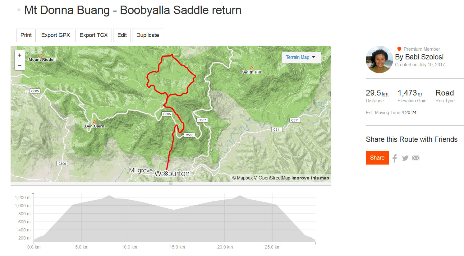
This was my plan for today (strava route to the right), with options to return earlier, should the tracks be unpassable. I knew it will be cold and I knew it will be wet, but I had to do it today, because the rest of the week was busy.
I am not going to lie, it was not all fun.
It was about 9.30 by the time I arrived in Warburton. There were clouds (or mist) at the top of the mountains, but I thought that’s OK, I can deal with that. Geared up, checked out the Visitor Centre for a more detailed map (bought the Yarra Valley – West Gippsland Adventure Map, even though I couldn’t really use it for this run, it’s not the right scale). They open at 10, but the lady let me in and helped me as much as she could. She never heard of Mt Boobyalla, which was a bit strange… I thought I’ve got my insurance—the pdf map I bought from Avenza yesterday, that should work.
Started running a few minutes before 10. The sign wasn’t holding any walking stick at the moment, there were a few on the ground, though. People must be using them! As soon as I did a few steps in the mud, I realised wearing the Speedcross wasn’t the best idea, even though it’s made for soft terrain, but mud…it only sticks to it, doens’t drain well and you quickly end up carrying another 800 g on each foot. OK, it’s extra workout, but today I didn’t need that. I paid attention and I didn’t fall on the ascent. Had some dark chocolate and ginger after about half an hour.
At the O’Shannassy Aqueduct this time there were even more animal footprints as last week. I was wondering, what it is. Could be deer??! I kept going, then got hungry again, so I had a VFuel gel, the Cool Citrus. This gave me a boost in spite of the mud that weighed me down. Today, I decided to go across Mt Donna Buang Rd as fast as I can to try and avoid the GPS anomaly I scored last Tuesday. It actually worked.
I got very close to a flock of yellow tail black coockatoos. Love those birds—they are so majestic! Could also hear lyrebirds nearby. At about 446 m, the wind picked up. Note to self: bring the beanie! There is a cable running along the left hand side of the track (if facing North), I guess is there for support. I took a picture of it, although it’s not that clear.
 Stopped for a few photos on the way up. One point was on Mt Victoria at the telecom tower. When you approach it, from afar it looks like the trail veers to the right, whereas the track goes straight as the sign shows. There was so much mud!!! This time it was deeper and wetter, there was no way around it. Had to step into the above the ankle mud on several occasions. I kinda enjoyed the sloshing sound, though.
I was hungry again, had a quarter sandwich with grape tomatoes. Couldn’t really enjoy it, as I was trying to breathe and deal with a runny nose at the same time…I am cursed, every time is cold, my nose is runny. Have to carry a ton of tissues with me. By the time I get to use the end of them, they are already wet from the rain.
I imagined what the view from the lookout would be now. The forest was spooky. Love that single trail before reaching Mt Donna Buang, it’s so beautiful. This time it was very spooky.
When I got to the top, I headed to the lookout. A car was approaching, so I stopped to give way. The driver decided to park (no signaling or something) and let me stand there a little bit in the rain. Not nice… I marched up the stairs. They are good, warms you up quickly if you are taking it faster. Up there, I’ve put the poles so they don’t fall, then tried to take some pictures and figure out where exactly the Mt Boobyalla track is. All I could see was the track and a sign that had the walking track picturegram on it. My fingers cooled down very fast. It was misty, and very, very windy. Chilly windy! Couldn’t wait to head down.

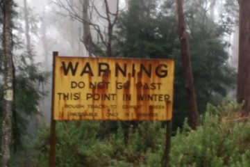
I tried to find the track on the pdf map. The phone (an old Samsung S5 inherited from my daughter) showed me the GPS finger. First it asked me to re-calibrate the compass, then just told me “not on the map” the GPS signal was not strong enough. I took the track I saw from up there. If it’s not it, I’ll just turn back. Aha, but it was a nice downhill…I was thinking, it will be interesting coming back, but went ahead anyway. First I thought—considering the rain—I’ll just go to the next intersection, do a couple of more kms (it can’t hurt, right?!), but the track was so beautiful and so much fun running, that I just kept going. In about 400 m, I saw the sign “Warning do not go past this point in winter Rough track to Cement Creek only passage in summer”. Well… I just had to check it out. Only to Cement Ck. If I can’t cross it, so be it, I’ll come back. But I need to try and there were signs all the way.
Sweet single trails, only those grasses and the bushes made it hurtful, but that’s my bad—should’ve worn the overpants. No point carrying them in the pack. But at that point I couldn’t be bothered. Turned right at Road 2, then right again towards Boobyalla Saddle (there was no sign, just the track). I reached a muddy area, with some wood pieces nicely placed over. I figured this should be it—Cement Creek. I knew I shouldn’t be doing this, but headed across those stupid wet wood. After two steps, I fell on my bumback pronto!! Hit my left elbow and surely smashed the mandarine and yes, the tomato as well!
Stood up (good to carry those poles, I can push myself up quicker), did some damage control. I could move my limbs OK, so I kept running. Taking it too slow wasn’t an option—these guys weren’t kidding about the showers—they came down with no mercy. And let’s not forget the chilly wind!! I passed Mt Boobyalla and didn’t even notice the cairn. Must have concentrated badly on the rocks, the Speedcross is not a good friend of wet rocks. Then there was that steep downhill before reaching Road 4. Wet, lots of branches to slip/trip on.
When I got to Road 4, I pulled out the phone again (it was all wet, wasn’t sure if it’s going to function for too long), tried to establish how far I can go. I already had nearly 13 kms on my Fenix. I knew I need to turn left here, so I did and then I saw two hikers. They seemed very surprised to see a woman there, I guess. I asked them about the road beyond the turnoff towards Mt Dom Dom.
The younger one (about my age, which is not that young) pulled out the Rooftop map, told him that won’t help. He checked anyway, then agreed. Then he pulled out the McMahons VicMap, the more detailed one 1:25 000. That was a bit better, but still didn’t show the road I was supposed to continue on. I’ve showed him my pdf map and told him what I have planned to do. He said that it’s too long, I’d be there all day. Told him that’s only 10 kms, that shouldn’t take longer than 1.30-2.00 hours. Then he asked me if I was a trail runner. I thought: doh!! I’ve got a light pack and the trail running gear. Told them I couldn’t run if I carried their pack. He said that they saw the road and a sign that says no entry, but if I ignored the sign, I should be OK. Boobyalla Saddle is about half a km away. We wished all the best and parted.
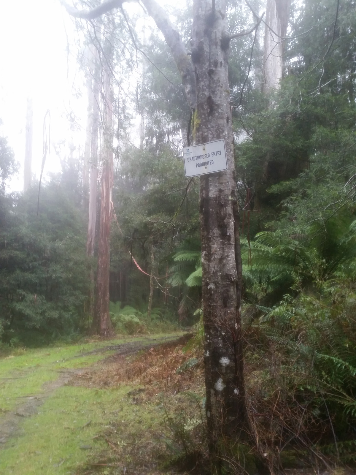
Headed down towards Boobyalla Saddle and the tabu road. When I got there, I saw the sign! It said clearly “Unauthorised entry prohibited”! I started on it, then stopped. I saw tyre marks and thought that car could be heading back any time. And then I’ll be in trouble. The map showed only a short section in the map reference (restricted) area, so with a short bush bashing it could be avoided alltogether. But today I wasn’t prepared to do any bushbashing. I was wet, I was tired and I thought of going back up Mt Donna Buang and then down to Warburton in the rain…so I turned back.
I realised I was hungry, had to have something, so I pulled out the other sandwich, again dealing with eating, the gloves, the poles and the runny nose. I stepped on a piece of a branch that hit back. Exactly where I cut my leg on the rocks in the Cathedral Ranges. Cursed a few times, the shin wasn’t happy. I got to the trail head and thought I’d try to take a proper picture while I am finishing eating. The phone was hard to work. It was wet and the touch screen didn’t work properly. I took a photo anyway, then wanted to get going when I realised I am missing a pole.
So I headed back to Boobyalla Saddle, it had to be on that half km portion. Well I ran back, couldn’t see it, went a few meters further on the prohibited portion just to make sure I didn’t miss them, then turned around and headed up the hill again, wondering shouldn’t I go ahead on the that road…it’s only a little portion that is prohibited, at least according to that map. Nope, I don’t want to get into trouble and I need that pole anyway. I was wondering how could I miss a yellow-green piece of something. About half way I found it, it was on the right side of the road. Picked it up and continued, dreading that steep climb I came down on.
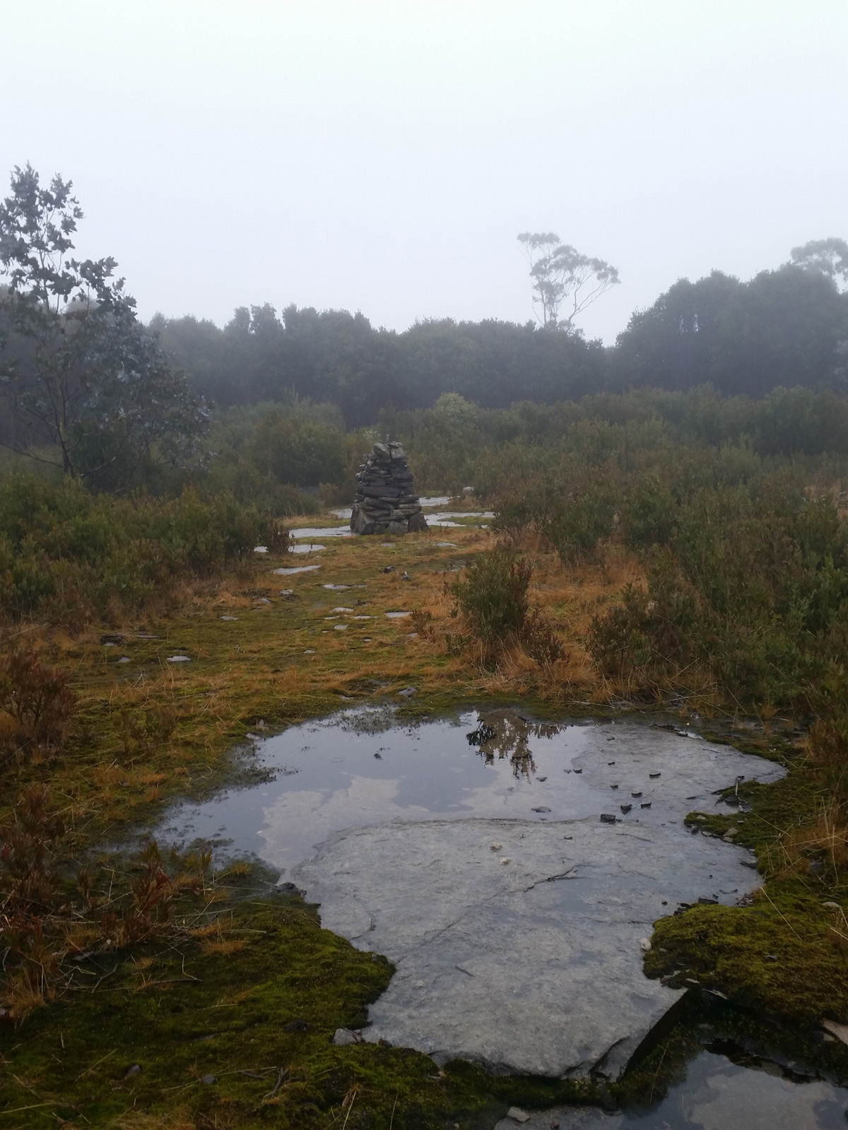
There were 15.7 kms on my Fenix here. I thought I’ll do around 30 today. Put my head down and started climbing. It was very slippery and those showers…The bushes kept scratching my legs, now it really hurt. Got up to Mt Boobyalla, looked around and saw the cairn. Nearly passed it again. Turned around, took a few pics, then walked through the puddles to the cairn. Took a couple more shots and a selfie, but had to get going, as it was really wet and windy, the body cooled down very quickly.
When I arrived to Cement Creek, I went the other way, into the mud, keeping a safe distance from the wet wood I fell on my way out. I wish the weather gods would’ve been kinder, this is such a beautiful place, would’ve loved to really enjoy it. Then the showers turned into icy ones, with seasalt like flakes hitting everything, piercing the skin. My fingers were so cold, couldn’t feel them. The gloves got wet, cold and heavy, but I left them on.
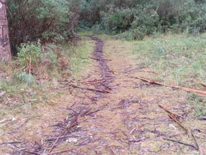
 After the short Road 2 section, it was time to climb back up to Mt Donna Buang. I stopped at the trail head to take a picture of the sign and thought I’d better check my legs, something doesn’t feel kosher. Well, I collected a few leeches around my ankle—not happy Jan! Damn!! Forgot to bring the salt!! I knew I had to let them feed until they are full and fall off, but that was a long way, they were still skinny.
This checking the leeches has taken up a lot of time—I stopped quite often to have a look. Had the other VFuel (Maple bacon), the body needed it. I was hoping I’ll catch up with the hikers, but they were obviously back at the Mt Donna Buang car park by then. I have probably passed their car when I walked across the car park. Quite a few people there, which was strange in these conditions. At this point I couldn’t wait to be back in the car heading home.
Parts of the descent to Mt Donna Buang Road were fun, others were really hurting (the knee high ferns), then others were above the ankle thick mud. I had the second mandarine here, it was a bit smashed from the bum fall, but still tasty. The forest road from Mt Victoria to the sealed road was an easy downhill. I promptly crossed the road got into the lovely rolling part. Wanted to make the most of it because soon will come the mud fun. My face got slapped by wet ferns so many times on this downhill, just couldn’t care counting. Checked the leeches, one fell off but the others were still feeding.
Then came the mud slide. Last Tuesday I enjoyed this part much more than now, today it felt way softer and more dangerous. I was so happy I only fell once on my way out (at Cement Ck), but coming down is a different beast. Landed on my bum 3 times and had 5 near misses, when I slipped, but kept the bum off the ground. These were the times my gloves and poles got very muddy.
When running along the barbed fence I noticed how beautiful the sun shines onto Mt Bride and there was a rainbow! Stopped to take a pic, had to fiddle with the phone, it was all wet and the touchscreen wasn’t working properly. Martyr Rd was wet and slippery. As I was passing the golf course, a little dog came barking, then I saw its owner, an elderly lady. She asked me if it was wet. I guess the way I looked totally warranted the question. Told her that yes, it was wet, windy and icy up there. She seemed impressed.
Got back to the car, took off the the gear, spoke to Otto (he wanted to know if I was OK, and how long before I get home), told him about 1.15, as I want to wash the mud off my legs in the creek. Walked down to the creek and took off the socks that were now completely black. I must have ripped off a few leeches with this move, but there was another one, insisting on feeding. Had to rip it off, even though I knew I’ll pay for this.
All up it was worth it. Sometimes I need to do this crazy things to feel alive and test myself. The beautiful dinner that was waiting for me with a tall glass of Nut Brown Beer has topped the day!!
Food: two quarter sandwiches with butter, cheese and home made smoked sauseges (made by Doru, Nelu’s brother) and 4 grape tomatoes each; two VFuel gels (Cool citrus and Maple bacon), two mandarines, dark chocolate with crystalised ginger (only had a piece each)
Gear: the usual wet gear, except for the long johns. Need to take the waterproof gloves next time. I wore the thermal top underneath the thicker Salomon jacket all the way and there was still times when it felt cold.
Check out the full gallery here