Wilsons Prom 44 km with David
09 April 2018
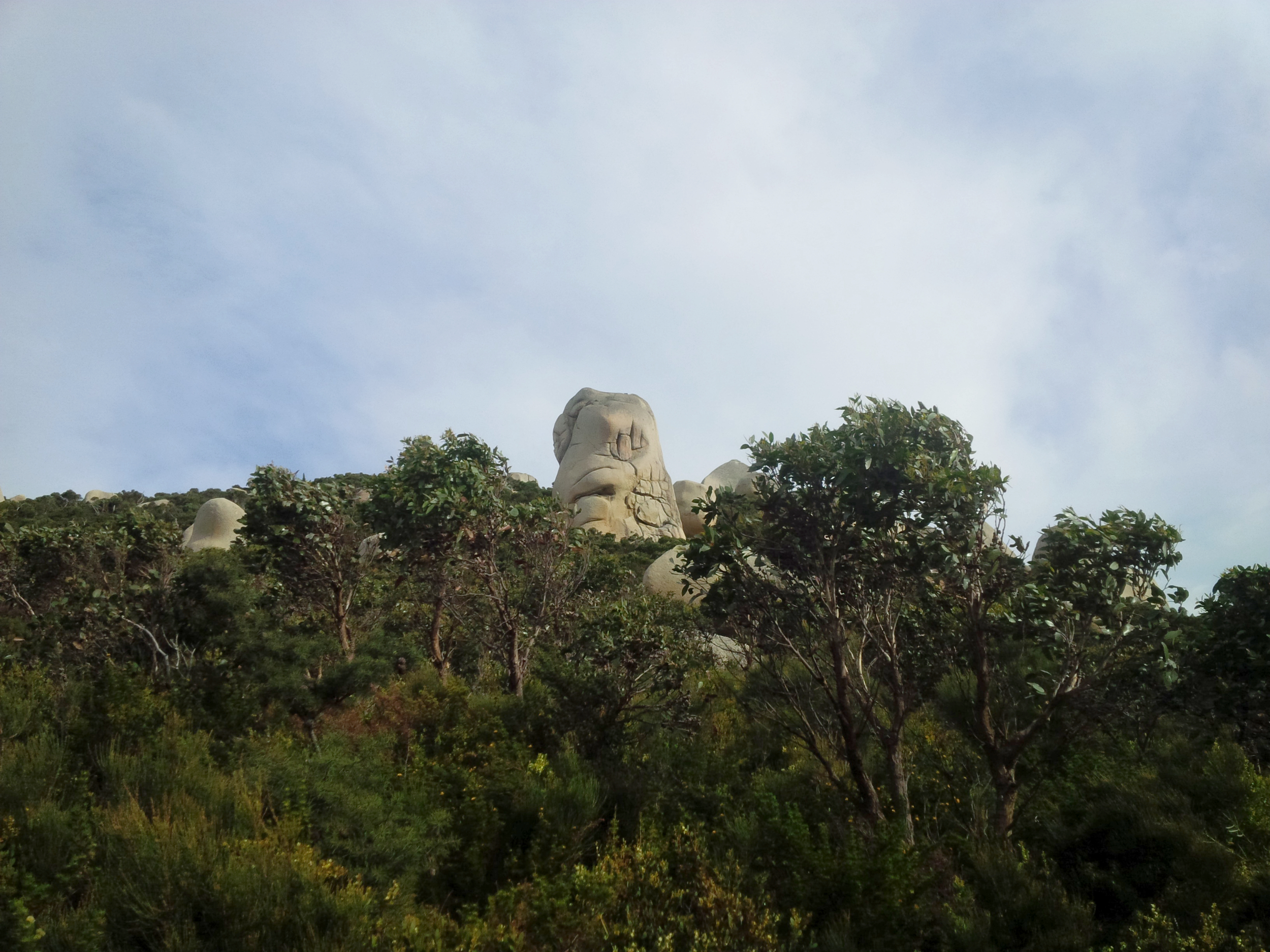
David picked me up at around 5:38, it was still dark but a pleasant Monday morning. We headed down to the Prom for his longest run to date and a recce of the 44 km course. The conversation was so engaging, that I hardly noticed the transition between night and day – the sun was already rising, fog in some places… We stopped for a photo of the boulder that looks like a goat’s head somewhere between Whisky Bay and Squeaky Beach. Told David it will be much nicer in the afternoon sun, we agreed we’ll stop on the way back, too.
After we pulled into the Visitor Centre car park, toilet, a few bites, gear up and got started. In spite of the cloudy sky the views from the road heading up to Telegraph Saddle car park were really nice. We stopped to take a few shots, got out of the way of the passing cars and were soon up at the parking. David took a few photos at the lookout (someone has put some bushes there since I’ve been here 😃), then we headed down Sealers Tk.
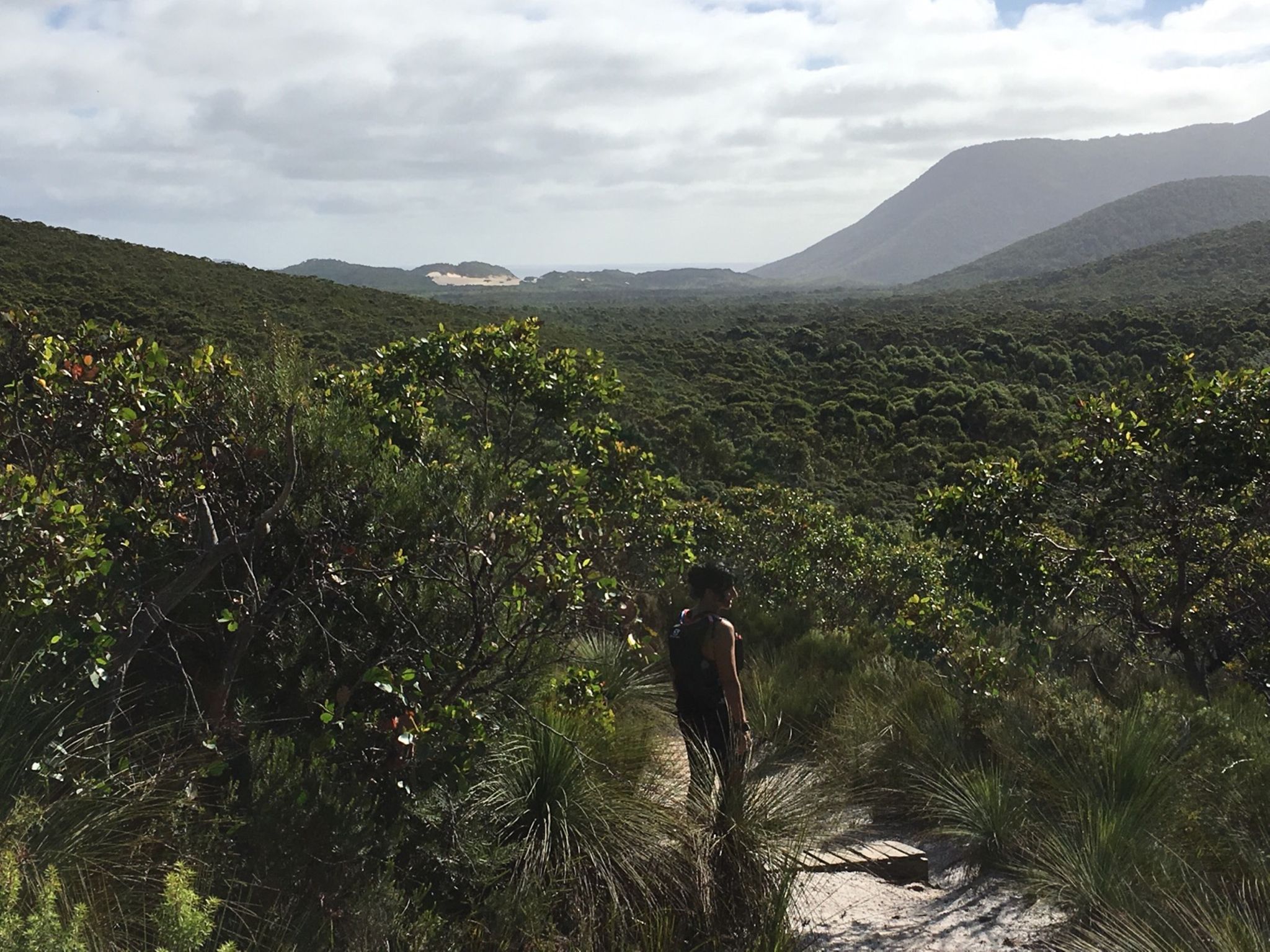
We agreed on taking it easy – it takes as long as it takes. David’s reaction to the trails at the Prom was exactly how I’d imagine it to be for every trail runner who hasn’t been there before. At Windy Saddle we had a quick chat with two girls, then I told David to go ahead and enjoy this part, fly down on it if he wishes – it’s my favourite track, that’s what I would do, too. Well, he certainly didn’t have the breaks on, I could hardly keep up with him. We bumped into some hikers a few times, stopped to take a few photos in a few nice spots (like that stone that marks a corner, haha!!) and soon reached the board walk. That was again a portion that we both enjoyed. By this time it was nice and sunny and humid.
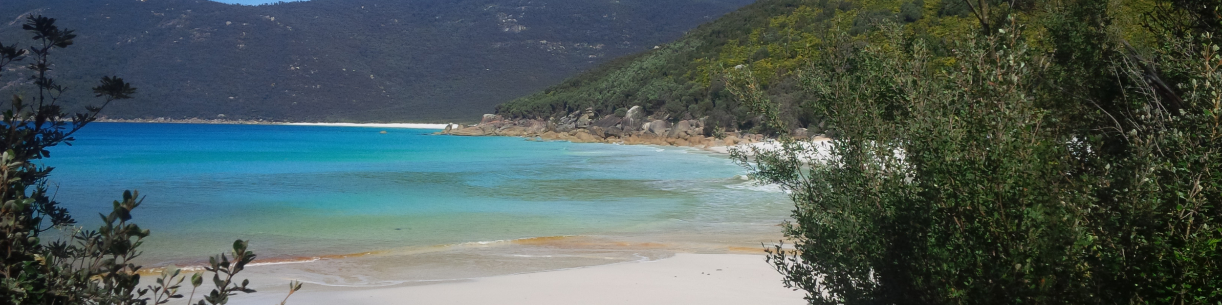
I was really excited to see (and capture) David’s face when he gets the first glimpse of Sealers Cove, so I headed ahead and took a few shots – I think I got it! We talked about what it is like when it’s high tide here and the creek can be up to waist when crossing. There were people walking closer to the water, in the quite compact sand. We took our shoes off to cross the less than knee deep water, then met Louise, a lady older than us, putting her hiking shoes on. We asked her where is she heading. She was from Fish Creek and decided to hike the Prom; she was amazed by us doing that loop in one day, then she took off saying, no doubt, we’ll catch up with her at some point.
We went through the camping ground, stopping to take a photo of a curious wallaby, then headed up the hill, chatting away and David being amazed by the beautiful, rolling trail, the everchanging vegetation and the stunning views.
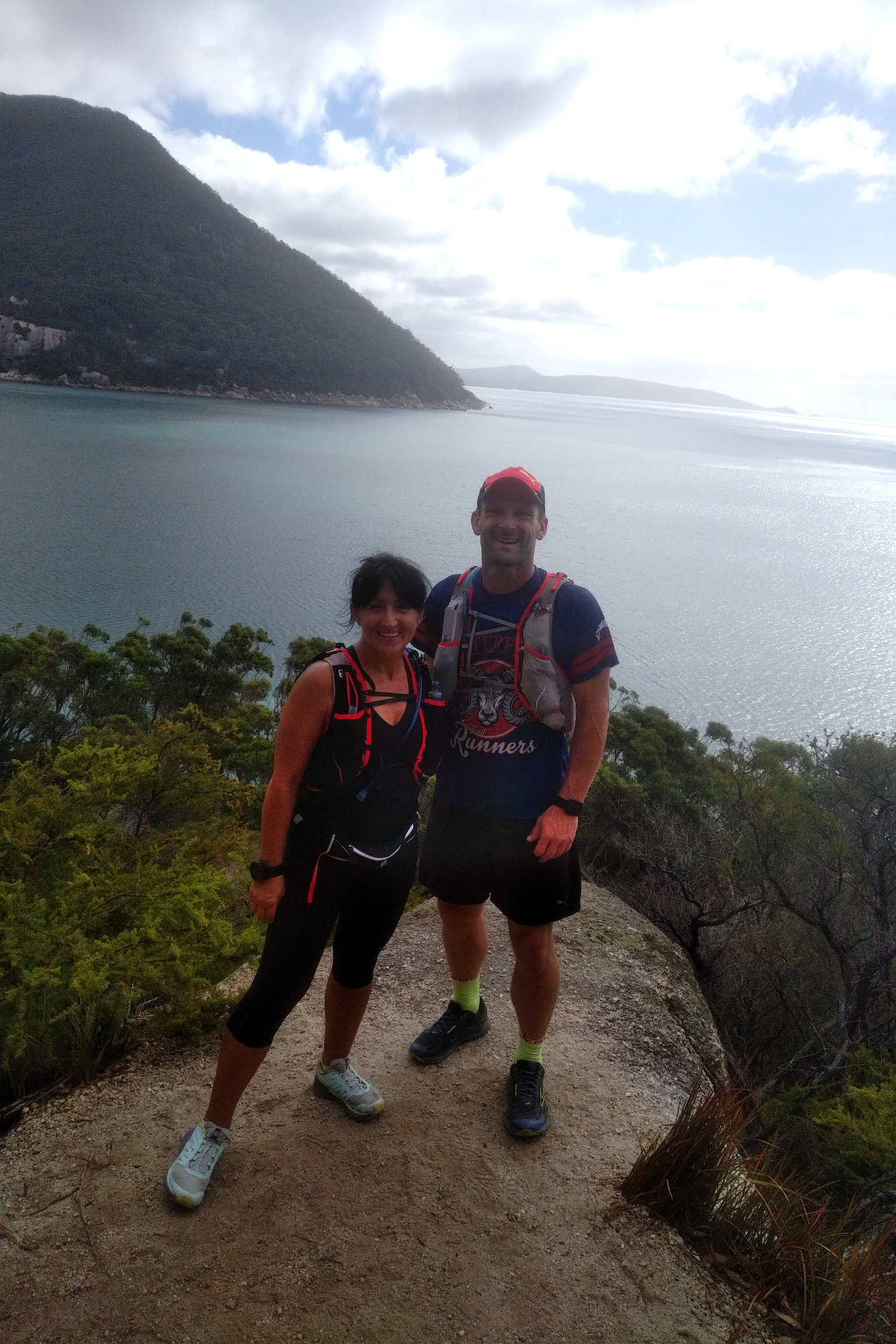
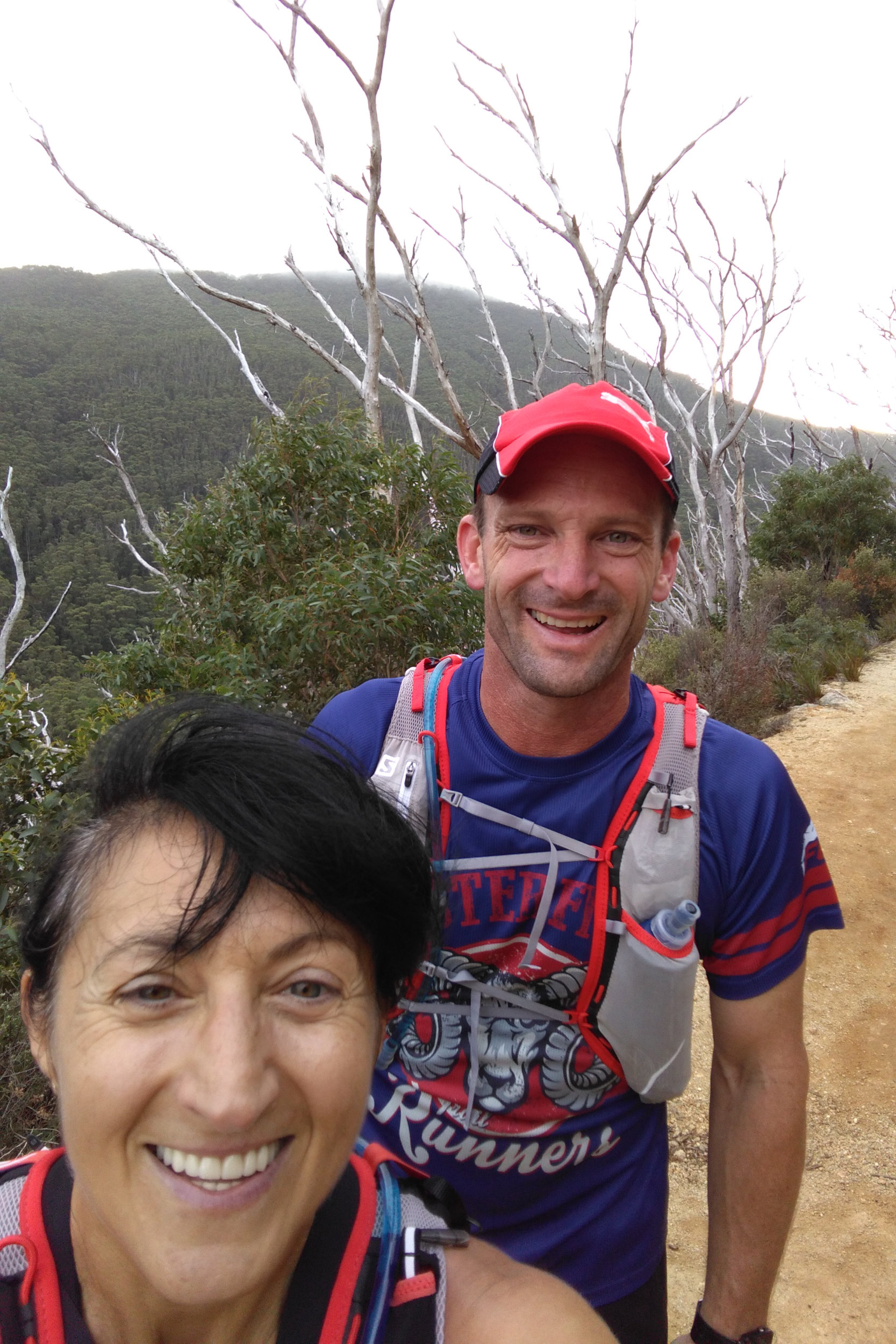
We caught up with Louise on the boulder overlooking Sealers Cove. Asked her if she wanted a photo. First she said no, but then gave me her phone to take a shot. She asked if we wanted a photo, as well so we lined up for the picture 😊. Louise still couldn’t get over us doing all this distance in such a short time, then she asked how old we were – told her I was 50 and David said he’s 43. She looked very impressed and wished us all the best as we took off.
We soon got to Refuge Cove Nth, where there were a few boats in the water. We even wondered if one of them was picking a few persons up, then a trail runner looking guy started to walk towards us. We asked him where is he going and where is he coming from, then at the introductions found out that he is Tom, and David and Tom went to the same school… it goes to show how small this world is! Tom ran into a branch earlier and cut the skin on his head open. David looked at it and told him there is nothing we could do about it, just keep it covered. We said good bye, then headed in opposite directions.

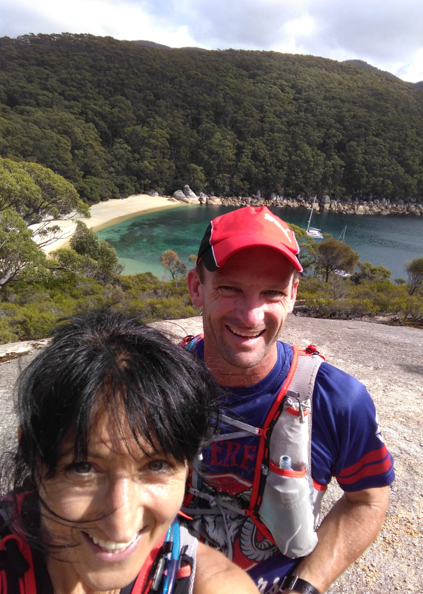
Refuge Cove was next and boy, it didn’t disappoint! David walked onto the beach to take some pictures while I went to the toilet (it was surprisingly clean), then we headed towards the camping ground. I showed him the tap, filled our soft flasks with water then headed back to the track.
A solo hiker we’ve seen earlier with a big pack, and hiking quite fast was already setting up his tent. Pretty much everything he was wearing and carrying was green and he was very efficient. You can tell it was school holiday, there were families with children and some youngsters in most camping grounds.
As we passed the sign that said “Kersops Peak 2.6 km” we agreed to go up to Kersops Peak for a peek. This sounded so funny. I could sense that David was itching to go a bit faster. Told him to go ahead and enjoy it, then watched him hop away with such an ease as I only saw Chris Roberts and Dan Beard go up one of the Dandenongs hills during the night run Gabor organised a while ago. It was getting warmer and I felt a bit sluggish. Took a quick spot check on my going so far: food was ok, I was also drinking the water with electrolytes, the hip was ok, didn’t hurt. Then it must be one of these: no training, sleep deprivation, the food and drinks I’ve been carrying on my bum since Easter or I didn’t totally recover from Razorback. I wasn’t looking for excuses, but wanted to know the WHY.
We ran together chatting for a little while, then told David to go ahead and have fun. We ended up doing this a few times: running together, him going ahead then waiting for me patiently. I really admire this about him. On the downhills we stepped on it and it was a lot of fun flying through the ferns and hopping over roots and rocks. I don’t think I ever ran this fast on these downhills when I was solo or even during one of the races.

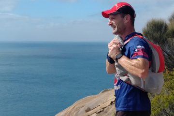
At the Kersops Peak junction we stopped and looked around amazed by the views. Took a few pictures, then headed up to the Kersops Peak summit for more. The track going up there is a tad steep and rooty and rocky with sudden switchbacks in some spots but if one stops every now and then to check the views, it’s an incredible sight.
We took a few shots on the top, pointed out the Lighthouse (seemed so far, far away), Waterloo Bay, Waterloo Bay Nth with its crystal clear water… we had a date (each), then headed down, talking about the Sunset Tk run at Lysty we both did a while ago.
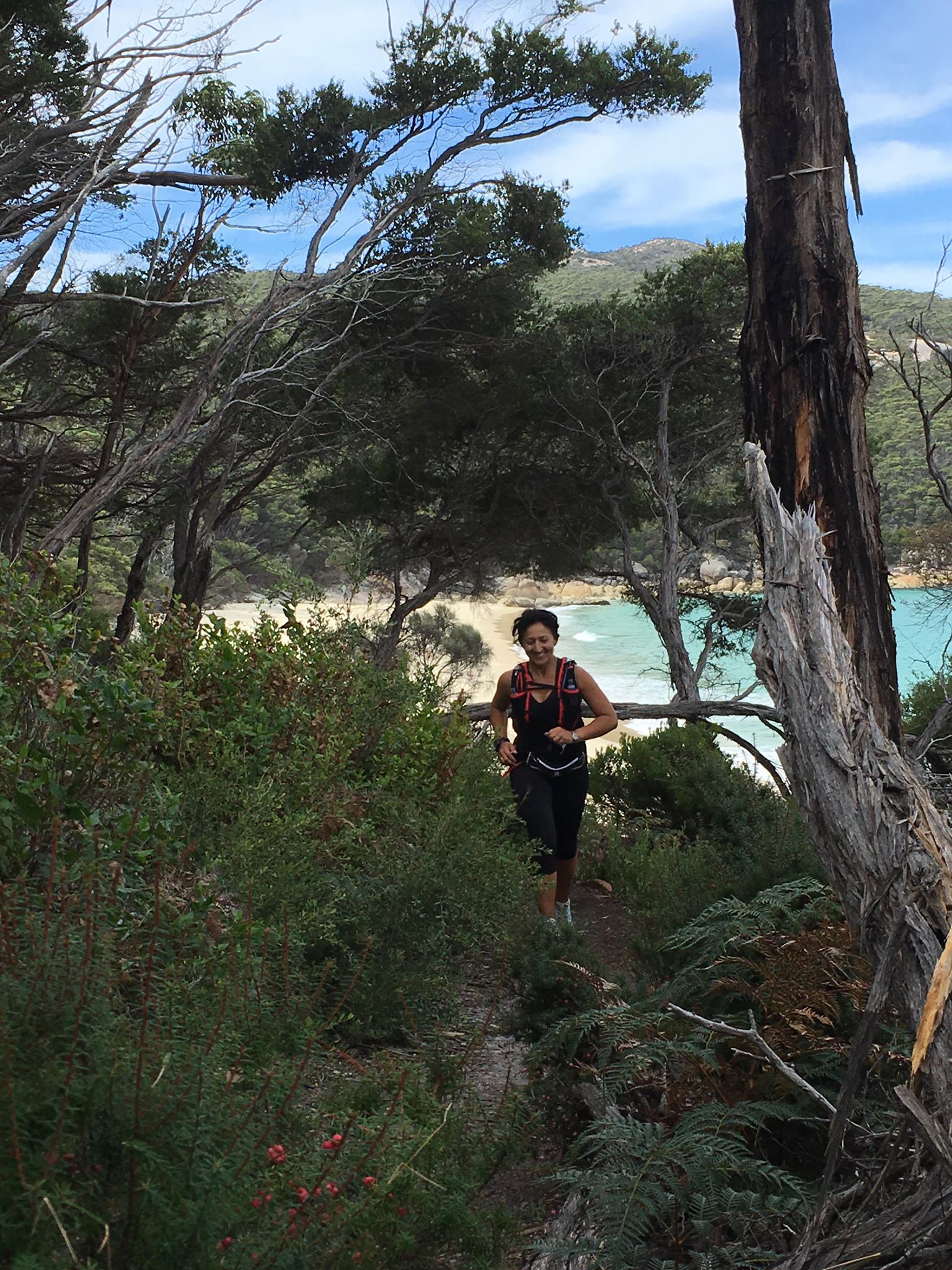 The track is steep, tricky and very technical down to Waterloo Bay Nth, but before reaching the beach there is a spot where one is presented with some of the most brilliant colours nature can produce. It’s only a small patch of the turquoise water powerfully contrasting the dark greens and browns of the trees. David shot ahead on the fun-run downhill, so I was hoping he’ll notice it. And he sure did. Furthermore, as I was turning a corner, I’ve realised he is sitting off the track waiting for me with the phone ready. He managed to take one of the best shots I have on these trails, with the previous beach as background.
There was a family scattered on Waterloo Nth beach, we said hello and kept going while admiring the rusty rocks ahead, then we started climbing towards the “Decision Rock”. It’s a big boulder where hikers usually sit down for a rest and marvel at the sight of Waterloo Bay. Told the story about the time we planned to do the 68 km with Julie and the weather forecast looked less than promising, so we had to make a decision here.
Little Waterloo Bay was next with its squeaky white sand and brownish creek. There were a few youngsters on the beach. We said hello, then kept on going towards the camp ground. I was hoping there is water flowing here. Campers were minding their business while we filled up our storages with the brownish water. I took some big gulps of water here, which proved to be a bad move. Need to slap myself every time I even THINK of doing this in the future!
As we were walking through the camp ground I told David about the times when after rain the sites are all under water – they are ponds. Literally. I also pointed out the sign that says something like “Lighthouse Tk 6.3 km”.
From here we pretty much rolled down to Waterloo Bay, hopping over the big rocks to get to the beach. That blindingly white sand and the constantly inviting water, that changes its colours with the movement of the clouds and brightness of the sun! Can’t get enough of it.
We headed towards the track, admiring the stones (that look like they were imported from Easter Island) on Mt Boulder. Striking sight against the dark green foliage. The sun was setting down on the other end of the peninsula casting some beautiful shadows.
David stopped to take pictures, then we ran-walked this portion (those big gulps of water must have messed up my system – again) and we soon hit Telegraph Junction. Told him about the veterans who come to support the run; they sit there, take our numbers, offer us food and water and are very nice. We walked to the turnoff, then headed West on the dreaded 4WD track.
At first it’s not that bad, but when the sand gets deeper, it’s not easy to move, so we ended up pretty much walking all this portion, pondering which 4WD would be best on this terrain. At least the company and conversation was great. At Oberon Bay the tank was completely dry, the tap turned upwards. We walked onto the beach in the deep sand and soon saw Oberon Bay at low tide.
The beach was runnable, but we walked it while I told David about the night when I did the 68 km and finished in the dark. The end of Oberon Bay was all covered with the moving water and there was such a thick mist, that I couldn’t see the beach exit.
We took our shoes off when crossing the small creek, the water was nice and cold for the feet, then sat down on a rock close to the track to put them back on. I watched how he meticulously cleaned the sole of his feet and in hindsight, I wish I did the same – ended up with a bloody blister (there is blood in it) on my left toe. There were about two tablespoons of sand in my shoes (these are the ones that apparently drain well).
We hiked, walked, ran the portion to Lt Waterloo Bay, chatting away and really looking forward to that beer. At least I was – couldn’t shut up about it.
Not sure if anyone noticed this – from Telegraph Junction the signs are getting closer and closer: there is one at Oberon Bay beach entry, another one at the exit; same at Lt Oberon Bay, giving the hikers/runners a “you are getting closer” sense.
When we arrived to Lt Oberon Bay, I pointed out the small pole that signals the beach track. There used to be a sign there long time ago. The sand is soft here, we walked along the short beach which other times seems like eternity, then climbed out on the sandy track. You make a painful step upwards, then slide back a little… As always, I couldn’t wait to get out of there.
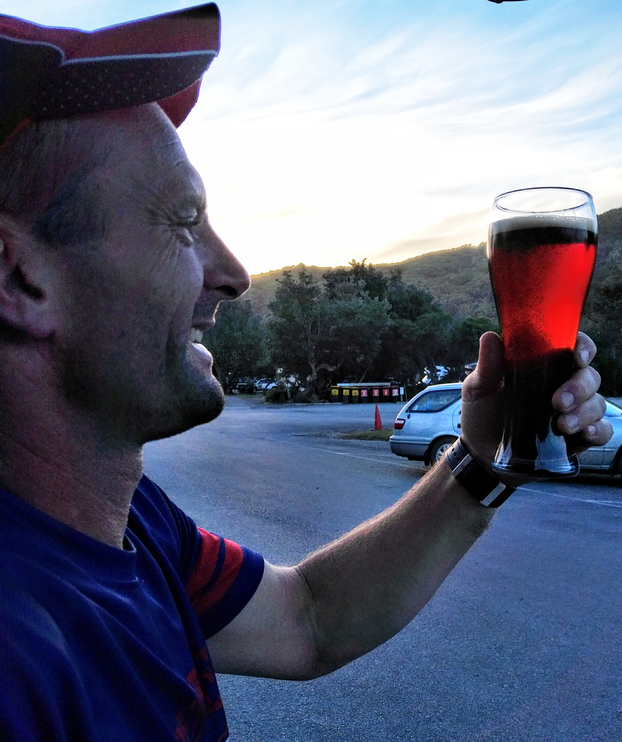
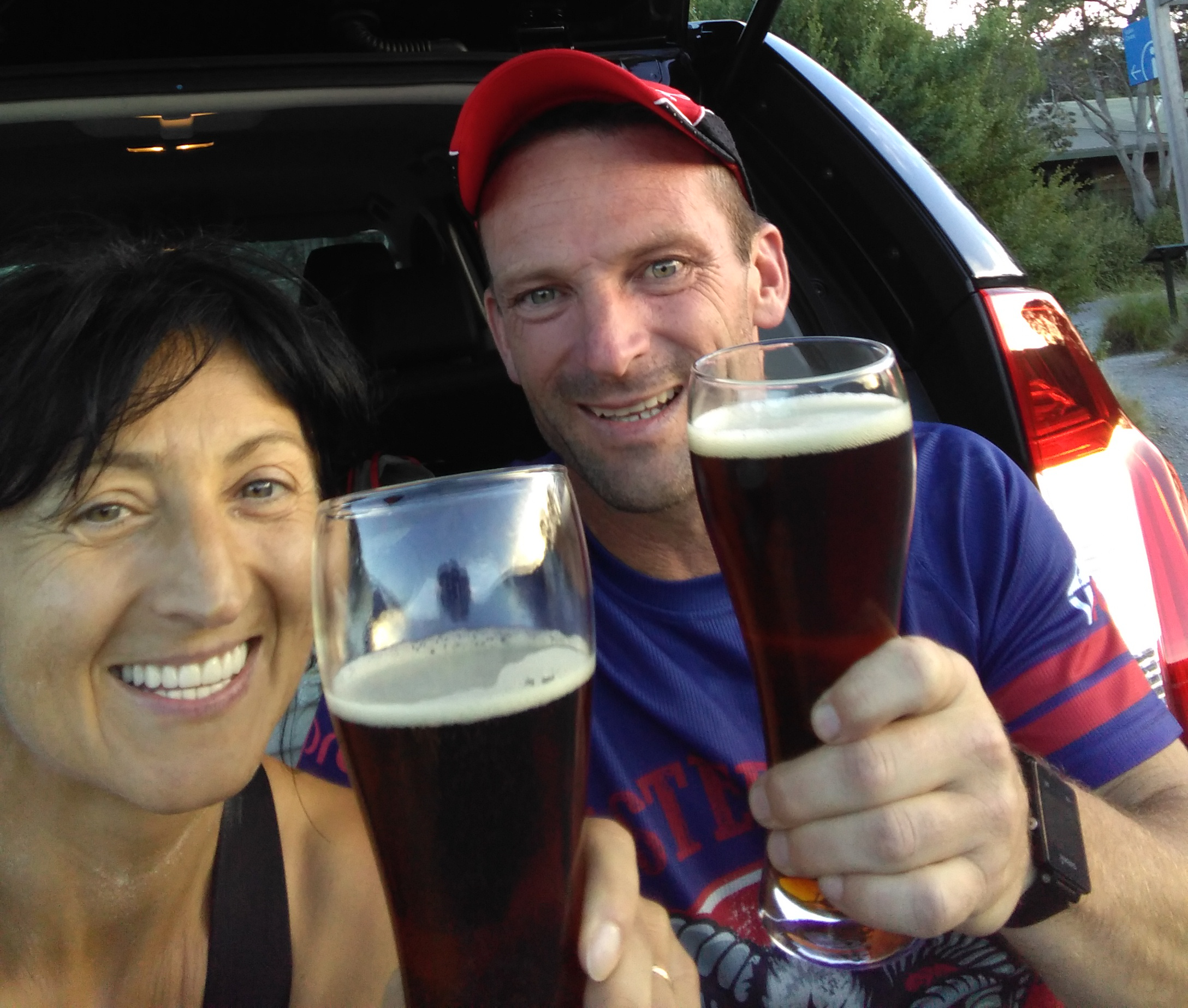
The sun was setting down and the colours were amazing as we kept walk/hike/running towards Norman Bay. I think Otto called as we were getting closer and asked how we are travelling. From Norman Bay we took the short cut to the Visitors Centre – the beer was getting closer. Once we arrived, called our spouses, then pulled out the tall glasses and opened the Nut Brown Ale. Those two glasses received a lot of attention on social media 😃
We had a shower and headed home. It was a great day and I am happy I could share the Prom with a friend who appreciates it.
Gear
The usual, from mandatory didn’t carry the long johns and overpants (had them with me, though).
Food and hydration
- 1 l of GU Tri-Berry Hydration Drink in the bladder
- 500 ml GU Hydration Drink Mix – Watermelon; re-filled at Lt Waterloo Bay
- 250 ml tap water; re-filled at Refuge Cove and Lt Waterloo Bay
- 6 rice paper rolls with red, yellow and green pepper, coriander, mint, a thin slice of steak—only had 4
- Dark chocolate and ginger
- Dates
- Clif Blok Shots
How to get there
This is the route we took from Leongatha to Tidal River. Click the More options link on the map to enlarge it.
Strava Activity
Feel free to study this activity.
Max elevation: 335 m
Min elevation: 5 m
Total climbing: 1720 m
Total descent: -1721 m
Total time: 08:43:18
Amenities
There are several toilets in Tidal River, we parked in the main parking area just opposite the Information Center
Friendly advice
Here are some thoughts that might be useful before heading out on an adventure like this:
- Always check the weather, and the tides at Refuge Cove as the creek at Sealers Cove could be quite deep to cross. This is where I usually look this up https://tides.willyweather.com.au/vic/gippsland/refuge-cove.html
- Carry enough food and water. After Little Waterloo Bay there is no water until maybe Oberon Bay. There is a tank there, but there is only water in it when there was enough rain.
- Get the Wilsons Promontory – Spacial Vision Map
- Carry a PLB, alternatively keep someone updated about your progress. Garmin has LiveTrack, Strava has Beacon. If you have a smart watch, these can work together very well wherever there is network coverage
Hope all this info has helped.