Mt Solitary cut short
2 November 2017
 I was itching to do this run for a while, it always sounded like a real badass outing, but was cautioned by my good friend Vicky [McPherson] to not go there alone… that warning was nearly three years ago. I thought, since I’ve got some experience under my belt and Thomas [Martin] made it look so simple and easy with his photos on Facebook, it’s time I tackled it. Thomas couldn’t accompany me because he was working but happily agreed to be my safety contact for the day. I am eternally grateful for that!
So I packed up my gear, dropped Otto off at work in Smithfield and headed out to the Blue Mountains. Saw the traffic in the opposite direction… like the Monash inbound in peak hour.
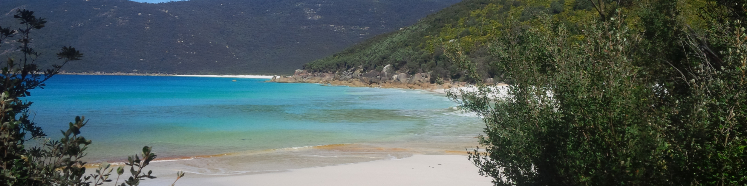
Beautiful day!! I was really looking forward to this adventure, full of excitement of the unknown and the difficult nature of the course. Parked the rental at the old Queen Victoria Hospital, geared up and headed out, for the first time taking a better look at the old buildings. It’s all downhill to Kedumba River on Kedumba Valley Rd, a slightly rocky forest road. I went down on it and back a couple of years ago, when I followed the course of the Kedumba Half Marathon. If it wasn’t for the views, it would be a pretty boring run.
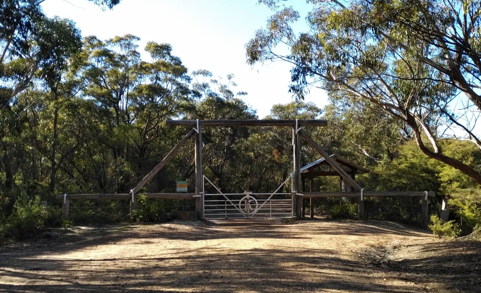 I soon crossed the gate, entering the Blue Mountains National Park and joining Kedumba Pass. I remembered the gates with the swine pictogram and the warning, and how scared I was back then, constantly checking trees to climb on should one of those feral pigs charge at me. I worked it out, though – those gates are there to keep the feral pigs OUT, so there shouldn’t be any once I am on this side of the fence. Good logic, eh?!
Saw lyrebirds, tried to take pictures, but they disappear so fast, it’s all blurry. The sign at the park entrance said 3.4 km to the Mt Solitary Tk, the course description says 4 km from start… I clearly remembered a sign on the left hand side pointing towards that track from years ago when I passed a place that looked like the turnoff. There was a sign that said “Sublime Point Trail”. Looked around but couldn’t see anything that said “Mt Solitary”. I kept going, but then felt that something is really not OK, when Otto rang – he asked me why I didn’t turn right. He was following me on Strava Beacon. Told him that I am aware of what happened, and turning back now – that’s an extra 3 km.
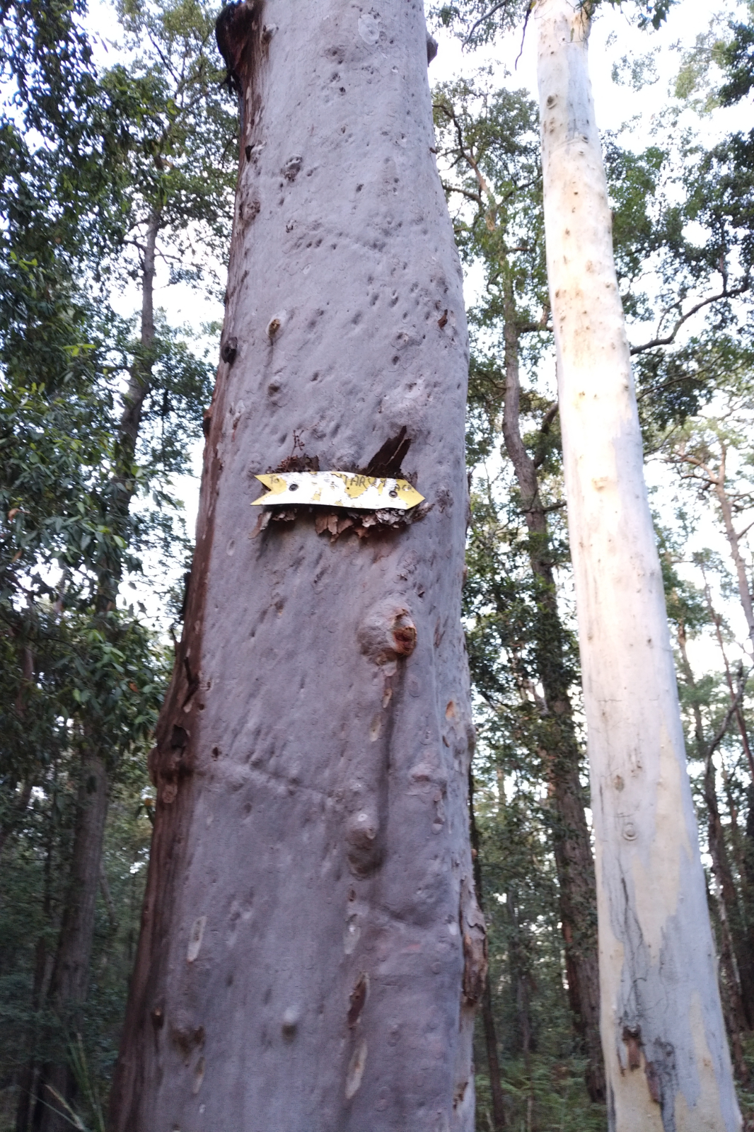 When I got back to the point where I should’ve turned, I had a better look around and noticed a very worn sign that was nailed to a tree, high enough for a short person like me to not see it. I took pictures for the future, then headed down to the intersection where Mt Solitary Tk and Sublime Point Tk meet. The single trail that follows is just plain running pleasure! I was having serious fun, when Paul rang – ended up a run-phone-meeting. Told him where I was and what I was about to do – he told me to be careful there.
Soon I reached the river. Crossed it with my shoes on, then started to look for the track on the other side. Well, it seemed like it doesn’t exist. Went back and forth a few times, up and down… saw some weird spots – like the ones are inhabited by someone. That was a bit scary right then and there. I’ve spent about 15 minutes here, until I finally found the track.
 The course is pretty much uphill from there. The notes are this: “After crossing the river, runners will make an arduous 3 km ascent to the eastern col of Mt. Solitary (11 km). This ascent is tough with the elevation change being in the region of 650 m over the 3 kms.” – they are spot on!! There were points where I thought I’ll roll back if I don’t lean forward. Passed the Kedumba kemping area and continued up-up-up and up in the forest. It was getting quite warm, too. Every now and then I looked back and took a picture of how steep it is. The track is mostly dirt with roots and rocks and it sometimes has two branches: one steep and straight, the other one a bit switch-backy.
As I was climbing, I’ve noticed something strange… it moved. I realised it was a goanna and it was sunbathing on a tree trunk. I asked him (nicely) to please move away so I can pass, which he did, posing for a few pictures in the mean time. At around the 13 km mark I reached a flat portion, which seemed like a camping area. The track looked like is going to the right, but also to the left… I walked around looking for it, thinking “backtrack, now show me what you can do!” – it is quite useless when you do lines like a crazy EEG. I decided to go higher grounds and see if I can spot the track, so I climbed a big rock. Wasn’t any wiser when I got back, but I thought I’d just follow my instincts and finally got back onto the track.
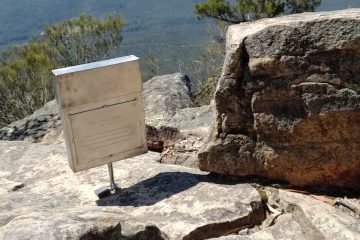
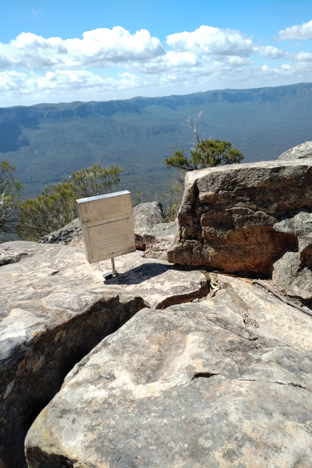 When I reached the col, I looked for the book Thomas told me to sign. All I saw is a metal sign saying it’s ‘Mt Solitary 919 metres “The Col”’ and an explanation of what Mt Solitary is for the Aboriginal people. Tried to message him, but there was no reception, so I took a few pictures of the amazing views of Kedumba Valley, Korrowall Ridge, Cedar Valley and soaked in the sights thinking who knows when I’ll get here next. I was really happy to be there!
Once I was on my way, a flat portion allowed for a bit of running. This is what the course description says “After reaching the col, runners will continue to climb to the high point of Mt Solitary (950 m). Runners will traverse the top of Mt. Solitary which is a glorious mix of single trail, with some rock climbing.”
In the mean time Thomas managed to call me and told me the book is in the metal box and that I’ll need to come back another time and make sure I put my name in it. He also made sure I was OK, which is very nice of him. There were spots facing North, where there were beautiful views of Jamison Valley. I took some great shots.
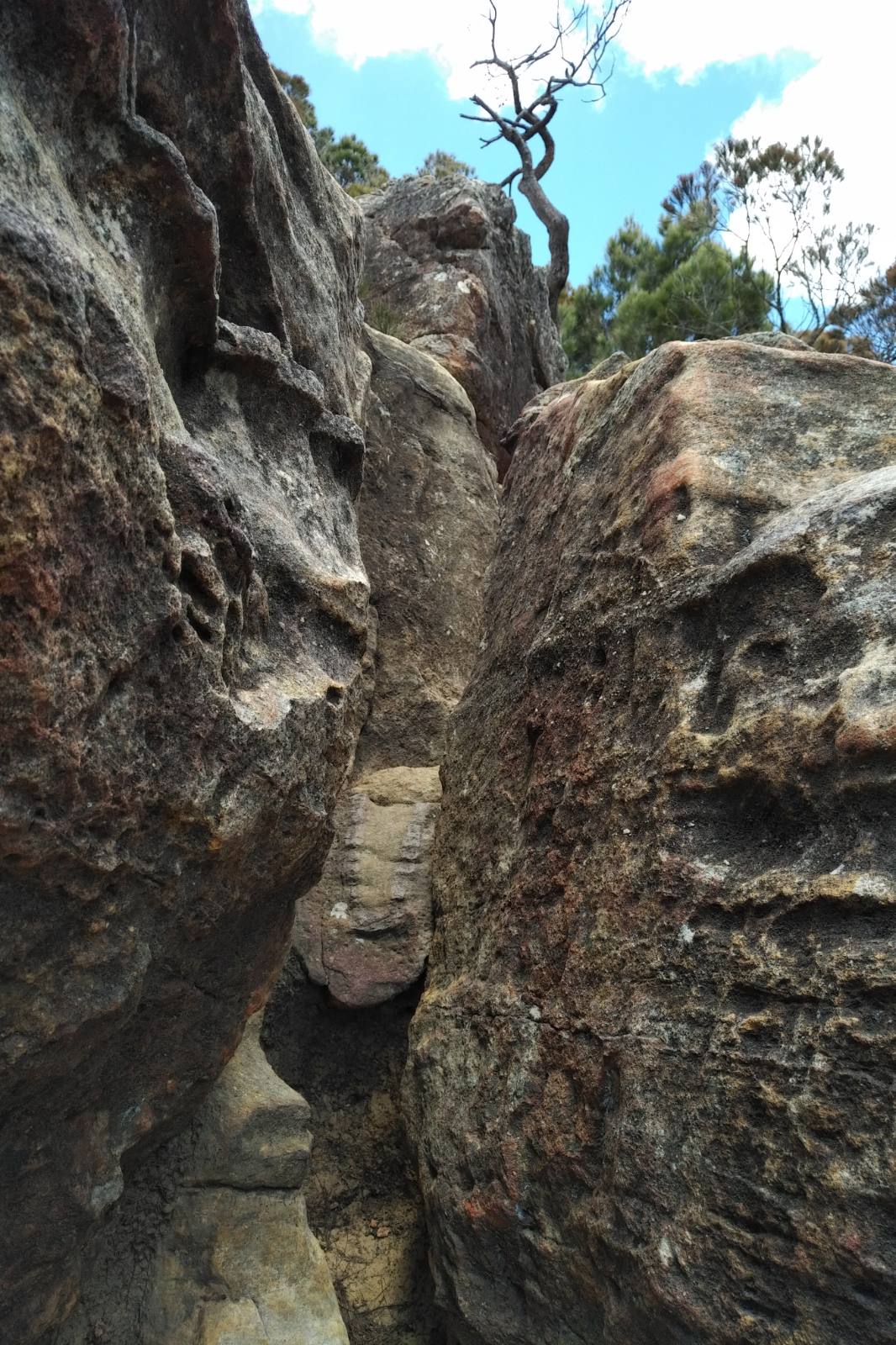
Continued the climbing, then started the descent. I could hear voices with German accent and realised in these 4:15 hrs and 17.3 kms I have not seen a human soul!! Scrambling down the Korrowall Knife Edge is not for the faint hearted and in hindsight I should have not gone there alone. At least not for the first time. There were places where a person with a bigger built wouldn’t have been able to get through (in my opinion).
Got to Cedar Gap, the point where I ran once when I came to do the Ruined Castle out and back from the Golden Stairs. I clearly remember the sign giving me a definite sense of “this is the point where you need to back off”. The trail is nice and rolling here, going mainly downhill. I was running out of water and whatever I had left was good to make a nice cup of tea. So I was very happy to see the water tank on the right. Went down the few stairs, filled my storages, then thought I’d better check out that toilet… well, it was one of the cleanest toilets I’ve seen on the trails, with lots of toilet paper rolls!!!
Once back on the track, I ran-walked most of the remaining distance, passing the stairs to the Ruined Castle, chatting with a young French couple, then two Asian youngsters. Funnily, parts of this track have vividly stuck in my memory when I first ran it. Could be because I was looking out for snakes back then, but frankly little corners, stones, roots, trees – just like it was yesterday. I soon reached the Golden Stairs and was happy I don’t need to climb them today.
What followed was (just like the Mt Solitary Track) virgin territory for me – never been past this point. The track was technical with lots of roots and some stones, but it was in the forest, which meant that it was a little cool in the heat of the day and all up it was a pleasant place to run. I’ve passed the tunnel, which the course describes as this “Keep a lookout for little known ‘Rennies Tunnel’ about 1 km north of Golden Stairs. This tunnel was used in the 19th century to remove shale from Megalong Valley (yes you can still go through the tunnel for a shortcut between the two valleys, but that is for another day). “.
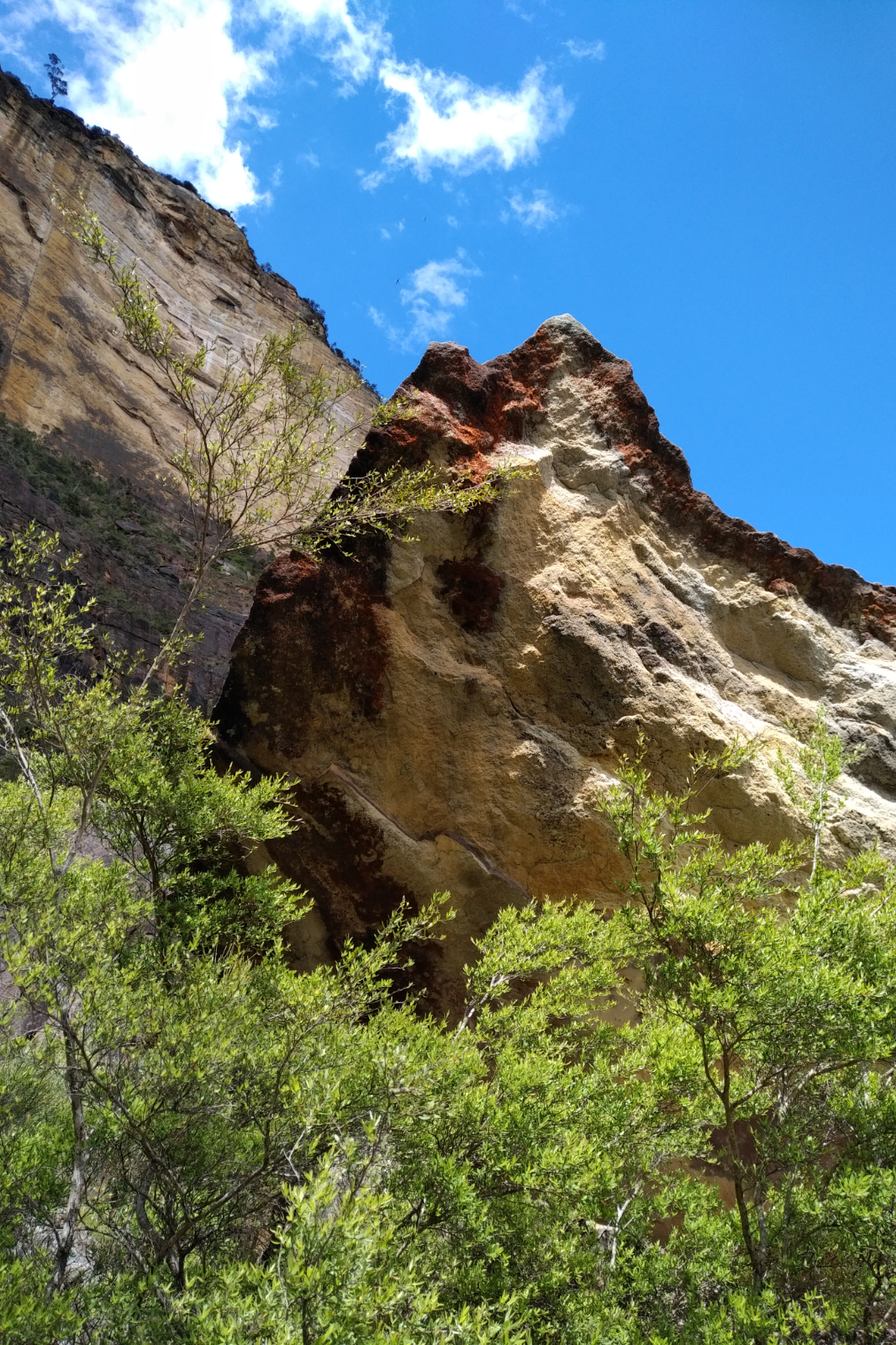
After this portion, lots of rocks – the course description talks about ‘The Landslide’ or ‘Dogface Buttress’. Looking to the right, I could see Mt Solitary. Hard to believe not that long ago I was up there scrambling down rocks…
I’ve made some quick calculations. If I keep going back to Kedumba Tk and up to the car, I risk running out of food and water and even worse – I won’t make it back in time to pick Otto up from work (he is pretty flexible with the hours but I didn’t think he’d like to work until 8-9 PM). I thought I’d be done in about 7-7:30 hrs (the Mt Solitary Ultra official cutoff is 7 hrs I think). So the plan was this: I’ll go up the Furber Steps to Scenic World, have a beer, catch the train or a taxi back to Wentworth Falls, then drive to Smithfield.
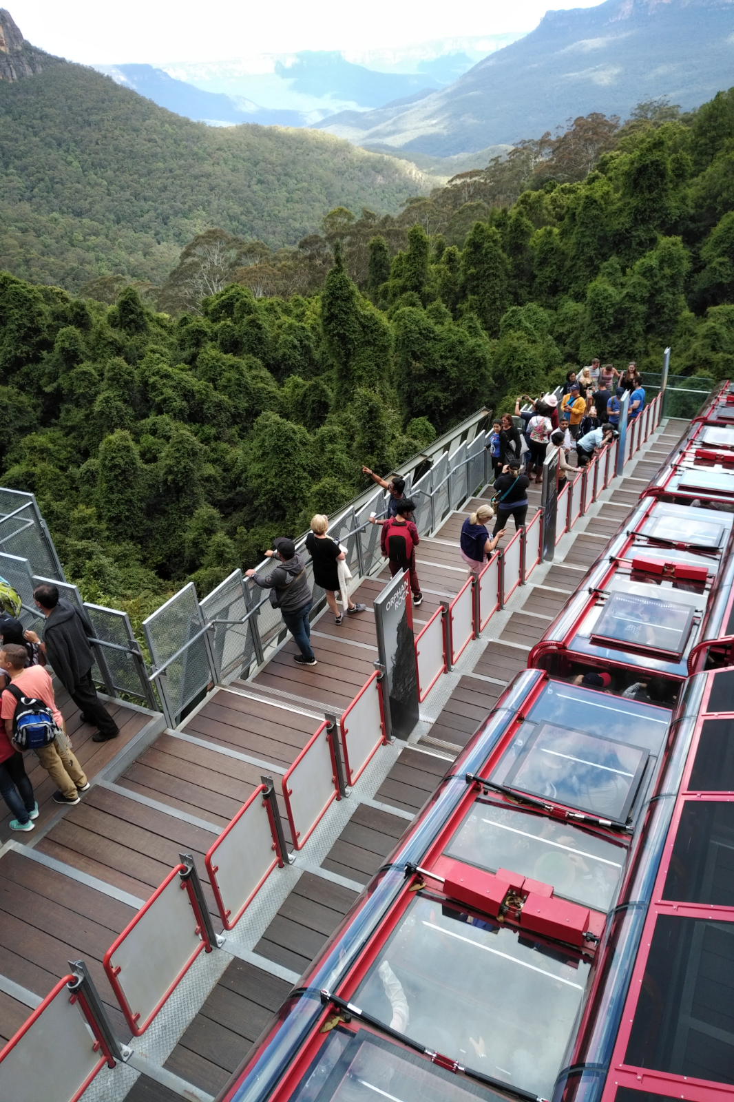 There were lots of tourists around the Scenic Skyway, I tried to get through as quick as possible followed by some strange looks. Once I hit Furber Steps I started to understand why people curse it, hate it, are scared of it – it’s very steep!! Your quads and calves start burning pretty early on. I’ve stopped a few times to take pictures or let others pass in the narrower parts. Tourists are not all nice. At the last outlook, I could hardly breathe, still said hello to the ladies hanging there, just to get the sock of no reply. It was a bitter pill to swallow.
Took a few more steps and had one of the runners’ worst nightmares – a cramp that made me hunch over the hand rail, not able to move and in a pain that I’ve never experienced before. A couple passed me, asked me if I was OK. Told them it’s a cramp, will survive and thanked them for asking. Once I felt a little normal, I started walking slowly towards the road, checked the sign and headed in the Scenic World’s direction. I was so looking forward to that beer… in fact I imagined buying TWO!!

So glad I had this $20 note with me (learned from the Dom Dom – Warburton trip) – stood in line and checked out the offer… the guy looked at me strangely when I asked for two beers (can’t remember what exactly was, but I know it was a local beer) and kindly asked him to open them, too. Sat down at a table in the sun, marveling at the sight of the Three Sisters, and people watching the tourists around me, while they looked at this weird dirty woman with two bottles of beer. The first one went down so fast, I am sure I had a brain freeze when I finished it. I actually enjoyed the second one, then put the bottles into the recycling bin and headed to the Explorer Bus stop, checked out when the next one arrives and chatted to the American couple waiting there.
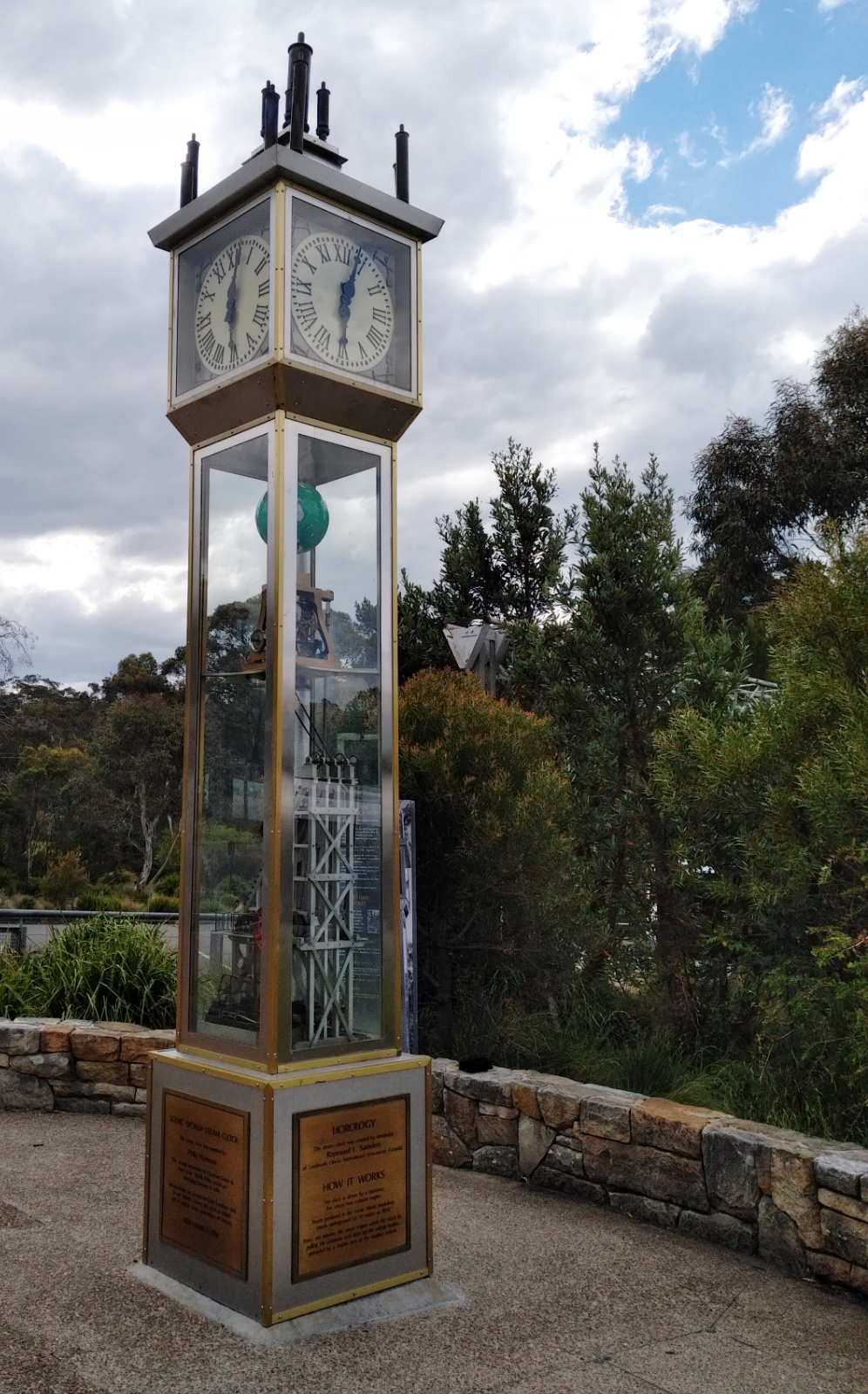
There were still 10 more minutes to wait, so I went for a look around, took pictures of the clock and didn’t notice the bus. By the time I realised it was there, it already took off… Great!!! Now what?! Went into the shop and asked about a taxi. The shop assistant was both shocked and amazed by my story and organised a taxi for me.
Taxi driver was a tad surprised by the whole thing, but swiftly drove me to where I parked. Paid him, said good bye then I cleaned up and changed into the dry clothes I’ve brought and headed to Smithfield. Poor Otto had to stay back a little, but he was OK.
I was a little disappointed with not closing the loop, but this was a good training and adventure on its own. I am writing this report six months later so recalling what I exactly ate is a bit fuzzy.