AC overnight “miler loop” with Tay – more of a hike
09 December 2017
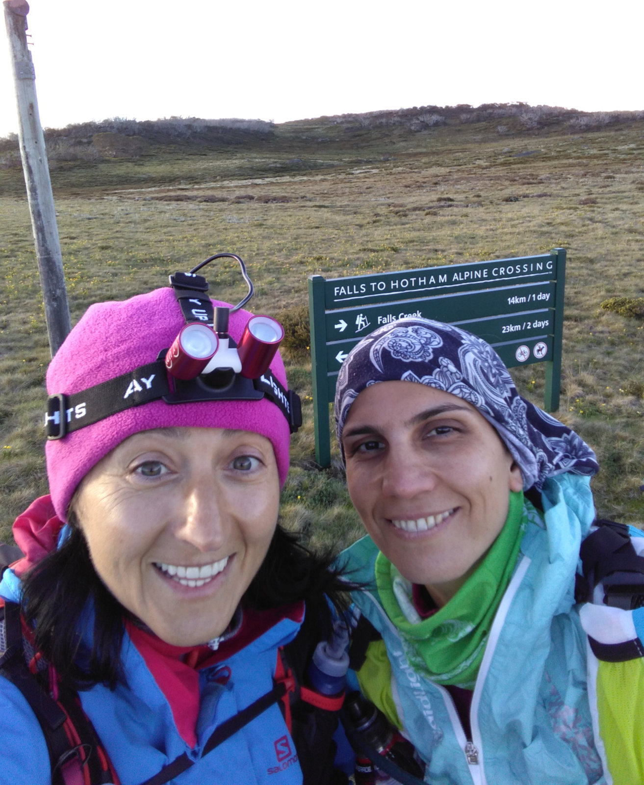
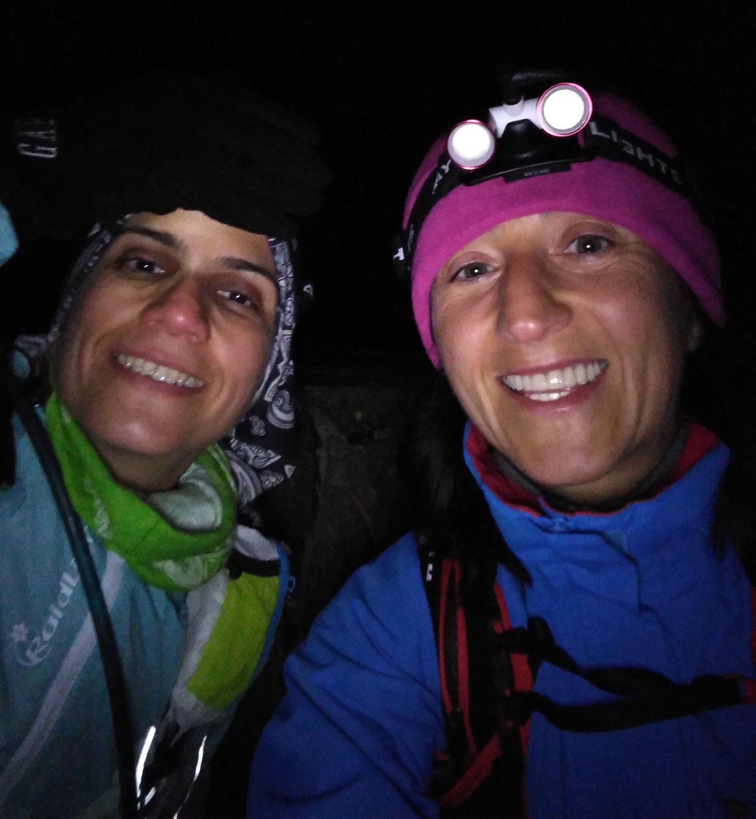
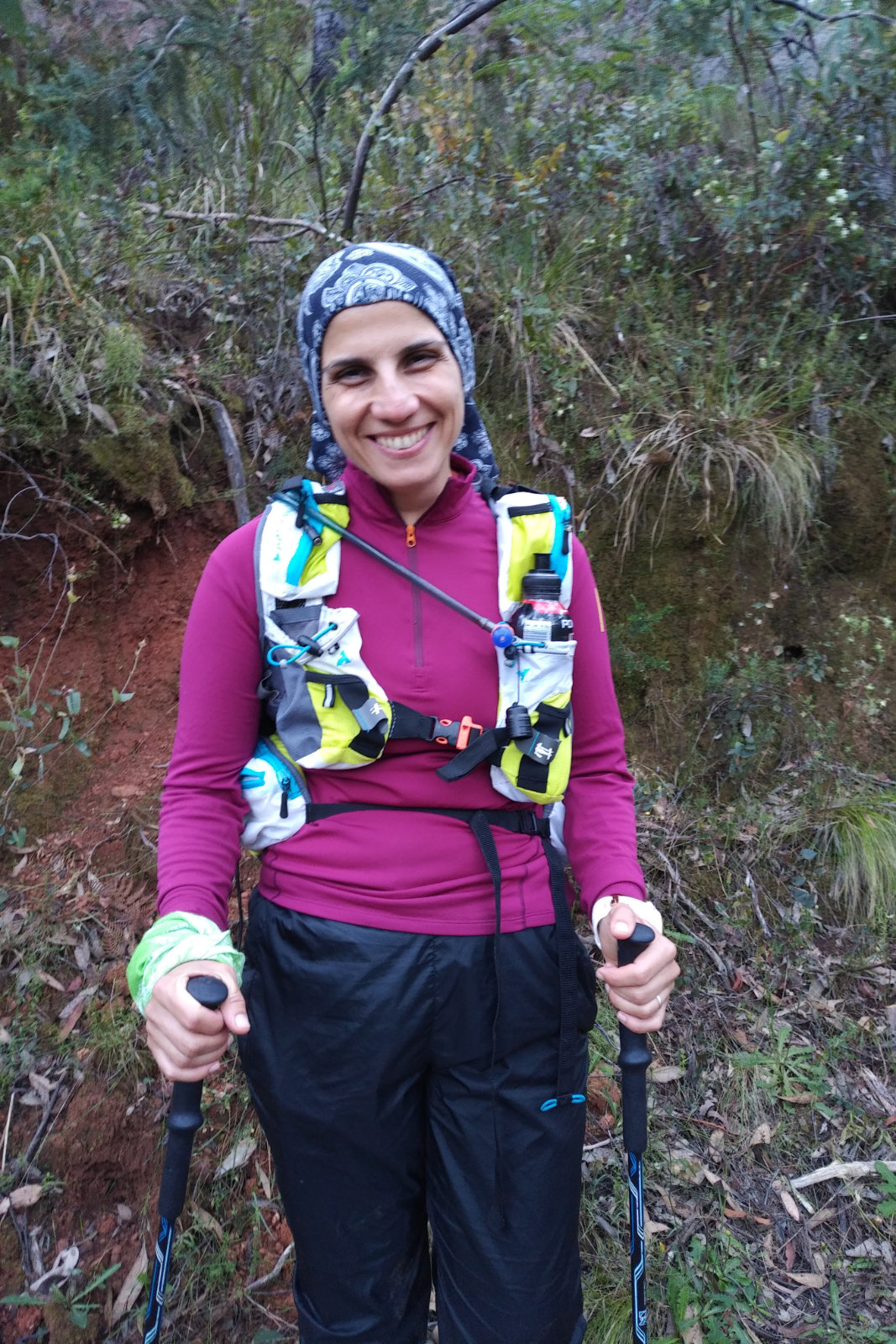
Picked up Tay [Alireza] at 1 PM. We stopped for fuel, then again in Bright for pizza and beer. By the time we arrived to the Cope Hut parking it was around quarter past 7. Geared up and started the long journey after taking a few pics at the trail head. Tay took the lead with an easy jog and I could feel that the pizza is going to take revenge if I keep this pace, so I asked her to let’s just walk.
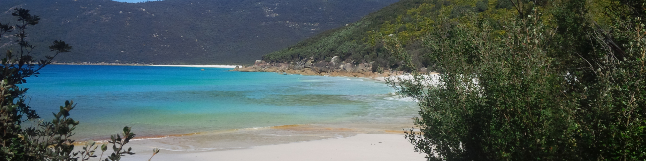
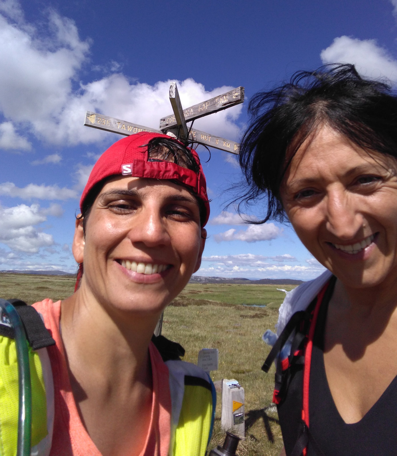
The sunset was absolutely stunning on the High Plains and it was quite warm. Got to the SEC Hut while I told her about my 10 km detour in 2015 Alpine Challenge 60 km. I suggested to check the hut out. It was small with a heater in one of the corners and the floor had a hole in the middle. There were other things in there, as well, but these were the two items that stood out for me. We couldn’t completely open the door, it was stuck. Outside, next to the door, there was a box with a note in it. We took a few pics then turned towards Pole 333. This is so much different to doing it in pitch dark!! It was only three weeks ago I was painfully hopping over and into puddles, tripping in rocks on this track. Those blisters are still there, only not hurting that bad [yet].

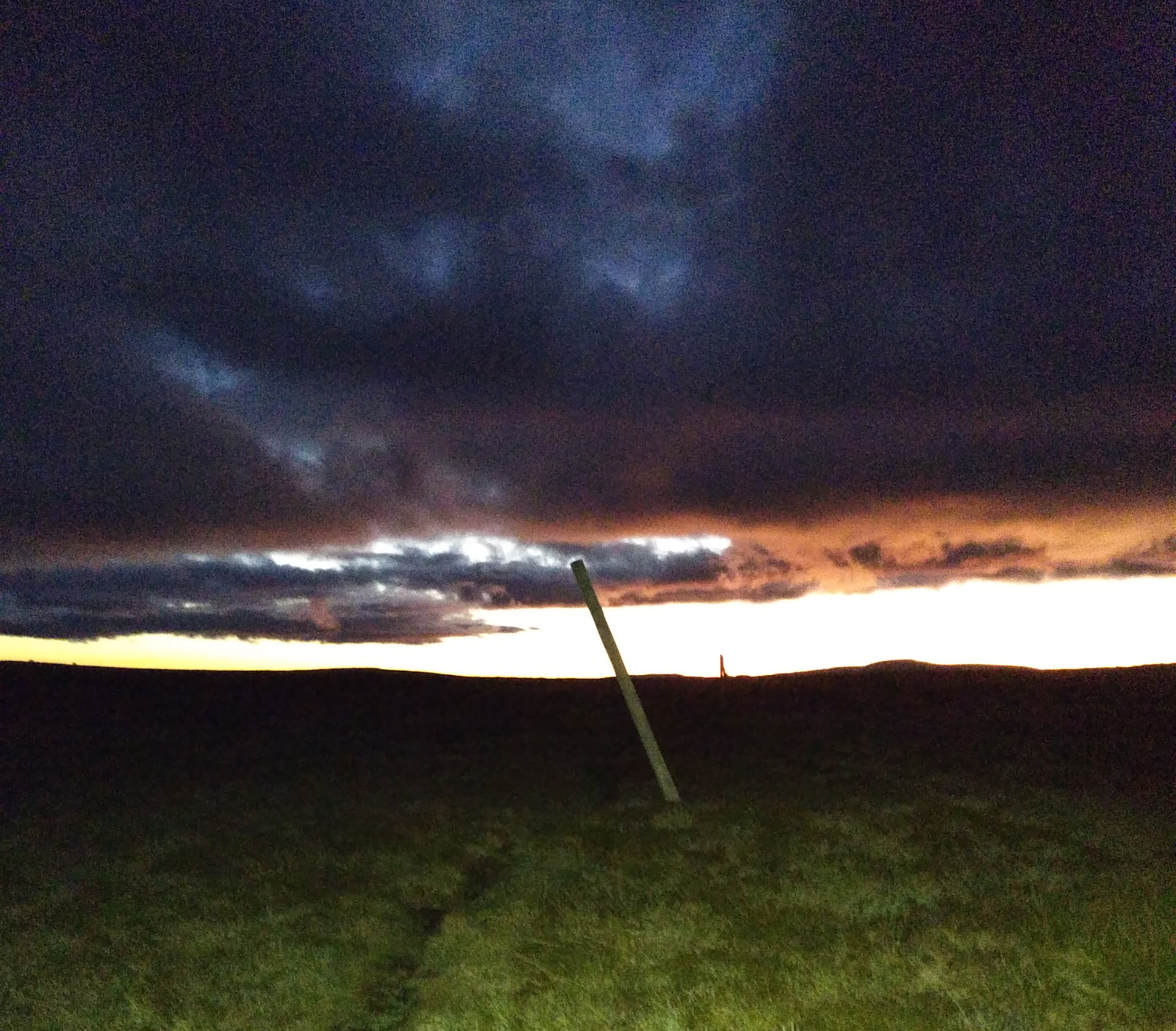
I was looking forward to seeing brumbies – and saw one. Took a picture, but very hard to make the horse out on it – it was too far away. At Pole 333 we took a few more pics, put the lights on and turned left towards Cobungra Gap. It was getting darker and the view of the pole line with the sun setting behind was just amazing. We could see lights to the left and figured it must be some people at Youngs Hut. Had to take one layer off, it was too warm.
Once we were heading down and leaving the High Plains behind, the scenery and the trail changed. Not only because we were limited to what the Ay Ups projected in front of us, but the grass, the little bugs, flowers – everything was different. There were these cockroaches that were probably mating – it was a funny sight for some very long kms. Tay rolled her ankle a little, but said she thinks she’ll be OK. We swapped places, I went first – this way she could better calculate her steps and I could see the trail for myself as I would if I was doing it alone during Alpine Challenge miler. All of the sudden, I saw a pair of red shiny dots in the dark. It was a deer! We must have scared poor animal with our head lights. It took off in a hurry. At this point, the sign at Pole 333 about deer management made sense… even though none of us agreed with it.
When we got to Cobungra Gap, Tay said she could hear voices… we listened, then turned left towards the camp site, chatting away, when we heard some noises. Realised there was a tent there, so we started whispering. Why wake up the hikers? Then further down, towards the river there were more tents. The grass was wet, by this time my shoes were pretty soaked, even without stepping into water. After we crossed the bridge, I filled my soft flasks with the cool Cobungra River water, then we passed Dibbins Hut and headed up Swindlers Spur.
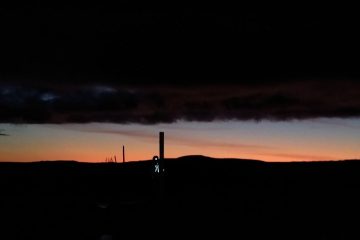
Swindlers Spur!!! It was hard going up, but not as hard as in the heat at Razorback. I was making a point of eating something about each half an hour and so far I was succeeding at it. The clouds were gone and the sky lit up with its shiny stars and a piece of the moon. We could also see the lights of Hotham Heights and some more on our far right. It was an interesting game guessing where they are coming from.
We got to Derricks Hut, where we could also see tents and worried we’d woke their citizens up. There was loud snoring coming from one of them and we gave checking out the water tap a miss and kept going. We’ve been chatting for most of the time, sharing stories and experiences. A long hike/run like this is one of the best ways to get to know someone. Also, very therapeutic.
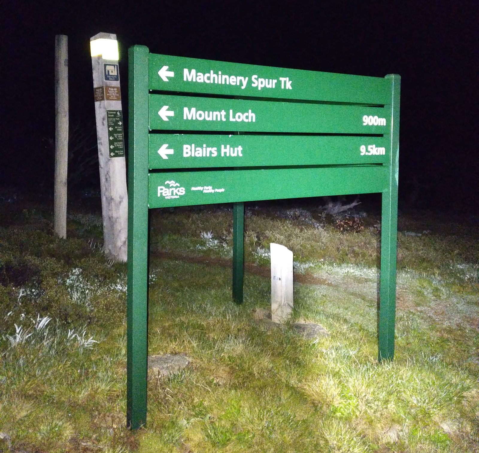
At the Machinery Spur turnoff we didn’t read the signs correctly and headed into the opposite direction. I mean, it was strange going towards Blairs Hut and Dibbins Hut, but that was the only sign that mentioned Machinery Spur. I haven’t done this bit in the dark, yet and I am 100% in daylight would’ve picked the right way (as I did 3 times before). So there we were, heading down the wrong way, passing Mt Loch when I said something’s not right, the track should be different. Can’t recall that much grass on it and we should have seen the chair lift by now. Checked the Avenza map and sure as hell we were going the wrong way! Turned around and hiked back to the intersection. Said hi to Mt Loch summit again.
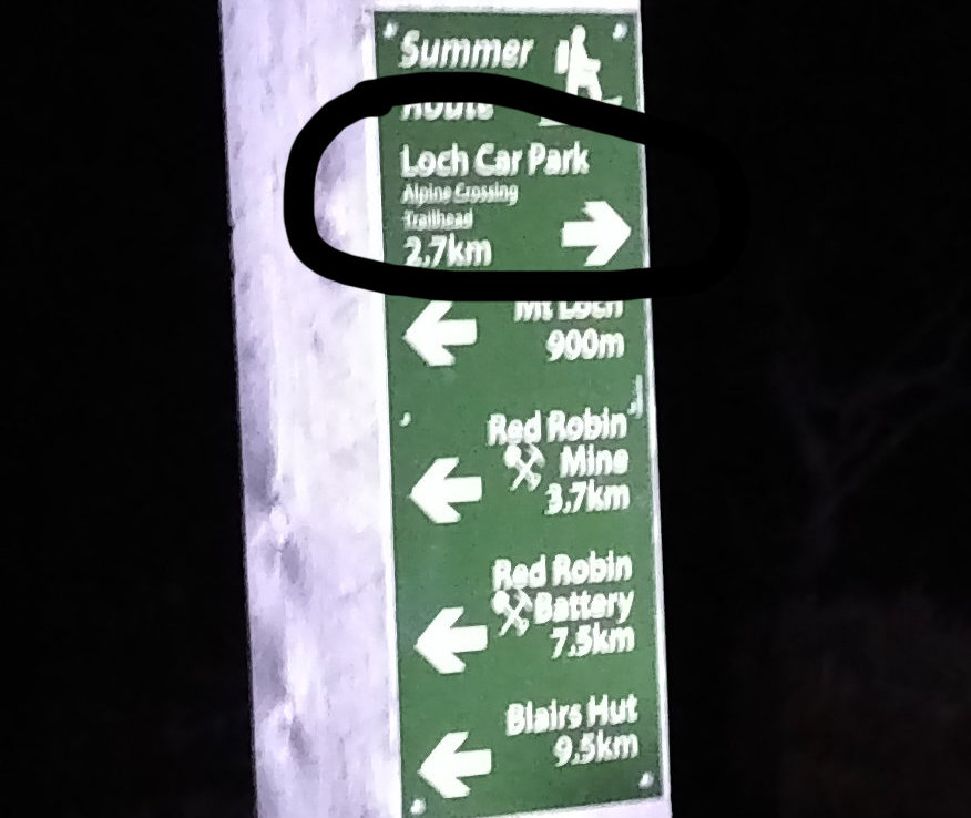
I had a closer look at the sign(s). Behind the one that actually says “Machinery Spur” – there is another pole with more signs, with the one on the top “Loch Car Park 2.7 km”. This little detour cost us about 4 km and 55 mins. Once back on the track we headed towards Loch Car Park, passing the chair lifts and Race Start Hut. By the time we got to the car park, the visible half of the moon was so big and shiny, I couldn’t help myself and took a few shots – they are not good for publishing, though. There were lots of cars parked there, probably the people sleeping in those tents at Derricks Hut… We had the mandarin I’ve carried with me – it was really good, but standing still we got cold quickly, so we left towards the Mt Hotham track.
I thought the hike up to Mt Hotham would be a pain in the butt without the little orange/pink flags Paul lines the track for us in races, but going up to the top is quite easy to follow, then we had to check the pdf map a couple of times. At the summit, we took a few selfies – which is funny in the dark, because the flash really blinds you, while you do all the funny, concentrating faces – then we headed down towards Diamantina Hut, agreeing that whatever kms appear on the signs is a big lie. The distances are always longer than what is written there.
At Diamantina Hut, we noticed another tent, just behind the building. I’ve never seen what it is like inside, even though I passed this hut several times, so we checked it out. It’s a relatively big open space inside with a heater in the middle. Tay noticed backpacks in there, then we checked out the plaque erected for Eric Johnson Gravbröt and headed down to the road. There were lots of cars parked there, hopefully we didn’t wake up anyone sleeping in them. The Razorback Trail head is kinda hidden, but we knew which way to go. This was the first time I approached the Bon Accord Spur from this side and wasn’t prepared for those little uphills before the turnoff. I thought we’d never get there!!
I was both looking forward and dreading Bon Accord Spur. I’ve done it in daylight and found it not much fun, as I was constantly vary of snakes. There was no such danger at night, but anything round I stepped on sent me a few cms down the track and gave me a bit of a shock – just like when tripping, same feeling. I was happy I was carrying poles, gave me a bit of an insurance. The millions of bugs our head lamps attracted have started to drive us nuts. Tay decided to stay a bit further back to avoid them a little. Not sure how this went, but she was stepping very carefully. We didn’t talk much on this portion, I felt tired and sleepy and was probably walking like a drunk – thanks for the poles, I kept the balance somehow.
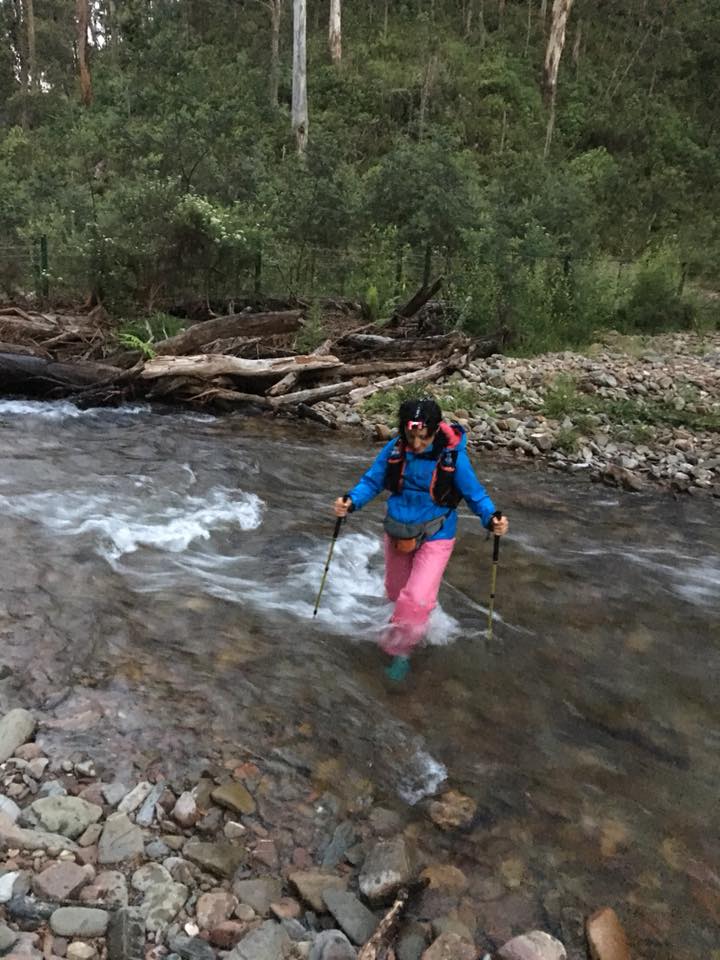
At around 4 I’ve noticed the sky started to lighten a bit, mentioned this to Tay. Washington Creek should be close, we could hear the water flowing for a while, even though it seemed we were so much higher… When we got to the creek, I filled my soft flasks, we put our head torches away, then looked for a spot to cross the creek at. Tay did the scouting, really. We looked at the least dangerous part, as the water was flowing rapidly in front of us and wondered “what would Celesta do?!” I’ve noticed how beautiful the stones were – lovely colours!! Then Tay just went for it, carefully stepping through the fast flowing water, balancing with the poles on both sides. As soon as she was getting out of the water I realised, I should’ve taken at least a shot of that.
I went next, with Tay cheering and taking pictures. The water was cold, but it felt really good. I could imagine those pesky blisters…
Once we were out we started climbing with Tay recalling her sweeper time at Razorback this year. We passed a hole on the left and wondered what that could be… a mine?! Good place to hide a body! Grrrrr!!! Funnily, there were no rails on pretty dangerous corners on this portion, but there were further up. The sun was rising and I was feeling really tired. We agreed to check out if there is any coffee spot open in Harrietville.
So glad we did, because after the coffee (and a Capi juice for me) at Morries (?) we were like refurbished. Otto called to see how we were going – he’s been tracking us all night.
Quick toilet stop, we took the wet and muddy overpants and the extra layer off and headed towards the Bungalow Spur trail head, discussing Pokemon and FIFA 2018 games and saying hello to the early riser citizens of Harrietville. Beautiful sunny morning, promising a hot day ahead (which we weren’t looking so much forward to – especially on the climbs). Getting closer to the trail head, we noticed how many cars were parked there – this must mean a lot of people at the top. Tay has signed us into the book and we started the climb, happily chatting away in the fresh morning air.
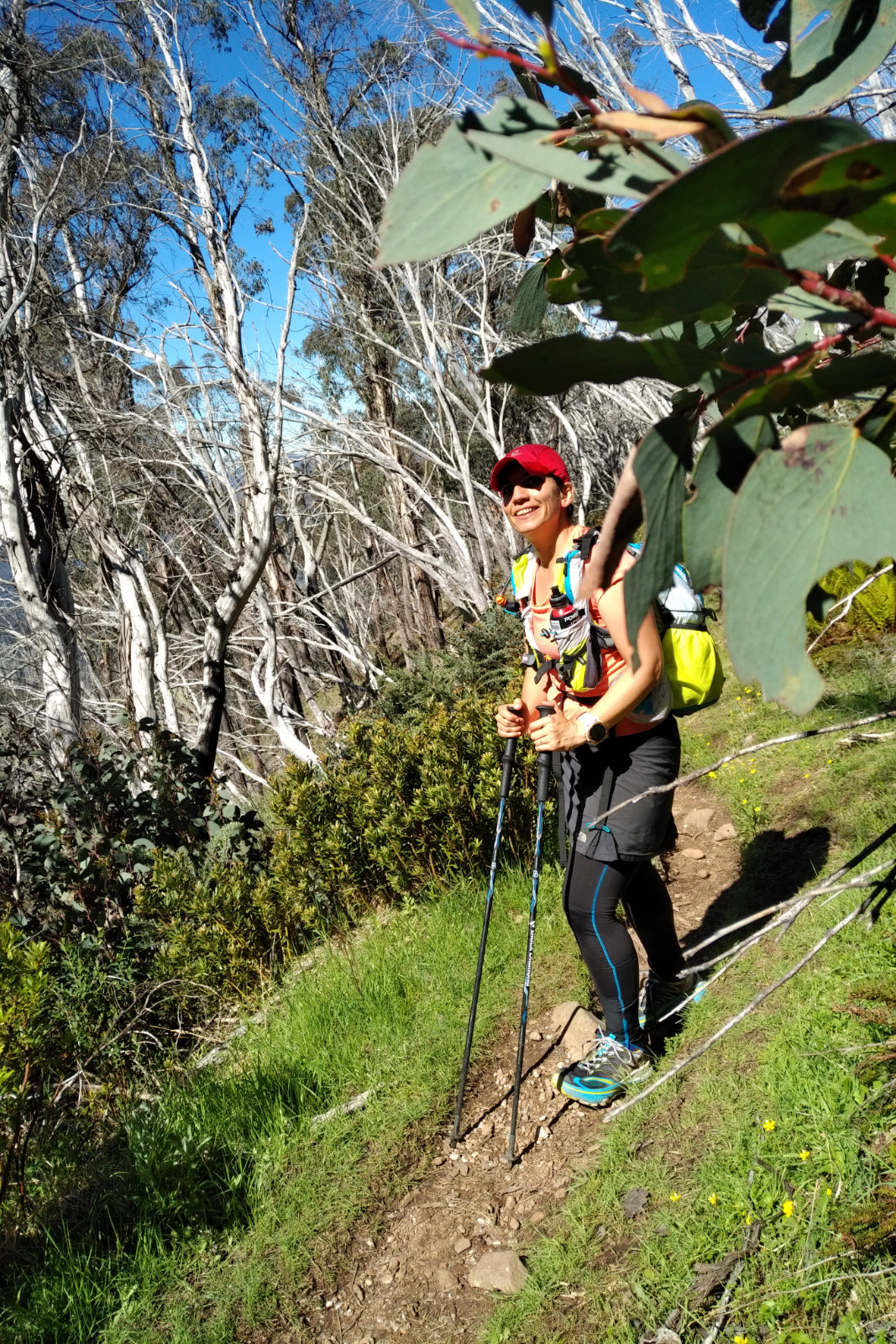
We saw a man coming down, he must have just went for a little stroll, didn’t have any equipment with him. We said hello and went on, without meeting a soul for a few kms. Then the school groups started coming down, with some very well mannered boys saying hello and stepping out of our way. We exchanged a few words with them and thanked them. Then more and more hikers were descending, the majority very nice. We had to climb over a few fallen trees. Everyone we told what we were doing seemed very impressed. Most of them thought we are only going up to Mt Feathertop.
As we were getting closer, it was getting warmer and we were really happy every time a little breeze hit our face for a few moments. An elderly man said “only about a half an hour” – I said to Tay “no way! We should be there much earlier” – turned out he was right! We passed the Old Federation Hut ruins, then saw the sign with the water spring. Thought this is a good time to check this out. Tay opted for a rest while I headed down to the spring. The water was flowing (after the rains earlier, it made sense) rapidly and it was nice and cool. I’ve filled in both flasks, thought I’d give one to Tay, as Kiewa Valley wasn’t (didn’t seem) that far away and wetted my triangle bandage. She said she’s got plenty of water, so I encouraged her to at least cool herself down with it, which she did, pouring some into her cap.

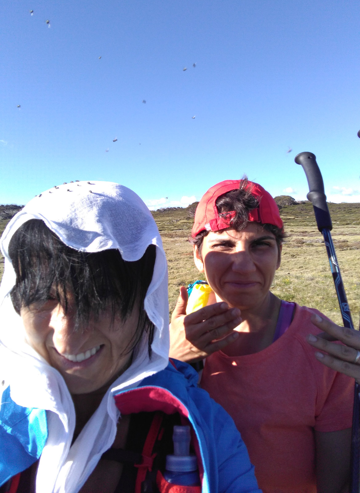
The flies started to be nasty as we passed Federation Hut. A family of four was there, clearly struggling with them. We told them where we are heading to Cope Hut, where we were coming from. Every time I tell people about these things, I always think that one day someone will get inspired and go for it, too. We agreed earlier, that we won’t go up to the summit (we’ve made that detour – it was enough), and that seemed like a very wise decision, especially from that point looking up to the summit.
We took a few pics at the hut, then a few more with the Razorback – majestic view!! At the Cross, there was a couple in the shade of the tree. The guy was sitting down on the grass and told us he is recharging. Tay was wondering how far the Diamantina turnoff is… I’ve pointed it out ahead. It seemed very far and it was getting warmer… it seemed Tay was very excited about getting down on Diamantina Spur and into the West Kiewa Valley. I couldn’t recall Diamantina being this rolling and with that many uphills, but being tired probably had something to do with it. The flies and the ants on top of the heat made it very difficult and so much harder than it already was. The ants would rush up your feet and bite you if you stepped onto their nest (fair enough, who can blame poor bastards?!) so it was a real quest keeping them off AND waving the aggressive flies away.
We saw some people on the next hill top, Tay asked if that’s still Diamantina. Yes, it was and Westons was somewhere far far away on the other side of the valley. I could smell aftershave on the way up that hill. When we got to those people, the woman was doing something with her pack and the guy was wearing a hat with the net in front of his face. He had knee-high gaters, as well. He asked me if I had a hat. I told him I don’t (I only had a beanie, which wasn’t practical to wear right then). Then he went on to ask whether we’ve done this before. I told him, yes, this is not the first time. Nice of him – concerned citizen. We told him where we are going and from where – then he understood.
Tay was really looking forward to Kiewa Valley, carefully stepping on the uneven surface. We’ve bumped into a school group. Mostly girls with huge packs. Went pass them as they told us that is dangerous down there and there are the teachers helping others. We had to wait a little while the girls were helped down the steep rocks by the teachers. They (the teachers) were very nice, keeping the troops happy and together, helping them along the way. The male teacher was so funny – he offered his hand to Tay and asked her if he could have a dance. He held my poles so I could use my hands for a grip on the rocks.
From there, it was a struggle going down; we could hear the water, yet it seemed so far away. Tay kept asking “can you see the water?!” – and I thought I could, but then it proved I wasn’t. I looped back a few times, didn’t want to get too far away from Tay, but I couldn’t stand in one spot either, because the ants would be straight on my legs and feet. The first sight of the dirt road was a huge relief. I clearly remembered from previous years doing Razorback, that Blairs Hut was on the right hand side and if one missed the turn at the big tree, could just keep going until the Westons turnoff.
We’ve filled the flasks, took our shoes off at the river, stood a bit in the water, wetted my triangle bandage, then looked at our feet being cooked. The huge blister on my left big toe has popped and now had that skin just there. Wasn’t a pretty sight. There was some logging happening in the area, things seemed different. Blairs Hut was on the left. Things like this drive me nuts!! We checked the map – just in case – and thought we might have had to cross towards Blairs, but then I said we should just keep going on this road and turn left further down. There was a sign not far away that pointed towards Westons (2 kms – yeah, right!!!). We turned left, then there was another turnoff towards Blairs to the left. We kept straight on the hike on the dirt road.

We hiked slowly, me speeding up when the ants attacked, calling them names and wearing the triangle bandage over my head, covering my face to keep the stupid flies out of my eyes, nose and mouth. This, of course meant I couldn’t see too well, so I stepped on things I would’ve avoided otherwise. The springs we passed were a great refresher, then finally we got to Westons Hut, hiding to the right. Tay couldn’t be bothered checking it out. I went behind it to double check if it was any water tap, but there wasn’t. I knew there must be a spring or a pipe somewhere further up.
The heat, the flies and the ants!!! On top of the fatigue and blisters!! I had the advantage of doing Alpine Challenge a few weeks earlier, but Tay hasn’t done any hard core training since Tor des Geants, when she damaged her quads and had to recover from that. This was her first outing since September. At least we weren’t running, we took it slower. We both had blisters, but I’ve already gone through at AC what Tay was putting up with now. I really felt for her.
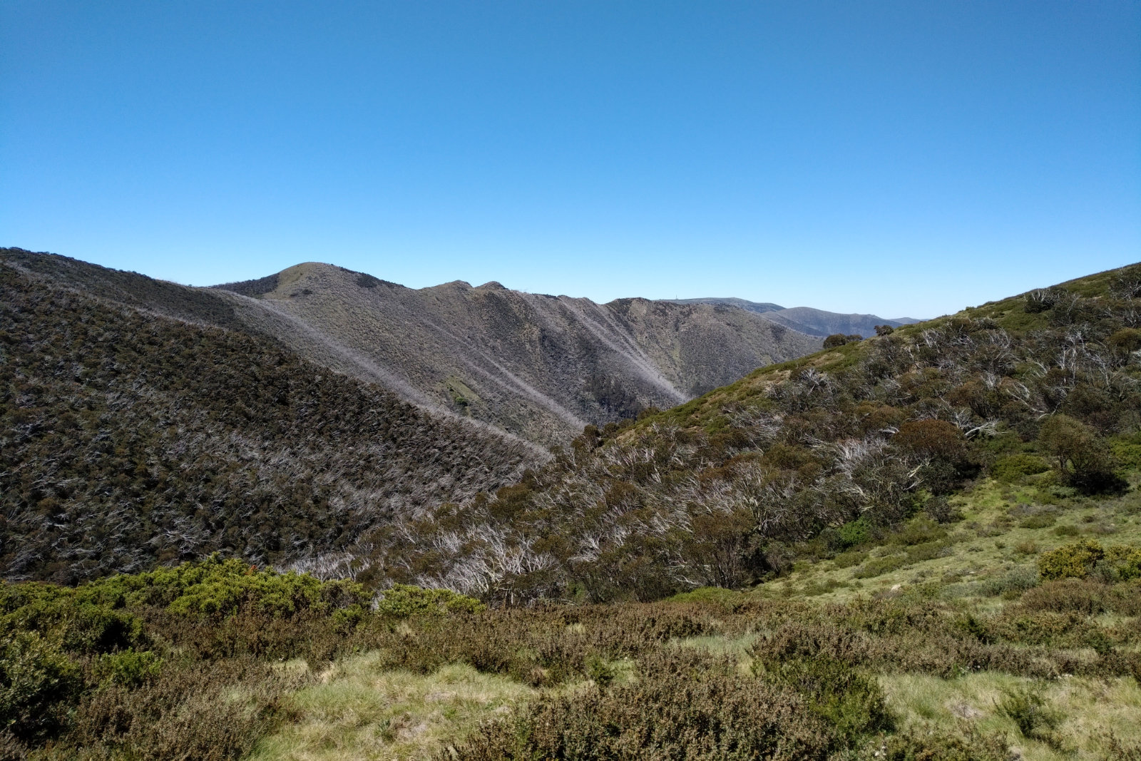
I was hoping that as soon as we get out of the tree line and onto the High Plains, the ants would go away. Yeah, there were more rare up there because of the grass. I decided to step into every puddle from there, until I sank into a black mud… I have to be more selective about which puddle I step into, otherwise it’ll take forever to clean my toe nails! Tay seemed a bit relieved that we are getting closer to Pole 333. Pointed her out which way we are going and told her from that point, there are about another 50 m to the pole. At least this hike was a bit more lenient. Otto messaged me, asking how long do we have to go. Replied to him we are close to Pole 333, but the message didn’t send as there was no reception.
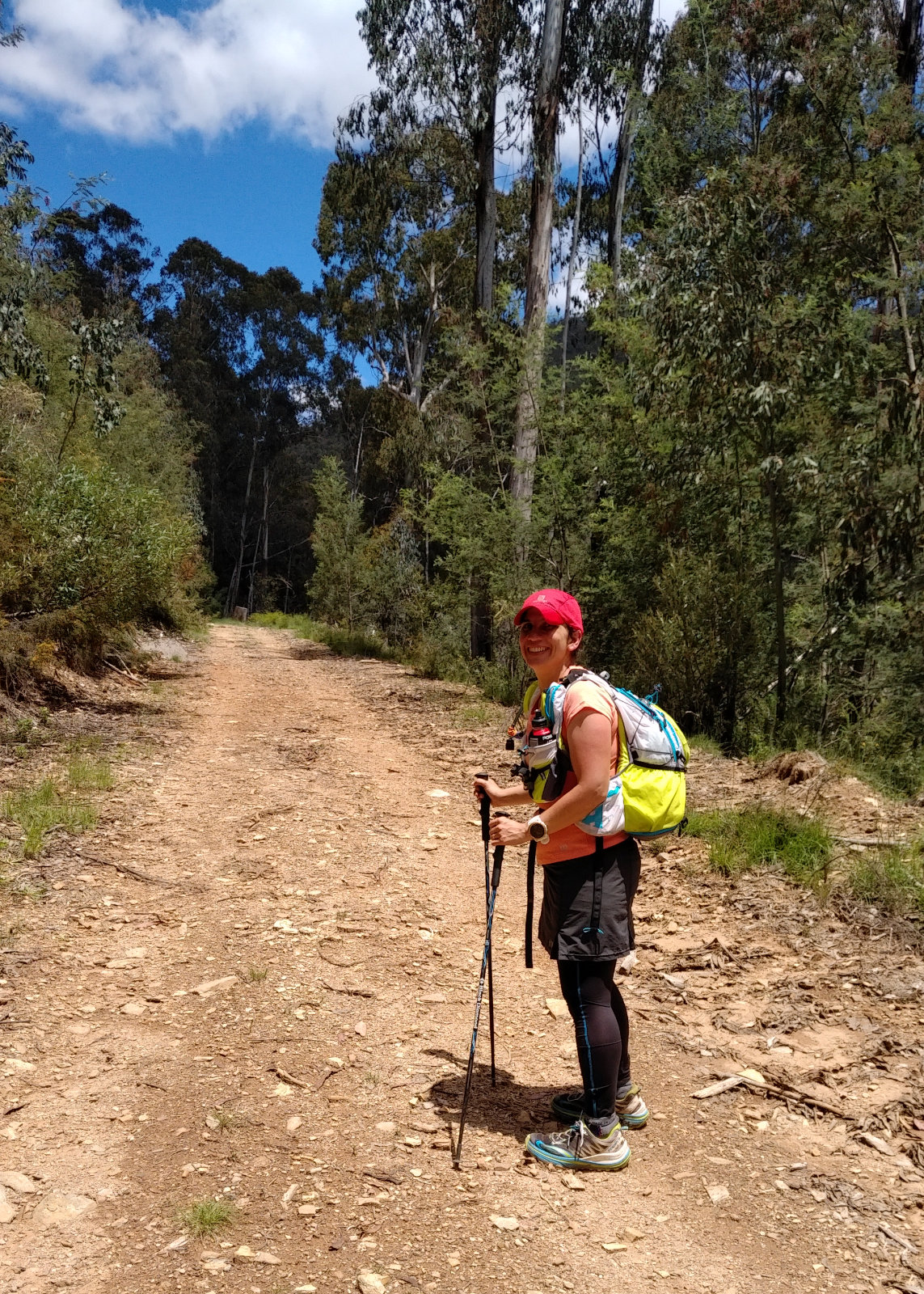
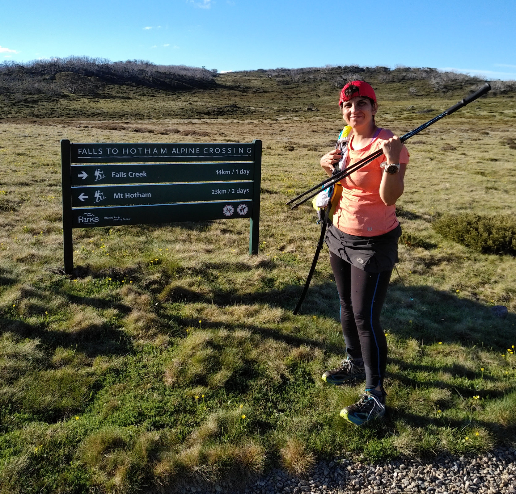
When I plotted this route, Strava wouldn’t let me go along Westons, but forced a straight line for about the last two kms. I calculated the times based on my worst performances, thinking if I was doing this as part of the miler, I would be pretty buggered and probably not going fast. I picked Cope Hut parking because that was along the road – Otto mentioned (later) why didn’t we go from Pretty Valley Pondage, it would’ve been much closer. He was right, but I’ve never driven to Pretty Valley Pondage and I know that’s not as straight forward as it seems. Anyway, based on my calculations, we should’ve finished in about 16 hrs. When I told this to Otto, he said bullshit – more like 22 hrs!!! And he was – again – right!! We ended up doing it in 23:02:30 with 22:39:43 moving time.
Back to Otto’s message… “yeah… 16 hours, right?!”
We stopped for a minute at Pole 333, like it was a monument. I guess in the eyes of many people it actually is! Just like Decision Rock at the Prom. Took a few pics then headed towards Cope Hut. The sign said 8 km, which we were really shocked about – thought it would be maybe 4???!!! In that stage and state I am not surprised. There was something white on the horizon and Tay asked if that was the SEC Hut. I assured her it was, when in fact it was a tree!!! How much worse it could get?! The sun was burning us, I have been covering my shoulders for a while, since the skin has peeled after Alpine Challenge and I didn’t want it to get burned again. 33°C!!! And those flies!!!
The pole line (that Tay was very happy about at the beginning, because they were like insurance we are going in the right direction) now seemed like an endless path – it was going on forever. Tay said maybe she should have brought some band aids with her, that might help with the blisters… me – head slap!!! I’ve got bandages!! Why didn’t I think of that earlier?! Pulled out the Primapores (they stick better than the Bandaids), while Tay sat down on the ground and took her shoes off. She stuck them on, then we were on the way. We kept putting one foot in front of the other and eventually saw the red roof. What a joy!!
Another 3.5 km on an easy terrain and we are back at the car. Tay was anxious because she couldn’t see the road, then she couldn’t see the car… then she saw a cyclist (on the road), which was a relief. The pole line seemed to go forever!! Checked the map how far we could be from finishing… we were about half way between the SEC Hut and the parking. Tay tried shuffling – it seemed more painful on the blisters, than just walking, so we were back to walking.
When we finally got to the trail head, we took a few pictures while the flies were driving us nuts, then went to the car and changed. Tay had some chips (gosh, these feel good at a time like this!) and Coke (enhanced with coffee) and I had a few sips of the Razorback Wheat beer. We talked about beer A LOT along these 78.58 kms. We decided to go straight (not turn towards Bright), have pizza in the Swiss bakery and get some beer from the local Sweetwater Brewery.
When we pulled over in Tawonga South just after the bakery, getting out of the car was a bit of a struggle, but we both managed the short walk into the shop. The shop owner was smiling from a mile!! Had to tell him why this is happening – he was still smiling. Then he took our order – Tay had a veggie burger and I had a Margherita pizza. To save time and energy, I had a ginger beer instead of a Sweetwater – I still needed to drive home… I couldn’t eat the whole pizza, took away the last two pieces. Put them next to the other piece from Bright and thought how good this will taste tomorrow morning…
Spoke to Otto a few times, he was really worried about me driving after that night. I kept telling him I’ll be OK – I got this. We did a toilet stop at Myrtleford, then a fuel stop closer to Melbourne. Tay was naggered, as much as she tried to stay awake and keep talking to me, she fell asleep. Otto insisted we talk every hour. Poor guy, was up all night following us on the map and now surely tired, falling asleep but worried about how I make it home. When we were getting closer to the city, there came the roadworks!! Dropped Tay off, then headed home, facing some more roadworks along the way.
Got home at 1:40. I’ve let Otto know, so he can finally go to sleep, too, then had the remaining beer (it was pisswarm), the three slices of pizza, while unpacking, and stuffing a load into the washing machine. Had to hand wash the pack and the jacket, leaving the shoes and the socks to soak (they will really stink by the time I’ll get home next Friday!!). Had a shower, set the alarm to 4:00 and went to sleep. The 1:45 hrs felt like 5 mins when the alarm went off at 4. Packed, washed my hair and took off to the airport… loooong day ahead!!
All up, so glad we did this – saw the course in the dark, been on my feet for another 24+ hrs and got the opportunity to know another lovely human!
Food
Two quarter toasted sandwiches with butter, cheese and salami accompanied by grape tomatoes
Lots of Mountain Berry Blok shots
1 piece of dark chocolate – I carried more, but didn’t feel like eating it, especially after they melted
Rice with peanut butter rolled in nori sheet – about 6-8 pieces
Rice with smoked trout and Philly (with baby cucumbers and capers) rolled into nori sheet – about 4-6 pieces
Rice with peanut butter and home made strawberry jam – about 4 pieces
1 mandarine – we shared
250 ml of sour cherry juice – finished it by the time we reached Mt Hotham
Water – not sure how much, but I tried to stay hydrated. 250 ml of tap- and the rest creek water
Gear
Usual Alpine running safety gear
Lululemon crop, top and socks
Salomon lined jacket, carried the Bonatti in the pack
Salomon Sense Pro 2
PLB