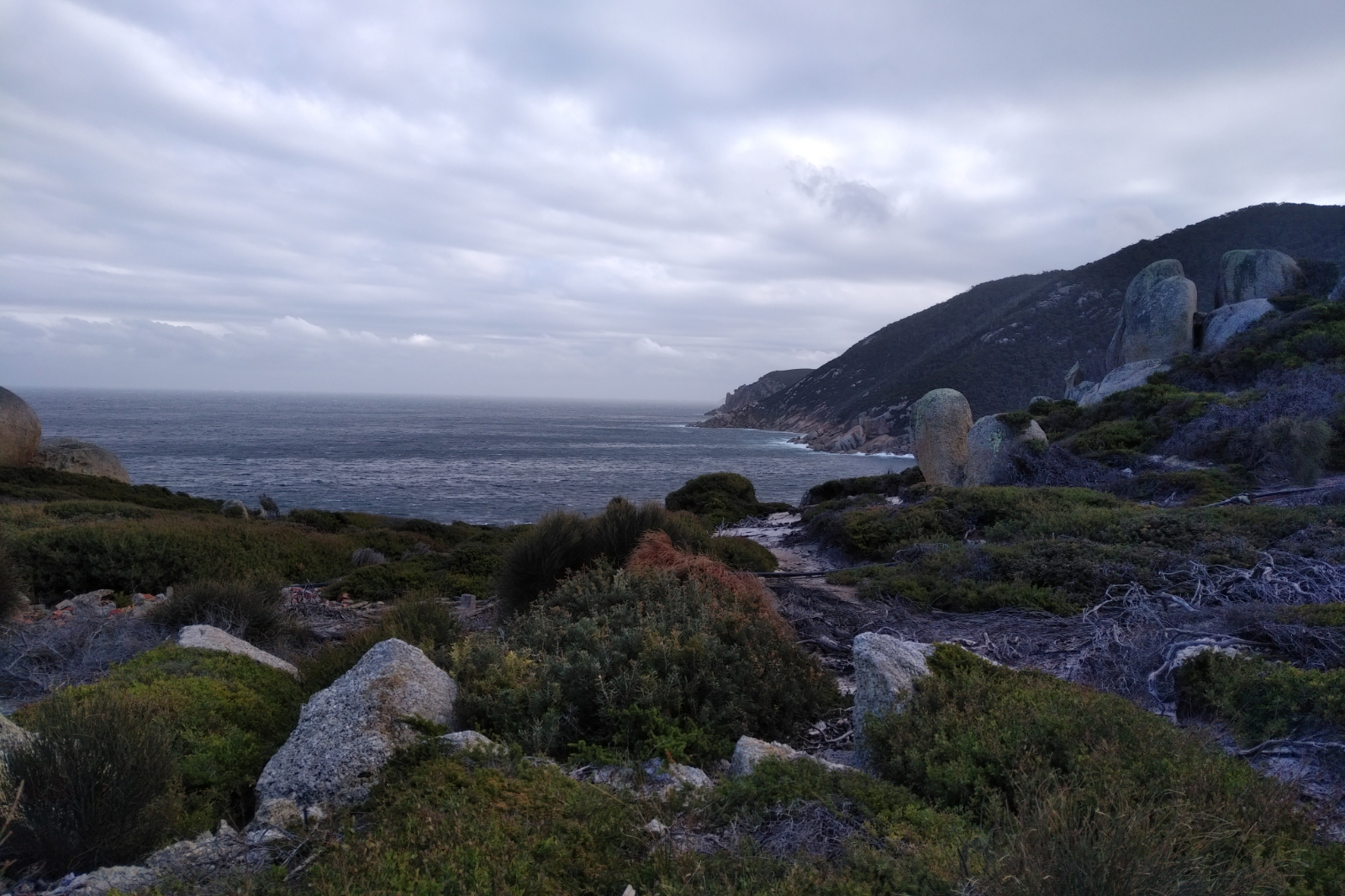
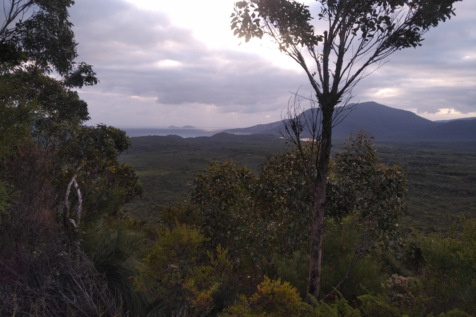
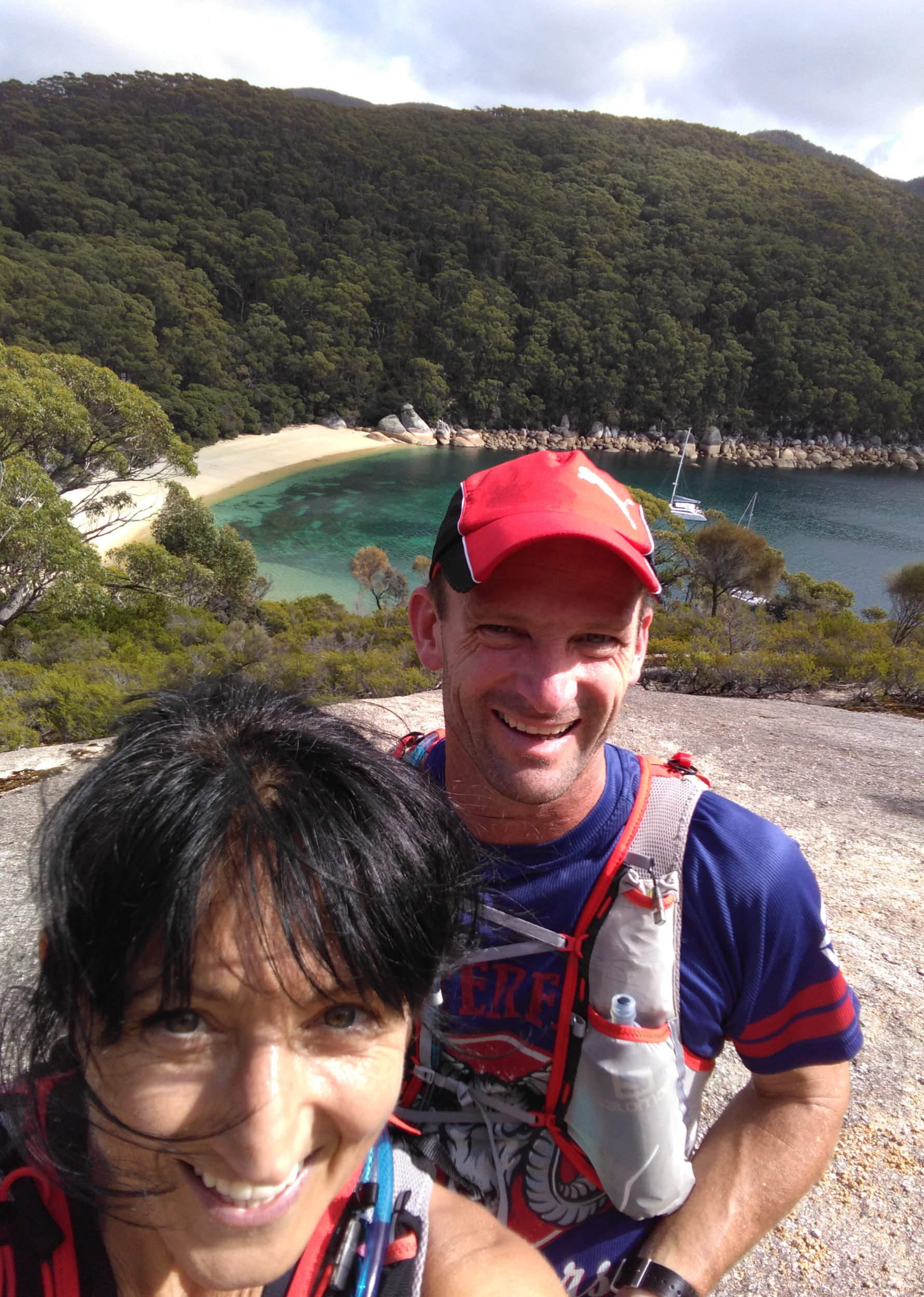
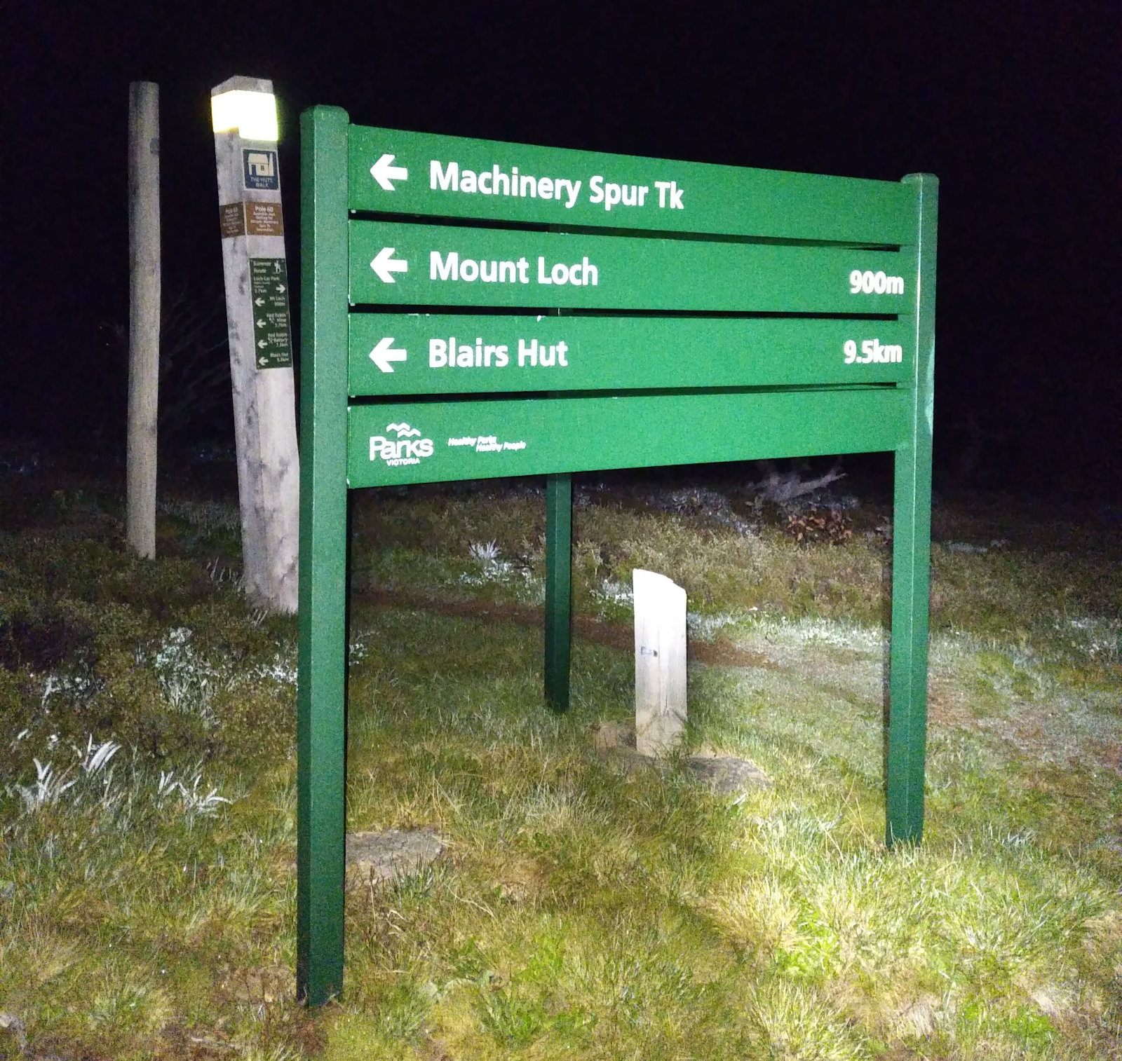
The tide looked perfect at Sealers, it was supposed to be showers and wind during the day. Today it was about testing a few things in adverse conditions.
Had new wheels (those didn’t need testing, as I had similar before and it was great)
New Lululemon top – ran in this at Mt Donna, but wanted to see what it is like on a long(er) distance
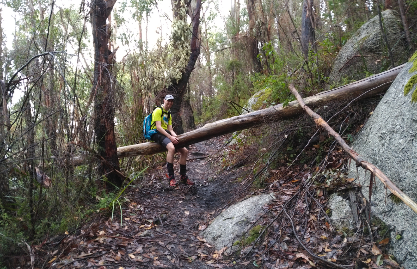
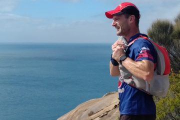
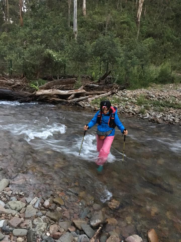
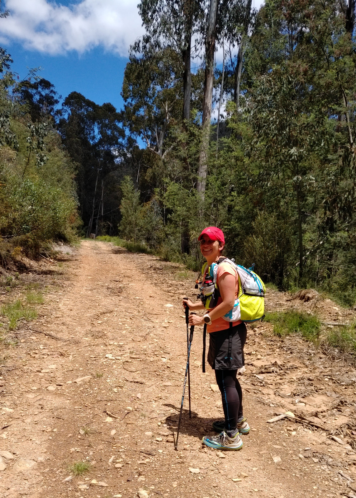
The new Salomon Agile 12 Set Lightweight Hydration Backpack – wanted to see how comfortable it is on a long run, how I could store stuff in it and if it’s as waterproof as the description says. Couldn’t have much food in the pockets (they aren’t big enough for this purpose), so I used the Ay Up’s fanny pack for storing the Bloks, rice paper rolls and protein bars. The packet of tissues ended up here, as well.
I started out with the thermals and the waterproof jacket and got warm very quickly, took the thermals off before I reached Telegraph Saddle car park. Had to keep the jacket on because it was very windy. Of course I took it off and put it back on a few times during the day, which seemed like a total waste of time.
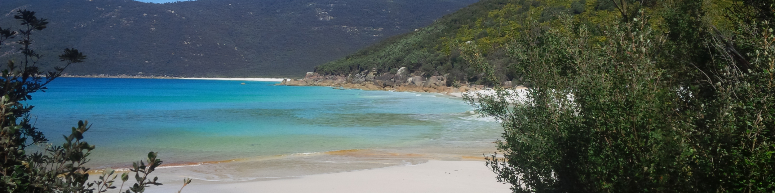
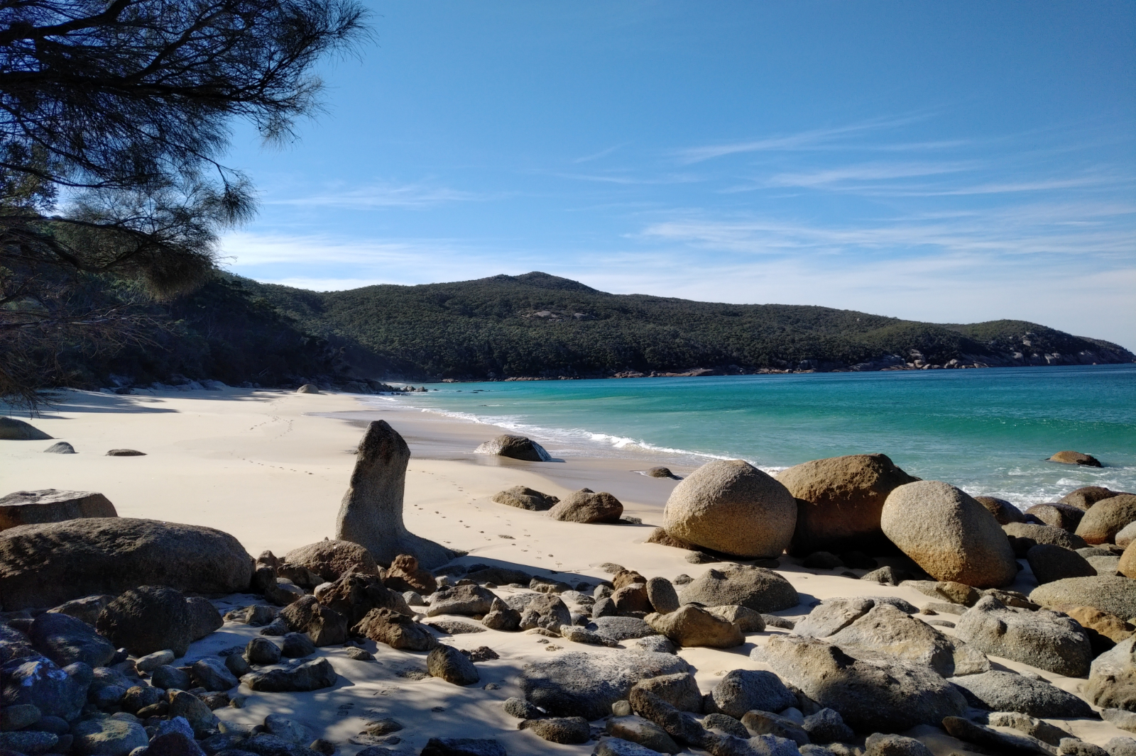
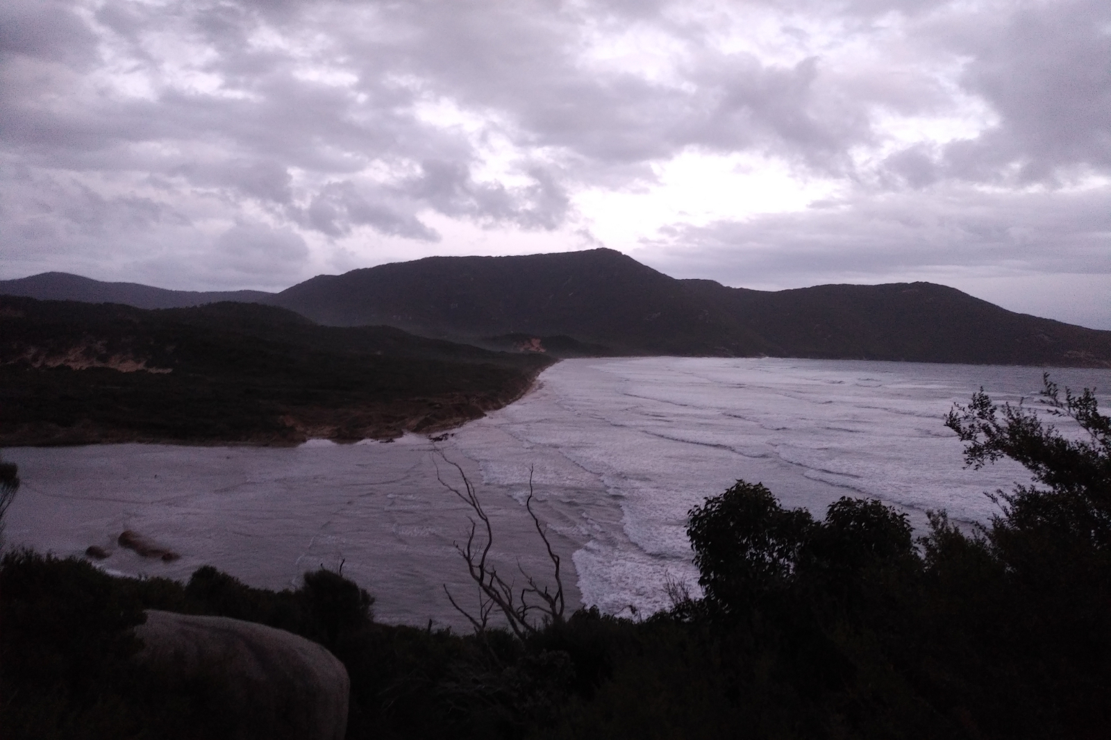
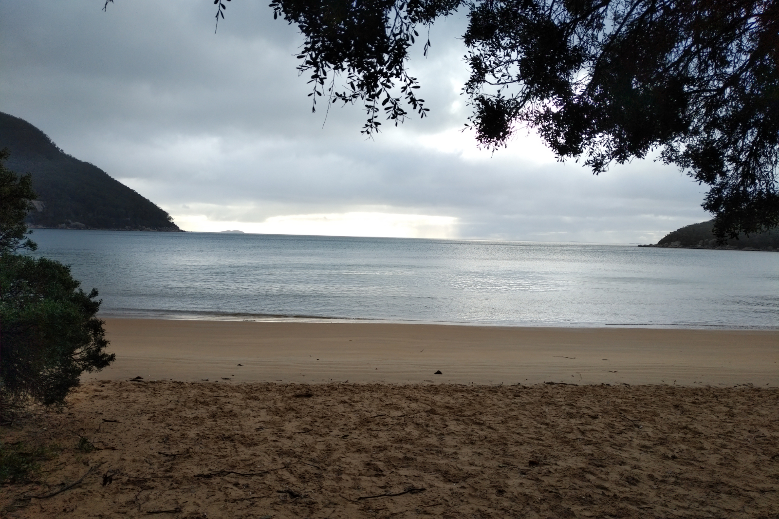
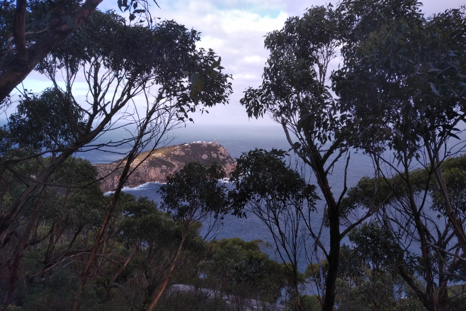
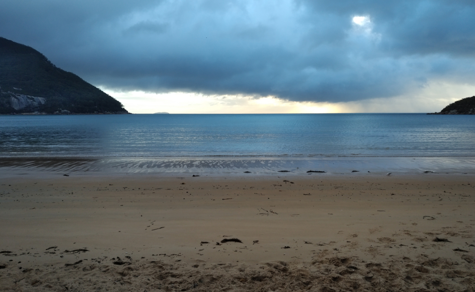
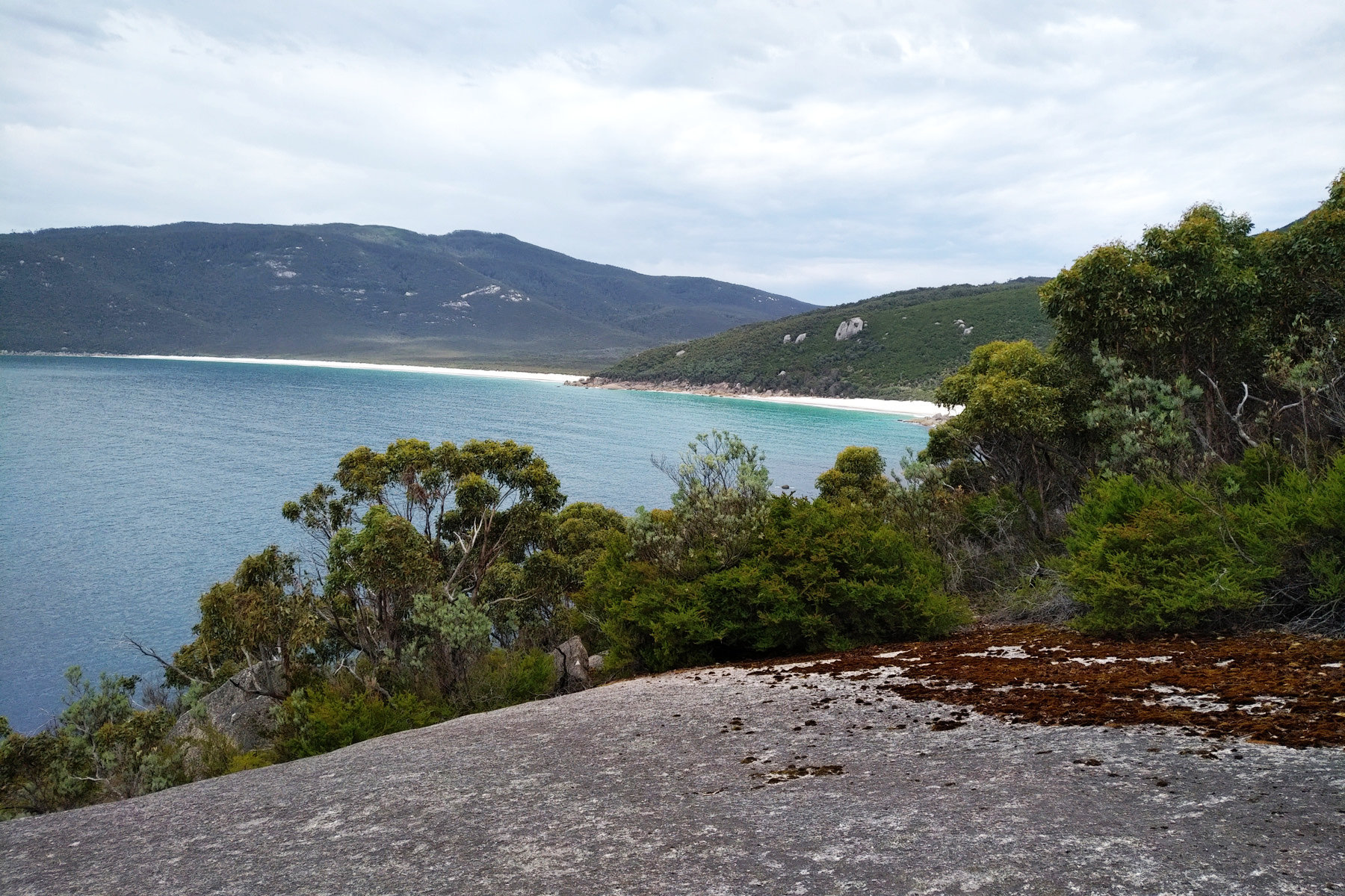
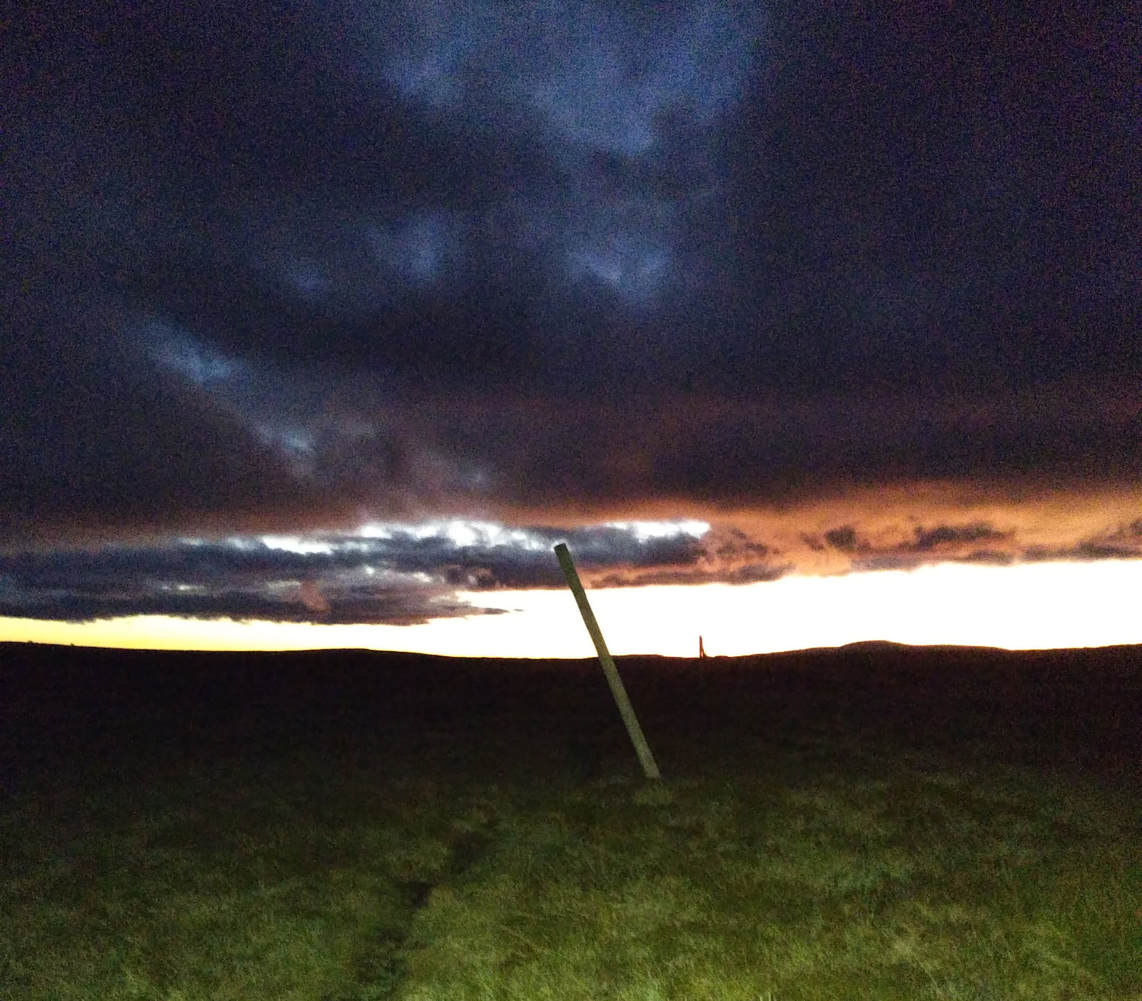
Sealers
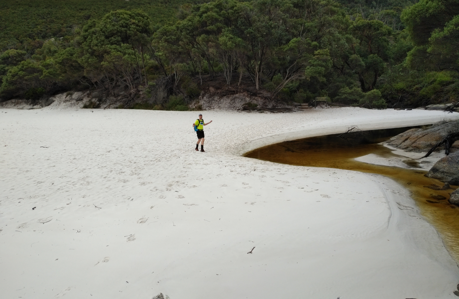
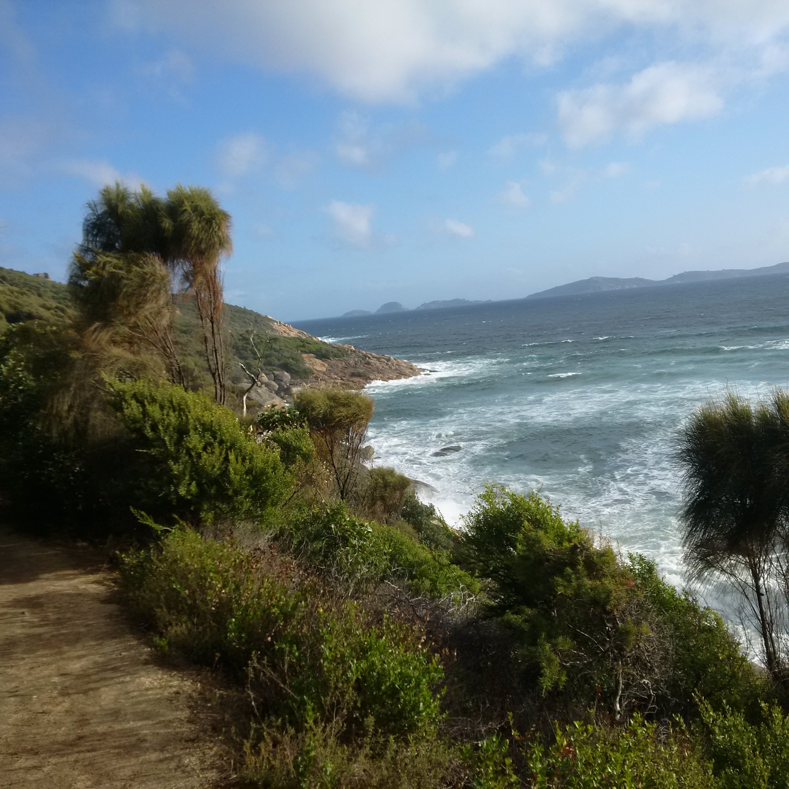
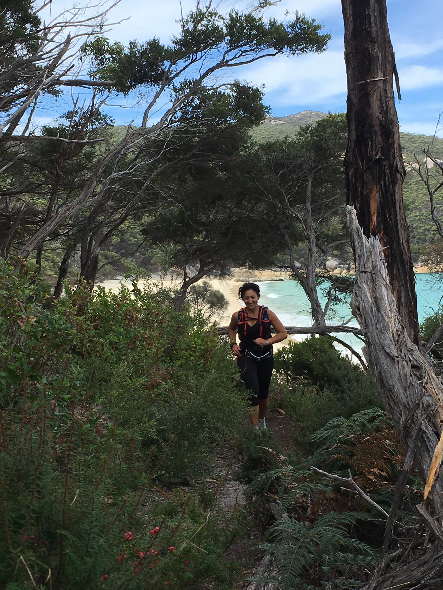
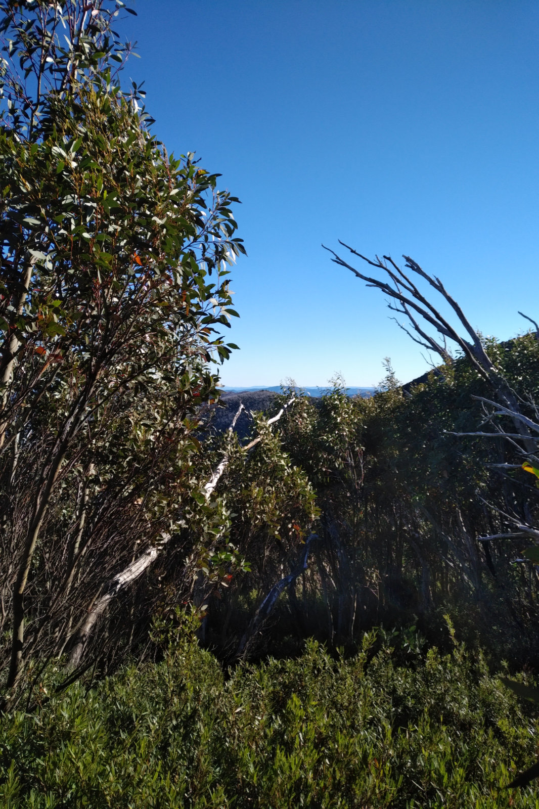
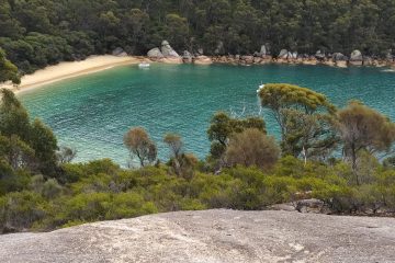
I expected a dark, wet and windy day… it was absolutely stunning all the way to the Lighthouse. The track to Sealers was soft and great to run on, not much mud to get around. The first peak at Sealers!!! Love that view! Then Refuge Cove Nth with its golden sand!! When I got there I remembered the very first time I’ve been here and couldn’t resist getting into the water. The camp sites were empty, not a soul, which was quite strange, but I didn’t mind.
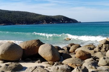
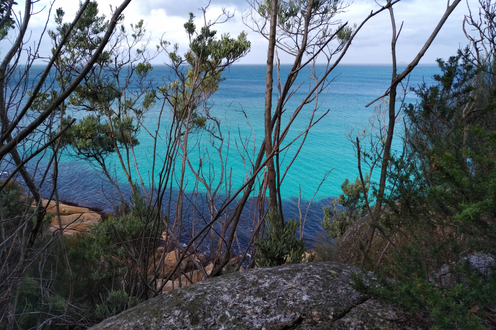
The water at Refuge Cove was pretty dark – must have been quite some rain there earlier. The view from the boulder above it was nevertheless stunning. The rest of the beaches were all brilliant blue – I took so many pictures, it’s not funny. I also found myself stopping and even going back to have another look at these views. I don’t think the pictures make them justice, they have to be seen with the naked eye.
Vodafone must have been doing some upgrades because I had next to no connection. Otto was worried because he couldn’t follow me on Strava (he didn’t even get the link, LiveTrack didn’t start). Restarted my phone twice, sometimes it works, but not today. Anyway, I’ve messaged him hoping that eventually he’ll get it. On the way up to Kersops Peak, there is always a section where the internet works. Got a 3G with no bars for a few seconds but that wasn’t enough. Up at the junction, I saw two backpacks on the ground, their owners must have gone up to the summit and didn’t want to carry the heavy stuff.
I usually have a date at this point, this time I missed it and headed downhill.
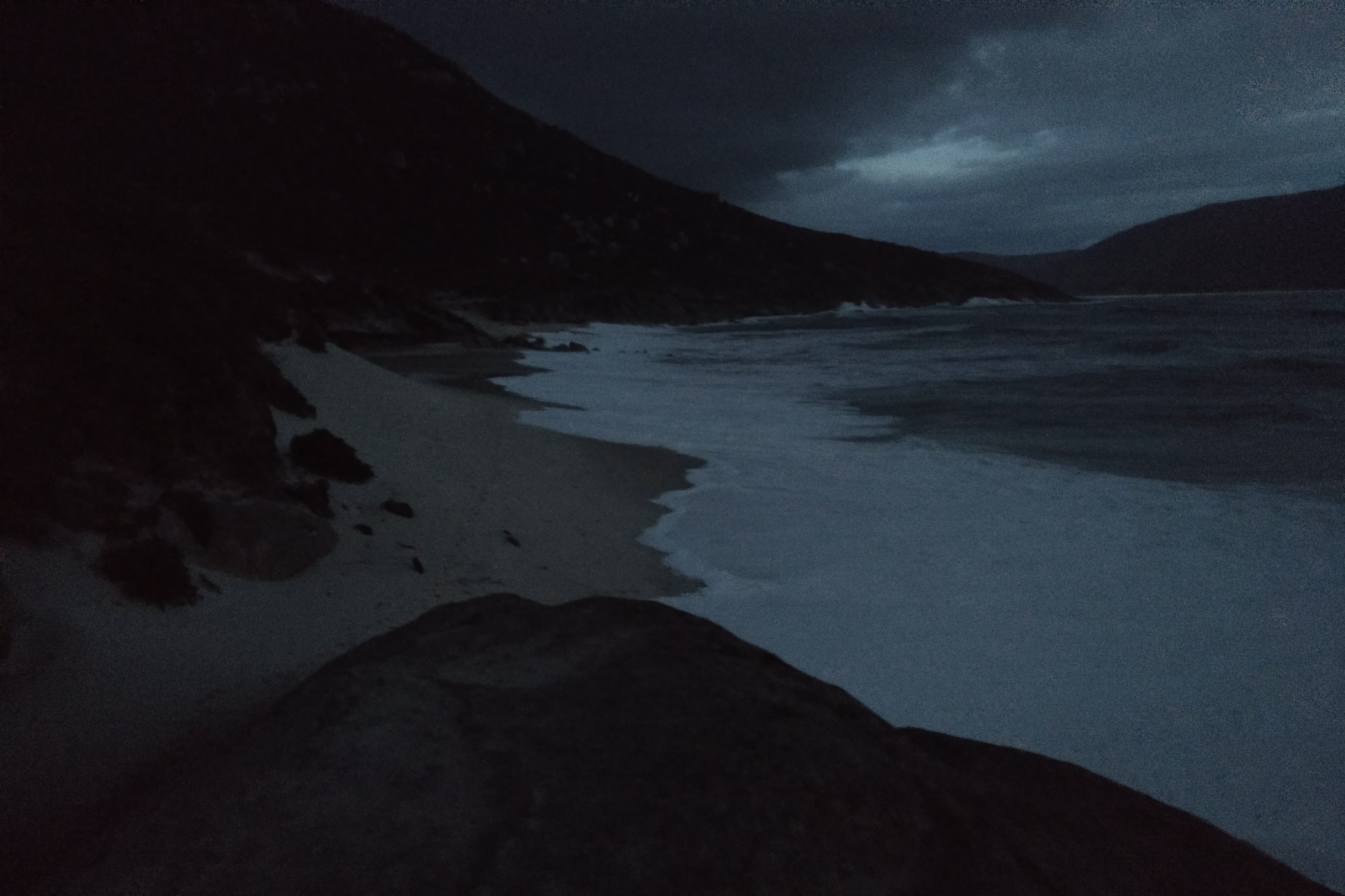
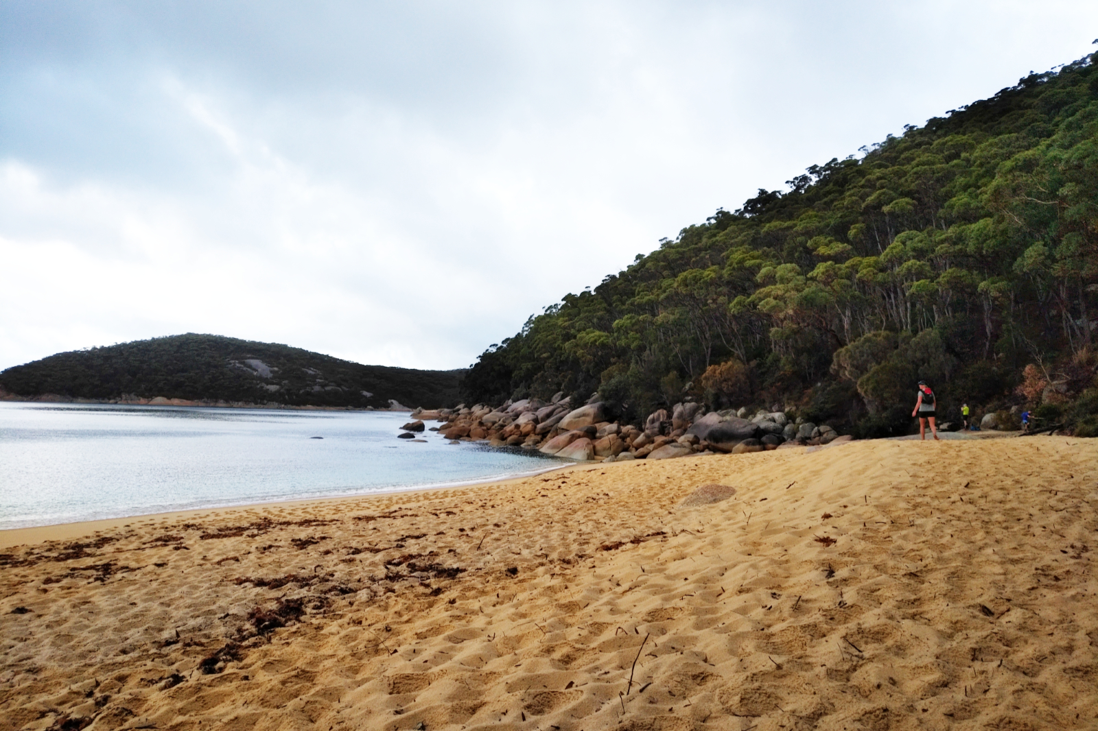
Waterloo Bay Nth
Waterloo Bay Nth was stunning!! Then at Little Waterloo Bay (which is equally beautiful) I saw the very one person I bumped into my entire day out there – a half-naked youngster with a round hat women would wear. Said hello and wished each other a nice day as I was passing. When I was up at the Decision Rock I thought today is too nice to cut it short, so Lighthouse it is!!
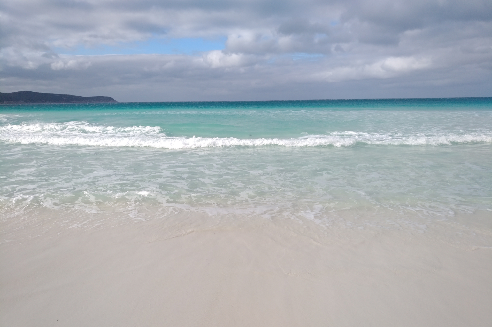
I was so looking forward for a dip at Waterloo Bay!! Could see the blindingly white sand from a fair distance… Everything was beautiful and great until I got there. The little delta was big, which meant no dry crossing here. I went down on the right side first to see if I could hop over the rocks, but that proved a no go – the little rock in the middle was in the water and clearly slippery. Went back and down the left (haven’t been this way for ages), went through the tight spot between two rocks, then figured if I could prop myself against that rock and could do one step without trussing against the other two which were about a meter apart, I could make it onto the sand without getting my shoes wet. This is when I slipped. Right foot straight into the water with a series of deep scratches that took the skin off and caused some not so nice bruises. Not a pretty sight. Left foot cramped which immobilised me for a few minutes. Skin off on both palms… Sat there until I could move, seemed forever.
Waterloo Bay in all its glory
First things first: had to wash off the blood, then took my clothes off behind a cliff (at least it wasn’t windy there) and went into the freezing cold water hoping the salty water would stop the bleeding… not really. This part of the beach was not sun kissed, therefore quite cold. I’ve put my clothes back on (shivering), then started running along the beach. The sand was compact enough to permit that and the sight of the crystal clear water took my mind off the bleeding wound and the burning of my palms. I sat down at the beach exit to put my socks and shoes back on when Otto rang. Gave him a sitrep, then I headed up.
I realised the bushes will scratch my already hurting wounds, so I pulled out the “first aid kit”. Not enough patches and even if I put them on, I’d cover some parts with the sticky part which would make it a pain in the ass taking them off. I pulled out the triangle bandage and loosely bandaged it. Only lasted a few steps, then again… and again, until I had enough and took it off. From here on, every single grass, bush or shrub that touched it, really hurt.
I started to feel the extra weight I’ve stuffed into the pack, my back was feeling it.
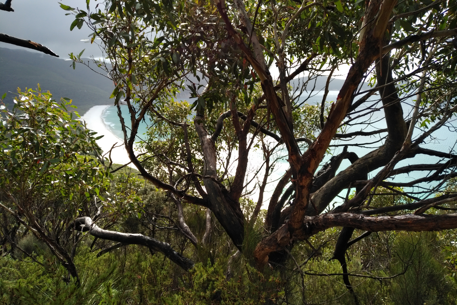
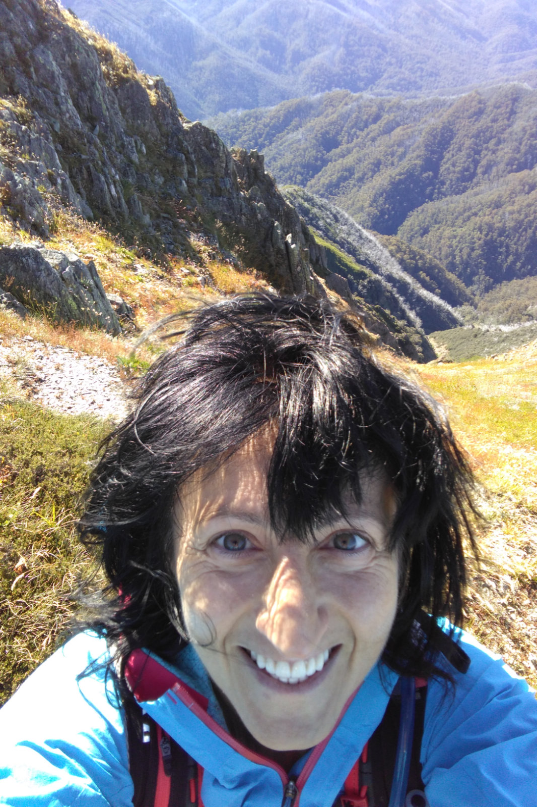
Looking towards Sth Point on the way to the Lighthouse
The weather was beginning to turn as I was going from the junction towards the Lighthouse. Strong winds have made for a not so friendly ocean. My friend was right about the extreme weather warnings – they were kicking in.
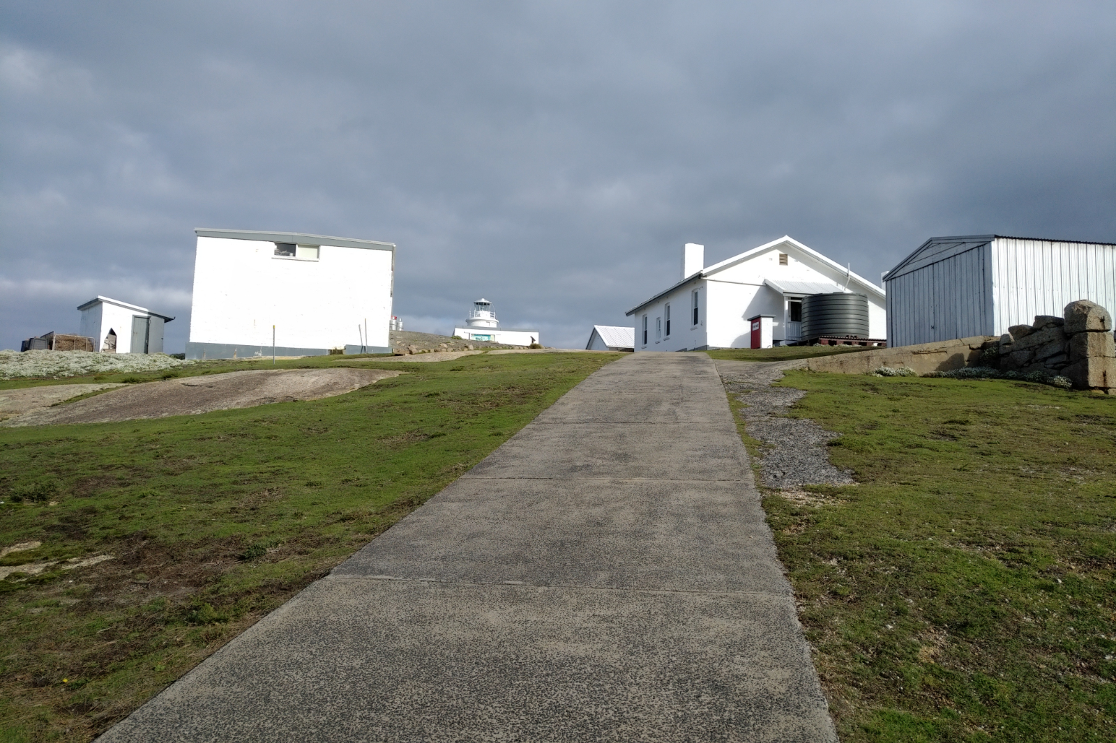
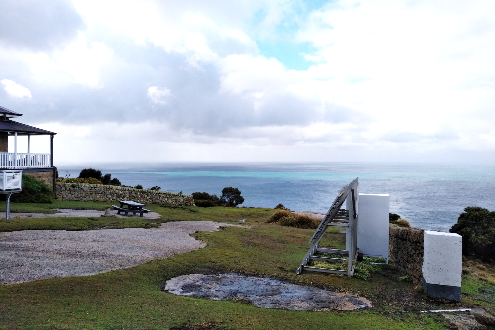
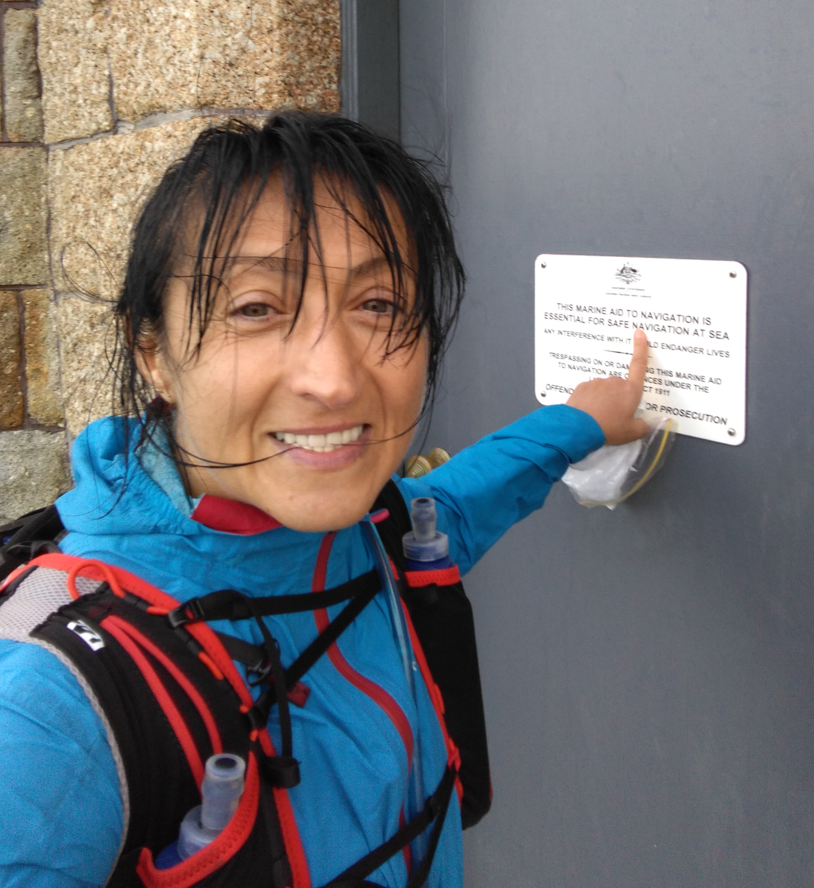
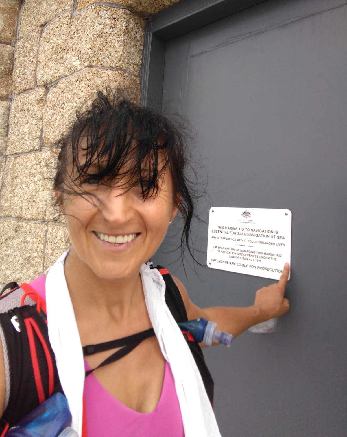
The cramps I got in my left calf when I fell still didn’t go away making the hike up to the Lighthouse really painful. I was looking forward to filling up and having some water. Had 250 ml straight away as soon as I got to the tap. Then took the Lighthouse door selfie, went to the toilet (it was eerie in there with the wind blowing), filled the two flasks and headed down all shivering beating myself up for not putting on the thermal before I got here. Stopping to do it on the way down was out of question, the wind was really chilly.
Usually not looking forward to the climb out from there, but now I couldn’t wait – it meant I would be warming up quicker. I’ve put the thermals on at some point when it was relatively no wind. They were a bit wet, still better than nothing.
Otto rang, told him I am OK, took a fall (didn’t tell him when or how bad it was, he was already worried), I have plenty of food and liquid and all is good. He asked me how far I need to go. Told him I was at 40 kms, another 20 to go. I must take him on this trip once so he understands what 40 kms means at that certain point. It means I’ve nearly done a marathon with 2000 m + elevation and whatever is left is peanuts compared to what is already done. It was (and always is) a bit debilitating when he asks “only that far you got?!”.
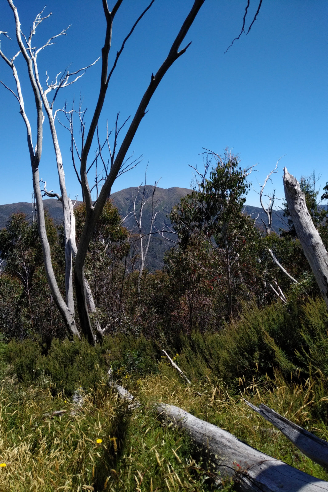
The view of Oberon Bay from Telegraph Tk
I went as fast as I could, every now and then thinking I could go faster, I am holding back… checked the hip – it was OK, so no reason to go slow. The cramps were still there, though. Saw a tent with neatly lined shoes at Roaring Meg, then a few more tents at Halfway Hut. I realised I forgot to eat and drink.
Rang Otto when I got to Telegraph Junction, as I promised him earlier. Put my phone in a plastic bag, as there were a few rain drops. I wasn’t looking forward to running through those shrubs and getting the wound scratched, but the sand didn’t seem too much fun, either. At the 52 km mark it started to rain. I couldn’t remember if the Ay Ups were waterproof… sooner or later I’ll need them.
I was a bit shocked when I got to Oberon Bay. The tide was high and when I looked along the non-existing beach, I realised it’s quite scary as there were parts where the water was hitting the sand wall… took my shoes off, put my phone in my jacket’s pocket (it’s supposed to be waterproof) and started running. The sand was varying between soft and ok-to-run-on and there was a lot of debris carried in by the tide. In the spots where the waves hit the sand wall the water have reached above my knees. I could see that the sand was wet way above that level on my right, which means a wave like that could just wash me away.
Then there is Lt Waterloo Bay!! Gee, that must be really scary. The waves are bigger there and the beach is narrower. I must step on it to climb out of that one too before it gets totally dark.
Looking back over Oberon Bay
I was wondering how deep the creek will be like at the end of Oberon Beach… could see water covering all that area to the trail head. To my biggest surprise it was quite flat, water didn’t reach my knees. I’ve sit down to put my shoes back onto my numb feet. A magpie came very close – not sure what it was hoping for. As soon as the shoes were on, I got going. Have to make it there before it gets dark. Last time I was a bit freaked out by the experience.
I stopped to take the head torch out of the pack while there was still some light. Assembled it, stuck it onto my nugget and went as fast as I could. I already decided that I’ll take the shoes off there as well because it felt warmer with the socks not being wet; the outside temperature started dropping, too.
Lt Oberon Bay from the boulder at the beach exit
Thankfully got over it without any issues. Took a deep breath, sat down on the rock to put my shoes back on, took a couple of shots looking back, then tried to call Otto but there was no reception.
My back really hurt by this point, not sure what I did wrong. That last km felt particularly hard this time. I was contemplating on just changing clothes and heading home, giving a miss to the shower I usually take after a run here. I finally could call Otto when I got back to the car; he suggested I take a shower, it will keep me awake on the way home.
While I was in the shower I could hear the rain on the roof… it was freezing getting out of there. Not many people camping this time.
Long drive home, it was pissing down with rain all the way to Nazza.
All up it was a great day. Saw lots of animals: plenty of wombats and wallabies, some kangaroos, rosellas, black cockatoos, a cat, rabbits, three owls and a deer.
Gear
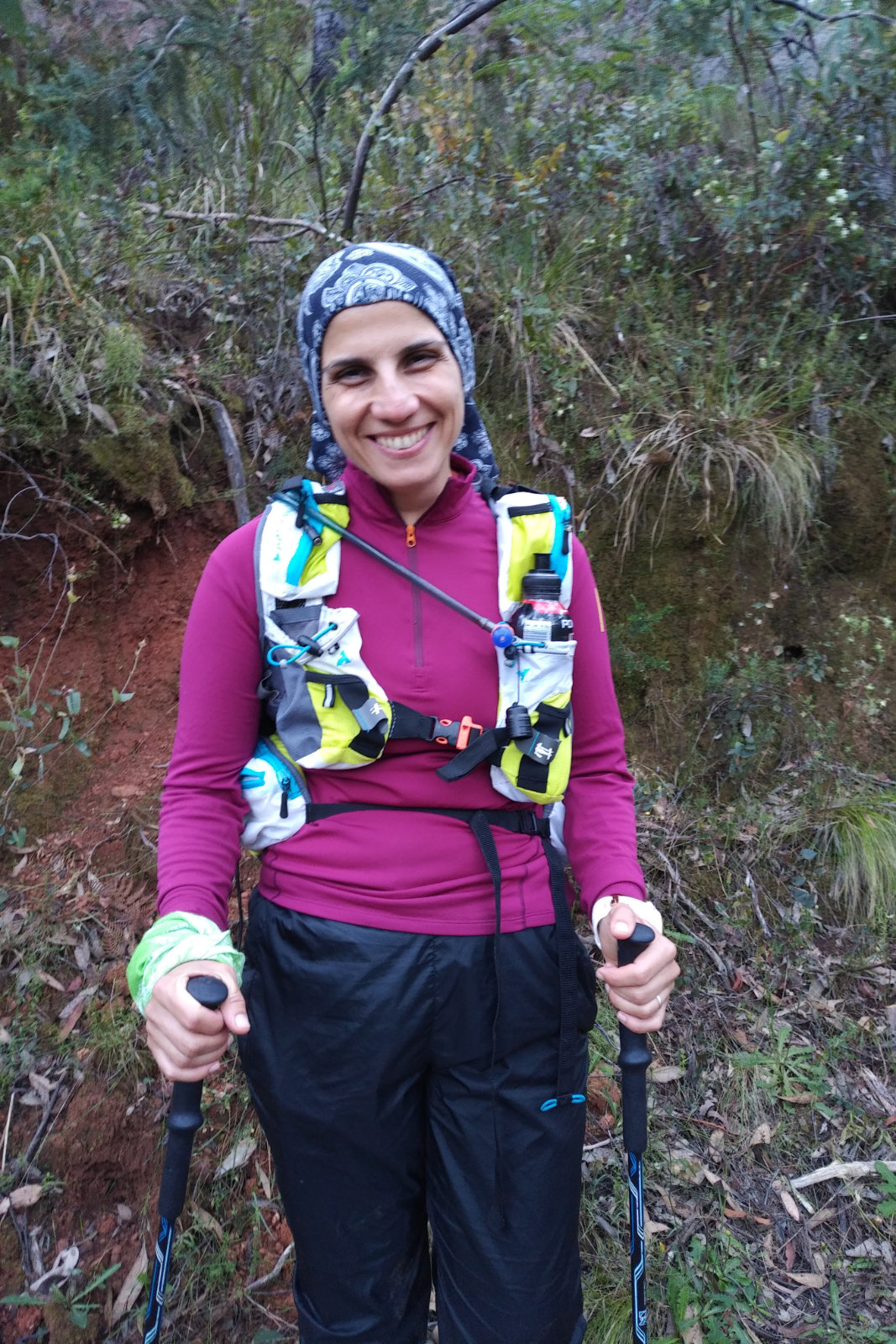
Lululemon top and crops
Salomon waterproof jacket (not the Bonatti)
Feetures socks (bought them at FSM) – great socks!!
Kathmandu thermals
Overpants and gloves – didn’t use them
Agile 12 Set Lightweight Hydration Backpack – didn’t manage to completely fill the back compartment
Nutrition and Hydration
About 1.5 l of GU Tri-berry
2 x 330 ml ginger beer
Re-filled the soft flasks with water at the Lighthouse but only had a few sips of it
4 x small rice paper rolls with Csabai, goat cheese, Philadelphia cheese, rocket, red capsicum, mint, coriander and cucumber
6 protein bars (don’t ask why I packed that many) – had 2
It was pissing with rain all the way to Yanakie – just like on race day. I left just after 5, wasn’t in any hurry to avoid the high tide at Sealers. Stopped for a few photos on the way, they are crap, not worth showing.
This time I parked at Telegraph Saddle car park, the plan was to go down to the Lighthouse, then to South Point and back straight via Telegraph Tk. There were a few cars parked, didn’t make much noise thinking someone might be sleeping in any of them.
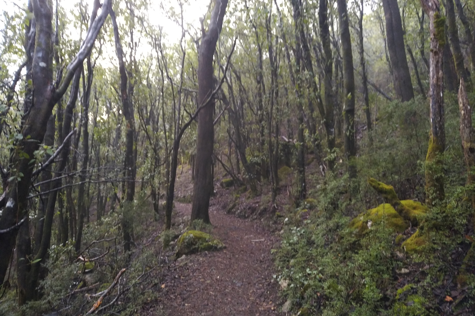
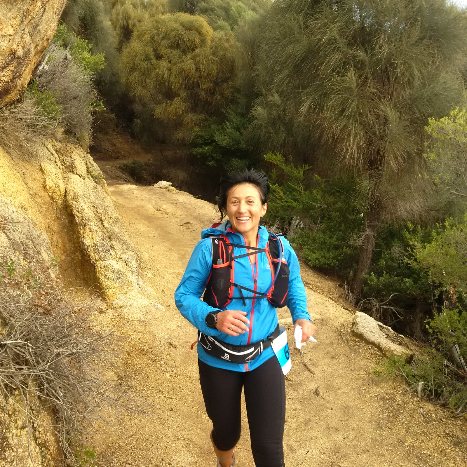
Geared up and got going at almost 7:45. It was strange not having to climb that concrete hill, but getting straight onto the track. Once I got over the niggle and warmed up, I really enjoyed the ride. It was a bit spooky in the forest, foggy.
Just before reaching that switchback, phone signaled an email… work… replied, then kept climbing. Did this a few times before the reception cut out. I took it really easy, didn’t care about pace. In fact would’ve loved to do this all day, on this beautiful track. The ground was soft, a bit softer than on race day, but not as muddy as other times after rain. It was just pure trail pleasure. The board walk was a bit slippery, so I really pulled back there. Parks Vic have cleaned some more or it, now it’s all clear. I was so excited about getting to Sealers… wondering how deep the creek will be… even packed two plastic bags, just in case I need to get deeper into the water.
The clouds over Sealers Cove
Sealers was a bit overcast, with a huge cloud hanging just above the bay. It made for a beautiful pic anyway. I had some food while getting to the creek crossing, then – as usual – I took my shoes off, crossed closer to the ocean, where the water was about knee deep, then put my shoes back on and started the hike. There was a girl at the camp ground (just realised, haven’t seen anyone on Sealers Tk, which is unusual), having her breakfast. She might have been hung over or something, because she didn’t notice me, in spite of me saying hello quite clearly…
When I saw the water at Refuge Cove Nth, I thought it’s going to be great!! Never mind the occasional showers – they are great, too! Before arriving to Refuge Cove, I’ve spotted a yacht… soon I saw a couple hiking my way. Said hello and asked them where are they heading (they had no packs). They said they are just going to the lookout – that boat is theirs. Told them they are so lucky, wished them all the best and kept going.
This is must shoot spot
I was so preoccupied with my thinking that I forgot to eat, then my tummy complained… it happened quite a few times on this run/hike.
At Refuge Cove I saw the inflatable boat the couple got to shore with and wondered did they take off their hiking shoes to get on the beach?… Kersops was coming up!
Didn’t push up Kersops, just put one foot in front of the other. Otto messaged me asking how I was going, because he didn’t get the Strava link… told him not to worry about it, it’s quite cloudy, the internet is rubbish. I had a date (with a pit) when I got to the top, took a few pics, then kept going. It was quite windy and it started to rain a bit, but I somehow enjoyed that, too knowing Waterloo Bay Nth is next and if the water is nice, I’ll have a dip. I was really looking forward to that.
As I was getting closer to the shore, the bright turquoise shone through the trees… yeah… dip it is!!!
Waterloo Bay Nth when I got there
I was so happy to see the beach is empty – all mine! Put my gear and clothes onto the big rock and walked towards the water. It was windy and the water was quite cold, but so refreshing!! Suddenly I felt something is off… looked back and saw a crow with a bag in its beak… shit!!! It was my phone!!! I put it in a ziplock bag so it doesn’t get wet and the damn bird was about to steal it! I yelled at it and started walking out, when I saw it dropped it and tried to pick it up… how on earth a bird has such strength. That phone is 215 g + the bag = about 220 g!
Then another surprise… there was a walker at the other end of the beach (this is not a long one). Saw the back pack and the hat, thought he/she was heading the other way…
The colour of the water was just amazing
I was dressed up and about to put my shoes on when the man walked by. He asked me if the water was cold. Told him yes, it was but it was great. Then he said “impressive!” I took this as a compliment.
The beach exit was quite weird, different to what it was before and I couldn’t figure out why. The signs were there, it was something about the rocks…
Lt Waterloo Bay was a stunning view and all the little peaks towards the water on the way there, too. Exchanged a few messages with Otto, he teased me about the onlooker 😃
The water at Waterloo Bay
I was already excited about Waterloo Bay, thinking if the water was THIS good at this small beach, it’s surely much nicer there… and boy, it was!!! If it wasn’t for the strong wind that blew sand in every orifice and stung when it hit my skin, it would’ve been heaven! The water was amazing! Nice and flat so I could even swim a little.
I ran most of the beach (minus the dip), then sat down to empty my shoes and socks of sand and put them on. Gosh, sand was everywhere!! Had one of the ginger beers I packed for extra energy before I hit the hill.
Exchanging messages with a good friend took my mind off the hill, I looked back a few times but somehow didn’t realise how hard it is, only saw the beautiful beach of Waterloo Bay. Then Otto messaged me… called him as writing and running on technical terrain doesn’t go hand in hand. He asked me (very nicely) to skip the out and back to South Point. Told him, that I’ll see how I go. He said he’d be much calmer if I wouldn’t finish so late in the dark…
I was surprised I didn’t trip that much. It was the shoes!! I was wearing the Pro Max. These somehow force me to lift my feet off the ground whereas the Sense Pro 2 is a total tripping tool.
Have no idea how I got to the Lighthouse Junction. All I know I enjoyed it and marveled at everything: mushrooms, ferns, moss. Many times I’ve ran by some beautiful mushrooms and a few meters later thought I should’ve stopped and took a shot, who knows if it’s going to be there when I come next time?!
This day was mixed… most of the hikes happened in sunshine and I felt quite warm, but taking off the Bonatti wouldn’t have been a great idea as I was totally soaked underneath (putting the thermal on at start surely wasn’t the best idea). Then there were the windy and rainy parts… when the clothing I was wearing was just perfect. I copped some rain before the Lighthouse, that’s for sure – I remember that, because I was wondering if I am going to score some suckers again.
I shuffled on the track towards the Lighthouse (the flat and downhill part, of course). When I reached the open area, the wind pushed me 1.5 m to the left. It crossed my mind “good luck to a chopper to land in this wind!”. At the intersection I looked down, to the left and thought “gee, Hamish had a long way to go down and then hike up on race day!”
Nearly there…
The uphill hike didn’t get any easier, especially since I was the only person on that road. When I got to the buildings, I took a few shots, then filled the flasks, had 250 ml on the spot, refilled then went to take the selfie and to the toilet. It was eerie there… the wind was so loud and the toilet water was moving in the bowl… like in a high rise building. Started to feel cold. When I walked out, I looked around and saw the resident wombat. Took a few pics of him and of the view of the horizon behind the lighthouse. Never been there before. Then all shivering, started the descent. Couldn’t wait to get into some cover, but the hike out has warmed me up.
Getting further away from the Lighthouse
Not sure at what point, but when I looked back I could still see the Lighthouse, I had the other one of the two ginger beers I’ve packed. It worked! I ran/walked this portion, then as soon as I got onto the 4WD track it started to rain. It was cloudy and windy and I thought going down solo to South Point might not be the best idea in this weather. If anything happens to me, I can’t even be rescued, so I decided to give Sth Point a miss today.
Dunno how I got down and up to Roaring Meg, then even further up on Telegraph Walking Tk. I guess it was the case of putting one foot in front of the other, but by the time I arrived to the 4WD track my toes really hurt, so running downhill was quite painful. Shuffled and called Otto with the sitrep. He was really happy that I headed back earlier and told me that the portion between Telegraph Junction and Telegraph Saddle car park is beautiful, the last 1.5 kms are steep. I’ve never been on this part of the track so I was kinda looking forward to it. I expected some elevation – Mt Oberon seemed quite up there from where I was…
This view is always captivating
When I got to the Junction, I saw a couple turning out of Mt Oberon Tk (the sandypainintheass one). I don’t think they saw me, because they kept kissing and the guy touching the girls bum… when I got closer to them I said hello in advance and told them that I didn’t mean to sneak up on them. They laughed and the guy’s first question was “how many kays did you do?”. Told him 46.34 (this is what I had on the watch), but will end up with about 51 by the time I get up there?! I asked them where are they going (since only the guy had a backpack). They said only to Telegraph Saddle. We wished each other all the best and I somehow got a bunch of energy and ran. Not fast, but I ran. Then came the up… and I got tired.
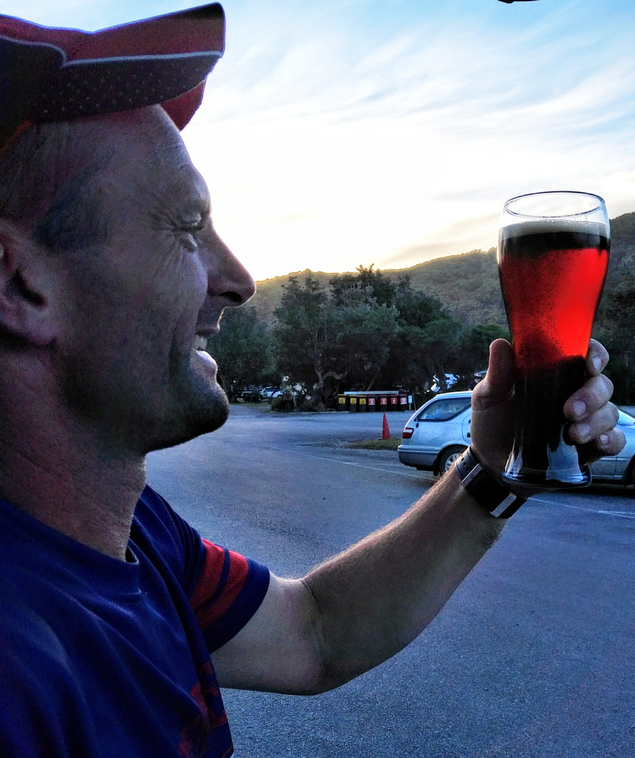
As I was “hiking” all of a sudden I could feel something. Looked back and saw these two running. They paid me back and sneaked up on me, but they were very nice. They said I inspired them. This felt really good. So good, that I was prepared to share my beer with them if they are in the car park when I get there.
He’s probably used to people taking photos
I was looking for that “beautiful” part Otto told me about… frankly, this part is nothing special after the coast. Yes, there are some dramatic rocks and creeks, but the shore beats this hands down. I kept looking at the radio tower on Mt Oberon, trying to calculate how far I could be from the car park… gosh, it seemed so never ending. About 200 m from the car park I saw a wombat on the left. Took a few shots of him, got quite close, too.
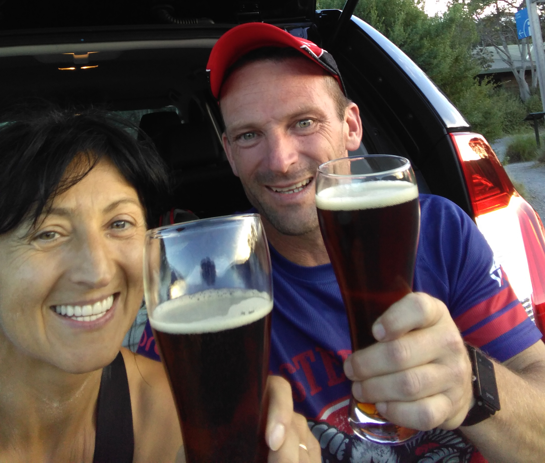
When I finally reached the car park, there was a car leaving and the others seemed without passengers, so beer, change, go was on the menu.
Got home safely – thank you my friend 😊
All up it was a great day. Haven’t seen a human soul between Refuge Cove and the couple on Telegraph Tk. This is a long time and many kms in solitude. The rain?! It’s another kind of good weather.
Gear
Lululemon crop, top, socks (changed at Waterloo Bay Nth)
Salomon Bonatti wp jacket
Kathmandu thermals
Salomon Pro Max shoes
Food and drinks
3 larger rice paper rolls
2 dates
1 small protein bar
Shot Bloks
Chocolate and ginger
1 mandarine
2/3 banana (two pieces)
2 x 330 ml ginger beer
GU Energy drink – 500 ml +250 ml (in flasks) +750 ml in bladder – refilled the flasks with water at the
Lighthouse. Brought back most of the water and a bit of the energy drink
It was pissing with rain as we were driving to the Prom on this Friday afternoon. The colours were amazing: the dark grey against the brilliant green of the pastures. Then there was the rainbow!! As we were getting “underneath” it, I was thinking this must be good…
Otto was tense all the way, he’s always like this when we drive to a race, no matter how many times I tell him everything will be okay, no need to worry about me. Got a message from my best friend with mixed news, but I was happy to hear from her – she always goes silent when things are not going well. We messaged for a while, then I thought stuff it, better call her. Viber is a bitch sometimes, cuts out when you least want it, but we still had a few good laughs.
Stopped in Leongatha to fuel up, then in Yanakie to buy a few more things (fresh eggs, yayy!) before heading down Foley Rd towards our accommodation. This year I booked a cottage at Tidal Dreaming Seaview Cottages. It’s on Dalgeish Rd, just off Foley, the view over Corner Inlet is just stunning. Unloaded the car then I headed down to Tidal River for registration and gear check. Otto asked me to try to get back before dark, he’ll get the dinner ready by then. I made the fresh pasta the day before, he made up the essence – the taste.
In spite of the strong wind that felt like it’s going to pick up the car like a feather, I enjoyed the drive and was looking forward to see the faces of fellow ultrarunners I only see at these races. Normally there are not many campers, but this time of the year Tidal River comes alive with all the runners and their families, walking with purpose. Said hello to some of them on the way to HQ then walked into the cabin, where the registration was happening. Paul greeted me with a “Babbbiii!!” then asked “Where is Otto?”. Told him what was going on, then the first thing he said was “show me your gloves!” – because I asked the other day if they are really necessary… I was very happy to see Duncan there. He is kind of “piece of mind” when he’s present.
Went to the registration desk, told Helen my name and bib number, then she asked me for my snake bandage and space blanket. Showed them both then chatted some more with Paul, saying hello to the fellow runners and the volunteers before heading back to the car. I thought that was OK, I’ll be back before it gets dark… then I saw this hair style. There is only one person I know who has it – Jacqui Hansen! Pulled over and got out to say hello to Jacqui and Darren. It turned out that none of us (Jacqui or I) should be running this weekend – doctor’s orders! Jacqui downgraded to the 44 km, I thought I’d just stick it out, que serra – serra!!
We wished each other all the best for next morning, then I headed off, driving carefully as the wombats and kangaroos were supposed to be along the road at this time. Called Otto to let him know I am just leaving.
Dinner was great and so was the red wine I washed it down with, too. Prepared the food and drinks for next morning, had a shower and went to bed. The wind was blowing so strong there and it was raining like there’s no tomorrow… didn’t sleep much.
Alarm went off at 3:45. Nothing unusual, this is the time I normally wake up when I head down to the Prom for a training run. Had my coffee, breakfast, had a shower, Otto woke up too, then we headed to Tidal River. It was pitch dark and windy. Otto worried. We saw a deer and there were others coming that way, too. In the Visitors Centre car park we pulled next to a white X-Trail, its passengers were getting out and realised they are our cottage neighbours, the man [Sam] is running, too. Felt a bit sorry for the two little girls being awake so early, both in their pjs.
At the start line
We walked to HQ greeting other runners on the way. Paul was really happy to see Otto, then as we walked out I nearly bumped into Dan. Big hug, haven’t seen him since Razorback, then he went to register. Greeted Sean, the man I saw a few times on my Prom training runs. He just did the Marathon des Sables and didn’t expect a fast time today, but wanted to do this race for the UTMB points. Otto chatted with him some more while I said hello to a few more familiar faces. I was looking for David, he said he’ll be at the start in the morning, but couldn’t find him in the dark. Saw Gabor, Otto took a photo of us as we usually do before races. Roll call 100 km runners, then the 60, countdown then start!! Otto gave me another kiss and told me to go well as I was heading off.
I though I’d just go by feel, will try to get as close to the 10 hr mark as possible (beers were waiting at the end!!) and see what happens. The majority of the field took off, I was somewhere towards the tail end, waiting for someone to have a similar pace as mine to stick with for a while. Didn’t have to wait too long, this tall guy, who introduced himself as Hamish said he can’t run fast because he has a knee injury. It was his first 60 km at the Prom (he already did the 44 before) and he wasn’t sure about the course – although he had it loaded onto his watch. Described it to him in a short version, then Otto drove past, taking a photo. When we got to the Mt Oberon turnoff I saw Duncan – he was marshalling at that point. Went to give him a big hug, which felt great then caught up with Hamish again. We ran/walked this concrete uphill, talking while the wind was helping us from behind, then soon arrived to Telegraph Saddle car park, where Otto was cheering everyone who ran. I already switched off my head torch and put it away – could see the track well (should be able to do it with my eyes closed). Another hug and kiss and he waved a good bye with “No swimming, please!”. I saw the shock on Hamish’s face, then on the downhill I told him why Otto said that – he laughed.
We ran together until we reached Windy Saddle talking and saying hello to the runners we passed and the ones who passed us. I saw Caz [Donovan], we greeted each other and she said that she’s so happy to finally be here when I am here (we’ve been trying to get the 60 km training run in for a while, pity it didn’t work out, it would’ve made a huge difference to her race) then she told me “go and do your magic, Babi!” – I said magic starts at Windy Saddle and I was really sorry about not sticking with her.
There were a few runners at Windy Saddle, I said hello, told Hamish that I’ll step on it from here, it’s my favourite part. I also told him that he’ll surely catch up with me on the uphills (which happened pretty much all the way to the Lighthouse: him going strong on the hills and me “flying” down on the downhills).
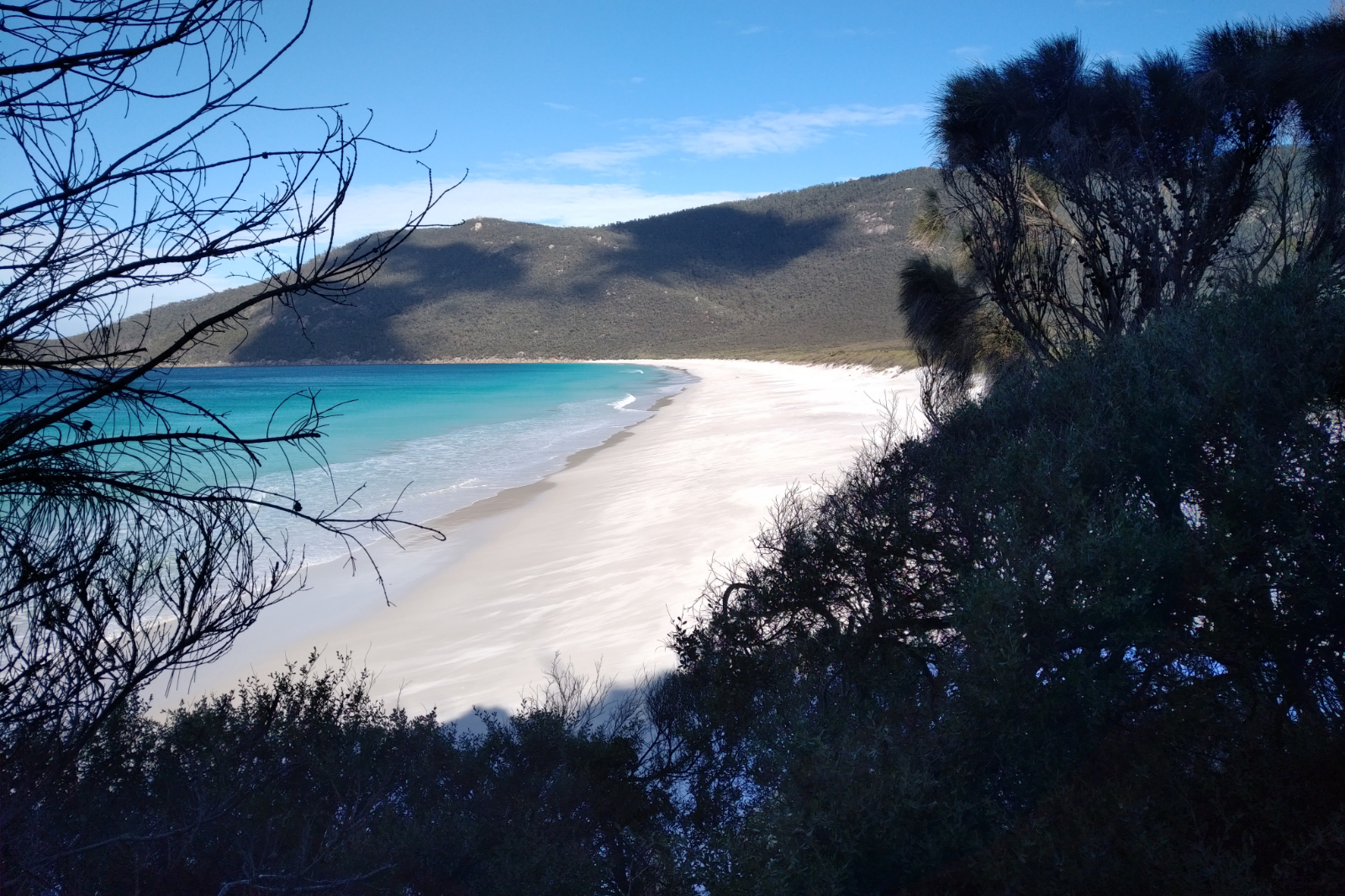
Sealers looked different today
I really enjoy this part, even in the mud! This year was far away from what it was like last year and the year before; in fact it was just perfect – the track was soft enough for a good grip, but not muddy enough to slip in every direction. I’ve passed quite a few people here and the hikers were nice to get out of the way, probably thinking how crazy this bunch is. There was a runner who was close behind me, keeping the same pace as I did. I offered to let him pass, but he said he’s happy with this tempo. He lasted nearly to the board walk, then I lost him. I ran alone to Sealers, the colours of the water always amaze me. Now there were heavy clouds hovering over the water, making it look way darker than it was.
Refuge Cove Nth
Ian was at the creek crossing shooting us as we approached. He said “you are the second person who takes their shoes off today!”. I told him why I was doing this, crossed the water, then went aside to put my shoes back on. Had an awful cramp somewhere under the lungs as I hunched to lift the right shoe. Stood there for a few moments until it went away, then finished with the socks and shoes and headed back to the track, saying good bye and thanking Ian for being there. In the mean time quite a few runners have crossed the creek and headed up towards the camp site. Hamish was back on as my running buddy. We ran/hiked together for a while, then he went ahead.
Hamish and Celeste at the Refuge Cove Nth exit
Celeste [Botton] took me over too before reaching Refuge Bay Nth. I took a few shots of them (not all clear, though) before I got there. The beach wasn’t as clean as it used to be, you can tell there was previously a storm from the debris scattered all over the sand. Refuge Cove came next. Didn’t need water this time, I had enough with me and only planned to refuel at the Lighthouse.
As soon as we started climbing out of Refuge Cove Hamish took off, then further in I could hear “Hey Babi, you are an animal!!” it was Steve Rennick, with two other runners. I looked back and was really happy to see them. Told him right now I wish I was a goat!! Gave him a hug, congratulated them and wished them all the best. As the third runner passed me, I’ve noticed he is so familiar… he was Ash[ley Bennett], the fast kid, doing his first Prom run!!
Otto messaged me asking how far I was from Waterloo Bay. Sent him back “22”, then it clicked this is not exactly clear, so I sent another text with “I am at 22 km mark”.
Near the Kersops Junction
As I was getting closer to the Kersops Junction I remembered how much different it was being here the previous two times… I stopped, looked back and pulled out the phone to take a picture, then Brett Godden popped up, so I took a few shots of him. He kindly returned the favour and took a few shots of me, then we wished each other all the best and he took off.
So far I’ve been eating and drinking well, tripped quite a few times (should’ve worn the Pro Max instead of the Sense Pro 2, the low drop is really a disadvantage here) and had some cramps which were manageable. Slipped and landed on my bum at the rock just after the junction (this is where Julie used to slip), but hey, it’s in the package!
Hamish on the tree
On the way down to Waterloo Bay Nth I caught up with Hamish again, took a shot of him sitting on a tree that was across the track. It looked so funny! We walked along the beach admiring the water, when we caught up with a runner that (again) looked so familiar!! It was Ash, limping with the jacket’s hood on, he must have been very cold. I double checked and when I was sure it was him, gave him a big hug and told him that I was sorry I didn’t recognised him earlier with the top on. Hamish looked at Ash, then me with a strange look on his face. Had to clarify this, so I told him this is Ashley Ramond Bennett, the one who runs without a top. We all laughed, when Hamish said that he thought that I couldn’t recognise Ash with my top on! It was hilarious in that setting! Asked Ash if I could help him in any way, if he needs bandage or anything. He said he’s OK, he just needs to walk all the way to the finish and asked if that was far away – told him there is quite a fair bit to go (we must have been at around 24 kms), then wished him all the best and walked off.
We got to the big trees that were fallen across the track, climbed over, then hill was coming up, which meant Hamish lengthened his steps while I was dragging my butt. I stepped aside every time a faster runner approached. Saw Caroline [Gavin] somewhere earlier (can’t remember where exactly), congratulated her, gave her a hug and told her she’s the first lady, then wished her all the best. I was having cramps at some of the weirdest spots during this race – right now the vastus lateralis (I’m not that clever to remember that, had to look it up). I already had the piece of banana I brought with me on the way up to Kersops – as a remedy for calf cramps – so had to keep drinking the sports drinks…
I could feel someone approaching. When I looked back it was David. I was really happy to see him, he was travelling so fast. He gave me a hug and asked if I was OK. I said I was OK (cramp suddenly went away – thank you David) and asked if he was OK, too. We ran together for a very short portion, then told him to step on it, agreeing we’ll have beers at the finish!
Lt Waterloo Bay
Caught up with Hamish again, we yo-yoed to Lt Waterloo Bay, then to Waterloo Bay. Tried to run along the beautiful beach, but Hamish’s knee was really hurting so I stuck with him, speed walking all the way to the exit. I kept looking at the water… it was so inviting! If I was there alone I would’ve surely gone for a dip, even in that – not so hot – weather.
Waterloo Bay
As soon as we got to the beach exit, the track goes steep up. Told Hamish to go ahead, will catch up on one of the downhills. Started the climb, which sometimes feels like it will never end. Every now and then I looked back over the beach (it’s so beautiful!), where others were running. It started to rain and I started to trip more often which was a bit of a worry, because it meant more chances to cramp, as well. Gosh, how lucky I was to avoid cramps for years!! Otto’s message came through “bummer, I left Waterloo Bay about 30 minutes ago!!” – meaning we just missed each other! For years I’ve been trying to convince him to do one of the loops with me – he MUST see Waterloo Bay… and now he’s seen it and I wasn’t there to witness it all.
Still Waterloo Bay
I was already on the other side of the mountain, when I tripped and fell on my side. I lied there on the ground for a while (it felt like eternity), unable to stand up and watched my right calf moving around uncontrollably, thinking “hope no one is coming, I don’t want anyone to see me like this”. It was very painful! Surely Peter Coady and Heidi Gratton appears… they asked if I was OK, or I needed any help. Told them it’s a cramp and as soon as it goes away I’ll stand up and continue. Peter asked if I had any salt tablets. Told him I have one better: I have the real thing – salt!! Then told them to go ahead, I’ll be fine. As soon as I could, I stood up, walked a little, tried to clean up the mud – at least my hands. Glad I always carry that sanitizer, put some on the wound on my hand and my legs, it stung! Then picked up the pace and went as fast as I could, catching up with Hamish on a downhill. I was surprised I didn’t pick up any leeches…
In one of the corners (the ferny and mossy kind) Suzie rang. She has a knack for calling me during races (or training runs for that matter), casually asking “so how are you Mum?!” When she hears I am panting and telling her I am running, only then she realises that “ah! You are running!! Everything OK?! Take care, we’ll talk later!”
At the Lighthouse
As I was getting closer to the Lighthouse I thought the fast 100 kms should be close by; I was really looking forward to greeting them, when about 2 kms from the Lighthouse Junction I spotted Dan. He was so fast and fresh as a daisy. Gave me a hug, then ran off. The next runner was very close behind him, then Shane Wheeler in third position. I realised too late it was Shane, otherwise I would’ve given him a hug, too. Got to the junction, headed left towards the Lighthouse. You could tell there is something going on here, usually not that many people get this far. I saw two hiker ladies going up, took them over – they both looked impressed. And tired. Then I saw Jenny [Rickards] and her friend Veronica coming down the concrete hill. Gave Jenny a big hug, asked her how she likes the course, then wished them all the best and headed up to the Lighthouse. Celeste was already filling her bladder, asked if she has finished – she said yes, but she’ll ask for more at Telegraph Junction.
I didn’t know who she was, we’ve never met in person before, but we were supposed to sweep Langfords to Hotham in January… I know one thing – she is a strong uphill runner and she’s got great legs!!
Lighthouse selfie
I filled my flasks and poured some in the bladder, then headed to take the Lighthouse selfie and then to the toilet. By this time my migraine that started somewhere around Waterloo Bay was becoming a nuisance (I only get them 3-4 times a year, this one was really badly timed) so I thought I’d just take two Panadols with the ginger beer I carried for “emergencies” – this was one of those emergencies! It was freezing up there!!! My fingers were a bit numb and my sweaty body was shivering underneath the Bonatti. I considered putting on the thermal, but the thought of having to take off the jacket and being exposed to that chilly wind didn’t sit well… as quick as possible I pulled out the Panadols and the ginger beer, took them, then headed out of the cover. Hamish has just gotten there, reminded him to take the selfie (otherwise it doesn’t count 😉 ), then kept walking/running downhill pondering over pulling out those mandatory gloves. Figured I should be out of this wind chill soon, not worth stopping for them.
I had some food and saw a few runners. Then at the Junction I bumped into Shane Winzar, who was doing the 100 km. Gave him a big hug, wished him all the best and headed out. I saw quite a few 100 km runners coming and was waiting to see Richard North, but I guess he must have been on the South Point out and back.
Otto took this shot on his way to Lt Oberon Bay
I have tried to run as much as I could (which was way more than other times), had cramps, then walked a bit. Around Roaring Meg I caught up with Celeste on the downhill. Asked her how she was, then told her she will surely take me over on the following uphill… pushed as hard as I could and on Telegraph Tk I called Otto as it was easier than typing a message. He told me I was travelling well and asked me what I would like him to bring. Told him a ginger beer would do wonders and I was already looking forward to catching up with him around Lt Oberon Bay… I don’t think I’ve ever pushed this much on Telegraph Tk, yet two runners I’ve ran from the start and then saw a few times during the day, have stepped on it and passed me on the 4WD tk (that’s pretty much downhill).
I was happy to see the veterans at the Junction. I’ve told them my name and number, they offered me sweets, water and chips. I reached for the chips (normally don’t, but now I craved the salty stuff), but when I heard they were salt and vinegar, my hand quickly stopped – can’t do vinegar. I said hello to David Shuterland, gave him a hug and wished him all the best as he took off, then I followed already dreading the sandy 4WD track to Oberon Bay. On this portion I was overtaken by Peter Coady and Heidi Gratton as I was shuffling along. Somehow I found energy and pushed to Oberon Bay wondering how high the tide would be here… I noticed Peter and Heidi were already there. It was windy, very windy, but runnable. Peter was tired, he slowed down to walking. We talked a little, then I told him I will try to go faster as my husband is waiting for me somewhere. Heidi was in a better shape, but she kept checking on Peter.
I got to the creek, walked through (the cold water felt really good), then started the climb thinking of that ginger beer and imagining how I am going to run through the finish and have proper beer with Karen, David and Otto. Heidi caught up with me and said something about Peter being slow as she passed me, then I saw her waiting just before Lt Oberon Bay. I was hoping to see Velta here, but all I saw was a girl sitting in a yoga pose on the top of the rock on the right and a few hiker boys arriving happily from the track. They were nice enough to let me get up the damn sand hill first, which I thanked them for. They also wished me luck – that was very nice, too.
See what a little ginger beer can do?!
That ginger beer!!! Where is Otto?!…
He appeared soon, very happy. Got the beer out, I drank almost the whole bottle and that gave me a boost. He asked me how I was, how IT was and told me how he got to Waterloo Bay. I like that he’s getting into this!! He also told me that the photographers are at the end of this track, then asked if I wanted to go along the beach or inland. Told him the tide is not that bad, still some sand to run on, let’s go via the beach – that’s the official course anyway.
I was very happy to see Ian and Velta when we got onto Norman Beach. They must have taken photos of us, but I haven’t seen any in the collection. The colours were striking here as the sun was setting and the clouds were so dark behind us. Otto took a few shots, then we ran/walked to the turnoff.
With the Boss of Organising
I could see someone familiar in a high-vis jacket – I recognised Duncan’s partner, Noreen from Bogong to Langfords last year, when Duncan and her were minding the Cope Hut checkpoint (and gave me as many orange slices as I wanted). We greeted each other and then Otto and I climbed out of this last beach. Otto took off so he could take a shot when I finish and catch me (so I don’t run anyone over 😃 ).
As I was running through the first parking lot, I remembered the BBQ my friend Miri and I had two years ago, when Otto couldn’t make it. We forgot to bring glasses and had red wine (quite a nice drop, too) from plastic containers… all this while it was pissing with rain around us. It was hilarious!
The finish is getting closer…
I wish I could see the clock earlier, I would’ve stepped on it from further. There were people cheering, which felt really nice. Paul let a big “Babiiiii!” out and said well done. Then Otto caught me which was great, because there were people behind him. Paul gave me the Caramello Freddo. I looked around then David and Karen came to say well done with a hug, both holding a beer…
I said thank you to Paul and the volunteers before walking to the car for the beers as we agreed. It was nice to meet Karen and to share our stories of the day (and many more) while enjoying Otto’s home brew.
I didn’t have a shower at Tidal River this time. Otto and I drove back to the cottage where I could finally wash off all the mud and dirt I’ve collected during the day, then had a nice steak and red wine before going to bed. Body was burning, keeping me awake for most of the night. I guess the muscles were working hard on rebuilding themselves. As I moved my feet, I sensed that tingling itch and then I realised – damn suckers!!! They got me again!! Had two bites on both ankles, which by next day got inflamed, swollen and even more itchy…
Next morning we had breakfast, packed up, cleaned the cottage and headed home.
I was so undercooked for this race with around 108 km total training in the month leading up to it (two Prom 44s, two 7ish and a slow 4.5 km) I just winged it, ridiculously still hoping to finish around the 10 hr mark. I nearly did – 10.05.55. This time the planets aligned, it wasn’t that hot, I could eat and had energy for most of the time. The hugs and kind words I received and gave to others have overpowered the cramps hands down. There is so much love and camaraderie on those trails and I feel privileged to be a part of it!
Gear
Lululemon crop, top, socks
Bonatti jacket
Red Lenser 5 in the morning
Salomon S-lab 12 l vest
Salomon Sense Pro 2 – not the best choice, tripped too much in them
plus the rest of the mandatory gear
Food and hydration
6 rice paper rolls with slices of meetballs, smoked cheese, lettuce, mint, coriander, red, yellow and green paprika and hommus
1 small mandarin
1 half banana
Clif Shot Bloks
A few pieces of uncrystallised ginger
A couple of pieces of dark chocolate and chocolate with filling
2 dates
330 ml of ginger beer at the Lighthouse and a bottle after Lt Oberon bay
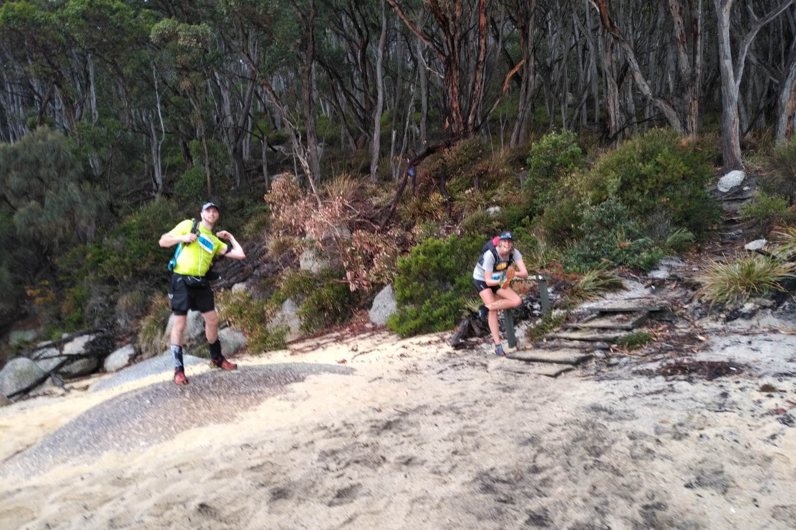
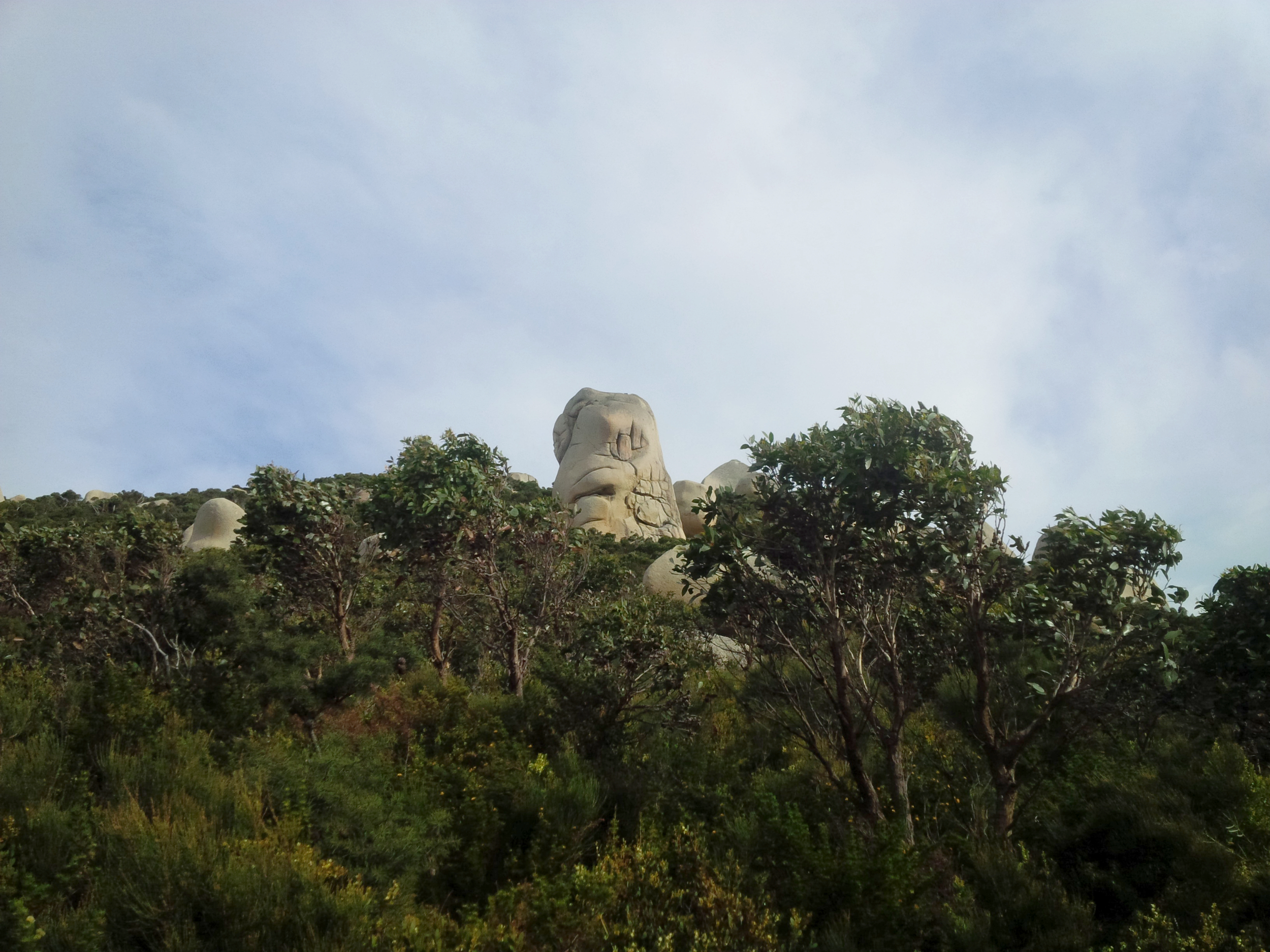
David picked me up at around 5:38, it was still dark but a pleasant Monday morning. We headed down to the Prom for his longest run to date and a recce of the 44 km course. The conversation was so engaging, that I hardly noticed the transition between night and day – the sun was already rising, fog in some places… We stopped for a photo of the boulder that looks like a goat’s head somewhere between Whisky Bay and Squeaky Beach. Told David it will be much nicer in the afternoon sun, we agreed we’ll stop on the way back, too.
On Sealers Tk
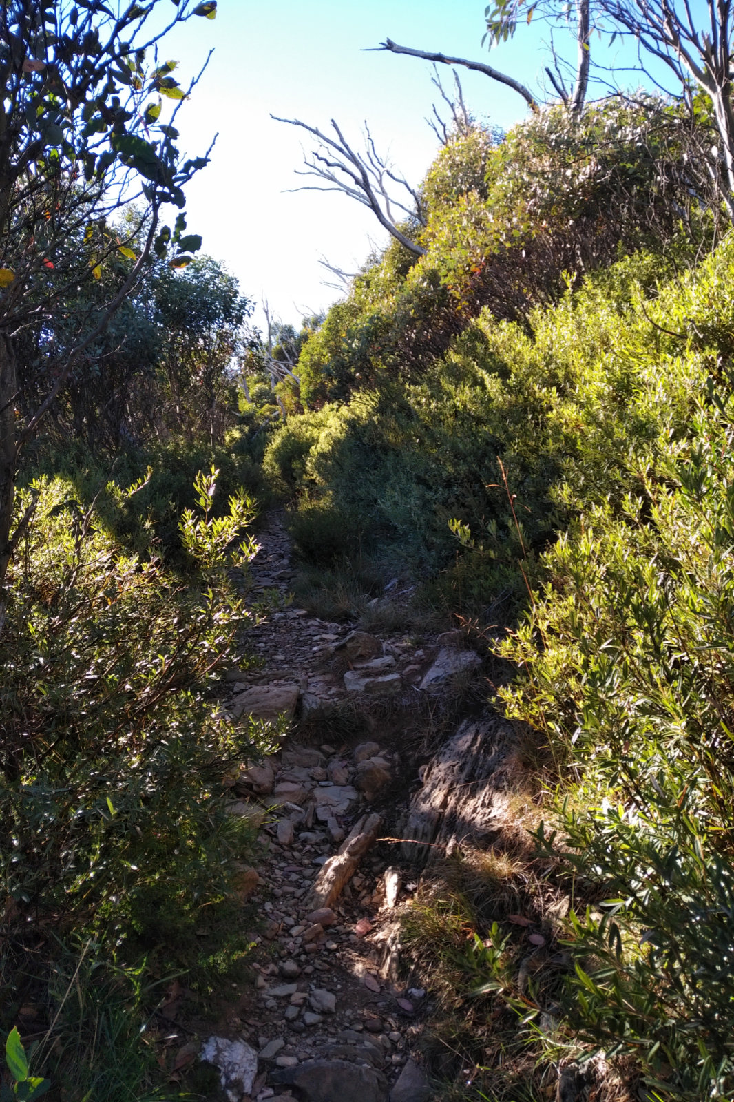
After we pulled into the Visitor Centre car park, toilet, a few bites, gear up and got started. In spite of the cloudy sky the views from the road heading up to Telegraph Saddle car park were really nice. We stopped to take a few shots, got out of the way of the passing cars and were soon up at the parking. David took a few photos at the lookout (someone has put some bushes there since I’ve been here 😃), then we headed down Sealers Tk.
We agreed on taking it easy – it takes as long as it takes. David’s reaction to the trails at the Prom was exactly how I’d imagine it to be for every trail runner who hasn’t been there before. At Windy Saddle we had a quick chat with two girls, then I told David to go ahead and enjoy this part, fly down on it if he wishes – it’s my favourite track, that’s what I would do, too. Well, he certainly didn’t have the breaks on, I could hardly keep up with him. We bumped into some hikers a few times, stopped to take a few photos in a few nice spots (like that stone that marks a corner, haha!!) and soon reached the board walk. That was again a portion that we both enjoyed. By this time it was nice and sunny and humid.
I was really excited to see (and capture) David’s face when he gets the first glimpse of Sealers Cove, so I headed ahead and took a few shots – I think I got it! We talked about what it is like when it’s high tide here and the creek can be up to waist when crossing. There were people walking closer to the water, in the quite compact sand. We took our shoes off to cross the less than knee deep water, then met Louise, a lady older than us, putting her hiking shoes on. We asked her where is she heading. She was from Fish Creek and decided to hike the Prom; she was amazed by us doing that loop in one day, then she took off saying, no doubt, we’ll catch up with her at some point.
We went through the camping ground, stopping to take a photo of a curious wallaby, then headed up the hill, chatting away and David being amazed by the beautiful, rolling trail, the everchanging vegetation and the stunning views.
This is the shot Louise took
We caught up with Louise on the boulder overlooking Sealers Cove. Asked her if she wanted a photo. First she said no, but then gave me her phone to take a shot. She asked if we wanted a photo, as well so we lined up for the picture 😊. Louise still couldn’t get over us doing all this distance in such a short time, then she asked how old we were – told her I was 50 and David said he’s 43. She looked very impressed and wished us all the best as we took off.
We soon got to Refuge Cove Nth, where there were a few boats in the water. We even wondered if one of them was picking a few persons up, then a trail runner looking guy started to walk towards us. We asked him where is he going and where is he coming from, then at the introductions found out that he is Tom, and David and Tom went to the same school… it goes to show how small this world is! Tom ran into a branch earlier and cut the skin on his head open. David looked at it and told him there is nothing we could do about it, just keep it covered. We said good bye, then headed in opposite directions.
Refuge Cove
Refuge Cove was next and boy, it didn’t disappoint! David walked onto the beach to take some pictures while I went to the toilet (it was surprisingly clean), then we headed towards the camping ground. I showed him the tap, filled our soft flasks with water then headed back to the track.
A solo hiker we’ve seen earlier with a big pack, and hiking quite fast was already setting up his tent. Pretty much everything he was wearing and carrying was green and he was very efficient. You can tell it was school holiday, there were families with children and some youngsters in most camping grounds.
On the boulder overlooking Refuge Cove
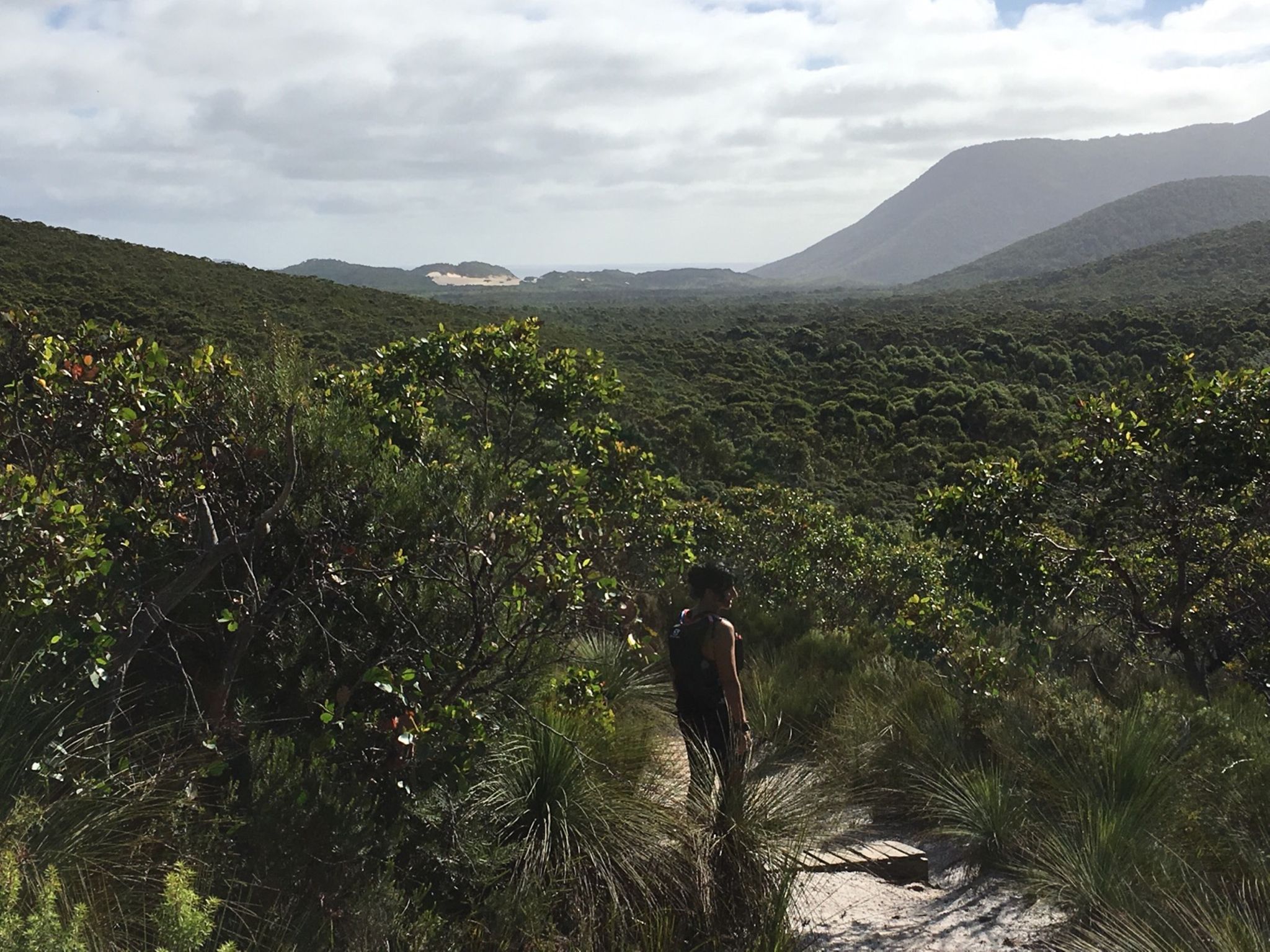
As we passed the sign that said “Kersops Peak 2.6 km” we agreed to go up to Kersops Peak for a peek. This sounded so funny. I could sense that David was itching to go a bit faster. Told him to go ahead and enjoy it, then watched him hop away with such an ease as I only saw Chris Roberts and Dan Beard go up one of the Dandenongs hills during the night run Gabor organised a while ago. It was getting warmer and I felt a bit sluggish. Took a quick spot check on my going so far: food was ok, I was also drinking the water with electrolytes, the hip was ok, didn’t hurt. Then it must be one of these: no training, sleep deprivation, the food and drinks I’ve been carrying on my bum since Easter or I didn’t totally recover from Razorback. I wasn’t looking for excuses, but wanted to know the WHY.
We ran together chatting for a little while, then told David to go ahead and have fun. We ended up doing this a few times: running together, him going ahead then waiting for me patiently. I really admire this about him. On the downhills we stepped on it and it was a lot of fun flying through the ferns and hopping over roots and rocks. I don’t think I ever ran this fast on these downhills when I was solo or even during one of the races.
Before the Kersops Peak Junction
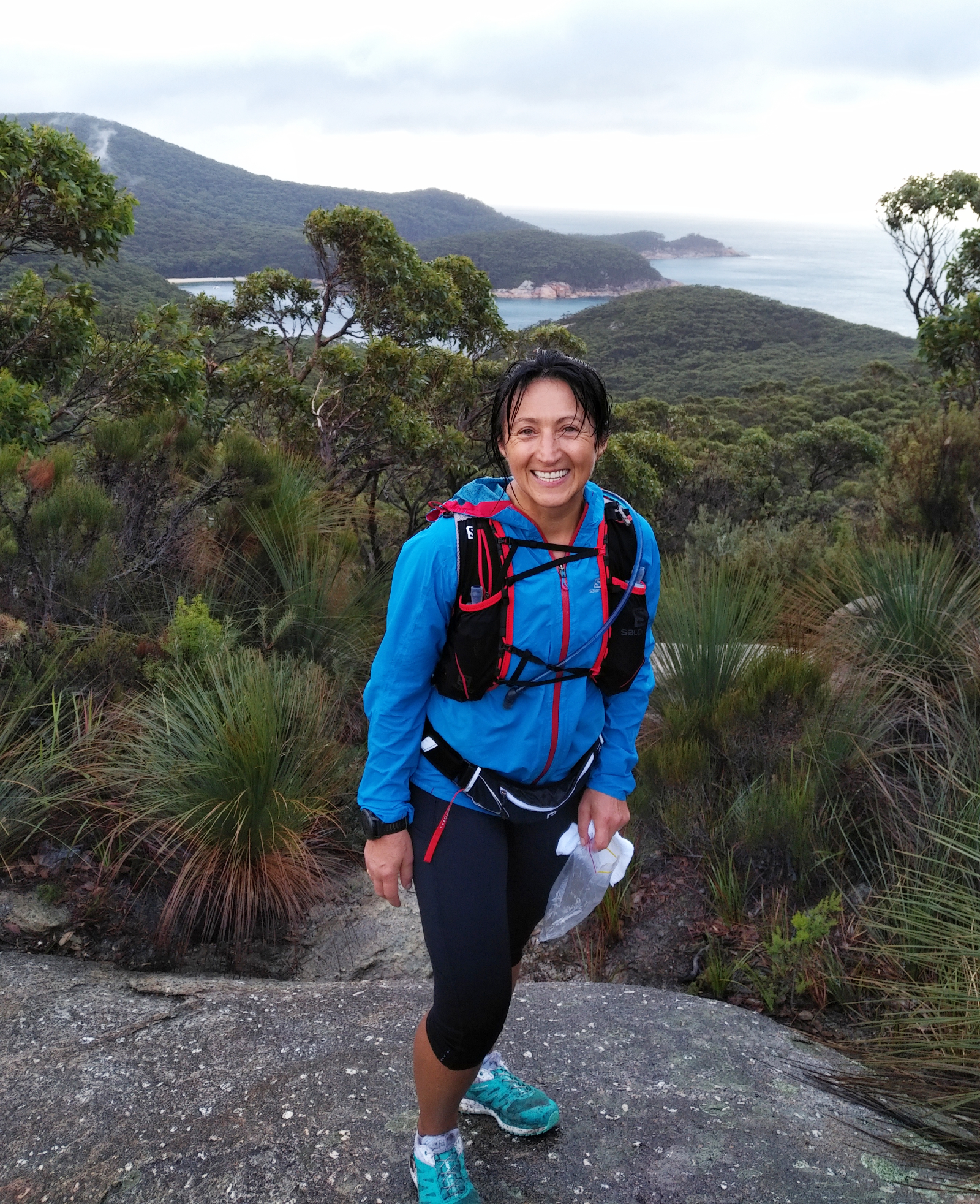
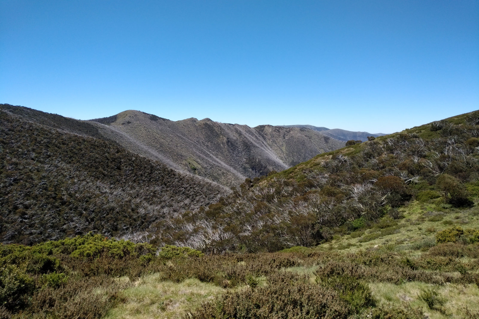
At the Kersops Peak junction we stopped and looked around amazed by the views. Took a few pictures, then headed up to the Kersops Peak summit for more. The track going up there is a tad steep and rooty and rocky with sudden switchbacks in some spots but if one stops every now and then to check the views, it’s an incredible sight.
We took a few shots on the top, pointed out the Lighthouse (seemed so far, far away), Waterloo Bay, Waterloo Bay Nth with its crystal clear water… we had a date (each), then headed down, talking about the Sunset Tk run at Lysty we both did a while ago.
The track is steep, tricky and very technical down to Waterloo Bay Nth, but before reaching the beach there is a spot where one is presented with some of the most brilliant colours nature can produce. It’s only a small patch of the turquoise water powerfully contrasting the dark greens and browns of the trees. David shot ahead on the fun-run downhill, so I was hoping he’ll notice it. And he sure did. Furthermore, as I was turning a corner, I’ve realised he is sitting off the track waiting for me with the phone ready. He managed to take one of the best shots I have on these trails, with the previous beach as background.
There was a family scattered on Waterloo Nth beach, we said hello and kept going while admiring the rusty rocks ahead, then we started climbing towards the “Decision Rock”. It’s a big boulder where hikers usually sit down for a rest and marvel at the sight of Waterloo Bay. Told the story about the time we planned to do the 68 km with Julie and the weather forecast looked less than promising, so we had to make a decision here.
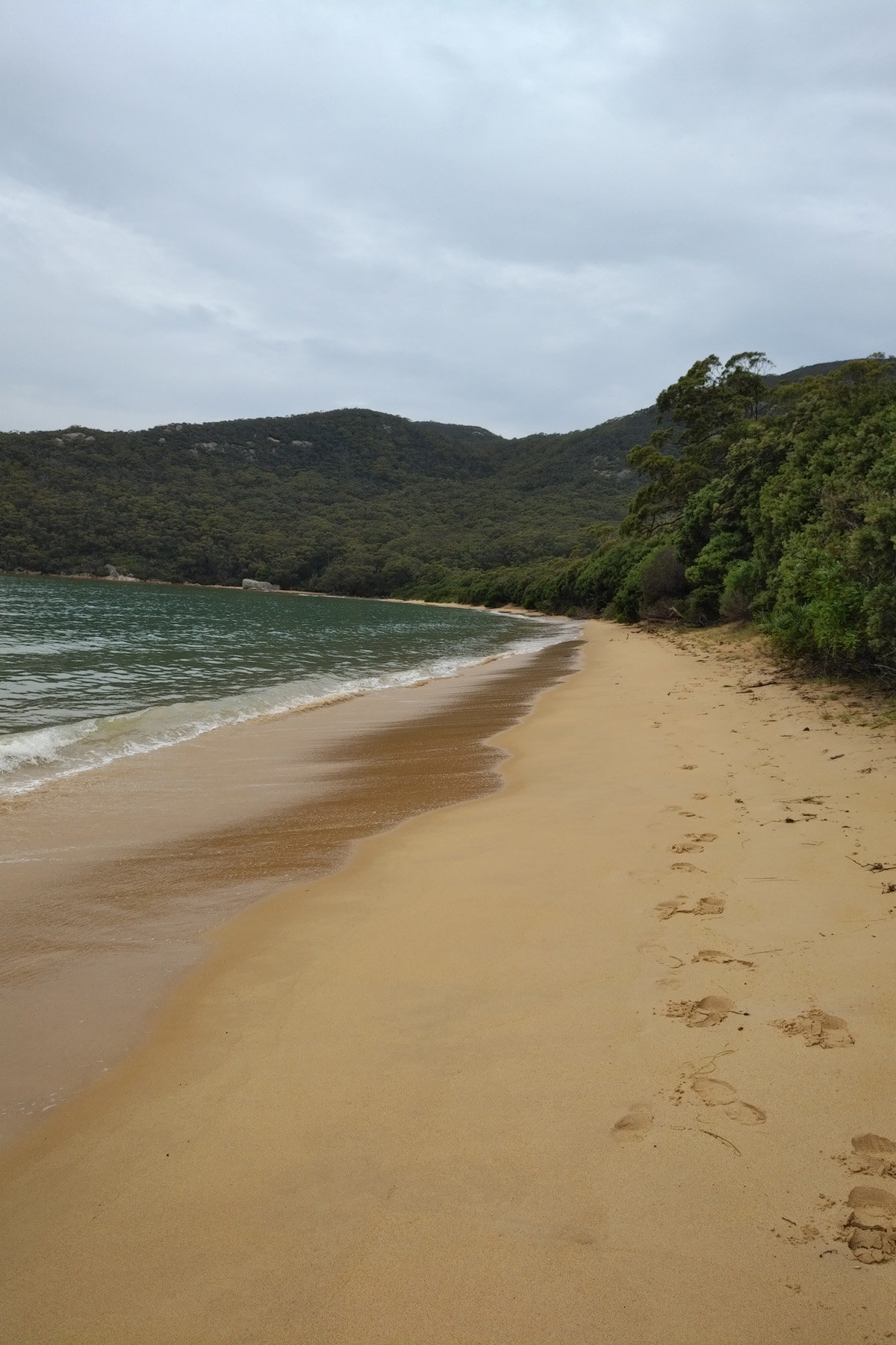
Little Waterloo Bay was next with its squeaky white sand and brownish creek. There were a few youngsters on the beach. We said hello, then kept on going towards the camp ground. I was hoping there is water flowing here. Campers were minding their business while we filled up our storages with the brownish water. I took some big gulps of water here, which proved to be a bad move. Need to slap myself every time I even THINK of doing this in the future!
As we were walking through the camp ground I told David about the times when after rain the sites are all under water – they are ponds. Literally. I also pointed out the sign that says something like “Lighthouse Tk 6.3 km”.
Mt Boulder
From here we pretty much rolled down to Waterloo Bay, hopping over the big rocks to get to the beach. That blindingly white sand and the constantly inviting water, that changes its colours with the movement of the clouds and brightness of the sun! Can’t get enough of it.
We headed towards the track, admiring the stones (that look like they were imported from Easter Island) on Mt Boulder. Striking sight against the dark green foliage. The sun was setting down on the other end of the peninsula casting some beautiful shadows.
On Telegraph Tk – overlooking Oberon Bay
David stopped to take pictures, then we ran-walked this portion (those big gulps of water must have messed up my system – again) and we soon hit Telegraph Junction. Told him about the veterans who come to support the run; they sit there, take our numbers, offer us food and water and are very nice. We walked to the turnoff, then headed West on the dreaded 4WD track.
At first it’s not that bad, but when the sand gets deeper, it’s not easy to move, so we ended up pretty much walking all this portion, pondering which 4WD would be best on this terrain. At least the company and conversation was great. At Oberon Bay the tank was completely dry, the tap turned upwards. We walked onto the beach in the deep sand and soon saw Oberon Bay at low tide.
The beach was runnable, but we walked it while I told David about the night when I did the 68 km and finished in the dark. The end of Oberon Bay was all covered with the moving water and there was such a thick mist, that I couldn’t see the beach exit.
We took our shoes off when crossing the small creek, the water was nice and cold for the feet, then sat down on a rock close to the track to put them back on. I watched how he meticulously cleaned the sole of his feet and in hindsight, I wish I did the same – ended up with a bloody blister (there is blood in it) on my left toe. There were about two tablespoons of sand in my shoes (these are the ones that apparently drain well).
We hiked, walked, ran the portion to Lt Waterloo Bay, chatting away and really looking forward to that beer. At least I was – couldn’t shut up about it.
You can tell who was thirstier
Not sure if anyone noticed this – from Telegraph Junction the signs are getting closer and closer: there is one at Oberon Bay beach entry, another one at the exit; same at Lt Oberon Bay, giving the hikers/runners a “you are getting closer” sense.
When we arrived to Lt Oberon Bay, I pointed out the small pole that signals the beach track. There used to be a sign there long time ago. The sand is soft here, we walked along the short beach which other times seems like eternity, then climbed out on the sandy track. You make a painful step upwards, then slide back a little… As always, I couldn’t wait to get out of there.
Just had to capture this
The sun was setting down and the colours were amazing as we kept walk/hike/running towards Norman Bay. I think Otto called as we were getting closer and asked how we are travelling. From Norman Bay we took the short cut to the Visitors Centre – the beer was getting closer. Once we arrived, called our spouses, then pulled out the tall glasses and opened the Nut Brown Ale. Those two glasses received a lot of attention on social media 😃
We had a shower and headed home. It was a great day and I am happy I could share the Prom with a friend who appreciates it.
Gear
The usual, from mandatory didn’t carry the long johns and overpants (had them with me, though).
Food and hydration
1 l of GU Tri-Berry Hydration Drink in the bladder
500 ml GU Hydration Drink Mix – Watermelon; re-filled at Lt Waterloo Bay
250 ml tap water; re-filled at Refuge Cove and Lt Waterloo Bay
6 rice paper rolls with red, yellow and green pepper, coriander, mint, a thin slice of steak—only had 4
Dark chocolate and ginger
Dates
Clif Blok Shots
How to get there
This is the route we took from Leongatha to Tidal River. Click the More options link on the map to enlarge it.
Carry enough food and water. After Little Waterloo Bay there is no water until maybe Oberon Bay. There is a tank there, but there is only water in it when there was enough rain.
Carry a PLB, alternatively keep someone updated about your progress. Garmin has LiveTrack, Strava has Beacon. If you have a smart watch, these can work together very well wherever there is network coverage
I knew I was undertrained for this but I had a plan: if I can manage the nutrition right, I can do it and I can do it better than two years ago. That was the plan.
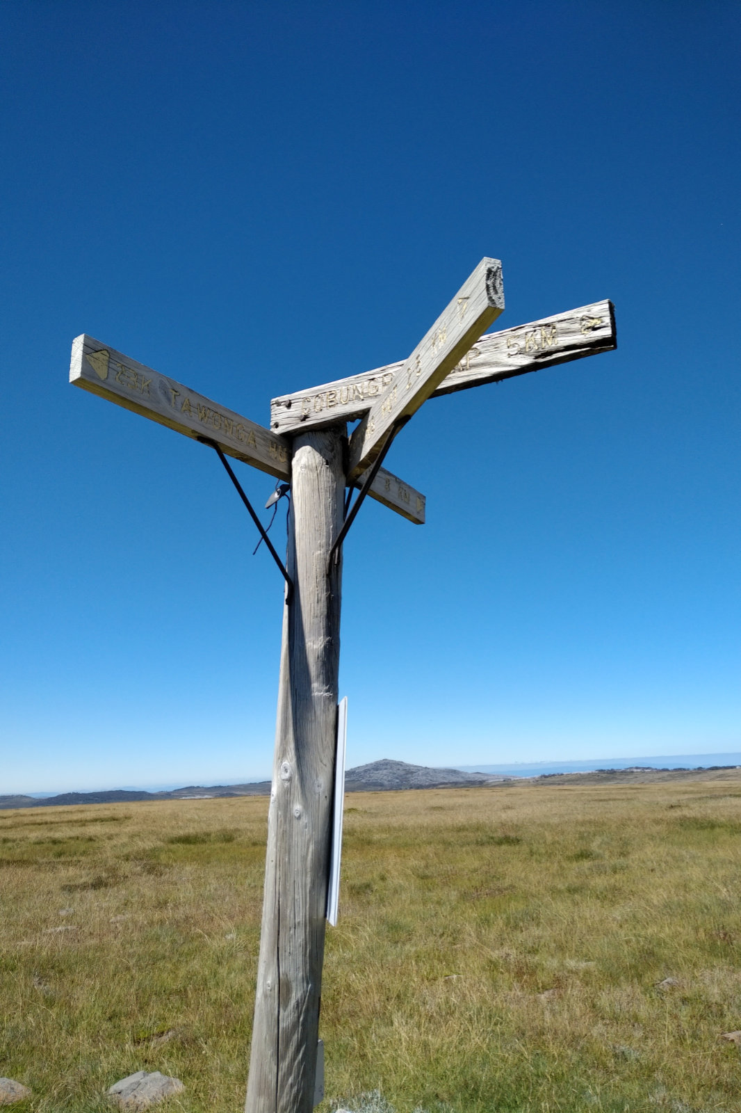
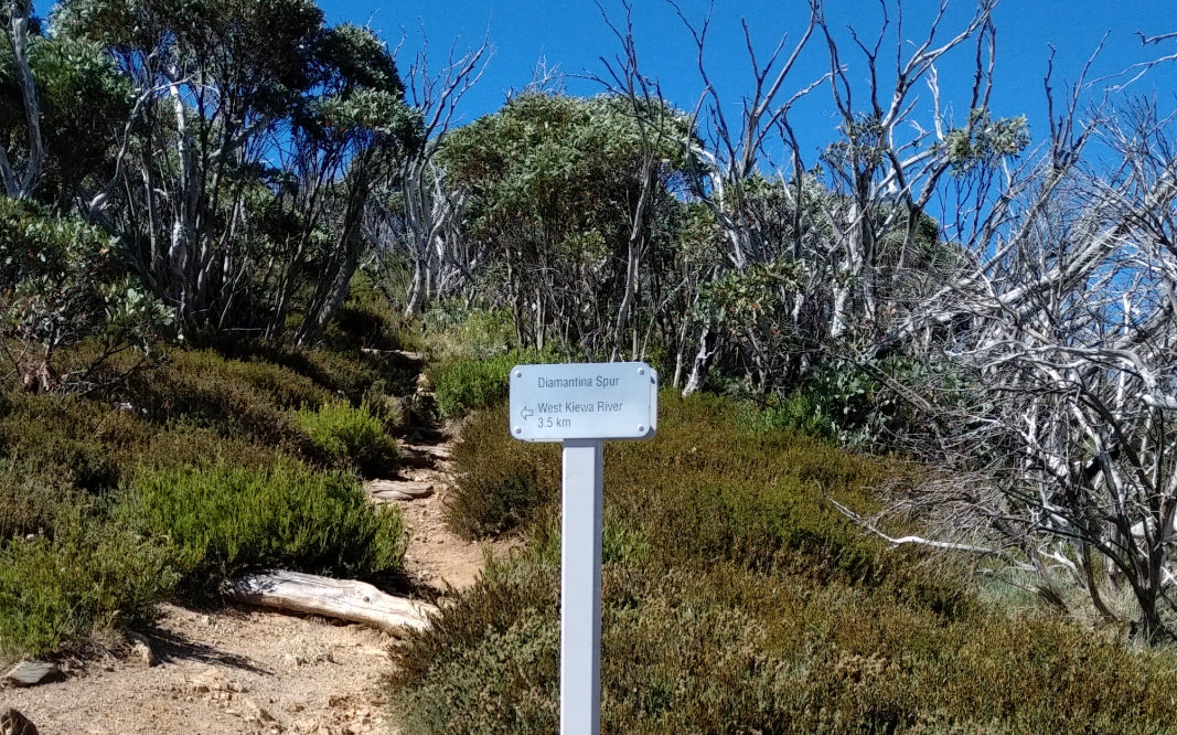
I’ve been on the course three times in the four weeks leading up to the run. First time I got to Diamantina Spur, then turned back (work), following week I got to Mt Lock car park and had to take the “short cut” down on Bon Accord, because I bonked going up on Swindlers (same hot day as this). Third time I just wanted to close the loop: went to Mt Loch car park along the Razorback ridge and did the remaining 24 km in ideal conditions. This is when I tested the nutrition and it worked great – true, there was no Swindlers in the equation.
I picked up Otto at the airport and drove up to Harrietville, stopping in Bright for pizza. I’ve made a shitload of pasta and pesto, thinking we’ll have a big pasta night. Ani and Nelu (my sister and brother-in-law) left quite late and got stuck in the Melbourne Friday traffic…
We booked Feathertop Retreat as our base for this weekend. From outside it looks like a small country house but it’s quite big inside, it can sleep 8-10 people. We really loved the place, it has a rustic, down to earth feel.
Once Otto and I have carried all the stuff into the house, I started getting ready for the day, making the rice paper rolls and making sure everything I don’t need to take to gear check is also in sight. At 7.15 Otto took me down to the Harrietville Hotel Motel – this is where the registration, gear check and briefing happened. He didn’t get out of the car, because he was wearing the Parkroyal slippers, which looked rather funny on his feet. I always wondered why these kind of slippers never look like a pair…
Julie [Savage] and Paul were at the registration table; I got my bib (6441 this year), we had a chat, then I looked for Chris Spano – I’ve brought him a few pieces of mandatory gear that he was missing. Ended up giving the overpants to Mark [Boulet]. It was great to see Duncan from ASAR – he was doing the gear checks. Other runners were sitting around, waiting for the briefing, too. I was convinced it starts at 7.30, but Paul said it’s at 8.30, so I walked back to the house and continued with the preparation. At 8.25 Otto took me down to the HQ again. Paul – in his usual easygoing style – delivered the briefing; snake bandage, good weather – bad weather, course change in case the thunderstorm hits. I liked the idea of not having to carry the thermals and the long johns on a hot day to make room for more water in the pack and that there was a possibility to take the Bon Accord option if one was not feeling fit to go all along the ridge, then down Bungalow Spur.
After the briefing, I had a short chat with Coral and her husband, then Jacqui and Darren when Gabor and Dan came over. They were supposed to stay in the cottage I’ve booked first (when I didn’t know my sis is coming too) and got stuck with (thanks heaps Stayz!). Dan decided to stay with two other friends, so I went with Gabor to the cottage to make sure he finds it and all is kosher with the owners. It was pitch dark as we were driving down to Shady Brook – same as last year, although back then I walked there. We checked Gabor in, then he drove me back to Feathertop Retreat. Otto was really happy to see him, even if it was very briefly – we all needed to get going.
Ani and Nelu arrived after 10, both exhausted. We were already showered, packed for next day and Otto has boiled some pasta for Nelu. These two had some palinka (strong liquor made of prunes) and were in a great mood. Ani was trying to send us all to bed, looking at me and telling me they won’t stop if we don’t drag them. It was funny, but I like it when people around me are happy so I wasn’t much worried about being tired.
This house is really well partitioned: I suggested Ani and Nelu to stay in the master bedroom (with the ensuite ), because it’s behind two doors, so I can have a shower, make my coffee and toast without waking up anyone (except Otto, of course). Alarm went off at 4.15. I like to take my time and not rush. Woke Otto up an hour later, and we walked out at 5.30. It was pitch dark where the street lights didn’t reach. Saw the head torches walking up the street. The bakery was open and empty.
So nice to see familiar faces at the start line… big hug to Tash, Gabor, hello to Jacqui, Coral, Chris Roberts. We usually take a selfie with Gabor before start, have no idea why we didn’t do it now. Otto is always nervous – for me. Told him so many times not to be, nothing will go wrong and I’ll be fine, but he can’t help himself. Then Dan appeared at the back. I introduced him to Otto. Countdown, then start. The mass of shoes started moving with the lights. Someone made some noise with a cowbell, I wonder what the people living in the house close by were thinking… but I loved it.
Otto ran next to me until we were in the front of the house, then he wished me luck, gave me a kiss and headed right. It’s always nice seeing the line of headlights going up Bungalow Spur. I wanted to keep a steady pace on this section. I’ve spent most of the uphill with Erin [Nightingale], who did Mt Bogong Conquestathon the week before and now should be recovering… Erin is a lovely lady and I hope our paths will cross again in the near future. We passed each other with Luke a few times, his hike is very strong. I’ve met Saravana – a runner from India, who came to Australia for a two week visit and decided to sign up for Razorback 64 km. I wondered what made him do this? I caught up with Luke at Federation Hut, he was repacking. We took a selfie, then I got going.
I usually put my Bonatti on at Federation Hut, but now I thought it’s not that bad, I can keep going… I must have been around the MUMC turnoff when I realised I really need to put the jacket on, it’s getting very cold. Took my pack off and put the jacket on while trying to put the pack back… everything was hanging everywhere! This is so not like me! So I stopped, fixed the jacket, the pack and started going up the stairs when I realised I don’t have my Salomon belt! I must have dropped it when I put the jacket on… there were all the gels, Clif Shot bloks and some lollies in it – the stuff that I can have in between real food.
I looked back, it was a bit steep to go back for that, so I decided to pick it up on the way down. I saw Clare [Weatherly] and mentioned to her that I’ve lost my belt and asked her to leave it there, will pick it up on the way back. It was blinding going against the sunrise, but the fresh air and the thought of a great day has made me feel alive and ready for the adventure.
Many runners were already heading down (fast ones must have been halfway down Diamantina by now), carefully hopping over those rocks. I saw Jacqui, she gave me a hug and told me “Well done kiddo!!” – that’s so sweet!! Really cheered me up, especially since I am a few years older than her. Tash was coming, too and gave me a hug and lovely, encouraging words. Then I saw Vanessa! Haven’t spoken to her for a very long time, so a hug and a little chat followed. Wished each other all the best and went the opposite ways. When I got to the top, Ian was clicking away, a few other people taking pictures and repacking. Told Ian we need to take a selfie – so we took a few with my phone and I posted one to fb. Ian took some stunning shots of the runners arriving to Mt Feathertop, love his work.
On the way down I saw Erin and Luke – took a photo of them, then came the first 22 km runner. Congratulated him. What surprised me was, that he was nice, thanked me and said “well done” or something along those lines. The second 22 km runner was nice, too. Then Julie was coming, which meant there were no more runners in the 40- or 64 field. Asked her if she’s seen my belt by any chance, she said she didn’t, so I started to worry a bit… maybe the wind picked it up and it will end up in the valley???!! I was looking hard for that belt, risking a fall at every step, but I couldn’t find it. I also looked at branches, maybe someone picked it up and put it on a branch… when I got to The Cross and didn’t see the belt hanging off that tree branch, I knew I’m not going to find it, so I recalculated my food plan and made a conscious decision not to let this get to me. I will work with what I have. Shit happens all the time, just need to be positive. Called Otto to let him know and asked him to make a couple more rice paper rolls and bring it to Diamantina Hut.
This year I decided not to get out of every 22 km runner’s way as I did in the previous years. It worked!!! I did go sideway or they stopped and let me pass, which I really appreciated. Saw Sasha [Taplin] speeding. Her face lit up and stopped for a hug and a few nice words, which was great. James [Brennan] was not far behind her – got another hug and good wishes!! How lucky I am today?! Saw the guy with the two kids, then another two young girls and I was amazed by them. Praised them, as I admire these little humans going for such a run.
As I was getting closer to the Diamantina turnoff, I saw a runner coming back from the Razorback and turning onto it… must have missed the turn… that sucks! I held off taking off the Bonatti until I turned onto Diamantina to avoid holding up anyone on the Razorback track. Steve [Lewis] was approaching as I was getting going. I asked him if this was his first Razorback. He said he did it a few years ago and he got lost on Diamantina Spur. Told him I’ve been here twice in the last few months, there is no way we’ll get lost. So we stuck together and chatted all the way down the spur, constantly watching out for snakes.
We reached the bottom in no time. There was another runner at the creek, filling up her flasks. I went on the right side, after the bridge to refill whatever I could and I also had a few gulps of the fresh, cold water. Steve kept going and he was out of sight by the time I looked around after I packed my flasks away. I took a quick inventory of my food stash… I’ve already had two rice paper rolls, some chocolate and a date. Should have one more roll two pieces of banana, one mandarine, two more dates, ginger and chocolate. I forgot about the extra roll and mandarine I packed for just in case. I decided to have a piece of banana. Turned left at the sign, then again. Then I reached the Blair Hut sign, turned left again…
Didn’t bother taking photos of the hut now, just went past, hopped over the creek, then turned around to wet my triangle bandage, when I noticed a dead fish just 20 cm from where I was standing. Glad I didn’t leave refilling the flasks to this crossing! It started to get warm… and then came Westons Spur – there should be a sign there. At this point I was about 5 minutes behind the schedule. As I was going up on Westons I heard some noises from behind. As I looked back, saw Steve a few steps behind me. Asked him what happened. He said he missed the turn and had to come back. He hiked so fast, I didn’t even try to keep up with him.
The track got narrower and the wild raspberries appeared along it, with blackberries here and there. I had some of both, they were so sweet. Julie likes these, too. I welcomed the shade, thinking there will be nearly nada on Swindlers. Had a sip of the beer I brought with me – it did give me an umpf. I remembered the time when I climbed this with Tay, the damn hut seemed so far away! Now it just popped up. Didn’t bother with the spring further up, still had plenty of water. I started to feel the effects of not eating… not good! The bushes scratched my arms again, couldn’t wait to get out of that area.
Once on the high plains I tried to shuffle as much as possible, thinking I’ll have to get some jelly snakes at Pole 333… when I looked up, I could see some movement there. As I was getting closer, there was a lady whose top was the same colour as Julie’s and that confused me so much!!! I couldn’t fathom how she could’ve gotten there without passing me somewhere. I didn’t leave the course… until I realised it was someone else. The lady took a photo of Jordan (the lovely checkpoint minder) and me, then she and her mates picked up their pack and took off towards Cope Hut, wishing us all the best.
I saw Tailwind powder there and asked Jordan if I could have some. He said of course, it’s his personal stash, but he brought it for us. So thoughtful!!! Told him what happened with my belt, so he tried to pour some Tailwind into my flask, with most of if flying everywhere (it was very windy up there). I took a few snakes, too and gave Jordan the rubbish I had on me (picked some up on the trail). He wished me good luck and I took off, trying to shuffle as much as possible on the flat. I had a snake… tossed it in my mouth for some long minutes. Then I tried to call Otto, to let him know how I was going. Call went straight to his message bank, so they must be somewhere in the valley, around Washington Creek… later on I managed to talk to him. Tailwind doesn’t sit well with me, I could hardly swallow the little sips I was taking.
Saw a group of hikers coming up from Cobungra. Had a little chat with them, then told I don’t envy them for the pack they are carrying and kept going. I’ve never seen this many people at Cobungra Gap and around Dibbins Hut!! I’ve filled my flasks, added cold creek water to the ~50 ml of warm beer I had in the bottle and put it in the water to cool more while I soaked my triangle bandage, washed my head, neck, face and arms. Got dizzy as I suddenly stood up from squatting next to the water. Headed up the dreaded Swindlers… it was already nice and warm, around 1.45. On the way up I thought – since no one is coming – I could just listen to some upbeat music. So Whitney Houston and the Mas Que Nada (the latter about 5 times).
As I was getting closer to Derricks Hut, I tried to call Otto, but got to his message bank again. They must be driving up and no signal, so I called Paul. Let him know about my whereabouts and told him about the belt, just in case someone has brought it back to him. He told me he’ll look out for it, then called me back saying that yes, it was handed in, I can have it at Diamantina Hut. That was a relief!! By this time I couldn’t eat, the sips of the watered down beer didn’t feel good. Had two pieces of ginger at Derricks Hut for some calories… then Otto called and asked if I wanted them to come to Loch car park. I said yes, and bring some beer, too.
Had no idea where I got the energy from, as I was running on empty for a while – even water made me gag – I shuffled down and then hiked up when I saw the troops heading my way. They were all cheerful, taking pictures… sis with a bunch of yellow flowers… told her that we may get into trouble for this, they might be protected. Ooooops!!! Asked Otto where is the beer? He said they didn’t bring it down, it’s in the car, but headed straight up for it. Love this guy!!! When I was nearly at the car park, Otto got there and opened a Nut Brow Ale for me. I had a few sips of the cold beer, then hunched a little until it absorbed and I was able to continue. Nelu said he’ll come with me up to Mt Hotham – he’s never been that way, so we headed up, along the pole lines and pink signs.
As we were getting closer to the summit, I recognised the old emergency guy I’ve met two weeks ago. He was studying the area with binoculars. Said hello and he remembered me. Nelu and I took a few photos at the cairn, then headed down to the Diamantina check point. Otto and Paul was making noises to cheer us coming. It was great to see Duncan here and the other gentleman, who offered to fill up my flasks with water. I had plenty of water with me, so I just asked if I could have water melon. Must have had at least 10 pieces! I bet my body absorbed the juice and the sugar like a sponge! Then I rearranged my pack – stuffed the extra food Otto brought (realised I still had another roll and a mandarine), swapped the Red Lenser 5 I used in the morning for the Ay Ups (they’ll be much better going down Bungalow Spur in the dark).
I decided not to change shoes, but continue in the ones I started with – Otto was a bit disappointed, he carried all this stuff for nothing… I had another sip of beer (beer after watermelon you ask?! There is a joke about this!) then I took off onto the Razorback Track along the ridge. It was still warm, but the wind made it reasonable. Saw some hikers, they were treading carefully on the rocks, looking at me strangely. When I bumped into a couple – that was more interesting! Guy asked me how long I have been running today and how long I’ve got to go. When I told him, he signalled that I was crazy, he would never do that. We had a lovely chat anyway. Then for kilometres, I haven’t seen anyone. The Sun was heading down, producing some amazing lighting. I took a selfie and posted it on Facebook. Looking at it later, it clearly shows that I was quite tired by then.
My plan to have food from Diamantina Hut to the finish quickly evaporated when I tried to have one of the rice paper rolls. I just turned it around in my mouth and could hardly swallow it. I tried a sip of beer… that didn’t feel great, either – and THAT wasn’t a good sign!! Every time I was going up, I felt no energy. The downhills were a bit more manageable, but up… really hard, even with the poles. I had the mandarine, last bite nearly came back up. I looked ahead and saw Mt Feathertop – still nearly that far to go! I kept looking for the Champion Spur turnoff, but couldn’t see it. At least I wasn’t sure – saw a track looking something around 47 km, making a mental note – will check it out when I get home. There were a few drops of rain, which was great. I would’ve loved it if it rained.
Saw a rabbit as I was getting closer to the Twin Knobs. Then the Diamantina Spur turnoff!!! Yayy! From here is pretty much downhill. I felt nauseous and even water was making me gag. Called Otto to let him know I was nearly at Federation Hut. There were two guys coming from Mt Feathertop, turning towards the hut, not even bothering to say hello. I stopped to have a sip of beer, hoping it will give me a little energy, but it didn’t feel good. At Federation Hut there were many people in tents, setting up their tents. I saw/heard something very uplifting as I got closer – a family of three (mum, dad and little girl) in a small tent. Parents obviously tickling the kid, she was giggling and so cute. I waved hello to them as I passed.
Further down I bumped into a group of teenage boys, carrying water in plastic bottles and a pan. They must have been to the spring. They said hello and looked at me with respect – I really liked that. Then I mad a huge mistake: I had a sip of water and even though I only swirled it in my mouth and spit it out, I realized vomiting is next. Had to stop and everything I still had in me (hardly anything) – left. Funnily, I instantly felt better. I could even run!! So I stepped on it. When it started to get dark, I took the lamp out and put it on so it’s ready when I need it. Everything went well until I tripped in a root that was sticking out. Fell onto my right knee. The most hurting part was my right hand, as I pretty much landed with most of my weight on it. I had the poles in that hand, so it was a very weird feeling.
Dropped an F bomb or more, cleaned myself up with hand sanitiser and the water I had in one of my soft flasks, then kept going looking harder. I couldn’t wait to get to Tobias Gap… Picture point came so slow… then Otto called, asking how far I was. Told him a couple of kms from the finish line… he said they are here, heading up the track. I could see lights, but those looked more like bugs than head torches. They were bugs, by the way. Could hear music from the road, must be close! Then I tripped again! I didn’t fall this time, but hit my little left toes hard. More F bombs!
Then I could hear Otto calling my name. These guys were so happy, and so was I. I asked Otto if he had any cold water, whatever I was carrying was piss warm. I had a few gulps, then started running. Have no idea where I got the energy from, but pretty much after I threw up, I could just run. Remembered what Dan said – “just roll down”. I was in front, then Otto and then Nelu. Were have crossed the little bridge, then were nearly at the end of the track, when Nelu stopped. He rolled his ankle again! Felt so bad for him, because every time he runs with me, this happens. He was so supportive – he kept telling me how well I was going, especially now, towards the finish.
When I had that water earlier, Otto asked if I wanted beer. I told him I only crave water – mineral water. He called Ani, my sister and asked her to put a bottle of beer (Golden Ale for Julie at the finish) and a bottle of mineral water in front of the house, we’ll pick it up as we pass. Otto picked up the bottles (I had a big gulp, it felt so good!!) and ran with them in his hands, Nelu caught up with us and now all three of us running on the road. I didn’t look down, so I couldn’t see that Nelu is limping a little… but he ran with me to the finish line. As we were getting closer to the turnoff and the pub, people started cheering. I was running as fast as I could, but suddenly the water I had earlier came up, I was back to the throwing up phase again. What a way to finish!!! I feel so sorry for the people who had to see this!
Once I was able to move, I ran into the finishing chute – 15.01.47. There was no one there so Otto wrote the time on the sheet and we tried to figure out if we are supposed to switch the light off, or not. I knew there were more runners in the 64 km distance, but I haven’t seen anyone on the Razorback, so I thought they might have gone down Bon Accord Spur and there was no point sending Julie all the way along the Razorback and down Bungalow Spur for me. The other runners needed the help of her more then I did.
Paul came and told me well done, then Jacqui and Darren. I was please to learn Jacqui scored the third place. It was a strong field. We left the beer on the little table for Julie and headed towards the house. Otto has prepared the BBQ, Ani made the potatoes and the salad… it was raining. I kept peeking out, looking out for Julie and the other runners (Paul told us they went on to finish the 64 km), hoping I can cheer them. Had a shower, a few bites of beef, salad and kartoffel and a few sips of beer (couldn’t even finish a glass), then headed to bed. There was some party close by and noise pretty much all night. Had hardly any sleep.
Next morning we cleaned up the place and headed home. Huge winds and dust storm on the way.
All up, it was a good experience. Not necessarily “feel good” experience, but and experience I have learned a lot from. And being able to do a thing like this is something I don’t take for granted. One thing I’ve realised is that – at least the pace I was travelling at – one can’t do this without support. I tried it before and failed miserably. But maybe if I tweak the nutrition a little??!!…
Gear
Lululemon crop, top, socks
Bonatti jacket and Rainbird overpants
Red Lenser 5 in the morning and Ay Up at night
Salomon S-lab 12 l vest
Food
4 rice paper rolls with beef, smoked cheese, lettuce, mint, coriander, red paprika and hommus
2 small mandarines
1 small banana cut in two
A few Clif Shot Bloks – before I lost the belt
A few pieces of uncrystallised ginger
A couple of pieces of dark chocolate
2 dates
Wild raspberries and blackberries
1.5 jelly snake
About 10 pieces of watermelon – at the checkpoint
About half a scoop of Tailwind naked – between Pole 333 and top of Swindlers
For those of you who don’t like or have patience for my long reports, here is the ‘trailer’ version:
Started around 6.30 in Harrietville on minimal sleep
Went up Mt Feathertop, did a 360° video and posted on fb
Ran down to the creek towards the MUMMC Hut (not much water, don’t count on it)
Diamantina Spur was a bit overgrown, but otherwise ok
Turned left at the Blairs Hut sign in the Kiewa Valley—that is the right way to go
There is no Westons Spur sign once passed the toilet, just turn left
Westons is so overgrown in places – not fun, lots of scratches on my legs and arms
The creek after Westons is hard to reach and hardly pissing
Was able to actually shuffle along more poles on the High Plains—thanks again Dan Beard
This is where I stuffed up my nutrition—didn’t eat in time
Going down towards Cobungra Gap hurt (dunno why)
Forced a gel down at Cobungra, nearly came back—this is where I knew things are definitely not going to plan
Went up Swindlers in full sun (again), had to stop occasionally—my heart seemed to pop out of my chest and my head was about to explode
Started to dream about that beer…
From Derricks Hut I could not shuffle, but fast walk
Didn’t go up to Mt Hotham summit, but took the road, stopping two cars and asking if they had anything fizzy with them – 3 cars didn’t stop, 2 cars stopped but didn’t have anything fizzy only warm water
Decided to cut it short and go down Bon Accord Spur – bloody sign says 12 km, giving people a very false hope
Sun was setting down as I headed down the spur, ended on my bum once and tripped many others
Lost phone reception
Bon Accord is overgrown in places, lots of trees and branches fallen down and across the track
Wild flowers on Mt Feathertop
Pulled my headtorch out when it started to get dark, had to change the batteries (Led Lenser) after a few steps—glad I did that while I could still see
Got startled by a deer
Arrived to Washington Ck at 7.18, it was pitch dark
Couldn’t find the track on the other side, the place is so overgrown with bushes and blackberry
Went bushbashing, got scratched all over my arms and legs and lost my phone
Decided to spend the night near the creek, but was worried about Otto being worried, so after about half an hour of arguing with myself, I decided to activate the PLB, this way Otto at least knows where I am
Tried to spot the flashing light of my phone in the dark, unsuccessfully
Waited for the rescue to arrive, while trying to get some sleep on the rocks
First time I heard the chopper – 0:21
Chopper flew away, then back then away again a few times
Lit my head torch every time it was above
Second attempt to approach the scene, I was blown away by the winds, then saw someone descending on a rope…
Jimmy (the police officer) put the harness on me, clipped us together and got winched while a possum walked by casually
The chopper took me to Wangaratta airfield
Got handed over to Wangaratta Police and taken to the station
Called Otto who already knew most of it, because he was in contact with the police—PLB is a great thing!!
Cameron from Wangaratta Police helped me find accommodation and made sure I got there safely
At this point I didn’t have anything to eat or drink. Once in the room, I had a beer
Otto and Suzie arrived in the afternoon. Otto flew back from Sydney in the morning, Suzie picked him up at the airport and they drove straight to Wangaratta
Stopped for lunch and beer in Bright
Went to pick the car up in Harrietville, didn’t go to search for the phone (“fuck the phone!” is what Otto said)
Drove home
Out of the mandatory safety gear list there were two pieces I didn’t have on me during the run: the thermal long johns and the beanie/hat. Out of the gear I carried with me I’ve used every single piece except the safety matches.
Now here comes the full version. Grab some wine, beer or whatever you fancy – it’s a very long story.
As I said it in the “trailer”, I started this thing on minimal sleep. Did that not only for practical reasons, but also to get accustomed to push on tired at the Alpine Challenge miler in November. Started my watch at 6.40 as I left the car park in Harrietville. Signed into the book, checking who else is out there (thanks Tay for telling me this). I’ve noticed a bunch of 6 people signed in, going to “Bogon” – I was wondering… did they have a look at the map, at all?! In spite of the 10ish°C I didn’t need the gloves and took the Bonatti off before I started the climb.
Bungalow Spur
While going up Bungalow Spur, I was thinking about how lucky I am to be able to do this. Get out during the week and just simply go for it. I was experimenting with food I haven’t had on a run before, like using rice wrap instead of bread and trialling the pre-packaged baby food; not packing chocolate and ginger this time. As usual, the climb seemed like it was going on forever, Otto called and said “I knew you were going to do this!! If I could win Tattslotto this sure!…anyway, just take care of yourself.” I promised I will and went on. Saw a parasailer, a red one appearing from behind the mountain. It was so sudden, I didn’t get the chance to take a shot.
I reached Federation Hut eventually. I could hear voices as I was getting closer, then saw two boys, walking to the water tank with bottles. I said hi, they reluctantly said hi back (what’s wrong with today’s youth??!! Absolutely no manners for some). I took my pack off at the hut and put on the Bonatti, it’s always windy up at Mt Feathertop. Took a few pics, then carried on tossing the idea of going down to the creek towards the MUMMC Hut. If I don’t go down today, I probably won’t get another chance for a very long time. I wanted to check it out, just in case I’ll ever needed water from there. I postponed the decision for the way back from the summit. It was a stunning day, wind wasn’t that bad going up.
On Mt Feathertop
Ani, my sister called as I was nearing the summit. Wanted to know how the weekend was… we had a chat, and by the time we hung up, I was up on the top. Took that 360° video, posted it on fb, then headed down. The views were amazing. I saw some clouds further and imagined going through them – how cool (literally) that would be?! I decided to go down to the creek, nearly finished a soft flask of water, would be nice to have a great tasting refill. As I was approaching the spring, hopped over some mud and finally saw the little trickle. Climbed up and filled the flask, had some of it, then refilled. It tasted great, indeed, but I think I won’t make this detour again.
As I was heading out of the muddy part, I lost my balance and stepped straight into ankle deep black mud which was hidden under the bright green grass. I swore a little, then headed up, when Otto called asking what happened, why am I off the track? Did you get lost? Told him what was happening – he didn’t like the idea but was relieved all is good. When I got to the The Cross, I decided to change the socks, it’s a long way to go and I didn’t want blisters. Taking off the Bonatti at this point was too early, wind was still chilly.
On the Razorback, I bumped into a couple, they were heading up to Mt Feathertop, then back along the ridge. We wished each other a great day and kept going. Looking back towards Mt Feathertop from Diamantina Spur was a beautiful sight – I did that a few times while I could see it. Took the Bonatti off, it started to get quite warm. I ran this ridge as much as I could, the bushes scratching my legs along the way. On one of the tops, I saw a bunch of guys – asked them where they are heading. They said “to Bogong Village” – aaaahhhh… the “Bogon bunch”!!!! – should’ve counted them, there should be 6. Told them about the Razorback Run in March, but they said they’ll be in NSW in a camp then. Wished each other a great day and I took off.
Diamantina Spur – one of the three drops
At the rock scrambling parts I took photos for George [Alexandropoulos] so he knows which are the “scary” parts of the Alpine Challenge miler. The poles here are a pain in the butt. Threw them down, then followed holding onto the rocks. When I was there last time with Tay, it seemed much easier – I was probably extra careful now because I was on my own. It was a warm day, I was really looking at the track – didn’t want to step on a snake or something… that was happening a lot today. Getting down to Kiewa Valley seemed much faster this time.
I filled the soft flask in the cold running water, then soaked the triangle bandage and cooled off my face, neck, arms. Felt good. I was hoping I find that turnoff, so I won’t need to go around as we did with Tay in December. Saw the “Blairs Hut” sign, pointing to the left in front of the trunk of a big tree. Since there were lots of pieces of big trees around, I guess the course description is somewhat confusing. Turned left at the sign and immediately recognised the track, then passed the hut after I took a few photos. Remembered the very first time I’ve been here – this is where I have met Helen [MacDonald].
Passed the toilet on the left, then turned left onto Westons Spur. There is no sign that says Westons Spur at this point. I turned left and up and started the climb. Had the plan to try something new – play some up beat music when it gets tough, so soon I had Mas Que Nada (Black Eyed Peas) coming from my right thigh pocket as I was pushing up Westons, looking out for snakes and glimpsing to the left every now and then – Mt Feathertop was still a stunning sight. I discovered some bright red berries. They were sweet and really nice, so every time I saw them, I had some. When (and if) I get my phone back I’ll post the pics.
A rare view from Westons
Just as I was thinking that Westons Hut is never going to come, there I was. Quick glimpse at the sign, didn’t even bother checking out the hut now, I was looking forward to some nice cold water from the spring further up. Saw the black and blue pipe, hopped over the mud… and the spring was hardly pissing. Worked hard to get a flask full of water, had some of it, then re-filled and got going. The ants were active again didn’t want to have anything to do with them. What followed after this was even more painful than the climb itself – scratchy bushes covering the track up to my forehead in places. The sweaty skin on my arms has suffered the most.
I could hear a chopper in the Bogong Village direction and thought if someone would ask me if I wanted a lift in a helicopter, I’d say “not necessarily, but since I’ve never flew in a chopper, I’d give it a go”….
Glorious Pole 333
It was hot with a light breeze on the high plains. I was looking forward to see some brumbies – they’ve left their mark on the track… should be somewhere… the view was amazing from there. I managed to shuffle some more here, nearly to Pole 333. The flies appeared, but they weren’t half as bad as when we were there with Tay. At Pole 333 I stopped, took a few shots, then turned right towards Cobungra Gap, keeping up the shuffle. Otto called, told him I was going well. I concentrated so much on keeping up the shuffle, that I put off eating until I reach the top and start descending. I think this was a big mistake. I did have something on the way down but probably missed the timing. I was still vary of snakes… treading carefully especially in the grassy parts. Saw the mountain ahead, the one I’ll need to go up next. Wasn’t looking forward to that.
At Cobungra Gap I saw a couple, they were probably setting up their tent on one of those elevated camp sites.
Cobungra Gap
Said hello, then turned right straight away as we did last time with Dan. I usually go around… dunno why. At the point where we met Douglas (the B2H checkpoint minder) I stopped to have a gel. First sip went down great, but after the next one I gagged. Pushed it down with some water anyway, then carefully ziplocked the packaging and headed down to the creek to wash my sticky hands, soak the bandage and fill up the soft flask with cold water. It felt great, especially since it started to really feel hot.
Swindlers Spur
Going up Swindlers Spur was exactly how it always feels at Razorback 64. Had to stop a few times to recollect myself – my heart was about to pop out of my chest and my head to explode… I imagined listening to music going up here, but I couldn’t be bothered with switching it on. Might have helped though. The lack of food and only small sips of water made it hard to move faster even when up on the flattish part. So far I think this was the best I did on this course and only hit the hard wall at the 36 km mark. Usually when this happens, I start to dream about a beer – that is what keeps me going. But on this occasion I knew Harrietville is a bloody long way to go. I couldn’t even shuffle, because as soon as I picked up some speed, I felt sick, ready to throw up.
Got an email asking me to get something done… replied with “I am in the mountains, will do it as soon as I get to the car”. Then Otto called, asking how it is going and letting me know he’s going for a beer… I thought that’s exactly what I need right now.
So I started to make some plans while walking as fast as I could. I thought I’ll ask whoever is at Derricks Hut if they have anything fizzy. There was no one there, so I hoped someone parked at Loch Car park would. Well… Loch Car park was full of earth moving machinery. Had to step over some dirt to get over to the road. I decided long ago, that I’ll give Mt Hotham summit a miss this time and walk along the road trying to stop cars and ask if they had anything fizzy…
The drivers of the first two cars l hauled looked away as they drove by. They probably thought I wanted a lift and they didn’t want a dirty hiker in their prissy car. It was quite disappointing. I thought that rule of the Universe, when you do something good and someone else might do something good to you in return works… very bitter. A week ago I gave my thermal top to a hiker at Federation Hut, because he wasn’t well prepared for the hike. I would’ve stopped if someone lifts their hand for help. I even stopped for others when they were out there in the middle of nowhere on a bike and asked them if they were ok, or if they needed something.
Fourth car was a ute, towing a boat. The guy stopped (big click as the boat followed), and asked if I was ok or needed a lift. Firstly I thanked him for stopping, then I asked him if he had anything fizzy with him. He looked around in the car and said he only has warm water, I can have that if I wanted. I told him I do have warm water and I do have food, but can’t eat or drink it – need something fizzy. He was very sorry, I could tell. He really wanted to help. Thanked him again and said good bye. The next car I hauled was carrying a family. They didn’t have anything fizzy, either but the woman asked me if I was OK, or if I was diabetic. She had some lollies and offered me one. I took it, because she really wanted to do something good. Thanked her and said good bye.
There were two cars parked at Diamantina, no one in them. I stood hunched over the rail guard at Diamantina for a minute or two, figuring out what to do, then looked at the signs and thought that Harrietville via Bon Accord Track 12 km looks much more appealing than getting a lift or going along the Razorback and down Bungalow Spur (the sign said 23 km). I started walking along the Razorback, looking back every now and then at the road. I’ve noticed a ute, which might have been the one with the boat that stopped. I thought if that’s the one, the guy is extremely decent. I was sucking on the lolly, but I noticed that it was making me sick, so I spit it out.
The sun was setting as I turned onto Bon Accord. The sign said 5.5 km to Washington Ck. I started to calculate… something is off here. Pulled out the map to check the distances again and reassured myself that I have way more to go than 12 kms. The descent was as painful as I remembered it from the two previous times I’ve been here. I stepped onto rocks and branches that rolled, landing on my bum hard once. Hit my right elbow and saw stars (like in the cartoons) circling around my head. I’ve lost reception and knew I had to step on it to make it back as soon as possible to Harrietville – Otto was already worried…
I tried a Blok shot, just kept it in my mouth to trick the senses… it worked for a while, but then I felt sick again and had to spit that out, too. I felt like vomiting, but nothing came out of me, since I didn’t eat or drink anything. I wasn’t worried about dying of hunger – there is a lot of fat stored in my body (all in the wrong places) that could be used for fuel. So many trees and branches to step over or duck under… I scored many scratches on this descend. When it started to get darker, I stopped and took the head torch out of the pack. I heard something falling into the grass there, but I couldn’t see anything.
I had a feeling that the batteries might be low (didn’t check them before I left, because I was hoping to only use it for maybe a half an hour today), so after a while I turned the torch on… sure enough it died within 30 seconds. Stopped, looked for the spare batteries… I usually put them in the same spot, but this time I must have moved them when I shuffled other things. At this point I thought “now I am f…d!!” took everything out of the pack and put it on the ground, finally found the damn batteries and luckily there was enough light to change them. As I started to put the stuff back into the pack, I’ve noticed those big ants are crawling on my feet, on the gear, everywhere. Quickly shook them off, packed up and kept going.
I could hear the creek, but I thought that I’ll never reach it, when suddenly I could see a fluoro tape on the left (thank you good soul for putting it there). Turned left, passed the bridge, filled my flask and crossed the creek, heading towards where I remembered the track was… I took a few steps, but it was so overgrown. I looked around, went to the right. Again, the trail ended in scratchy bushes. Went back and a bit to the left, couldn’t see any entry there… no log, either. Came back again and climbed up on the steep, dusty track-like part, again to hit the bushes. Got scratched by the blackberry thorns so much, it really hurt. I took my phone out, thought I’d check where we joined the track with Tay – no reception. Tried in a different direction – the spider webs got stuck on my face… grrrr! Did a few more tries and none of them seemed right.
It looked like I’m not going to find the damn track, so I decided to spend the night next to the creek and will surely see better in the morning. I just need to SMS Otto and let him know. Reached for the phone again, and realised in a shock, that it’s not in the pocket!! I must have lost it when I fell one of the several times into the bush. I was really angry with myself at that point. Went back to the rocky part and switched off my head torch, hoping I could see the flashing red or blue light… nada!!! I sat down, took off my wet shoes and socks. My feet started to get cold, so I put the gloves on my toes to keep them warm. The air wasn’t cold, but I was wet from sweat and knew it won’t take long until I start cooling down and shaking…
Pulled out all my gear from the pack, put on the thermal top, the overpants, the Bonatti… then I started to feel cold again. I pulled out the safety blanket and covered myself with it, lying down on the rocks, using my pack as pillow and scanning the other side for any tiny red flash. I thought of pushing the red button on the PLB – at least they’ll know I am there. What if I just wait it out?! I am sure Otto will tell me off for not using it… so I did this for about a half an hour, I am not sure. Then I thought I’ll just do it. Pulled out the PLB from the pack, extended the antenna and pushed the red button. It started flashing. I put it on a flat rock in front of me with the antenna pointing up. It must have been 9.30ish.
I laid down, covered myself with the safety blanket and tried to get some sleep until the help comes. I thought if they see the location, there will be someone coming from Harrietville – that would’ve been simple and easy… the time was passing, I was half awake-half asleep, when I felt something at my toes… switched the head torch on and saw a rat running away, towards the water. WTF?! From there on I looked around more often. Fell asleep a bit, when I could hear the chopper. It was 0.21. I switched on my head torch and started packing frantically. Looked up, moved around a bit so they can see me better – then the chopper flew away. They did this a few times at different intervals, then it came back at some point, came really close. I thought this is it! But then it went away again.
I still didn’t give up on looking at the opposite side, scanning the bushes for any light, but whatever it was, must have been a vision. I didn’t eat anything or had any water for many hours now… and the food I had with me wasn’t appealing, either. The tomatoes became sauce when I fall on my bum further up, soaking the bread – looked yuck. I tried a sip of water every now and then, it was OK. Otto must be very worried by now, I thought; he must be thinking the worse… whereas I felt safe there, on the banks of Washington Ck, much safer than walking down Church St in Parramatta in the middle of the day.
The chopper came back, then away, then back again, now getting closer and lower. I had no idea what to do. First I tried to get out of its radius, the wind it was making was very powerful. Small rocks and chips were flying everywhere. Then it got a bit close to the tree I was standing under, chopping off small branches. I thought I’d better get out of there, a limb might fall on me and they’d have a casualty. Then it lowered itself and I saw someone descending from it. The guy landed on the slope, but quickly came up on the flatter part. I went there, fell a few times from the powerful air movement. First thing I did, was to thank him for coming. He presented himself as Jimmy and asked if I am Rozsa and if I was OK. I told him, yes I am and he started to get the harness ready for me.
Made a ball of the safety blanket and stuffed it in my pants. Packed up the poles and had them hanging off my wrist. As he was fixing the harness, a possum has walked by about half a meter from us, casually like “oh, someone’s being picked up this Wednesday, let’s have a closer look”. Pointed it out to Jimmy – he laughed. I noticed my right pinky was bleeding… where did I do this?! He asked me to kneel and hold him, then signalled to his colleague to pull us up. I imagined being scared in such a situation every time I saw this happening to others, but I felt safe, really safe. When we were up at the chopper, I thought “now what?!” the other officer – Nick – has pulled us in, I was on my knees, then Jimmy tapped the chair signalling for me to sit on it. It was a bit awkward in that small space, with all the harnesses clipped to everything, then the poles…
They’ve reorganised themselves, then gave me a headphone and microphone and asked me what happened. Told them briefly, then they said they are taking me to Wangaratta, because they need to refuel, and the local police will look after me. I thought, wouldn’t it be simpler to drop me off in Harrietville?! Anywhere?! I went with the flow, had no choice at that point. We soon arrived to Wangaratta, got out of the chopper and had a lovely conversation once they’ve taken my details. Jimmy said he’s got the same kind of PLB and it had great signal. Asked him to help me deactivate it (couldn’t read the small writing on the back), which he did.
I promised them a beer, then they wished me all the best and handed me over to Simon, the local police officer.
Simon took me to the station and told me they have a domestic, can’t look after me, someone will help me, just wait here. Cameron came and has shown me where the toilet is and asked me if I was OK. Told him I was ok, but I would love to call my husband if it’s possible. He pointed out a phone to me and asked me where my car was, how am I going to get there. Told him the car is in Harrietville and he suggested I stayed in Wangaratta at a motel until someone would come and pick me up. I called Otto, who already knew what happened and asked me if I was OK. Told him all is good, I just need to get back to Harrietville for the car and to look for my phone. I asked Cameron if a taxi to Harrietville is a possibility. He gave me the options: taxi centre number (called them, the guy said it would be $200+, so I tossed this idea, although looking back it would’ve been the cheapest option); and suggested the Rayley Motel (they had a truck accident the other week and this was the only place where they’ve answered the phone in the middle of the night).
Called the Rayley and I must have awaken a lady called Gloria, but she said as long as I have the credit card number, they can accommodate me… I thanked Cameron for his help (he asked what happened and was genuinely interested in it), another officer drove me to the motel and didn’t leave until I was inside the building. Hats off to Victoria Police!!
Once in the room, I called Otto, had a beer, a shower and went to bed. Only washed the socks, as I was sure the clothes wouldn’t dry over a few hours. Had a couple of hours sleep, woke up like clockwork at 5.59. Had two juices from the minibar, a shower, dressed up and checked out
Otto and Suzie called a few times and told me they are on their way, but there are roadworks on the freeway, so I sat on a bench in front of the hotel, watching the traffic, waiting for the black BMW to arrive.
Otto flew back from Sydney (had all his travel changed overnight, I guess his bosses weren’t delighted), Suzie picked him up at the airport and they drove straight to Wangaratta. None of them slept much (if anything at all). On the way to Bright they told me their side of the story… gosh!!! They had it so much worse then I did!!! If I knew this is going to happen I wouldn’t have pushed that stupid button. It’s a long story, lots of phone calls with Victoria Police and the emergency. Otto has surely ended up with more gray hair and was still stiff and angry-anxious-worried for another day.
We stopped for lunch at the brewery, then drove to Harrietville to pick up the car. Otto said “fuck the phone, you’ll pick it up another day” – I was totally ok with this. Then we drove home.
This whole two days were a huge experience for me and for my family. And Paul and Carole, because Otto has contacted them, too. Everyone was worried at some point.
The things that I took away from this:
Only activate the PLB in life-death-serious situation – it’s not worth shaking up this many people otherwise; although if I was bitten by a highly poisonous snake, I’d be kaput by the time help arrived
My family really loves me and cares about me
My family doesn’t know that I am not the kind of person who goes close to the edge of a cliff to have a better look
I’ll be taking the spare phone with me (as I used to before I had the PLB) if I am going alone, so remote and so far
Carrying the mandatory gear makes the difference, you never know when you get stuck
My training needs so much fine tuning, it’s not funny
I’ll be carrying a sip of beer with me (even if it’s ginger beer) on long runs/hikes
Gear
Lululemon top (very old) and the fast and free crop, socks (two pair very high speed)
LED Lenser 5 with spare batteries – thought the Ay Up was overkill
Snake bandage and small first aid kit (swipes, Panadol, bandaid, Opsite Flexigrid dressings – ended up using two of the latter)
poles
PLB
Nutrition
One toasted bread with butter, Jamon and cheese with tomatoes (brought it back)
3 pockets of trout paste packed into a piece of lettuce then into a square of rye flat bread with tomatoes – I think I had 1.5 the rest got smashed when I fell on my bum
3 pockets of rye flat bread with vegemite – first two went down well at different times, but I could only have the half of the third one
3 pockets of rye flat bread with butter and apricot jam – first one was a delight, had the half of the second one and the third one got smashed when I fell
Pre-packaged baby food x 2: Just Vegies Sweet Potato, Corn, Spinach and Carrot – this was a disaster, made me gag but the Smooth Sweet Potato Carrot Apple was really well received by my tummy
1 Salted Caramel Apple VFuel gel, 1 Cool Mint Endura gel, Mountain Berry Blok Shots, not sure how many
Water about 1.5 l, 250 ml sour cherry juice, about 125 ml coffee with sugar (carried all these in soft flasks); I also had about 1 l of tap water in the bladder for emergency
The plan was this: I sleep a few hours during the day, go to sleep early, wake up at midnight and start driving at 1 am to arrive to Harrietville at around 5.30 and start at about 6. I also planned to not go alone, it would’ve been much safer out there and especially the drive home; but things don’t always go to plan… some assholes have hacked the sites I look after and I needed to fix that first – no sleep during the day. By the time I ended up going to bed, it was after 9.30. I only saw mean hackers in my dream, woke up at 11.39. Worked a bit, spoke to Suzie and Evgeni (they were in Milan, wondering what the hell I am doing up at that hour) and finally rolled away at 1.43 am.
Getting out of town wasn’t smooth sailing with the road works on the Monash and Tulla and even further out, but once I was over that, I just had to concentrate on kangaroos. Stopped for fuel and to stretch out at the stations and was glad I packed some coffee in one of the 250 ml soft flasks – I could sip on that for a bit of “pick me up”. The moon was mesmerising, it was hard not to keep looking at it – so shiny and big! From the freeway at Glenrowan to Myrtleford, then after Bright I really had to focus. Nearly hit a rabbit and saw two roos on the side of the road.
By the time I got to Harrietville it was daylight. I pulled into the small parking at the caravan park end, toilet, had something to eat, geared up and got going. It was 6.25. The air was crisp, had my gloves on until Otto called. Took a photo of the house we’ll be staying in March on Feathertop Lane – Ani and Nelu can even come out with their coffees in their hands and cheer us all, I thought. As I was shuffling along, listening to Otto, a car passed me. The driver was eating an apple; we waved each other, then he kept driving. When I got to the trail head the same person was putting his hiking shoes on. We said hello and wished each other a nice day. I signed the book and hit the trail.
Shortly, had to stop to take my Bonatti off, it got too warm. Stuffed it into the back pack, extended the poles and kept going. I knew it’s going to be a long day, I haven’t done any training since L2H, but I was just happy to be out there – finally! I didn’t want to rush Bungalow Spur, needed energy for Westons and Swindlers, as well. One step in front of the other… ran the flats as much as I could, the overgrown bushes made it a bit harder, though. I saw a deer on the left hand side before Picture Point, by the time I got my phone out it hid in the bushes. Lots of birds, I even saw a lyrebird. Gabor loves them.
Bungalow Spur a tad overgrown
Bungalow Spur seemed to go forever. Last time I’ve been here it was in December, with Tay. We were chatting away back then, now I listened to the sound of the forest. Switchbacks, a bit of mud, rocks, leaves, roots… then I passed Tobias Gap. Kept looking back to see the mountains, the view was just amazing. Passed the old Feathertop Hut site, then the creek turnoff… then finally got to Federation Hut. Took a few photos, then looked at Mt Feathertop and the Razorback – yep, I’ll need to go along both today. The wind picked up earlier and it was getting cold, pulled out the Bonatti and put it on, then headed towards The Cross.
On my way up I was thinking, that I maybe should go and check out the creek at the MUMMC Hut, it’s “only” 500 m from the Feathertop track, but then I looked at the watch and dismissed the idea. Another time. The views were amazing as I was going up towards the summit. Couldn’t resist – had to take photos (this is where the bad hair shot happened). Passed the turnoff to the MUMMC Hut then saw the Stairway to Heaven (I just called it that), the track goes up like a beautiful staircase. At the summit I took a 360 degree video, checking out the line of Diamantina Spur.
Getting close to Mt Feathertop summit
I was getting emails in the meantime… one of the sites (I didn’t get the chance to fix it, yet) was restored, but I had a bad feeling about it. Checked it on my phone (so glad there is good reception up there) and it was badly hacked, I really needed to do something about it. As I was fiddling with the phone, pulling it out from and putting it back into my pocket I tripped and fell onto my left knee. Gosh, that hurt! Those sharp rocks are so unforgiving! I walked a bit, checking the damage, swearing away, then picked up the tempo until Otto called, then Paul.
Passed the Cross and wanted to enjoy the Razorback to Diamantina Spur. Didn’t really work out – more emails… I was tossing the idea of cutting it short – I must fix that site! Ran to the Diamantina Spur turnoff, turned around and headed back. I was both glad and disappointed.
As I was getting closer to Federation Hut, I could see someone laying out his clothes onto the veranda. I recognised the guy from the car, then thought I’ll need to find a place to put my pack down until I pack away the Bonatti. When I got there, I said hello and asked him where he is heading. He said he wants to go up Mt Feathertop, then along the Razorback and down Bon Accord Spur.
The Diamantina Spur turnoff
That’s feasible in a day, right?! I told him that’s 40 km and of course he can do it if he keeps moving. Asked him what happened to his clothes. He said he miscalculated the heat coming up and now he’s cold. He doesn’t have anything else warm with him and up there is quite chilly – next time he’ll have to bring a thermal, like mine (the Bonatti).
When I heard the word thermal, I thought I could give him my thermal top I was carrying for emergencies. Pulled it out from the pack, took it out from the plastic bag and gave it to him. Might be a bit tight, but is a thermal, nevertheless. He was very grateful for that. Asked him if this is his first time here, he said yes. Told him to watch for the fork before turning onto Bon Accord. He’ll need to keep right, otherwise he’ll miss the turn. He thanked me for that. I started going, but then I remembered I could show him on the map I was carrying. We said good bye, wished each other all the best and I got going.
As I was running-hopping along, I thought I should’ve given him the map, and maybe some food, too. I also should’ve told him where to get water, as there is nothing until Washington Creek… then I thought how could you leave without a map?!
I stopped to actually read this sign
I tripped quite a few times on the way down and frankly hated those moving rocks. Heard a larger animal in one of the corners, but I couldn’t see it. I was really focusing on not stepping onto a snake. It looked like “snake-world” there. Thankfully I didn’t see any. By the time I got back to Harrietville it was quite warm, 31 C. I quickly changed, washed up and set up my laptop on one of the picnic tables. It was quite a nice way to work. Had some food, a 750 ml bottle of ginger beer while people were coming and going around me.
By the time I finished what I needed to do, it was after 2 and time to head home. Soaked the towel and put it on the knee and the triangle bandage around my neck and drove home. No aircon for me.
Gear
Lululemon top (very old) and the fast and free crop, socks (two pair very high speed)
LED Lenser 5 with spare batteries – thought I will only need it for about half an hour
Snake bandage and small first aid kit (swipes, Panadol, bandaid, Opsite Flexigrid dressings)
poles
PLB
Nutrition
3 mini sandwiches of toasted bread with butter, Jamon and cheese with tomatoes (brought 2 back)
1 small banana (brought it back)
1 Peach VFuel gel, 1 Cool Mint Endura gel, Mountain Berry Blok Shots, not sure how many (had the VFuel)
Water 500 ml, 250 ml sour cherry juice, about 125 ml coffee with sugar (carried all these in soft flasks); I also had about 750 ml of tap water in the bladder for emergency. Didn’t drink all the coffee
What a day!!
Woke up at 1.41 A.M., scared I missed the alarm… it was set to 2.45. Maybe slept 3 hrs??!!
Rolled out of the garage at 4 sharp and in spite of the road works on the freeway, I was on the Hume Highway at 4.51. All went well until after Milawa, when I was driving against the strong sunlight and decided to wipe the windscreen. Didn’t realise I was stepping on the acceleration a tad harder, doing 108 in the 100 zone, when I have noticed that bastard hiding under a tree in a white SUV. Stepped on the break, but probably too late… bitter taste…
Arrived in Mt Beauty at 8.17 with plenty of time to have some food, etc. I promised Brett I’ll be at the coach station before 9. Had my very dry sandwich, then went looking for a toilet, when I saw Dan’s smiling face in the bakery. Said hello and asked how is he getting to Langfords. He said he is getting a ride with Brett. Asked if I could, too. Lucky day, there was another spot in Brett’s van. I went back, parked the car, grabbed my gear, then we got into the Trail+ van. I’ve met Sarah, Brett’s daughter. The conversation was very interesting, so much so, that we didn’t notice all the curves to Langfords Gap. Except for Brett, of course – he was driving very carefully.
I thought we’d get going as soon as we arrive, but then I’ve learnt that we might only leave after 12. The checkpoint was just being set up, so we helped wherever we could. It was exciting being on this side of the fence, hearing when the first runner is about to arrive, helping the runners through the checkpoint, chatting with the 29 km competitors who were getting ready to start. I’ve met Skye [Meredith], I’ve only realised who she was when I saw her tending to Thierry. George [Mihalakellis] gave me a Lumix and said “Just take photos” – so I did. Grabbed every opportunity to nail a moment of the race.
Otto called to ask what’s happening because he didn’t get the tracking link. Told him we will only leave around 12 and he wasn’t happy, because that meant me getting home even later and we were on the 7 am flight to Sydney in the morning… I’ve met Steve Rennick’s Dad, a lovely, old fashioned gentleman – really rare nowadays. He was waiting for Steve to reach the checkpoint, then headed up to Mt Hotham to the finish. Dan went ahead with a camera to see how far the lead runners were. This guy is a machine!! A very nice one.
There were many youngsters running through Lanfords Gap. I’ve learnt it was a camp and they were all training; it’s usually like this at this time of the year here. All those boys and girls were really serious about their running, you could tell this is their main sport: six packs, lean thighs and calves… the whole package. What really shocked me was, that they weren’t carrying any water and frankly, it was getting hot. Some came up and asked for water, but the Checkpoint Boss (Olivia) turned them away “if we give one person water, we’ll need to give to everyone and we don’t have enough. We need to look after our runners, first”. Yes, it sounded harsh, but she was right. Their coach was responsible for their safety and should’ve made sure they all carry water on such a hot day. Besides, the aqueduct was right there.
As the time passed, I realised I wasn’t prepared for this wait in terms of nutrition. I had enough for the 6ish hours, but not for 8 or more. I ended up having some bits and pieces from the check point and a banana – that was really good.
The checkpoint got very busy with the 64 km runners arriving then leaving and some of the 35 km runners finishing. We helped the 64 km runners with their water and gear. I loved the young lady finishing in the 35 km. She didn’t know she was first. Then I saw Paul Todd finishing, realised Catherine is there – I was really happy to see them, haven’t run with them for a very long time. Matt Veenstra said hello. Then the 29 km runners lined up for a photo and for the start. We were starting soon…
I was meant to sweep with Celeste Botton, but she got injured just a couple of days before the event, so when I first learnt that my new sweeping partner in crime is Dan Beard, my first thought was “what an honour!!”, then I kinda panicked – “gee, I can’t possibly keep up with this guy over 29 kms!”. As soon as we got going (at 12.07) he put me at ease – “We go at whatever pace you want. We are not in a hurry”. We started at an easy pace, but with full stomach and chatting I started to puff. It usually takes me about 2 kms to warm up and those 2 kms are pretty much harder than they should be. So I asked Dan to please walk a little. Then we did the 5 pole run – walk thing, chatting along and Dan counting the poles. This was really reassuring.
Cope Hut Checkpoint
At the Wallaces Hut turnoff we noticed the AAWT orange marker and talked about people possibly missing the course because of the “continue on the AAWT” phrase in one of the course descriptions. Then we saw our first “casualty”. I think his name was John (he had an Italian surname). We reeled him in and learned he is cooked – he’s stopping at Cope Hut. Walked with him to the checkpoint where we were greeted by Ali and Jamie [Moxham] who were running the checkpoint. Serge was lying on the ground on a sheet, with a dressing on his forehead. Dan asked him what happened. He had kidney problems, had to turn back to the checkpoint.
Ali gave us one of those colourful icy things – superdooper??!! – this was awesome as it started to get hotter (around 1?). Dan found out how far we are from the last runner, Ali took a few pics of us, then we headed off towards Pole 333.
Towards Pole 333 with Sarah
We did a few “let’s do 5 poles” then ran into Sarah, who was sweeping ahead and now returning to Cope Hut. She is such a happy girl! We chatted a little, took a few shots, then headed off in opposite directions. Dan saw the last runner and estimated us to be about 20 minutes behind him. The last two times I have been on this track it was dark, wet and I was buggered. This time it was actually pleasant: the conversation and the company was awesome and made it all so much easier. The lack of the race pressure helped, too. We saw a blue something… couldn’t believe my eyes – it was the checkpoint!!
We stocked up with water, I wetted my triangle bandage to cover up and cool my neck and shoulder, Dan wetted his hat, then we headed off – Swindlers was still ahead. Picked up some markers, which Dan pegged to my pack. We did the 5 pole thing again, then when we arrived to pole 267 we agreed on stepping on it on the downhill. Loved this bit!!! Every time I got here at Razorback I was already cooked, so running it with relatively fresh legs was really enjoyable.
Dan and Marianne on AAWT
We bumped into a hiker, an older lady, big backpack. It wasn’t easy going up that track. She sat down a bit while she talked to us. We found out she is Marianne, one of the hikers in a group of ten – five went the opposite way and that she has left her poles on Swindlers on the left, just off the track. She asked if we found them, could we let her know and/or give them to her mates.
I’ve punched in her phone number into my phone, took a picture of her and Dan then continued on. Before we knew it we were at Cobungra Gap. Went straight on this occasion (I usually go around. Why?! I don’t know). We already agreed to get some more water and cool down a bit in the creek, at the little bridge. We saw Marianne’s two mates half sitting, half lying on the ground, having a rest (it was already hot). We had a little chat, then bumped into Doug(las), our checkpoint minder, who was waiting for us. Passed Dibbins Hut, then started the hike up Swindlers Spur. I wasn’t looking forward to this part – it always happens in the hottest part of the day (except for the very last time, when Tay and I did it in the dark).
Dan found Marianne’s poles
As we started hiking, we were looking around for Marianne’s poles – they would’ve been really handy, as both Dan and I have left our poles at home. I didn’t talk much, as I tried to just keep going and breathing. Dan was the one who spotted the poles, on the left as Marianne described it. Took a picture of Dan holding them and tried to send it to Marianne, but since she wasn’t set up on my phone as a contact, I just didn’t know how to do it, so I just called her instead. She was very happy (they were Black Diamond – I wouldn’t want to lose those, either) and she asked if we could give them to her husband at Derricks Hut. We promised we will, Dan gave them to me and we kept on going – me in the front, Dan and Douglas.
Dan asked Douglas to find out how much water they have at the checkpoint and if there is too much, to just keep half of a canister and dispense of the rest – we needed to carry out the empty bottles, etc. When we reached the flatter part, Dan suggested we step on it a little so we won’t be too far from the last runner. He found out from Douglas about how much time difference is between us and him. We ran-walked this bit and soon arrived to Derricks Hut, where the guys were already packing up the checkpoint. Marianne’s husband was there, so I gave him the poles, he was very happy and thankful.
I had the last two slices of orange, we stocked up with water, stuffed the things in a cooler bag, Dan tied the water canisters together with a rope, grabbed the rubbish bag and got going, knowing that the last runner is close by and he is not doing well. Dan carried everything (wasn’t heavy, but still), I felt so bad about that. Kept asking him to give me at least one of the bags – he said “later”. We stepped on it a little, ran wherever we could, than sure enough, spotted the runner and his companion. The lady was carrying his pack, which was telling us he must be really bad. Dan ran up to him and asked how he was.
Walking with Justin
He was Justin, he said he is cooked. Dan told him that he still has time to make the cutoff, but … had already given up. We walked him to the road, where his mate was picking him up. We’ve asked them to take the checkpoint stuff, so we can move a bit faster.
It’s a bit of a slight downhill from the AAWT turnoff onto Machinery Spur – we’ve used this to make up some time, then walked up to Loch Car park. We didn’t have to go up to Mt Hotham, as that chekpoint was already taken down, Brett was heading our way. Just needed to get to Diamantina Hut. I’ve been looking for course markers all along and here I’ve spotted one, then another one… we’ve looked at each other and realised “Shit! There are more to collect!” – so we started going back and taking down the markers, then the signs cable tied to the poles. We gave them to Brett, who has just pulled into the car park and told us he had already picked up the ones further up and asked if we could take a car from the other car park into Mt Beauty.
There was a 4WD just leaving the car park. I recognised the man with the beard from the Cope Hut checkpoint. Dan asked him if he had two spots to take us to Mt Beauty. The car was full, but the man has moved a box into the back, freeing one spot (or two tight ones). Dan said he’s going to run, I can take the ride. Could tell he was waiting for a chance to really stretch his legs or push uphill. As we got closer, we stopped to ask him how far he is going. The next car park – there was the car parked that we were supposed to drive to Mt Beauty. The guys had to pick up another sign in between, giving Dan the chance to get to the car. By the time we got there, he had already opened the doors (it was hot) and was trying to start it up.
As we got going, we both agreed we don’t need aircon – fresh air, even if hot, it’s better. The ride down to Mt Beauty was long but the conversation was interesting, so we didn’t even notice. In Mt Beauty, we passed Katherine McMillan. Dan turned around and we stopped to pick her up, gave her a lift to the Motel. Dan wanted to make it to the presentations. We’ve seen Brett, stopped to ask him where we were supposed to drop the car off. He went to find out, then we drove to get my car from the main street, then to the address, gave the key to its owner, Dan had a quick chat with him, then we went back to the pizza place. We said good bye and I headed home – long way to drive.
Called Otto and had the watermelon that was already warm – felt good anyway. I took the short route now, didn’t drive through Bright so I can get home as fast as possible. It was a beautiful sunset, balmy night – still close to 30 C. I nearly ran over a snake. I’ve been expecting to see at least one on the course – especially at around Cobungra Creek and Blairs Hut. Dan was even joking about it, telling Douglas that’s why he lets me run in front, so I can get he snakes. I am willing to take this risk any time.
I was feeling tired and had to concentrate hard to not fall asleep. Myrtleford was so silent – hardly anyone on the streets, only a few cars. I was contemplating on stopping at that modern toilet block to wipe the dust off and change, but then I thought I need to stop to fuel up and clean the windscreen anyway and put it off until Glenrowan.
Rolled into the BP station at Glenrowan, took a while until I managed to clean the windscreen – it was full of bugs. Fuelled up, whipped most of the dirt off myself, changed, bought a Coke (didn’t have Coke for years, thought now is a good time) and got back onto the freeway. Spoke to Otto a few times, he kept checking on me – I could tell he was so ready to fall asleep. The roadworks on the Monash have slowed me down, but it wasn’t that bad, rolled into the garage at 12.38. Otto poured me a beer and went to bed, I had unpacking and washing to do. I was wrong, we were on the 7 am flight, not the 7.30 – so 4 am wake up was on the cards. I realised I had only slept about 5 hours over two nights.
All up, I loved the experience. This was new to me – sweeping for Trails +, Langfords to Hotham, getting to know Dan and some of the runners; meeting Marianne and her mates… I have such a respect for the people volunteering at these events – it’s just amazing.
Gear
I was testing this Lululemon top for long[er] runs – not a winner. It’s a bit tight on the ribs, causing a weird sense of tight muscles. Good for 5 km, but nothing over. Lululemon Fast and Free crop and socks; Salomon Speedcross 4 size 6.5 (they were taped with gear fix tape, not electrical tape as I told Doug and Dan on the way up Swindlers. I only realised when I was washing them – might need glasses permanently). All the good weather gear as listed on the Trails+ website.
Nutrition
Packed quarter sandwiches, gels (a few VFuel and a few Endura Cool Mint), Cliff blok shots, rice sushis (I mean there was nothing else in them, but rice) and rice-jam-peanut butter slices. I ended up carrying back some of them – pretty much forgot to eat and only realised when it was nearly too late. The stuff I picked up at the checkpoints felt good, though.
Originally I planned to go to the mountains and do Langfords Gap – Mt Hotham return (58 km). I was supposed to catch up with Paul somewhere on the trails there.
Last minute plan change resulted in me not being prepared for THIS run.
Woke up at 2.45 after a tossing-and-turning kinda night, only had one coffee (usually have a double and a single espresso), watched the uneventful sunrise on the way to the Prom. Before Fish Creek I had a near miss with a koala. Yes, ABS works as it’s supposed to. By the time I’ve reached for the phone to take a close up, the koala has waltzed into the bush. Showers on the way to Tidal River and as I started the watch. The camping was full, I’ve never been here before NYE.
I wasn’t in a rush – wanted to make the most of my last trip to the Prom this year. Gosh, I missed this place!!! It was a warm, humid morning. Had goose bumps as the cold rain drops were hitting my skin. Quite a few cars at Telegraph Saddle, but haven’t seen anyone there. At Windy Saddle there was a man fiddling with his pack and a boy wetting the bushes. His face was covered by the leaves, could see everything else, though. He ran sheepishly to his dad when I said hello.
Sealers Beach at high tide
Sealers Tk was quite dry, very few muddy patches to hop over and the board walk was nicely cleaned – thanks Parks Victoria!! Saw a tent and a bivvy at the start of the board walk, then a few hikers before reaching Sealers Cove. Thought I’d use the toilet there, but the smell as I opened the door was revolting, so I gave that a miss. Sealers was at high tide – I knew it, because I’ve checked the tides, but have never seen it like this before. There was blue bottle on the beach – no wonder no one is in the water. Took my shoes off and jogged a little until I saw a guy walking in the water… I was thinking maybe he is trying to avoid the deep bit… Then I saw someone in a Two Bays t-shirt and asked him if I could take a picture of him with the high tide. By the time he said yes, I pretty much took the shot. Then we started talking about the tide, Two Bays and stuff like that… in the mean time the other guy arrived, we introduced each other. Tim [Baldwin] already knew who I was (I was convinced he is Tim Woods… what a mistake!). Him and his brother Kingsley were about to head back to Tidal River.
Crossing Sealers Creek at high tide
We said goodbye and I headed into the above waist water, then turned around and asked Tim to take a photo, which he did. Thanks Tim!!
On the other side there was a lady and many kids. We had a quick chat while I was putting my shoes back, then I got going. The camp was full, I sloshed (wet pants and all) across and off on the track. Water was trickling down from my clothes, straight into my shoes… not sure how effective taking my shoes was.
I’ve bumped into many hikers on my way – won’t get into details. Some of them were nice, others were indifferent and just said “Hi”. I chatted with a few (the nice ones) – they kept popping up in the most unexpected places.
One of my favourite beaches
So far I’ve been eating every half hour – a biteful or two, not too much, just to keep my energy levels up. My plan was to carry 1 l of liquid (500 ml of water and 500 ml of sour cherry juice) until Refuge Cove and fuel up with water there, while trying to pace the sour cherry juice to last to the Lighthouse. When I finally got to Refuge Cove, the first thing I’ve noticed the 5 boats in the bay. “How good is that?!” – I thought. Then I saw a family with a dog on the beach… the sign clearly says no cats, dogs or firearms in the National Park. I thought what kind of example that man shows to his kids… at the camp ground I headed straight to the tap. There were lots of tents there and the smell of the toilets hit me from quite a distance. There was a young lady filling up her flask at the hardly trickling tap. I stood there with my 500 ml soft flask for a minute or two, then I turned around and headed back to the track. There was no way I’d spend 10 minutes there to fill up my flask. I was hoping I’ll find water at Lt Waterloo Camp. When I had reception I’d message Otto (that I am at x km and doing OK), then had a quick fb chat with Evgeni… didn’t move while this was happening so the thing sends.
I started to get worried about this whole water thing, because I was sipping on the sour cherry juice – which was very nice by the way – just not such a good idea, as I didn’t feel like eating anything. A bit like having a dessert before lunch.
Waterloo Bay from the Decision Rock
The tap at Lt Waterloo was dry. Saw people with yellow water in their plastic bottles, probably waiting for it to clean. I had two purifying tablets but the thought of filling the soft flask with that not-so-healthy-looking water and then drinking the chlorine tasting result somehow didn’t appeal. Of course, as a last resort, I’d do it.
I decided to have a dip at Waterloo Beach and that kept me positive and going. There was a group of youngsters playing cards when I got there, said hello, I took my shoes off and started jogging, eyeing a spot where I could stop for the dip. A couple was coming from the opposite direction, the girl was limping a little, her knee was bandaged. Asked her if she needed anything, maybe more bandage. She said she’s OK. Asked them where they are heading to – they said Refuge Cove and asked whether it was far and whether it was straight forward getting there. I assured them it’s not that far and the track is easy to find – they can’t get lost.
Then I took my clothes off and went for that long awaited dip. Water felt really good and I wished I could stay longer. Managed to delay the starting migraine with a bit of cold water on the back of my head, but I knew that’s not over, yet. Putting the already wet clothes onto wet skin was like trying to get into a wetsuit. Jogged nearly to the beach exit (gosh they need to fix that sign – can’t see it from the distance), changed socks, then turned to start the climb, when I saw a few kids taking pictures. Then the parents… they asked me how far the turnoff to Telegraph Tk is and if it’s easy to see.
Didn’t find the hike out that bad this time, perhaps because compared to the Alps this was not a big deal, but can’t say it was easy, either. I was really thirsty, had the sour cherry juice and the little vitamin juice from the Virgin lounge (150 ml??), still hoping I’ll find water in that creek I always filled up from. I was pretty much walking like a zombie. Could hear water flowing in the valley, but didn’t feel like bush bashing… then I finally got to that creek with plenty of water. Climbed down and somehow filled up the flask (a bit like doing push ups), had the half of it, then filled it up again. I decided to fill up everything at the Lighthouse and rather carry extra than run out of water again. Saw a few hikers with water bottles in their hand – told them to be careful with the water, there’s not much along the way.
The obligatory Lighthouse door touch
At the junction I saw a backpack on the ground. Its owner obviously didn’t want to lug it up to the Lighthouse. I soon saw him and chatted with him a bit about water – of course. He said that if the tap at Lt Waterloo is not working I could go further up and get water from there. He also said there is plenty at Roaring Meg (which I knew). I asked him which way he’s going, he said he’s heading to Moaring Reg and will camp there. We had a laugh. Told him I’ll probably catch up with him on the way there.
I promptly filled up the flask at the Lighthouse and had half on the spot, then headed to the toilet (after checking all the corners for snakes, of course). There was soap!!! How nice?! It was a strong, cold wind – had to put the Bonatti on, then I took the customary selfie at the door.
When I was about to go back to the tap, I saw a boy and thought I know him… fair enough Renata (the ranger lady) appeared and was really happy to see me as was I to see her. She greeted me like an old friend – it felt really good. Then asked me if I was OK. Told her not 100% and she asked if she could get me anything. Told her if she had anything fizzy, that would be great. She brought a blue Hydralite and a glass and mixed it for me – such a beautiful gesture!!! Then Sean appeared – the guy I saw at the Prom a few other times with his son. He is training for the Marathon des Sables. We had a chat, then I thanked them and said good bye and headed down.
I was getting warm and took the Bonatti off, then thought I MUST eat something and take two Panadols, otherwise the migraine will make it way harder than it already is. I somehow swallowed two bites of one of the sandwiches and had two tomatoes, then took the Panadols. The two hikers coming towards me didn’t know what was happening and looked at me very strangely.
I tripped many times and hit my toes today. There was a bit of cursing happening… realised the Sense Pro 2 is definitely not the best shoe for the Prom. Should’ve worn the Sense Pro Max for this – next time!!
Otto called me once I was on Telegraph Tk and back in Reception World. Told him what the situation is – can’t run but walk as fast as I can and not to worry.
Tried to jog, but every time I gave it a go, I felt nauseous, forcing me to speed walk instead. At Roaring Meg – there was plenty of water – saw the hiker I spoke to at the Lighthouse earlier. He just got there. He asked me about where I came from and where I am heading. When I told him he seemed shocked. Like others before, he asked if I do this in one day. Told him yes, and my best time is 10:17 and that’s not a big deal, others can do it in about 6 hours, I am a back of pack runner. Told him about the Prom Run and the other two distances – you never know!!
I was at about 46 kms when Otto rang again, worried because he lost the signal. Told him not to worry, still can’t run, but will walk as fast as I can.
The flies!!! Gosh, they are a nightmare!! Stopped at Half Way Hut (first time) and got some water in the flask I’ve been drinking from. It was rain water and a bit luke warm, so maybe the tap water from the Lighthouse is a better choice. At least it’s cleaner.
Don’t know how I did the sandy 4WD track to Oberon Bay – just wanted to get over it. At Oberon Bay, there were quite a few people on the beach – they looked at me strangely when I appeared, waving the flies away with my white triangle bandage. The beach brought on some more pain – the March flies!!! I hit a few, but two managed to bit me, so my arm is now not so pretty with the red marks… couldn’t wait to get out of there. It was low tide but had to step through the flowing creek, so sloshing was on the cards on the way up. 5.7 km to Tidal River!! Let’s do it!
I was hoping the big flies go away once I get off the beach… I was wrong. One of them kept following me until I hit it. I was also hoping for that thunderstorm – didn’t happen. Could see Lt Oberon Bay and was already dreading that climb out. Imagined the flies making it worse, too. I tripped a few times in those rocks and that really hurt. The crows were flying across kind of laughing at me.
At Lt Oberon Bay I thought I’d just go crazy, the flies were like in a horror movie. Sand got into my shoes, didn’t care, just stepped as fast as I could. When I got to the climb out, a couple was about to set their picnic basket and rug onto the rock, they were having a great time. They looked at me like I was some alien, didn’t even say hello. Once I was on the bridge, I took a deep breath and kept thinking of that beer… it should be cold enough. Imagined how I’d open it and pour it into the tall glass I brought with me… another 3.7 km to Tidal River (which felt like eternity).
Did the few climbs, grinding my teeth, then passed the track to Norman Point (300 m), then called Otto, told him I was nearly back at Tidal River. Looked over Norman Beach – people were walking leisurely, probably with full tummies. I honestly don’t know how I did that 1.3 km from the beach to the car, all I remember is that I could smell steak, juicy steak and I wished I could have a bite; then I had to let two cars pass at the pedestrian crossing – they didn’t think it would be nice to let that crazy woman pass.
First things first: opened the boot, then the car. Got the house key out (there is a bottle opener on it), got the tall glass out of the kitchen towel (it was nice and cool from the ice pack), then opened the beer and poured it into the glass just like I imagined all the way from the Lighthouse. Had a big sip, then two smaller ones. Then put my gear down, took the shoes off, grabbed my stuff and went to have a shower. Forgot to stop the watch – only realised in the shower.
Then hobbled back to the car, tried to reach Lucinda and Steven, but facebook was overloaded, couldn’t post anything and couldn’t message. I drove around a bit, looking for their caravan; couldn’t see it and I was afraid I’d run over the kids playing on the road, so I headed home.
Food and drink
Toasted sandwich quarters (two bites each, really) some with butter, cheese salami and sliced cornichons, others with Philadelphia mashed with cornichons and salted capers and turkey breast. Packed grape tomatoes with them. I think I had 8 of these mini sandwiches (and tomatoes), but only had 3-4
VFuel gel – had one salted caramel apple
Clif Blok Shots – packed about 12 pieces, but only had about 6
Chocolate and ginger
500 ml Sour Cherry Juice
150 ml Fly Healthy (??) Vitamin Juice
Water – not sure how much I had all up, was sweating a lot. Carried the bladder and the tube in the pack to fill it up at the Lighthouse and thought refilling the soft flasks will get me there. Not on a hot day!!!
Gear
Didn’t take all the mandatory gear with me this time – had the Bonatti, a head torch, the PLB, snake bandage, other first aid stuff (first time I had the Panadol). Used the Bonatti at the Lighthouse – it’s always windy and cold
Usual Lululemon gear
Salomon Sense Pro 2 – the Sense Pro Max would’ve been a wiser choice here. I’ve noticed at Alpine Challenge that I wasn’t tripping that much in them
Salomon agile 250 belt – perfect for carrying gels, blok shots and the like
Triangle bandage – seems like that is an essential item in the summer, too
Picked up Tay [Alireza] at 1 PM. We stopped for fuel, then again in Bright for pizza and beer. By the time we arrived to the Cope Hut parking it was around quarter past 7. Geared up and started the long journey after taking a few pics at the trail head. Tay took the lead with an easy jog and I could feel that the pizza is going to take revenge if I keep this pace, so I asked her to let’s just walk.
The sunset was absolutely stunning on the High Plains and it was quite warm. Got to the SEC Hut while I told her about my 10 km detour in 2015 Alpine Challenge 60 km. I suggested to check the hut out. It was small with a heater in one of the corners and the floor had a hole in the middle. There were other things in there, as well, but these were the two items that stood out for me. We couldn’t completely open the door, it was stuck. Outside, next to the door, there was a box with a note in it. We took a few pics then turned towards Pole 333. This is so much different to doing it in pitch dark!! It was only three weeks ago I was painfully hopping over and into puddles, tripping in rocks on this track. Those blisters are still there, only not hurting that bad [yet].
At Pole 333
I was looking forward to seeing brumbies – and saw one. Took a picture, but very hard to make the horse out on it – it was too far away. At Pole 333 we took a few more pics, put the lights on and turned left towards Cobungra Gap. It was getting darker and the view of the pole line with the sun setting behind was just amazing. We could see lights to the left and figured it must be some people at Youngs Hut. Had to take one layer off, it was too warm.
Once we were heading down and leaving the High Plains behind, the scenery and the trail changed. Not only because we were limited to what the Ay Ups projected in front of us, but the grass, the little bugs, flowers – everything was different. There were these cockroaches that were probably mating – it was a funny sight for some very long kms. Tay rolled her ankle a little, but said she thinks she’ll be OK. We swapped places, I went first – this way she could better calculate her steps and I could see the trail for myself as I would if I was doing it alone during Alpine Challenge miler. All of the sudden, I saw a pair of red shiny dots in the dark. It was a deer! We must have scared poor animal with our head lights. It took off in a hurry. At this point, the sign at Pole 333 about deer management made sense… even though none of us agreed with it.
Sunset on the AAWT – was better in reality
When we got to Cobungra Gap, Tay said she could hear voices… we listened, then turned left towards the camp site, chatting away, when we heard some noises. Realised there was a tent there, so we started whispering. Why wake up the hikers? Then further down, towards the river there were more tents. The grass was wet, by this time my shoes were pretty soaked, even without stepping into water. After we crossed the bridge, I filled my soft flasks with the cool Cobungra River water, then we passed Dibbins Hut and headed up Swindlers Spur.
Swindlers Spur!!! It was hard going up, but not as hard as in the heat at Razorback. I was making a point of eating something about each half an hour and so far I was succeeding at it. The clouds were gone and the sky lit up with its shiny stars and a piece of the moon. We could also see the lights of Hotham Heights and some more on our far right. It was an interesting game guessing where they are coming from.
We got to Derricks Hut, where we could also see tents and worried we’d woke their citizens up. There was loud snoring coming from one of them and we gave checking out the water tap a miss and kept going. We’ve been chatting for most of the time, sharing stories and experiences. A long hike/run like this is one of the best ways to get to know someone. Also, very therapeutic.
The sign on Machinery Spur
At the Machinery Spur turnoff we didn’t read the signs correctly and headed into the opposite direction. I mean, it was strange going towards Blairs Hut and Dibbins Hut, but that was the only sign that mentioned Machinery Spur. I haven’t done this bit in the dark, yet and I am 100% in daylight would’ve picked the right way (as I did 3 times before). So there we were, heading down the wrong way, passing Mt Loch when I said something’s not right, the track should be different. Can’t recall that much grass on it and we should have seen the chair lift by now. Checked the Avenza map and sure as hell we were going the wrong way! Turned around and hiked back to the intersection. Said hi to Mt Loch summit again.
This is the sign we missed
I had a closer look at the sign(s). Behind the one that actually says “Machinery Spur” – there is another pole with more signs, with the one on the top “Loch Car Park 2.7 km”. This little detour cost us about 4 km and 55 mins. Once back on the track we headed towards Loch Car Park, passing the chair lifts and Race Start Hut. By the time we got to the car park, the visible half of the moon was so big and shiny, I couldn’t help myself and took a few shots – they are not good for publishing, though. There were lots of cars parked there, probably the people sleeping in those tents at Derricks Hut… We had the mandarin I’ve carried with me – it was really good, but standing still we got cold quickly, so we left towards the Mt Hotham track.
At the Mt Hotham summit
I thought the hike up to Mt Hotham would be a pain in the butt without the little orange/pink flags Paul lines the track for us in races, but going up to the top is quite easy to follow, then we had to check the pdf map a couple of times. At the summit, we took a few selfies – which is funny in the dark, because the flash really blinds you, while you do all the funny, concentrating faces – then we headed down towards Diamantina Hut, agreeing that whatever kms appear on the signs is a big lie. The distances are always longer than what is written there.
At Diamantina Hut, we noticed another tent, just behind the building. I’ve never seen what it is like inside, even though I passed this hut several times, so we checked it out. It’s a relatively big open space inside with a heater in the middle. Tay noticed backpacks in there, then we checked out the plaque erected for Eric Johnson Gravbröt and headed down to the road. There were lots of cars parked there, hopefully we didn’t wake up anyone sleeping in them. The Razorback Trail head is kinda hidden, but we knew which way to go. This was the first time I approached the Bon Accord Spur from this side and wasn’t prepared for those little uphills before the turnoff. I thought we’d never get there!!
I was both looking forward and dreading Bon Accord Spur. I’ve done it in daylight and found it not much fun, as I was constantly vary of snakes. There was no such danger at night, but anything round I stepped on sent me a few cms down the track and gave me a bit of a shock – just like when tripping, same feeling. I was happy I was carrying poles, gave me a bit of an insurance. The millions of bugs our head lamps attracted have started to drive us nuts. Tay decided to stay a bit further back to avoid them a little. Not sure how this went, but she was stepping very carefully. We didn’t talk much on this portion, I felt tired and sleepy and was probably walking like a drunk – thanks for the poles, I kept the balance somehow.
Crossing Washington Creek
At around 4 I’ve noticed the sky started to lighten a bit, mentioned this to Tay. Washington Creek should be close, we could hear the water flowing for a while, even though it seemed we were so much higher… When we got to the creek, I filled my soft flasks, we put our head torches away, then looked for a spot to cross the creek at. Tay did the scouting, really. We looked at the least dangerous part, as the water was flowing rapidly in front of us and wondered “what would Celesta do?!” I’ve noticed how beautiful the stones were – lovely colours!! Then Tay just went for it, carefully stepping through the fast flowing water, balancing with the poles on both sides. As soon as she was getting out of the water I realised, I should’ve taken at least a shot of that.
I went next, with Tay cheering and taking pictures. The water was cold, but it felt really good. I could imagine those pesky blisters…
Looking forward to that coffee
Once we were out we started climbing with Tay recalling her sweeper time at Razorback this year. We passed a hole on the left and wondered what that could be… a mine?! Good place to hide a body! Grrrrr!!! Funnily, there were no rails on pretty dangerous corners on this portion, but there were further up. The sun was rising and I was feeling really tired. We agreed to check out if there is any coffee spot open in Harrietville.
So glad we did, because after the coffee (and a Capi juice for me) at Morries (?) we were like refurbished. Otto called to see how we were going – he’s been tracking us all night.
Quick toilet stop, we took the wet and muddy overpants and the extra layer off and headed towards the Bungalow Spur trail head, discussing Pokemon and FIFA 2018 games and saying hello to the early riser citizens of Harrietville. Beautiful sunny morning, promising a hot day ahead (which we weren’t looking so much forward to – especially on the climbs). Getting closer to the trail head, we noticed how many cars were parked there – this must mean a lot of people at the top. Tay has signed us into the book and we started the climb, happily chatting away in the fresh morning air.
Tay on Bungalow Spur
We saw a man coming down, he must have just went for a little stroll, didn’t have any equipment with him. We said hello and went on, without meeting a soul for a few kms. Then the school groups started coming down, with some very well mannered boys saying hello and stepping out of our way. We exchanged a few words with them and thanked them. Then more and more hikers were descending, the majority very nice. We had to climb over a few fallen trees. Everyone we told what we were doing seemed very impressed. Most of them thought we are only going up to Mt Feathertop.
As we were getting closer, it was getting warmer and we were really happy every time a little breeze hit our face for a few moments. An elderly man said “only about a half an hour” – I said to Tay “no way! We should be there much earlier” – turned out he was right! We passed the Old Federation Hut ruins, then saw the sign with the water spring. Thought this is a good time to check this out. Tay opted for a rest while I headed down to the spring. The water was flowing (after the rains earlier, it made sense) rapidly and it was nice and cool. I’ve filled in both flasks, thought I’d give one to Tay, as Kiewa Valley wasn’t (didn’t seem) that far away and wetted my triangle bandage. She said she’s got plenty of water, so I encouraged her to at least cool herself down with it, which she did, pouring some into her cap.
At Federation Hut
The flies started to be nasty as we passed Federation Hut. A family of four was there, clearly struggling with them. We told them where we are heading to Cope Hut, where we were coming from. Every time I tell people about these things, I always think that one day someone will get inspired and go for it, too. We agreed earlier, that we won’t go up to the summit (we’ve made that detour – it was enough), and that seemed like a very wise decision, especially from that point looking up to the summit.
We took a few pics at the hut, then a few more with the Razorback – majestic view!! At the Cross, there was a couple in the shade of the tree. The guy was sitting down on the grass and told us he is recharging. Tay was wondering how far the Diamantina turnoff is… I’ve pointed it out ahead. It seemed very far and it was getting warmer… it seemed Tay was very excited about getting down on Diamantina Spur and into the West Kiewa Valley. I couldn’t recall Diamantina being this rolling and with that many uphills, but being tired probably had something to do with it. The flies and the ants on top of the heat made it very difficult and so much harder than it already was. The ants would rush up your feet and bite you if you stepped onto their nest (fair enough, who can blame poor bastards?!) so it was a real quest keeping them off AND waving the aggressive flies away.
The majestic Razorback
We saw some people on the next hill top, Tay asked if that’s still Diamantina. Yes, it was and Westons was somewhere far far away on the other side of the valley. I could smell aftershave on the way up that hill. When we got to those people, the woman was doing something with her pack and the guy was wearing a hat with the net in front of his face. He had knee-high gaters, as well. He asked me if I had a hat. I told him I don’t (I only had a beanie, which wasn’t practical to wear right then). Then he went on to ask whether we’ve done this before. I told him, yes, this is not the first time. Nice of him – concerned citizen. We told him where we are going and from where – then he understood.
Tay was really looking forward to Kiewa Valley, carefully stepping on the uneven surface. We’ve bumped into a school group. Mostly girls with huge packs. Went pass them as they told us that is dangerous down there and there are the teachers helping others. We had to wait a little while the girls were helped down the steep rocks by the teachers. They (the teachers) were very nice, keeping the troops happy and together, helping them along the way. The male teacher was so funny – he offered his hand to Tay and asked her if he could have a dance. He held my poles so I could use my hands for a grip on the rocks.
Just turned onto Westons
From there, it was a struggle going down; we could hear the water, yet it seemed so far away. Tay kept asking “can you see the water?!” – and I thought I could, but then it proved I wasn’t. I looped back a few times, didn’t want to get too far away from Tay, but I couldn’t stand in one spot either, because the ants would be straight on my legs and feet. The first sight of the dirt road was a huge relief. I clearly remembered from previous years doing Razorback, that Blairs Hut was on the right hand side and if one missed the turn at the big tree, could just keep going until the Westons turnoff.
We’ve filled the flasks, took our shoes off at the river, stood a bit in the water, wetted my triangle bandage, then looked at our feet being cooked. The huge blister on my left big toe has popped and now had that skin just there. Wasn’t a pretty sight. There was some logging happening in the area, things seemed different. Blairs Hut was on the left. Things like this drive me nuts!! We checked the map – just in case – and thought we might have had to cross towards Blairs, but then I said we should just keep going on this road and turn left further down. There was a sign not far away that pointed towards Westons (2 kms – yeah, right!!!). We turned left, then there was another turnoff towards Blairs to the left. We kept straight on the hike on the dirt road.
The flies were killing us
We hiked slowly, me speeding up when the ants attacked, calling them names and wearing the triangle bandage over my head, covering my face to keep the stupid flies out of my eyes, nose and mouth. This, of course meant I couldn’t see too well, so I stepped on things I would’ve avoided otherwise. The springs we passed were a great refresher, then finally we got to Westons Hut, hiding to the right. Tay couldn’t be bothered checking it out. I went behind it to double check if it was any water tap, but there wasn’t. I knew there must be a spring or a pipe somewhere further up.
The heat, the flies and the ants!!! On top of the fatigue and blisters!! I had the advantage of doing Alpine Challenge a few weeks earlier, but Tay hasn’t done any hard core training since Tor des Geants, when she damaged her quads and had to recover from that. This was her first outing since September. At least we weren’t running, we took it slower. We both had blisters, but I’ve already gone through at AC what Tay was putting up with now. I really felt for her.
I was hoping that as soon as we get out of the tree line and onto the High Plains, the ants would go away. Yeah, there were more rare up there because of the grass. I decided to step into every puddle from there, until I sank into a black mud… I have to be more selective about which puddle I step into, otherwise it’ll take forever to clean my toe nails! Tay seemed a bit relieved that we are getting closer to Pole 333. Pointed her out which way we are going and told her from that point, there are about another 50 m to the pole. At least this hike was a bit more lenient. Otto messaged me, asking how long do we have to go. Replied to him we are close to Pole 333, but the message didn’t send as there was no reception.
When I plotted this route, Strava wouldn’t let me go along Westons, but forced a straight line for about the last two kms. I calculated the times based on my worst performances, thinking if I was doing this as part of the miler, I would be pretty buggered and probably not going fast. I picked Cope Hut parking because that was along the road – Otto mentioned (later) why didn’t we go from Pretty Valley Pondage, it would’ve been much closer. He was right, but I’ve never driven to Pretty Valley Pondage and I know that’s not as straight forward as it seems. Anyway, based on my calculations, we should’ve finished in about 16 hrs. When I told this to Otto, he said bullshit – more like 22 hrs!!! And he was – again – right!! We ended up doing it in 23:02:30 with 22:39:43 moving time.
Back to Otto’s message… “yeah… 16 hours, right?!”
At Pole 333
We stopped for a minute at Pole 333, like it was a monument. I guess in the eyes of many people it actually is! Just like Decision Rock at the Prom. Took a few pics then headed towards Cope Hut. The sign said 8 km, which we were really shocked about – thought it would be maybe 4???!!! In that stage and state I am not surprised. There was something white on the horizon and Tay asked if that was the SEC Hut. I assured her it was, when in fact it was a tree!!! How much worse it could get?! The sun was burning us, I have been covering my shoulders for a while, since the skin has peeled after Alpine Challenge and I didn’t want it to get burned again. 33°C!!! And those flies!!!
The pole line (that Tay was very happy about at the beginning, because they were like insurance we are going in the right direction) now seemed like an endless path – it was going on forever. Tay said maybe she should have brought some band aids with her, that might help with the blisters… me – head slap!!! I’ve got bandages!! Why didn’t I think of that earlier?! Pulled out the Primapores (they stick better than the Bandaids), while Tay sat down on the ground and took her shoes off. She stuck them on, then we were on the way. We kept putting one foot in front of the other and eventually saw the red roof. What a joy!!
That was torture
Another 3.5 km on an easy terrain and we are back at the car. Tay was anxious because she couldn’t see the road, then she couldn’t see the car… then she saw a cyclist (on the road), which was a relief. The pole line seemed to go forever!! Checked the map how far we could be from finishing… we were about half way between the SEC Hut and the parking. Tay tried shuffling – it seemed more painful on the blisters, than just walking, so we were back to walking.
When we finally got to the trail head, we took a few pictures while the flies were driving us nuts, then went to the car and changed. Tay had some chips (gosh, these feel good at a time like this!) and Coke (enhanced with coffee) and I had a few sips of the Razorback Wheat beer. We talked about beer A LOT along these 78.58 kms. We decided to go straight (not turn towards Bright), have pizza in the Swiss bakery and get some beer from the local Sweetwater Brewery.
The finish
When we pulled over in Tawonga South just after the bakery, getting out of the car was a bit of a struggle, but we both managed the short walk into the shop. The shop owner was smiling from a mile!! Had to tell him why this is happening – he was still smiling. Then he took our order – Tay had a veggie burger and I had a Margherita pizza. To save time and energy, I had a ginger beer instead of a Sweetwater – I still needed to drive home… I couldn’t eat the whole pizza, took away the last two pieces. Put them next to the other piece from Bright and thought how good this will taste tomorrow morning…
Spoke to Otto a few times, he was really worried about me driving after that night. I kept telling him I’ll be OK – I got this. We did a toilet stop at Myrtleford, then a fuel stop closer to Melbourne. Tay was naggered, as much as she tried to stay awake and keep talking to me, she fell asleep. Otto insisted we talk every hour. Poor guy, was up all night following us on the map and now surely tired, falling asleep but worried about how I make it home. When we were getting closer to the city, there came the roadworks!! Dropped Tay off, then headed home, facing some more roadworks along the way.
Got home at 1:40. I’ve let Otto know, so he can finally go to sleep, too, then had the remaining beer (it was pisswarm), the three slices of pizza, while unpacking, and stuffing a load into the washing machine. Had to hand wash the pack and the jacket, leaving the shoes and the socks to soak (they will really stink by the time I’ll get home next Friday!!). Had a shower, set the alarm to 4:00 and went to sleep. The 1:45 hrs felt like 5 mins when the alarm went off at 4. Packed, washed my hair and took off to the airport… loooong day ahead!!
All up, so glad we did this – saw the course in the dark, been on my feet for another 24+ hrs and got the opportunity to know another lovely human!
Food
Two quarter toasted sandwiches with butter, cheese and salami accompanied by grape tomatoes
Lots of Mountain Berry Blok shots
1 piece of dark chocolate – I carried more, but didn’t feel like eating it, especially after they melted
Rice with peanut butter rolled in nori sheet – about 6-8 pieces
Rice with smoked trout and Philly (with baby cucumbers and capers) rolled into nori sheet – about 4-6 pieces
Rice with peanut butter and home made strawberry jam – about 4 pieces
1 mandarine – we shared
250 ml of sour cherry juice – finished it by the time we reached Mt Hotham
Water – not sure how much, but I tried to stay hydrated. 250 ml of tap- and the rest creek water
Gear
Usual Alpine running safety gear
Lululemon crop, top and socks
Salomon lined jacket, carried the Bonatti in the pack
Salomon Sense Pro 2
PLB